Vârful Sărății
Vârful Sărății (Romanian: Vârful Sărății) is a 2,384 m peak according to OpenStreetMap (Wikidata gives 2,311 m without source) on the main ridge of the Făgăraș Mountains, on the sharp Custura Sărății section between Negoiu Peak (about 0.7 km east) and Șerbota (about 0.9 km west). Nearby is Lespezi (1.9 km southeast). The main Făgăraș ridge trail, marked with a red stripe "Olt valley — Podragului saddle — Lereasca saddle — Plaiul Foii hut", passes over the summit and coincides with the European E8 route.
Right near the summit, the map marks Bivouac site below Vf. Sărății, and about 560 m away is Negoiului Bivouac Site. Lower down, on the northern slope, are Negoiu Hut (about 2.6 km) and Refugiul Scara II (2023) (about 2.8 km).
Getting there / routes
The most popular loop via Custura Sărății starts from the Negoiu hut. According to muntii-nostri.ro, from the hut you follow the blue triangle up the Valea Zmeilor to the Șerbotei cirque (40 min), then to Cleopatra saddle (1 h 30 min) and to the Negoiu summit (30 min). From Negoiu, take the red stripe along the Custura Sărății ridge to Șerbota peak (2 h 50 min), then to the Scara shelter (1 h 20 min), and return to Negoiu hut via the blue cross (1 h 50 min); there is a spring near the Scara shelter. Pure walking time is 8 h 40 min, with breaks about 11 hours; one report gives 20.7 km and 2,320 m ascent, another 17.9 km and 1,460 m. The route is rated moderate to difficult. Vârful Sărății lies in the middle of the longest and most demanding section of the loop—from Negoiu to Șerbota—so allow extra time for this stretch (2 h 50 min without breaks) and start early from the hut: the authors set off at 8:00.
Cleopatra saddle can also be reached by the blue triangle from Porumbacu de Jos via Negoiu hut, the red triangle from Cabana Cumpăna past Izvorul Negoiului spring, and from Șerbota peak by the yellow stripe through the Pietroasa cirque.
Safety, season and rules
Custura Sărății is a narrow rocky ridge above 2,300 m: only attempt it in dry, calm weather, with experience on rocks and enough time; in storms or fog it is very dangerous, and in winter the ridge is for alpinists only. The Făgăraș Mountains are not a national park, but a Natura 2000 protected area "Munții Făgăraș" (ROSCI0122) with its own regulations: stick to marked trails and take your rubbish with you (regulations, as checked). Bears are common in the Romanian Carpathians: stay on marked trails, make noise, avoid dusk, and do not keep food in your tent; near sheepfolds, shepherd dogs may attack—do not run, stop and shield yourself with your backpack (see Salvamont România advice).
In case of emergency, call the national mountain rescue dispatcher 0SALVAMONT — 0725 826 668 or 112.
Getting there from Ukraine
Border crossings
- Porubne – Siret — road and pedestrian, 24/7
- Diakivtsi – Racovăț — road and pedestrian, 24/7 No freight traffic.
- Krasnoilsk – Vicovu de Sus — road and pedestrian, 08:00–20:00 Cars up to 3.5 t and pedestrians only; not 24/7.
- Solotvyno – Sighetu Marmației — road and pedestrian, 24/7 Passenger traffic only: vehicles up to 3.5 t with up to 9 seats, pedestrians.
- Diakove – Halmeu — road, 24/7 No pedestrian crossing.
By car
Rakhiv – Sibiu ≈390 km, ≈5 h 33 min (via Solotvyno – Sighetu Marmației); Ivano-Frankivsk – Sibiu ≈524 km, ≈7 h 52 min (via Solotvyno – Sighetu Marmației); Chernivtsi – Sibiu ≈435 km, ≈8 h 00 min (via Diakivtsi – Racovăț). Times without border queues, our road routing (GraphHopper, OSM).
Checked 03.11.2026; border crossing hours and timetables change — check before you travel.
Comments
Travellers’ experience: reports, tips, questions.
No one has reported on this trail yet. Been here lately? Tell others what it is like now.
Water and shelter nearby
- Spring below Călțun Spring (south-west slope)1.8 km · Not verified · 2 171 m
- Spring below Călțun Spring (south slope)1.9 km · Not verified · 2 192 m
- Călțun Spring, 2 165 m2 km · Not verified · 2 165 m
- Spring below Puha (north-east slope), 1 507 m2.2 km · Not verified · 1 507 m
- Spring below Puha (north-east slope), 1 470 m2.6 km · Not verified · 1 470 m
- Negoiu Hut2.6 km · Standing · 1 540 m
- Refugiul Scara II (2023)2.8 km · Not verified · 2 146 m
- Spring below Puha (south slope)2.9 km · Not verified · 2 084 m
Trails nearby
All trails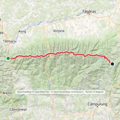 HardMulti-dayMarkedFăgăraș main ridge: Olt Valley Tămașului SaddleElevation profile358–2 525 m93.1 kmascent 6 545 munder 1 km from Vârful Sărății
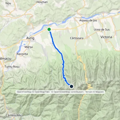 Hard1–2 daysMarkedPorumbacu de Jos Cleopatra SaddleElevation profile398–2 361 m26 kmascent 1 962 m≈ 10 h walkingunder 1 km from Vârful Sărății
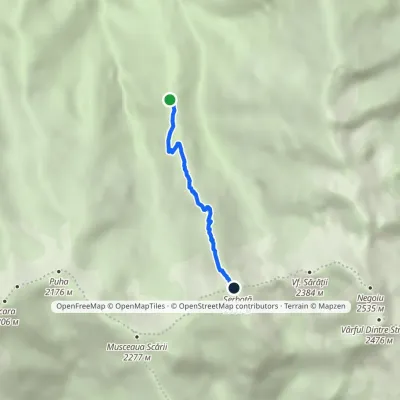 HardOne-dayMarkedNegoiu Hut Șerbota PeakElevation profile1 538–2 331 m3.1 kmascent 793 m≈ 2 h walkingunder 1 km from Vârful Sărății
Nearby attractions
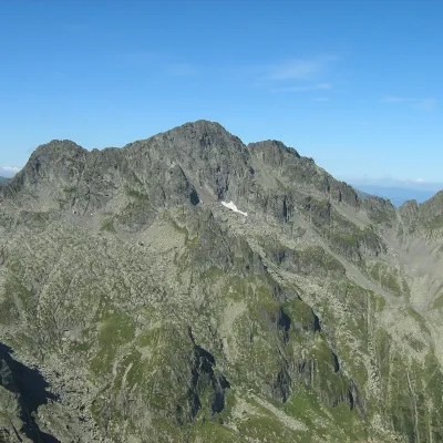 PeakNegoiu Peakaltitude 2 535 munder 1 km from Vârful Sărății1 trail to the topNegoiu Peak (Romanian: Vârful Negoiu, Hungarian: Negoj-csúcs) is a 2,535 m summit on the main ridge of the Făgăraș Mountains in the Southern Carpathians.
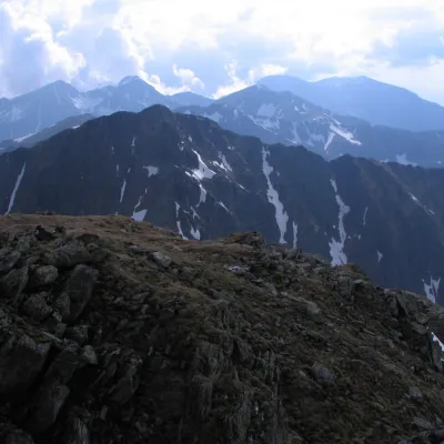 PeakȘerbotaaltitude 2 331 munder 1 km from Vârful Sărății2 trails to the topȘerbota (Romanian: Vârful Șerbota, Hungarian: Serbota-csúcs) is a 2,331 m summit on the main ridge of the Făgăraș Mountains in the Southern Carpathians, west of Negoiu...
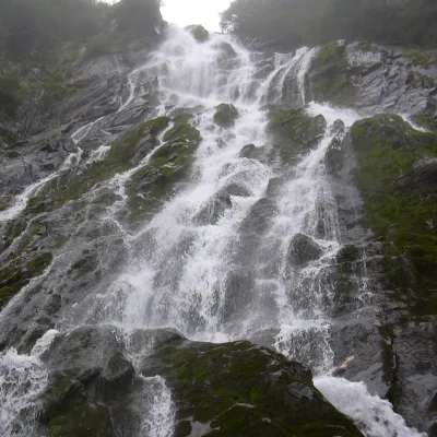 WaterfallBâlea Waterfall (Cascada Bâlea)Făgăraș Mountains6.6 km from Vârful Sărățiiheight 60 m1 514 m above sea levelBâlea Waterfall (Cascada Bâlea), also called Urlătoarea Bâlei because of the roar of the water, lies on the northern, Sibiu side of the Făgăraș Mountains, between the...
Craft nearby
All craft places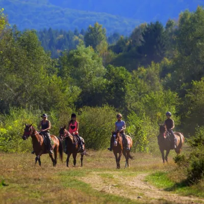 Horse ridingHermannstadt Mountain Horses: horse rides below the FăgărașPorumbacu de Sus12 km from Vârful SărățiiHorses in the Avrig Valley below the Făgăraș Hermannstadt Mountain Horses (Hermannstadt is the old German name of Sibiu) is a riding stable in the Avrig Valley (Valea...
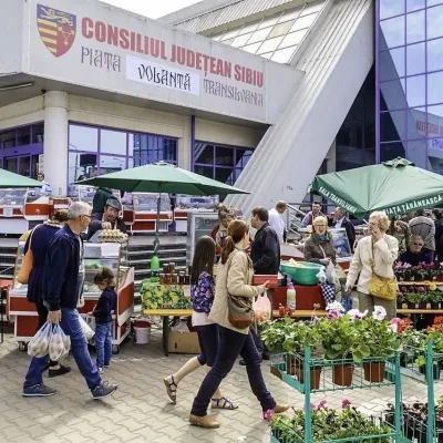 Markets & fairsTransylvania Farmers’ Market in Sibiu: Saturday producers’ marketSibiu38 km from Vârful SărățiiThe Transylvania Farmers’ Market (Piața Țărănească Transilvania) is an open-air Saturday market next to the Transilvania sports hall in Sibiu.
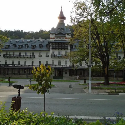 Water parks & thermal poolsCălimănești-Căciulata: thermal pools and springs in the Olt gorgePăușa40 km from Vârful SărățiiCălimănești-Căciulata is one of Romania's best-known spas, stretching along both banks of the Olt where the river enters its gorge between the Cozia massif and the...
