Turícka Magura
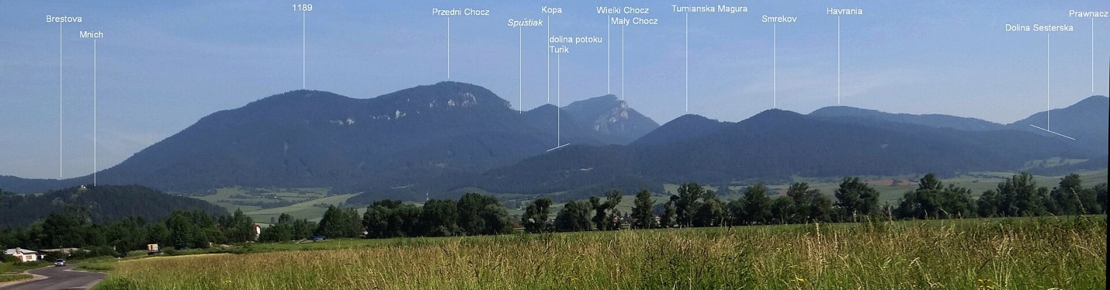
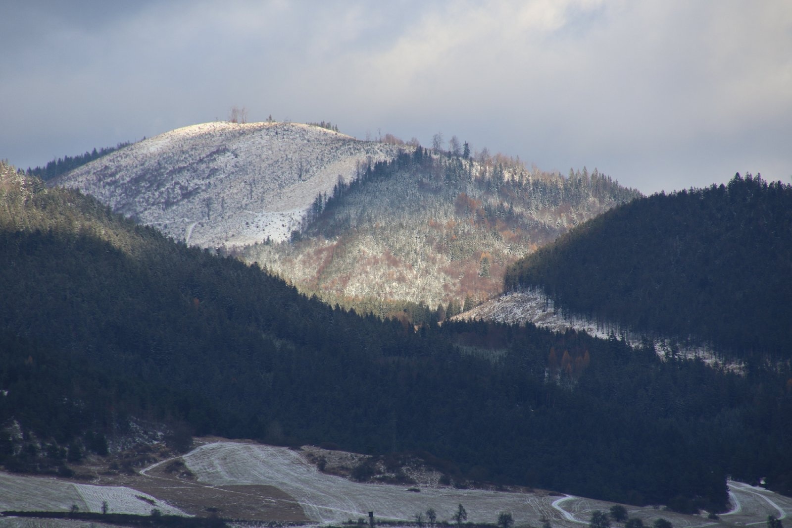
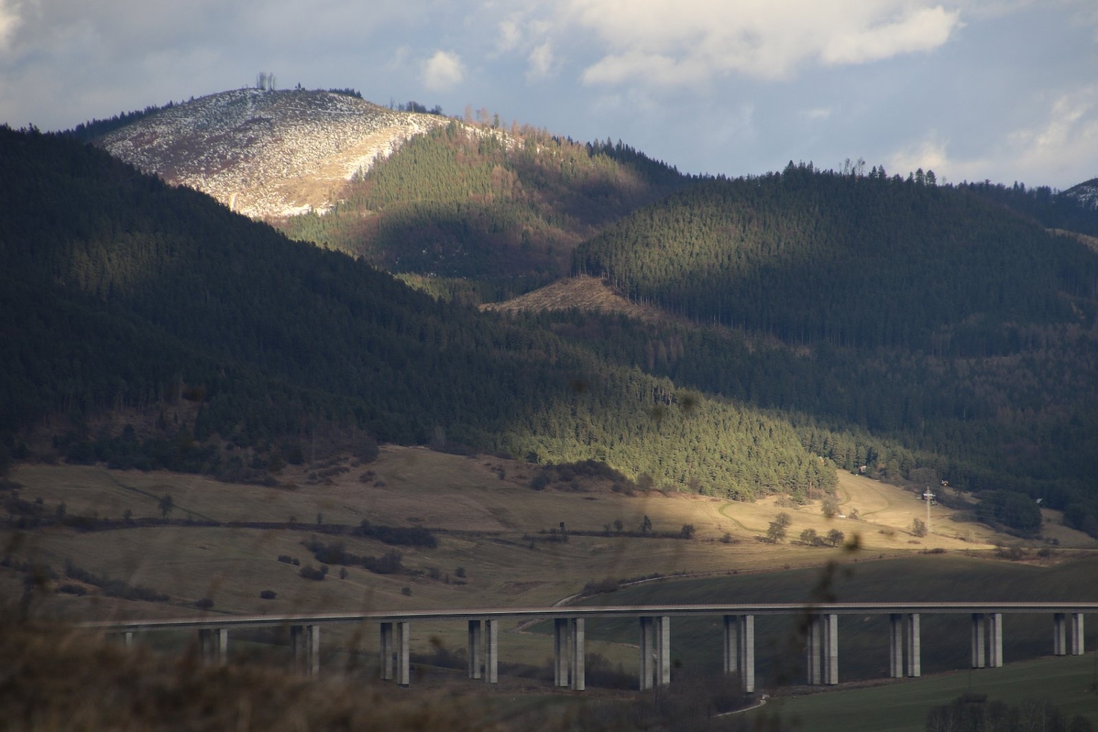
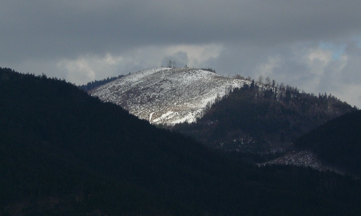
Turícka Magura (also Turanská or Turianska Magura; Polish Magura Turicka) is a 1085 m summit in the western part of the Choč Mountains in Slovakia. It rises west of the village of Lúčky, about 6 km north-east of Ružomberok, in Ružomberok District, Žilina Region, on the lands of Turík and Lúčky. From the north-west it towers over the village of Turík, which gave it its name. The nearest villages are Turík and Lúčky (2.7 km each), Kalameny (3.5 km) and Liptovská Teplá (4.4 km).
The mountain belongs to the group of Veľký Choč, the highest peak of the Choč Mountains. It lies on a spur running south-east from Veľký Choč via Malý Choč to Smrekov (1024 m). The broad Žimerová saddle separates it from Malý Choč, and another saddle to the south-east from the slightly lower Smrekov. Around it rise Bukov (1218 m) to the north, Veľký Choč (1611 m) and Malý Choč (1465 m) to the north-west, and Zadný Choč (1288 m), Kopa (1219 m) and Predný Choč (1249 m) to the west. The massif is bounded by the Turík stream valley to the west and the Jastrabá valley to the north. All water drains to the Váh: the western part via the Turík stream, the eastern via the Žimerový potok.
How to get there / routes
No marked trail leads to the summit, which is why, despite easy access, it is rarely visited. The nearest route is the red trail from Lúčky north-east to Veľký Choč. You can leave it at the Žimerová saddle and continue unmarked along the ridge to the top; forest roads around the mountain are another option. The sources give no walking times, so take a detailed Choč Mountains map or navigation.
What you can see from the top
Older Polish guidebooks described the summit as almost entirely wooded, with views only from small meadows – mainly of the rocky cliffs of Malý and Veľký Choč. Today, according to Slovak sources, logging has cleared the summit, giving an all-round panorama. In good weather you see many peaks of the Choč Mountains, the Liptov basin, the Skorušinské vrchy, the Western and Low Tatras, the Greater Fatra and the Babia hora massif. Recent photos confirm the open summit.
Nature and history
The Turícka Magura massif is built of Lower Cretaceous marls as well as Jurassic and Triassic limestones, in which several small caves have formed. The slopes are generally steep, cut in the south and north by a few deeper side valleys, and the dome-shaped summit area is markedly flattened. The summit lies outside protected areas – unlike the neighbouring Choč peaks. "Magura" is a very common Carpathian mountain name; the adjective "Turícka" points to the village of Turík below.
Safety, season and rules
The mountain is accessible all year, but without waymarks it is easy to lose your way, especially in the forest below the summit. Clear-cuts may hold fallen timber and eroded logging roads; in winter the slopes are snowbound. Keep away from active logging sites. Slovak Mountain Rescue Service (HZS): 18 300 (+421 18 300) or 112.
Interesting facts
- The mountain has at least three Slovak names: Turícka, Turanská and Turianska Magura.
- The limestones of the massif hide several small caves.
Photos: Jerzy Opioła, CC BY-SA 3.0; Mineralysk, CC0; Mineralysk, CC0; Mineralysk, CC BY-SA 4.0 — Wikimedia Commons.
Getting there from Ukraine
Border crossings
- Uzhhorod – Vyšné Nemecké — road, 24/7
- Malyi Bereznyi – Ubľa — road, 24/7 For cars and buses; pedestrians not confirmed by the Ukrainian border service, lorries up to 3.5 t.
- Mali Selmentsi – Veľké Slemence (pedestrian) — pedestrian, 09:00–21:00 Kyiv time Pedestrians and cyclists only; inconvenient for the Tatras without onward transport.
- Chop – Čierna nad Tisou (rail) — rail, 24/7
By car
From Uzhhorod ≈275 km, ≈3 h 35 min without queues: Uzhhorod – Vyšné Nemecké → I/19 to Košice → D1 motorway via Prešov, Poprad and Liptovský Mikuláš to Ružomberok (≈270 km, ≈3 h 25 min from the border). From Lviv it is faster through Poland: M-10 → Krakovets – Korczowa → A4 to Kraków → S7/DK7 to the Chyżne – Trstená border → R3 and I/59 via Dolný Kubín to Ružomberok: ≈482 km, ≈6 h 15 min (via Uzhok and Ubľa ≈500 km, ≈7 h 30 min). The D1 requires an e-vignette (eznamka.sk).
Checked 23.10.2026; border crossing hours and timetables change — check before you travel.
Location on the map
Water and shelter nearby
- Captured Spring in Jastrabej doline860 m · Not verified · 776 m
- Spring pod Hradiskom900 m · Not verified · 788 m
- Žimerová Canopy, 1 035 m1.1 km · Not verified · 1 035 m
- Spring in Žimerová1.2 km · Not verified · 741 m
- Spring below Malý Choč (south-east slope), 1 079 m1.5 km · Not verified · 1 079 m
- Spring below Malý Choč (south-east slope), 1 082 m (2)1.6 km · Not verified · 1 082 m
- Spring below Malý Choč (south-east slope), 1 082 m1.6 km · Not verified · 1 082 m
- Liskovský potok Spring1.7 km · Not verified · 871 m
- Márna Spring1.8 km · Not verified · 792 m
- Spring below Predný Choč1.9 km · Not verified · 876 m
- Spring below Konislav (north slope), 769 m1.9 km · Not verified · 769 m
- Spring below Konislav (north slope), 771 m2 km · Not verified · 771 m
- Spring below Bukovinka (north-east slope), 759 m2.1 km · Not verified · 759 m
- Spring below Malý Choč (north-east slope), 1 184 m2.2 km · Not verified · 1 184 m
- Spring below Malý Choč (north-east slope), 1 201 m2.2 km · Not verified · 1 201 m
- Biely Breh Spring2.2 km · Not verified · 946 m
Comments
Trails nearby
All trails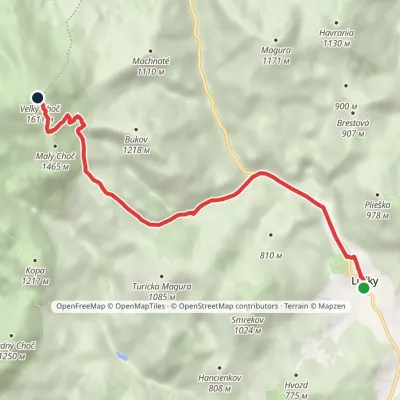 ModerateOne-dayMarkedLúčanský Waterfall Veľký ChočElevation profile578–1 611 m7.2 kmascent 1 036 m≈ 4 h walkingunder 1 km from Turícka Magura
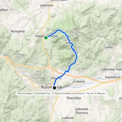 ModerateOne-dayMarkedRužomberok, station Valaská DubováElevation profile477–1 299 m12.9 kmascent 641 m≈ 4.5 h walking1.6 km from Turícka Magura
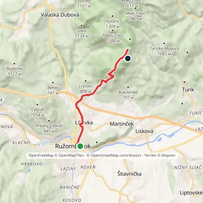 ModerateOne-dayMarkedRužomberok, station Sedlo SpuštiakElevation profile477–1 217 m7.5 kmascent 807 m≈ 3.5 h walking1.8 km from Turícka Magura
Nearby attractions
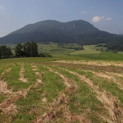 PeakPredný ChočMartinčekaltitude 1 249 m2.2 km from Turícka MaguraPredný Choč (Polish Przedni Chocz) is a 1,249 m summit in the Choč Mountains of northern Slovakia, part of the Veľký Choč group.
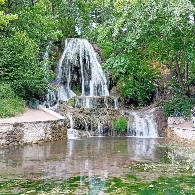 WaterfallLúčanský vodopád (Lúčky Waterfall)Lúčky2.7 km from Turícka MaguraLúčanský vodopád is an unusual travertine waterfall right in the centre of the spa village of Lúčky in Lower Liptov, at the foot of the Chočské vrchy hills, 13 km from...
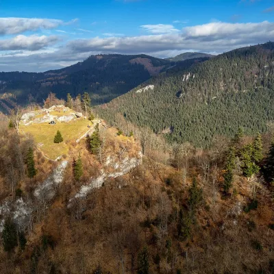 CastleLiptov Castle (ruins)Liptovská Sielnica5.1 km from Turícka MaguraLiptov Castle (Liptovský hrad), also known as Liptov Old Castle or Sielnica Castle, is the ruin of a medieval fortress on the summit of Sestrč (999.9 m) in the Choč...
Craft nearby
All craft places Water parks & thermal poolsLúčky Spa and AQUA-VITAL ParkLúčky2.3 km from Turícka MaguraLúčky Spa (Kúpele Lúčky) lies in a quiet valley beneath the Choč Mountains, in the village of Lúčky near Ružomberok.
 Water parks & thermal poolsBešeňová Water ParkBešeňová6.7 km from Turícka MaguraBešeňová — the "thermal heart of Liptov" Bešeňová Water Park (Vodný park Bešeňová) lies on the edge of the village of the same name in the western part of the Liptov...
 Craft beer & breweriesURSUS craft brewery, Čutkovská valleyRužomberok9.7 km from Turícka MaguraURSUS craft brewery (Remeselný pivovar URSUS) is the first brewery of the town of Ružomberok, tucked away in the picturesque Čutkovská valley in lower Liptov.
 Cheese dairies & pasturesSalaš Krajinka near RužomberokRužomberok10 km from Turícka MaguraSalaš Krajinka is a genuine sheep farm on the edge of Ružomberok in lower Liptov. It was founded in 1983 to keep a thousand sheep, and the owners have deliberately...
 Koliby & Hutsul cuisineSalaš Dechtáre above Liptovská MaraGalovany11 km from Turícka MaguraSalaš Dechtáre is a wooden koliba above the Liptovská Mara reservoir that is described as one of Slovakia’s first commercial salaš restaurants.
 Water parks & thermal poolsAquapark TatralandiaLiptovský Mikuláš15 km from Turícka MaguraAquapark Tatralandia is a large year-round water leisure complex near Liptovský Mikuláš, on the northern shore of the Liptovská Mara reservoir.
