Predný Choč
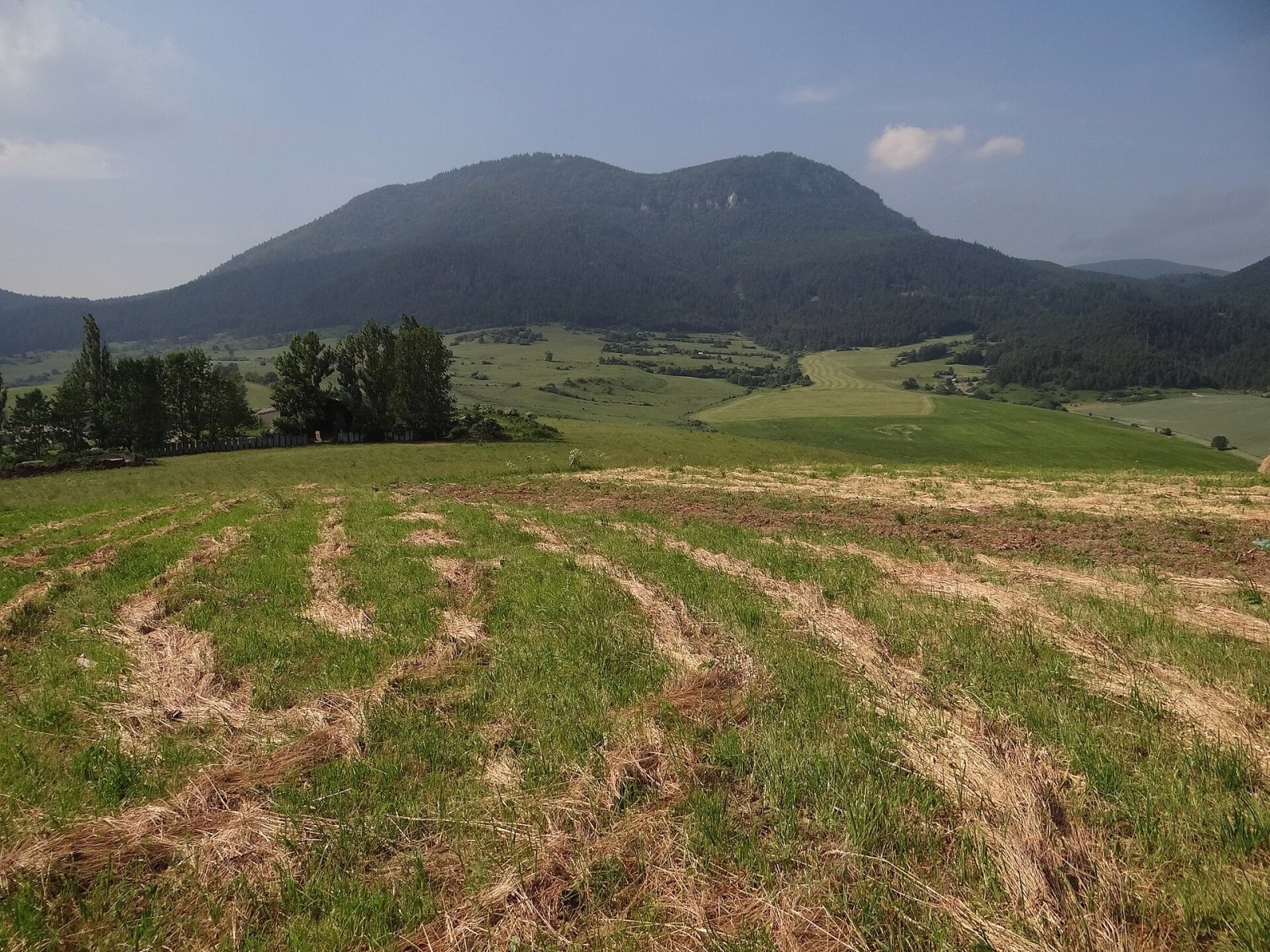
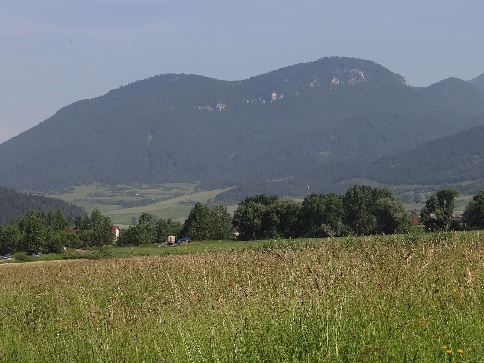
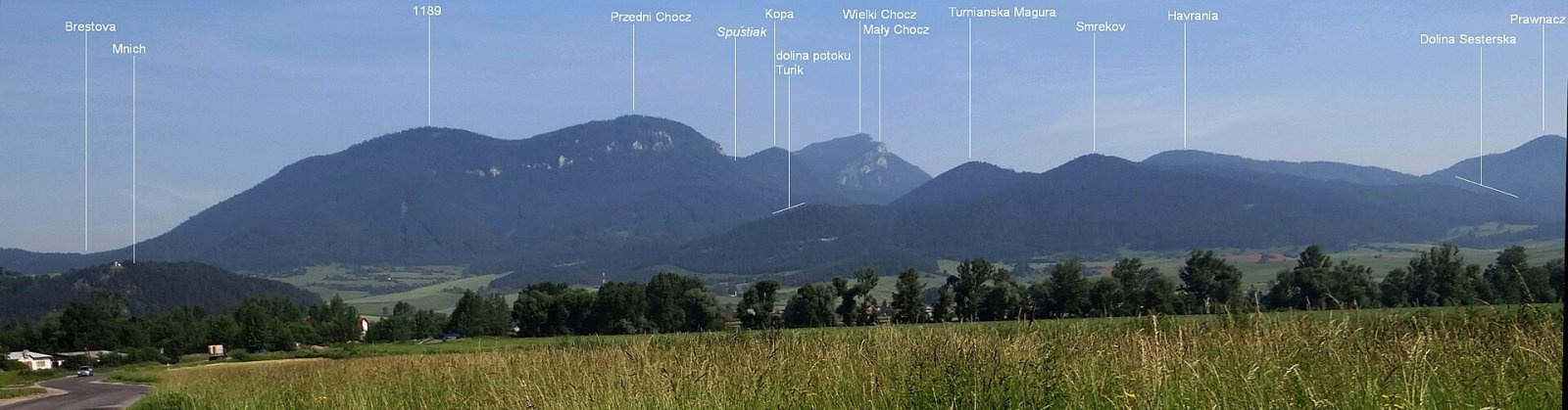
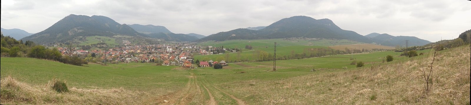
Predný Choč (Polish Przedni Chocz) is a 1,249 m summit in the Choč Mountains of northern Slovakia, part of the Veľký Choč group. It lies south-west of Veľký Choč (1,608 m), north of the village of Lisková and about 6 km north of the town of Ružomberok in the Žilina Region. The nearest settlements are Likavka and Lisková about 4 km to the south and Valaská Dubová to the north-west. A winding ridge runs here from Veľký Choč via Stredná poľana, Zadný Choč (1,288 m) and Kopa (1,217 m); the Spuštiak saddle (1,095 m) separates Predný Choč from Kopa. The upper part of the massif belongs to the Choč national nature reserve.
How to get there / routes
Two marked trails cross the slopes of Predný Choč and meet at the Spuštiak saddle; both bypass the summit itself — the red on the west, the blue on the east.
- Red: from Likavka via the Likavský hrad junction to Spuštiak; a short branch leads from it to the summit area.
- Blue: from Likavka or Lisková via the Pod Smrekovom junction to Spuštiak; from Valaská Dubová via Stredná poľana to Spuštiak.
A side path from the red trail leads to a paragliding launch on a meadow in the south-eastern part of the massif.
What you can see from the summit
The forest on the summit greatly limits the view, but the crags on the southern slopes and the meadow near the lower south-western top (1,199 m) open views to the east and south. Majestic Veľký Choč dominates the northern horizon; the south-western Choč Mountains, the Liptov basin, the ridges of the Lesser and Greater Fatra, and the Low and Western Tatras are well visible.
Nature and history
Like Veľký Choč, the Predný Choč massif was carved out of a huge slab of the Choč nappe resting on rocks of the lower Križná nappe. The summit area is built mainly of Reifling limestone, with grey bedded Middle–Upper Triassic dolomites lower down and dark, almost black Gutenstein limestones lower still. The south-eastern side of the ridge is cut by steep cliffs and rock walls that drop in several steps to the Liskovský brook valley; the gentler north-western slope also has a belt of rock walls. In one of these crags, at 932 m, is the two-entrance mouth of the Chladné oči cave.
The mountain is almost entirely forested, except for a few clearings on the broad flat near the lower top. In the middle of this flat, traces of a prehistoric hillfort (Hradisko na Prednom Choči) were found. From 1968 to 1991 the western slopes and the whole Volová valley served as a training ground for Soviet troops and were completely off-limits.
Safety, season and rules
The summit area lies in the strict Choč reserve: do not leave the marked trails and do not climb the crags. The southern cliffs are dangerous, especially in wet weather and in winter when the paths ice up. Slovak Mountain Rescue (HZS): 18 300 (+421 18 300); emergency number 112.
Interesting facts
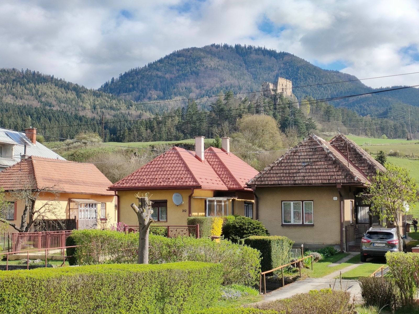
- At the foot of the mountain above Likavka stand the ruins of Likava Castle, passed by the red trail.
- The meadow overlooking Liptov is used as a paragliding launch site.
Photos: Jerzy Opioła, CC BY-SA 3.0; Jerzy Opioła, CC BY-SA 3.0; Mineralysk, CC0; Jerzy Opioła, CC BY-SA 3.0; Peter Derer, CC BY 3.0 — Wikimedia Commons.
Getting there from Ukraine
Border crossings
- Uzhhorod – Vyšné Nemecké — road, 24/7
- Malyi Bereznyi – Ubľa — road, 24/7 For cars and buses; pedestrians not confirmed by the Ukrainian border service, lorries up to 3.5 t.
- Mali Selmentsi – Veľké Slemence (pedestrian) — pedestrian, 09:00–21:00 Kyiv time Pedestrians and cyclists only; inconvenient for the Tatras without onward transport.
- Chop – Čierna nad Tisou (rail) — rail, 24/7
By car
From Uzhhorod ≈275 km, ≈3 h 35 min without queues: Uzhhorod – Vyšné Nemecké → I/19 to Košice → D1 motorway via Prešov, Poprad and Liptovský Mikuláš to Ružomberok (≈270 km, ≈3 h 25 min from the border). From Lviv it is faster through Poland: M-10 → Krakovets – Korczowa → A4 to Kraków → S7/DK7 to the Chyżne – Trstená border → R3 and I/59 via Dolný Kubín to Ružomberok: ≈482 km, ≈6 h 15 min (via Uzhok and Ubľa ≈500 km, ≈7 h 30 min). The D1 requires an e-vignette (eznamka.sk).
Checked 23.10.2026; border crossing hours and timetables change — check before you travel.
Location on the map
Water and shelter nearby
- Biely Breh Spring580 m · Not verified · 946 m
- Spring below Predný Choč700 m · Not verified · 876 m
- Liskovský potok Spring760 m · Not verified · 871 m
- Spring below Konislav (north slope), 769 m1.1 km · Not verified · 769 m
- Spring below Konislav (north slope), 771 m1.1 km · Not verified · 771 m
- Márna Spring1.1 km · Not verified · 792 m
- Spring below Bukovinka (north-east slope), 759 m1.1 km · Not verified · 759 m
- Chočský potok Spring1.2 km · Not verified · 751 m
- Spring above Medzi Hroblami1.2 km · Not verified · 735 m
- Jachym Spring1.2 km · Not verified · 747 m
- Spring below Bukovinka (north-east slope), 703 m1.4 km · Not verified · 703 m
- Spring below Malý Zadný Choč (south-west slope)1.4 km · Not verified · 1 250 m
- Spring below Bukovinka (east slope)1.5 km · Not verified · 685 m
- Kramariská Spring1.5 km · Not verified · 728 m
- Spring below Lovisko Hut (east slope)1.5 km · Has water · 788 m
- Spring below Bukovinka (south-west slope), 635 m1.6 km · Not verified · 635 m
Comments
Trails nearby
All trails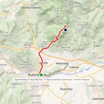 ModerateOne-dayMarkedRužomberok, station Sedlo SpuštiakElevation profile477–1 217 m7.5 kmascent 807 m≈ 3.5 h walkingunder 1 km from Predný Choč
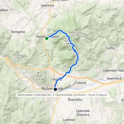 ModerateOne-dayMarkedRužomberok, station Valaská DubováElevation profile477–1 299 m12.9 kmascent 641 m≈ 4.5 h walkingunder 1 km from Predný Choč
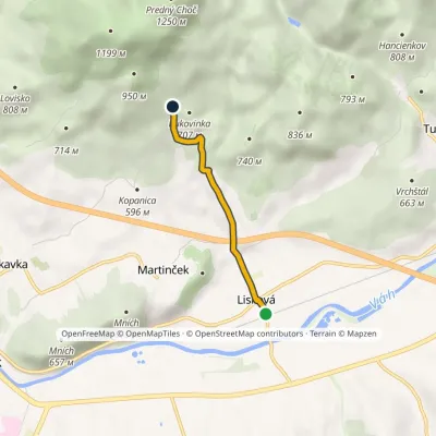 EasyOne-dayMarkedLisková Junction under SmrekovElevation profile488–696 m3.1 kmascent 211 m≈ 1 h walking1.3 km from Predný Choč
Nearby attractions
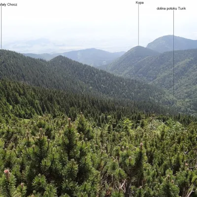 PeakMalý ChočLúčkyaltitude 1 465 m2.6 km from Predný ChočMalý Choč (Polish: Mały Chocz) is a 1,465 m summit in the Choč Mountains of northern Slovakia, a fore-summit of neighbouring Veľký Choč (1,608 m).
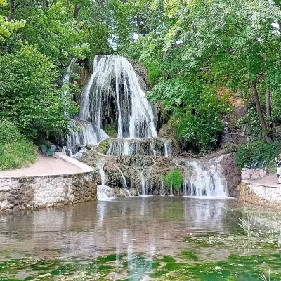 WaterfallLúčanský vodopád (Lúčky Waterfall)Lúčky4.8 km from Predný ChočLúčanský vodopád is an unusual travertine waterfall right in the centre of the spa village of Lúčky in Lower Liptov, at the foot of the Chočské vrchy hills, 13 km from...
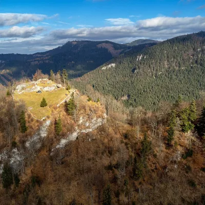 CastleLiptov Castle (ruins)Liptovská Sielnica7.3 km from Predný ChočLiptov Castle (Liptovský hrad), also known as Liptov Old Castle or Sielnica Castle, is the ruin of a medieval fortress on the summit of Sestrč (999.9 m) in the Choč...
Craft nearby
All craft places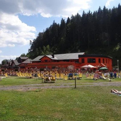 Water parks & thermal poolsLúčky Spa and AQUA-VITAL ParkLúčky4.5 km from Predný ChočLúčky Spa (Kúpele Lúčky) lies in a quiet valley beneath the Choč Mountains, in the village of Lúčky near Ružomberok.
 Craft beer & breweriesURSUS craft brewery, Čutkovská valleyRužomberok7.6 km from Predný ChočURSUS craft brewery (Remeselný pivovar URSUS) is the first brewery of the town of Ružomberok, tucked away in the picturesque Čutkovská valley in lower Liptov.
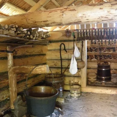 Cheese dairies & pasturesSalaš Krajinka near RužomberokRužomberok8 km from Predný ChočSalaš Krajinka is a genuine sheep farm on the edge of Ružomberok in lower Liptov. It was founded in 1983 to keep a thousand sheep, and the owners have deliberately...
 Water parks & thermal poolsBešeňová Water ParkBešeňová8.2 km from Predný ChočBešeňová — the "thermal heart of Liptov" Bešeňová Water Park (Vodný park Bešeňová) lies on the edge of the village of the same name in the western part of the Liptov...
 Koliby & Hutsul cuisineSalaš Dechtáre above Liptovská MaraGalovany13 km from Predný ChočSalaš Dechtáre is a wooden koliba above the Liptovská Mara reservoir that is described as one of Slovakia’s first commercial salaš restaurants.
 Water parks & thermal poolsAquapark TatralandiaLiptovský Mikuláš17 km from Predný ChočAquapark Tatralandia is a large year-round water leisure complex near Liptovský Mikuláš, on the northern shore of the Liptovská Mara reservoir.
