Vulcan
Brașov County · Romania
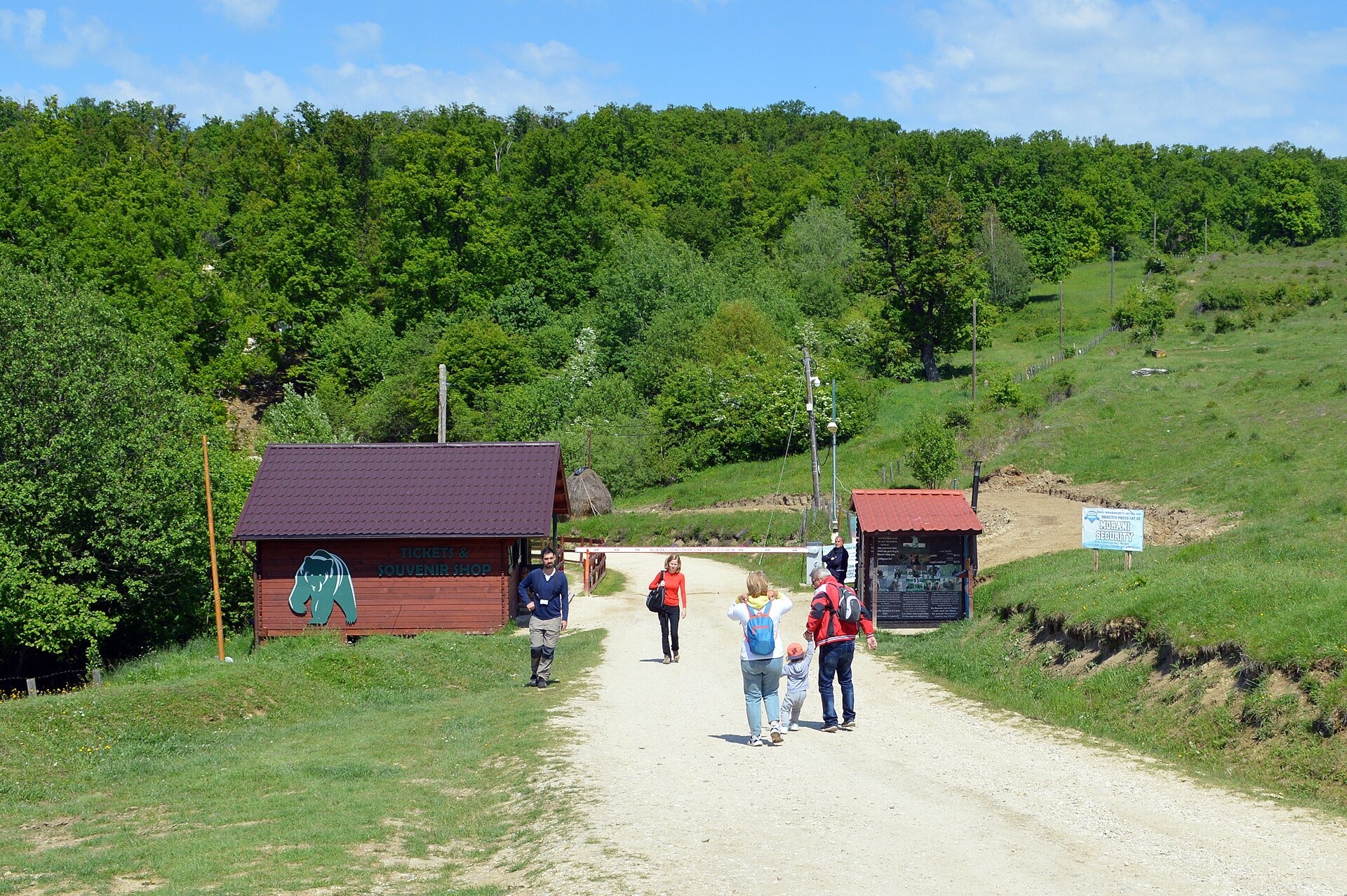
Vulcan is a village in Romania.
Elevation: about 600 m above sea level. Population: 3,841 (2021).
Here and nearby on the site: 1 craft place.
Facts: Wikidata, OpenStreetMap. More on Wikipedia
Comments
Travellers’ experience: reports, tips, questions.
Share your experienceSign in to write a comment, an «I was here» report or ask a question. There are no anonymous comments — that keeps the conversation honest.
No ads, insults or other people’s contacts. The first comment of a new author is checked by hand.How we handle data
No one has written here yet. Be the first — your experience helps others.
What's nearby
Trails nearby
All trails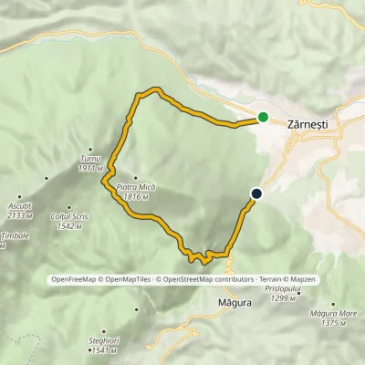 ModerateOne-dayMarkedZărnești Gura Râului Hutvia Valea CrăpăturiiElevation profile718–1 605 m11.7 kmascent 887 m≈ 4.5 h walking12 km from the centre
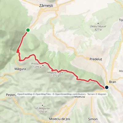 ModerateOne-dayMarkedGura Râului Hut BranElevation profile748–1 375 m10.3 kmascent 669 m≈ 3.5 h walking13 km from the centre
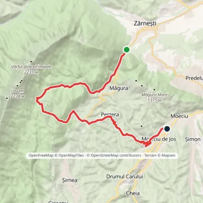 ModerateOne-dayMarkedGura Râului Hut Moieciu de JosElevation profile761–1 436 m21.5 kmascent 721 m≈ 6.5 h walking13 km from the centre
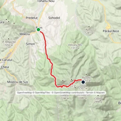 HardOne-dayMarkedBran Omu Hutvia Poiana GauraElevation profile762–2 505 m15.5 kmascent 1 865 m≈ 7 h walking14 km from the centre
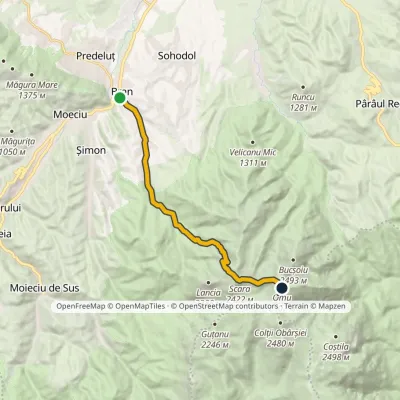 HardOne-dayMarkedBran Omu Hutvia Scara PeakElevation profile762–2 505 m13 kmascent 1 841 m≈ 6.5 h walking14 km from the centre
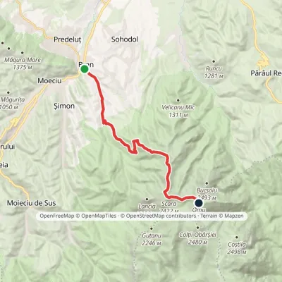 HardOne-dayMarkedBran Omu Hutvia Țigănești SaddleElevation profile762–2 505 m15 kmascent 1 847 m≈ 7 h walking14 km from the centre
Peaks nearby
All peaks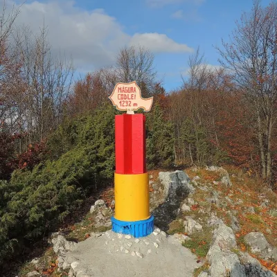 PeakMăgura CodleiCodleaaltitude 1 294 m8.5 km from the centreMăgura Codlei (German Zeidner Berg, Hungarian Feketehegy) is a forested mountain 1,294 m high in the Burzenland (Romanian Țara Bârsei), in Brașov County.
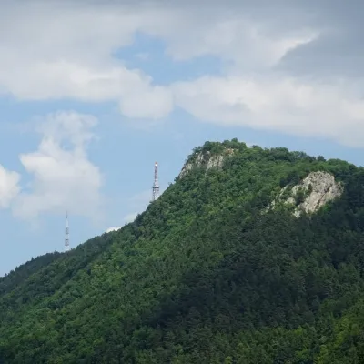 PeakTâmpaBrașovaltitude 960 m13 km from the centreTâmpa (German Zinne, Hungarian Cenk) is the city mountain of Brașov, 960 m high, almost entirely surrounded by the city and rising about 400 m above it.
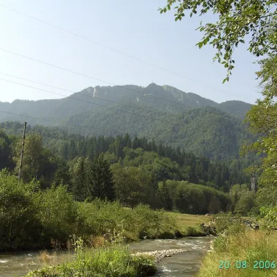 PeakPostăvarulPoiana Brașovaltitude 1 799 m13 km from the centrePostăvarul (Romanian Vârful Postăvarul, popularly Postăvaru, German Schuler, Hungarian Keresztényhavas) is a 1,799 m summit, the highest peak of the small Postăvarul...
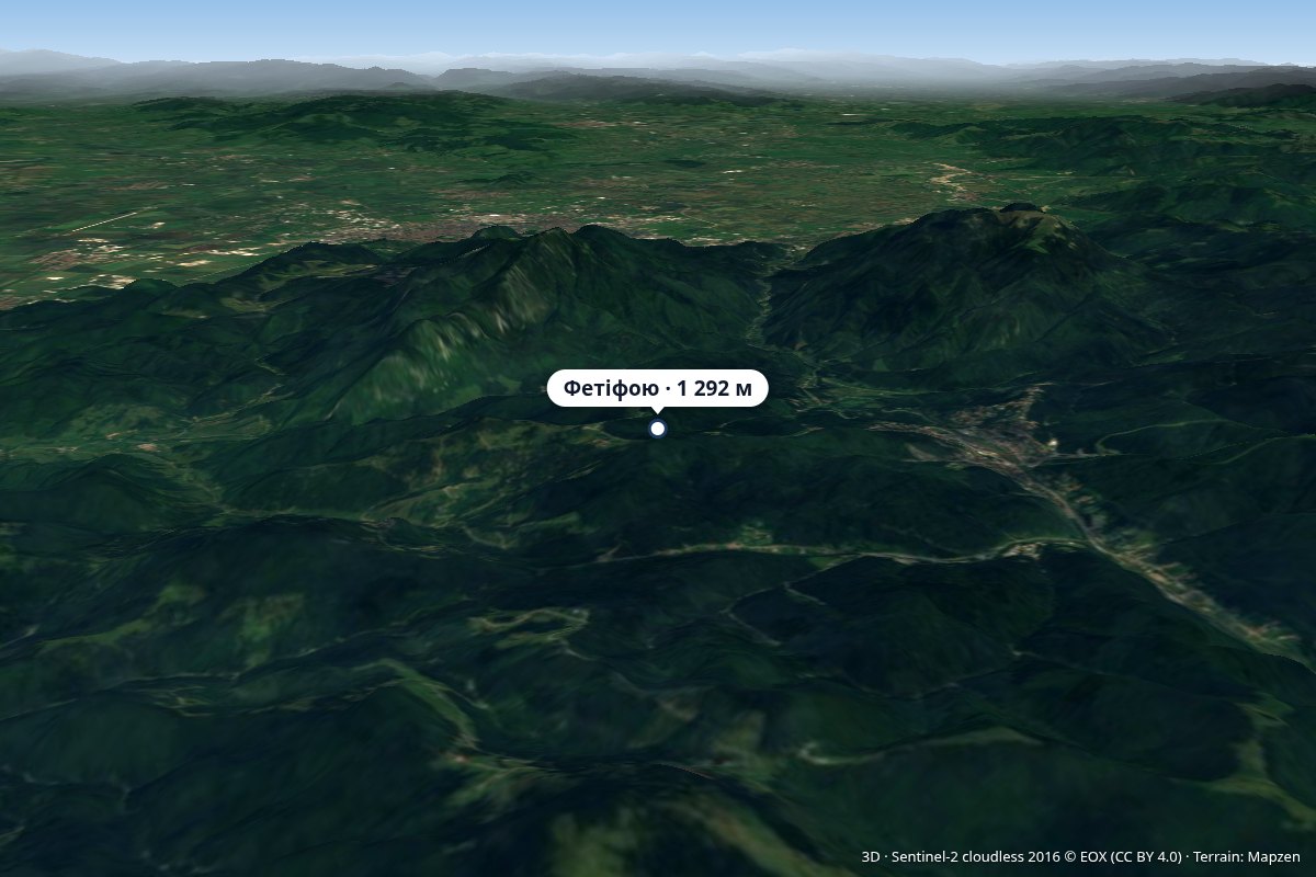 PeakFetifoiuPârâul Recealtitude 1 292 m16 km from the centreLeánykahavas, Saxon Hohe Rong) is the southernmost massif of the Postăvaru Mountains, a 1,292 m peak above the resort of Predeal in Brașov County.
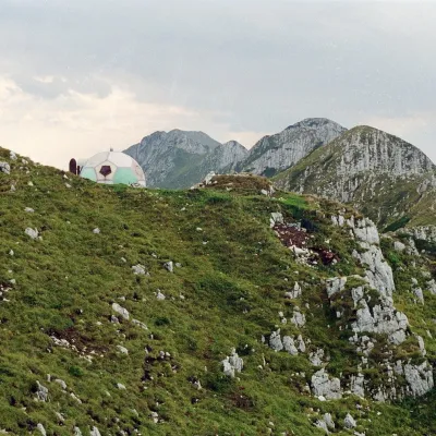 PeakAscuțitZărneștialtitude 2 133 m18 km from the centreVârful Ascuțit, "Sharp") is a 2,133 m peak in the northern part of the limestone ridge of Piatra Craiului, in Piatra Craiului National Park.
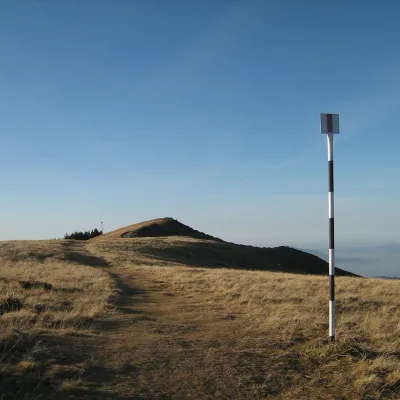 PeakPiatra MareTimișu de Josaltitude 1 843 m19 km from the centrePiatra Mare (Romanian Vârful Piatra Mare, “the Great Stone”, German Hohenstein, Hungarian Nagykőhavas) is the highest summit of the small massif of the same name south...
What to visit
All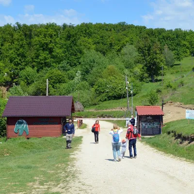 Wildlife parks & animal farmsLibearty Bear Sanctuary in Zărnești: a forest for rescued bearsVulcan5.1 km from the centreThe AMP Libearty Bear Sanctuary lies near the town of Zărnești in Brașov County, at the edge of a forest below the Piatra Craiului massif.
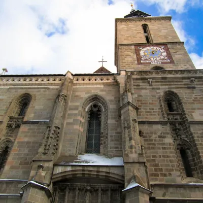 ChurchBlack Church in Brașov: Gothic church of the Transylvanian SaxonsBrașov13 km from the centreThe Black Church (Biserica Neagră, German Schwarze Kirche) is the main church and symbol of Brașov, the largest town of the historic Țara Bârsei region in southern...
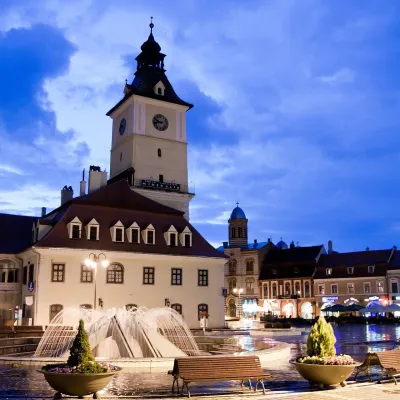 ArchitectureBrașov historic centre: Council Square and the Council HouseBrașov13 km from the centreBrașov's old town lies in a sheltered valley below Mount Tâmpa, on the south-eastern edge of Transylvania.
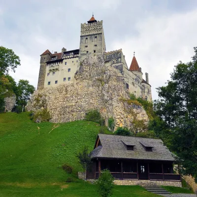 CastleBran Castle — "Dracula's Castle": pass fortress and Queen Marie's homeBran14 km from the centreBran Castle (Castelul Bran) stands on a rock above the village of Bran in Brașov County, between the Bucegi and Piatra Craiului massifs.
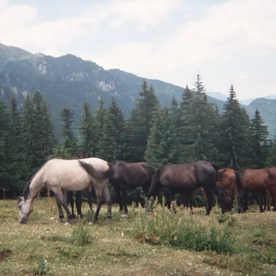 Mountain meadowPoiana DihamPârâul Recealtitude 1 350 m19 km from the centrePoiana Diham (Romanian: Poiana Dihamului) is a wide mountain meadow in the Diham Mountains, on the northern edge of the Bucegi massif.
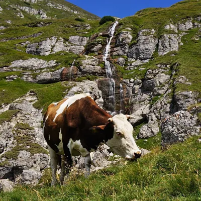 WaterfallObârșia Ialomiței Waterfall (Cascada Obârșia Ialomiței)Bușteni · Bucegi Mountains23 km from the centreover 100 m high2 035 m above sea levelObârșia Ialomiței Waterfall (Cascada Obârșia Ialomiței; on maps also Cascada Obârșiei) lies in the Bucegi Mountains, at the head of the Obârșia valley, at about 2,000 m.
Huts, shelters and springs nearby
Getting there from Ukraine
Border crossings
- Porubne – Siret — road and pedestrian, 24/7
- Diakivtsi – Racovăț — road and pedestrian, 24/7 No freight traffic.
- Krasnoilsk – Vicovu de Sus — road and pedestrian, 08:00–20:00 Cars up to 3.5 t and pedestrians only; not 24/7.
- Solotvyno – Sighetu Marmației — road and pedestrian, 24/7 Passenger traffic only: vehicles up to 3.5 t with up to 9 seats, pedestrians.
- Diakove – Halmeu — road, 24/7 No pedestrian crossing.
By car
Chernivtsi – Brașov ≈395 km, ≈7 h 03 min (via Diakivtsi – Racovăț); Rakhiv – Brașov ≈419 km, ≈7 h 24 min (via Solotvyno – Sighetu Marmației); Uzhhorod – Brașov ≈522 km, ≈8 h 39 min (via Diakove – Halmeu). Times without border queues, our road routing (GraphHopper, OSM).
Checked 03.11.2026; border crossing hours and timetables change — check before you travel.
