Scara Peak
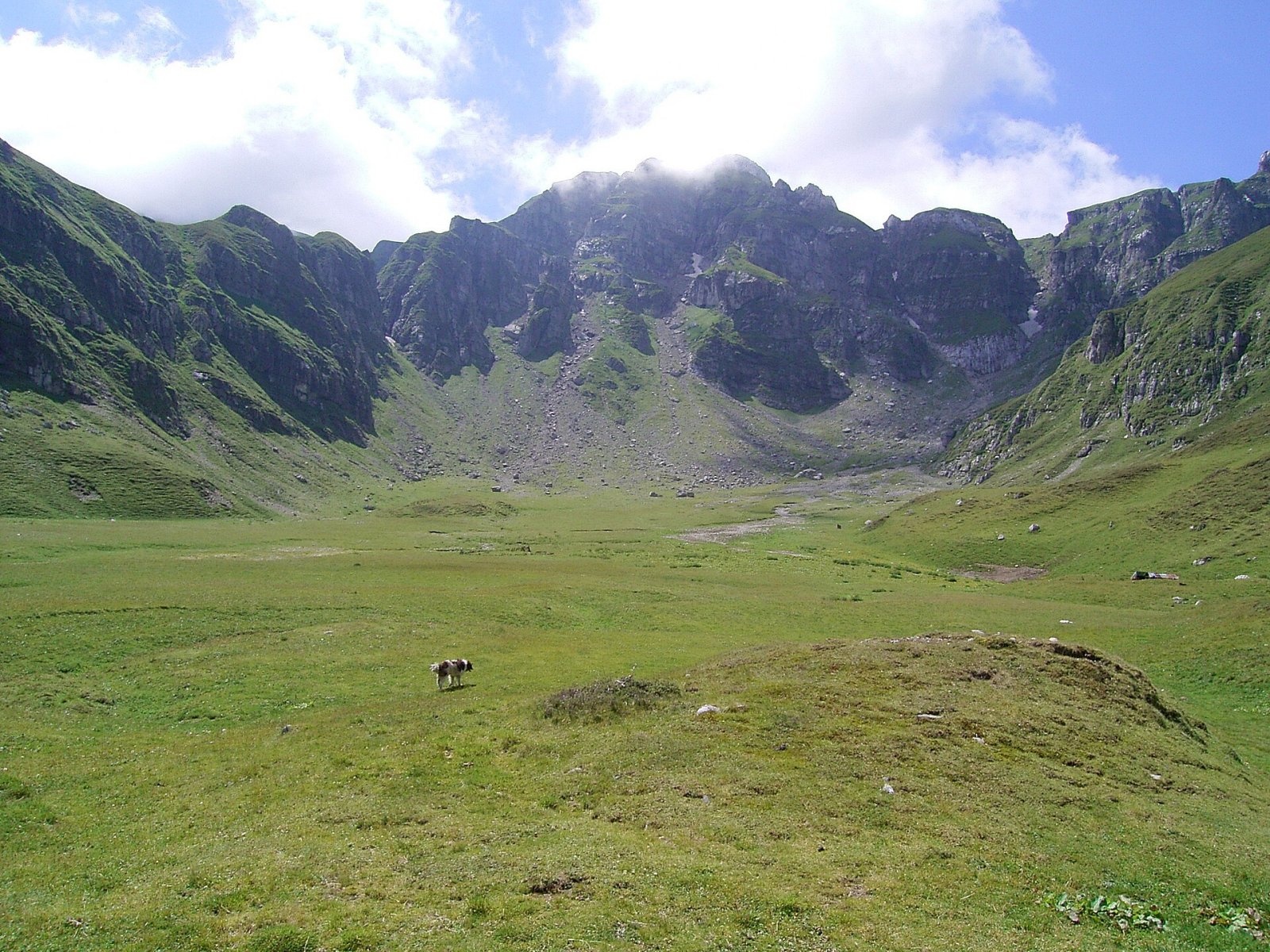
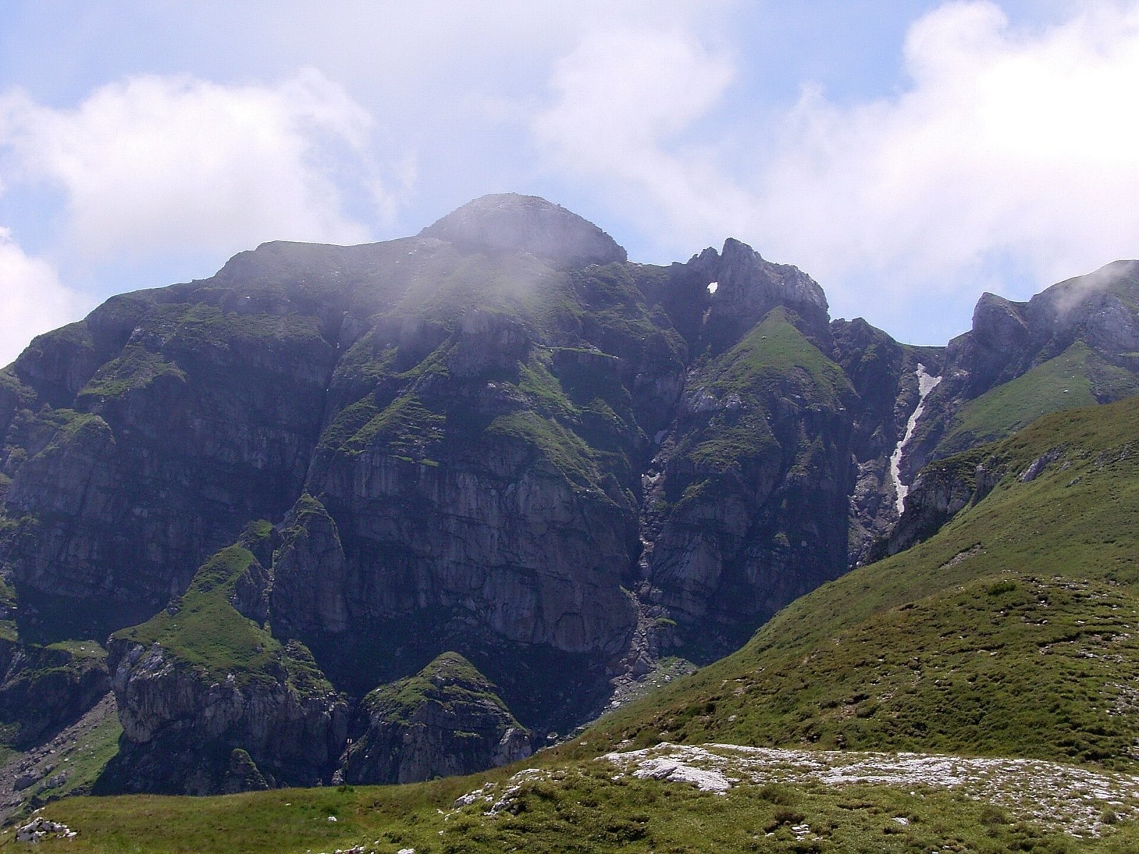
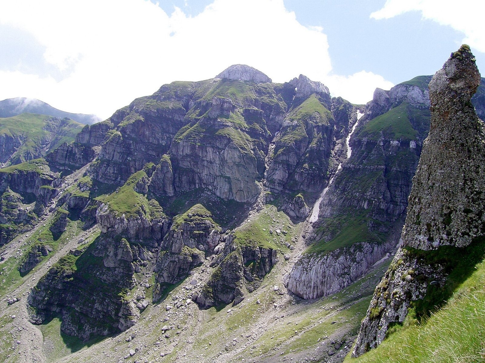
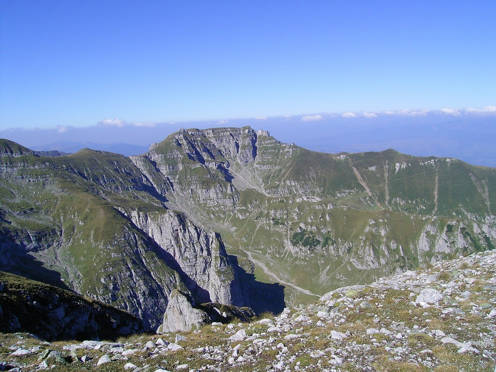
Scara Peak (rom. Vârful Scara) is a 2,422 m peak in the Bucegi Mountains, on the border of Brașov and Prahova Counties. According to Romanian Wikipedia, it is about half an hour along the ridge trail from the massif’s highest summit, Omu Peak (about 1.8 km east in a straight line), and Scara itself is clearly visible from the ridge of Bucșoiu, from the ridge and from the Țigănești valley.
The nearest settlements are the village of Șimon (about 8 km as the crow flies), Moieciu de Sus (about 8.1 km), the town of Bușteni (about 8.8 km), and Bran (about 8.9 km), famous for its castle. To the Omu Chalet hut on Omu summit is about 1.8 km; closer, at about 1.5 km, stands Țigănești Hut.
Getting there / routes
The yellow triangle route "Bran – Scara Peak – Omu Hut" passes over Scara. According to muntii-nostri.ro, from Bran the trail passes through the village of Poarta, the Ciubotea valley past the Salvamont Ciubotea base (Bran-Ciubotea Salvamont Hut), a long meadow, and then a long gentle threshold of the first glacial cirque. The route crosses three cirques in succession, after a shepherd’s shelter turns right and climbs for about 45 minutes up the eastern slope of the Ciubotea ridge on rocky steps right under Scara Peak. The trail then crosses the summit plateau, descends the western slope of Scara under the limestone "window" of Țigănești to the Gornurilor saddle, and then climbs another 30–45 minutes to the Omu Hut (2,507 m).
This route is 13.1 km in total, about 6 hours 45 minutes, with 1,909 m ascent; it is of medium to difficult grade. The authors call the ascent exhausting and recommend it for experienced hikers used to about 2,000 m elevation gain in about 7 hours; in winter the route is not recommended and considered inaccessible.
According to the same description, the village of Poarta at the foot of the Bucegi is already a true mecca for photographers. From the Salvamont base, the trail goes through forest to a long meadow with a semi-ruined forester’s hut, then diagonally up the Urletoarea-Clincei ridge and in 45–50 minutes enters the Ciubotea valley with a view of the Colții Ciubotei rocks. Ahead rise the Țigănești towers, and from the wide Podul-Spinteceturilor platform on the Scara ridge, the summit itself is already visible. On the summit plateau, remains of a semi-spherical shelter destroyed by wind have survived, according to the description. The Omu Hut, to which the route leads, is the highest hut in the Carpathians, and next to it operates the Omu meteorological station, the highest permanently inhabited place in Romania.
Another way from Bran is the red stripe via the Țigănești saddle to the Omu Hut; it passes near Scara. Also nearby are the Mălăiești Hut and Mălăiești Salvamont Hut huts in the Mălăiești valley, and among springs, Spring below Lancia (about 1.5 km from the summit).
Safety, season and rules
The peak is in the Bucegi Natural Park: a ticket is required — 10 lei per adult for three months, purchased online or from rangers (as of the date checked, see bucegipark.ro). The Bucegi plateau is known for dense fog: stick to the markings. In winter, the cirque slopes are avalanche-prone, and the Ciubotea rocky ridge is only for experienced and equipped hikers. Bears are common in the Romanian Carpathians: do not leave marked trails, make noise, avoid dusk, and do not keep food in your tent; near sheepfolds, shepherd dogs may attack — do not run, stop and shield yourself with your backpack (advice from Salvamont România).
In case of emergency, call the national mountain rescue dispatcher 0SALVAMONT — 0725 826 668 or 112.
Photos: Harabagiu Dan (Hardsr at ro.wikipedia), Public domain; Harabagiu Dan (Hardsr at ro.wikipedia), Public domain; Harabagiu Dan (Hardsr at ro.wikipedia), Public domain; Harabagiu Dan (Hardsr at ro.wikipedia), Public domain — Wikimedia Commons.
Getting there from Ukraine
Border crossings
- Porubne – Siret — road and pedestrian, 24/7
- Diakivtsi – Racovăț — road and pedestrian, 24/7 No freight traffic.
- Krasnoilsk – Vicovu de Sus — road and pedestrian, 08:00–20:00 Cars up to 3.5 t and pedestrians only; not 24/7.
- Solotvyno – Sighetu Marmației — road and pedestrian, 24/7 Passenger traffic only: vehicles up to 3.5 t with up to 9 seats, pedestrians.
- Diakove – Halmeu — road, 24/7 No pedestrian crossing.
By car
Chernivtsi – Bușteni ≈426 km, ≈7 h 32 min (via Diakivtsi – Racovăț); Rakhiv – Bușteni ≈454 km, ≈8 h 01 min (via Solotvyno – Sighetu Marmației); Uzhhorod – Bușteni ≈557 km, ≈9 h 15 min (via Diakove – Halmeu). Times without border queues, our road routing (GraphHopper, OSM).
Checked 03.11.2026; border crossing hours and timetables change — check before you travel.
Comments
Travellers’ experience: reports, tips, questions.
No one has reported on this trail yet. Been here lately? Tell others what it is like now.
Location on the map
Water and shelter nearby
- Țigănești Hut1.5 km · Not verified · 2 169 m
- Spring below Lancia1.5 km · Not verified · 1 725 m
- Omu Chalet1.8 km · Standing · 2 507 m
- Izvor Mecet Spring2.1 km · Not verified · 2 279 m
- Mălăiești Salvamont Hut2.4 km · Not verified · 1 709 m
- Mălăiești Hut2.4 km · Standing · 1 720 m
- Spring below Bucșoiu2.4 km · Not verified · 1 694 m
- Spring below Guțanu (west slope), 1 580 m2.7 km · Not verified · 1 580 m
- Spring below Obârșia2.7 km · Not verified · 2 008 m
- Spring below Guțanu (west slope), 1 652 m2.9 km · Not verified · 1 652 m
Trails nearby
All trails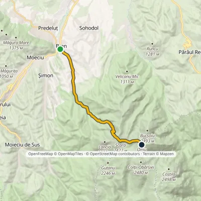 HardOne-dayMarkedBran Omu Hutvia Scara PeakElevation profile762–2 505 m13 kmascent 1 841 m≈ 6.5 h walkingunder 1 km from Scara Peak
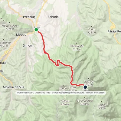 HardOne-dayMarkedBran Omu Hutvia Țigănești SaddleElevation profile762–2 505 m15 kmascent 1 847 m≈ 7 h walkingunder 1 km from Scara Peak
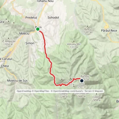 HardOne-dayMarkedBran Omu Hutvia Poiana GauraElevation profile762–2 505 m15.5 kmascent 1 865 m≈ 7 h walkingunder 1 km from Scara Peak
Nearby attractions
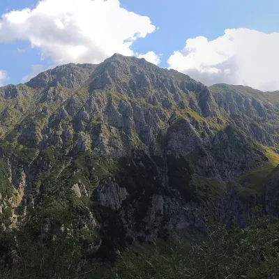 PeakBucșoiuPârâul Recealtitude 2 492 m2.3 km from Scara PeakBucșoiu (Romanian Vârful Bucșoiu) is a 2,492 m summit in the northern part of the Bucegi Mountains. According to Romanian Wikipedia it is the third-highest peak of the...
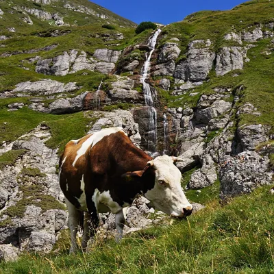 WaterfallObârșia Ialomiței Waterfall (Cascada Obârșia Ialomiței)Bușteni · Bucegi Mountains2.6 km from Scara Peakover 100 m high2 035 m above sea levelObârșia Ialomiței Waterfall (Cascada Obârșia Ialomiței; on maps also Cascada Obârșiei) lies in the Bucegi Mountains, at the head of the Obârșia valley, at about 2,000 m.
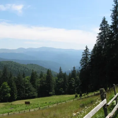 Mountain meadowPoiana IzvoarelorBuștenialtitude 1 448 m5.1 km from Scara PeakPoiana Izvoarelor ("the meadow of the springs") is a mountain meadow at about 1,455 m on the south-eastern slope of Mount Diham, in the northern part of the Bucegi...
Craft nearby
All craft places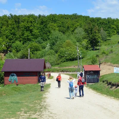 Wildlife parks & animal farmsLibearty Bear Sanctuary in Zărnești: a forest for rescued bearsVulcan16 km from Scara PeakThe AMP Libearty Bear Sanctuary lies near the town of Zărnești in Brașov County, at the edge of a forest below the Piatra Craiului massif.
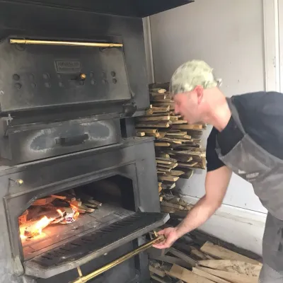 Craft producersDieter’s Bread in Câmpulung: wood-fired artisan breadCâmpulung34 km from Scara PeakCâmpulung (also called Câmpulung Muscel) is an old town in Argeș County at the foot of the Iezer-Păpușa Mountains, on the road to the Rucăr–Bran pass.
 Water parks & thermal poolsPucioasa: sulphur baths and inhalations in the Carpathian foothillsPucioasa41 km from Scara PeakPucioasa is a small spa town in Dâmbovița County, in the valley of the Ialomița river among the wooded hills of the Carpathian foothills, about 20 km north of the city...
