Topľa River
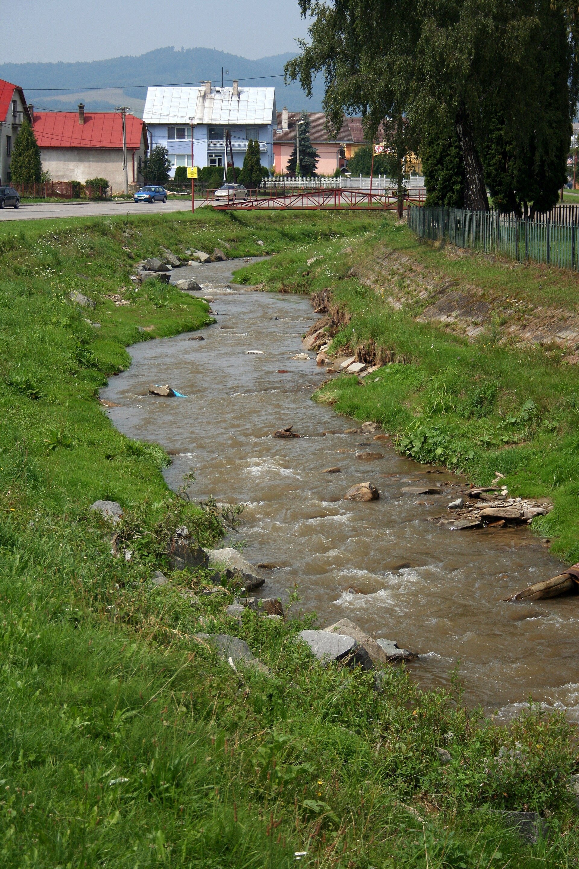
The Topľa (in Ukrainian tradition also Tepla) is a river in eastern Slovakia, the right-bank and largest tributary of the Ondava. It is 129.8 km long, and its basin covers 1,506 km² according to Slovak sources or 1,544 km² according to Polish ones. The mean flow is 8.3 m³/s at Hanušovce nad Topľou and 11.1 m³/s at the mouth. The Topľa is an upland-and-lowland river: it rises in the Čergov hills, flows past Bardejov, Giraltovce, Hanušovce and Vranov and on the East Slovak Lowland near Parchovany joins the Ondava at about 102 m.
The course: from source to mouth
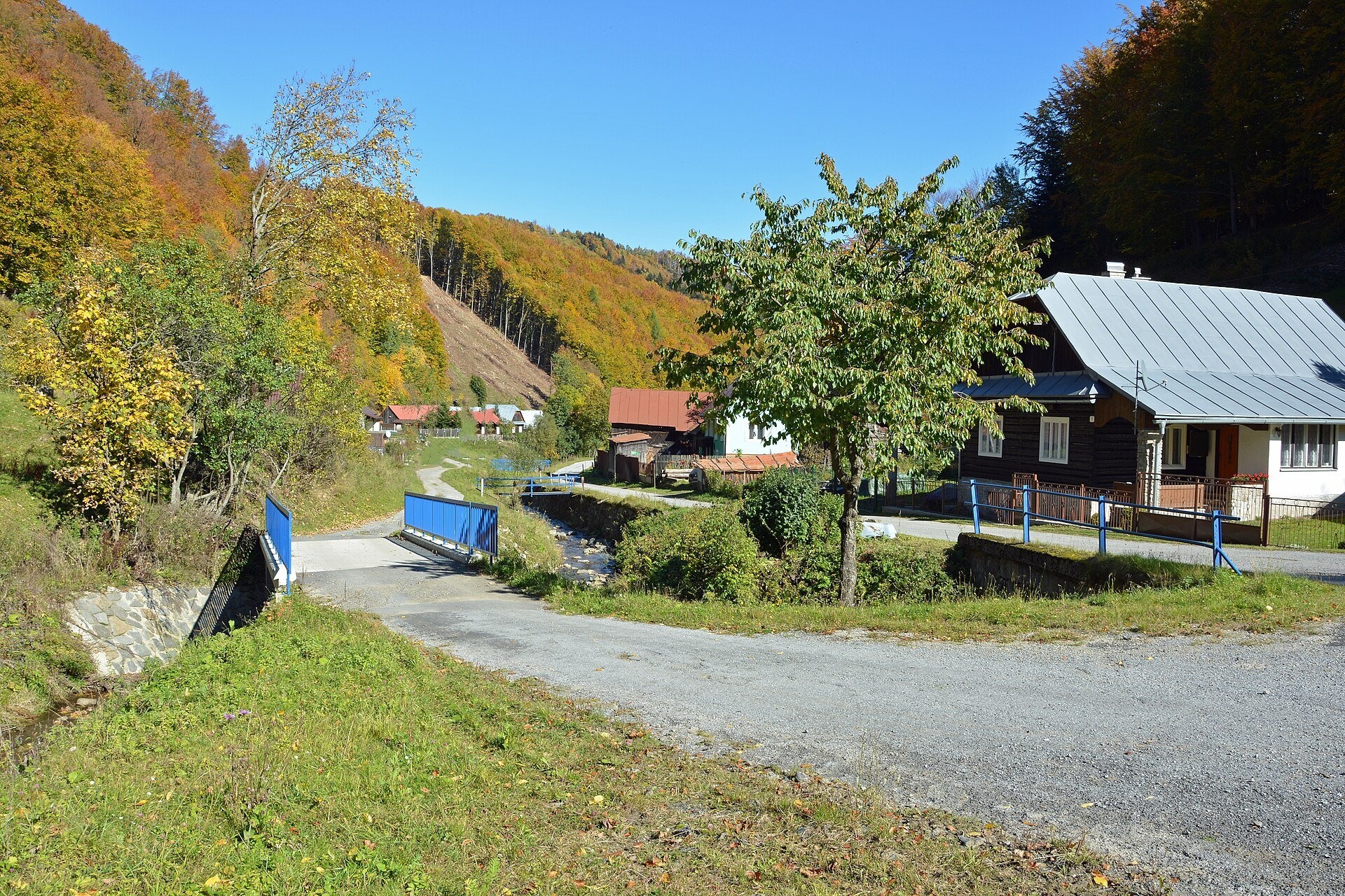
The springs of the Topľa lie at 980–1,000 m about 1.5 km south-east of the summit of Minčol (1,157 m), in the centre of the Čergov hills, about 2 km south-west of the village of Livovská Huta. The spring area is protected by the «Pramenisko Tople» nature reserve. At first the river flows north-east down a deep, narrow valley, and from the village of Livov, where it receives the Vlčí potok on the right, north; here its bed passes through another reserve, «Livovská jelšina».
In an intermontane basin below Malcov the Topľa takes in its first larger tributary on the left, the Večný potok, and turns east. Below Gerlachov the Slatvinec joins on the right, at Tarnov the Sveržovka on the left, bringing water from below the main Carpathian ridge between the Tylicz pass and Płaziny above Wysowa. In Bardejov the river receives the left-bank Kamenec and the right-bank Šibská voda, and beyond the town gradually turns south-east. In its middle course the Topľa meanders strongly through the eastern Ondava Upland, passes Giraltovce, where the Radomka joins on the left, and Hanušovce nad Topľou. From there its valley widens and separates the Ondava Upland from the Slanské vrchy, from which the river collects many small tributaries, among them the Hermanovský potok from below Šimonka, the highest summit of these hills. In Vranov nad Topľou the left-bank Čičava and the right-bank Lomnica join; then the Topľa enters the lowland, becomes a lowland river, takes in the Olšava on the right and near Parchovany joins the Ondava.
In the Slovak division of relief, from Hanušovce the Topľa flows through the Beskid Foothills, from Vranov through the East Slovak Hills, and then enters the East Slovak Plain. Through the Ondava and then the Bodrog its water reaches the Tisza; together with its tributaries the Topľa drains most of the Bardejov district.
What to see along the river
- Bardejov: historic town centre and St Giles’ Basilica — a medieval town on the Topľa.
- Icon Exhibition of the Šariš Museum, Bardejov — in Bardejov near the river.
- The «Pramenisko Tople» reserve below Minčol — the river's springs in the Čergov forests.
The river and people
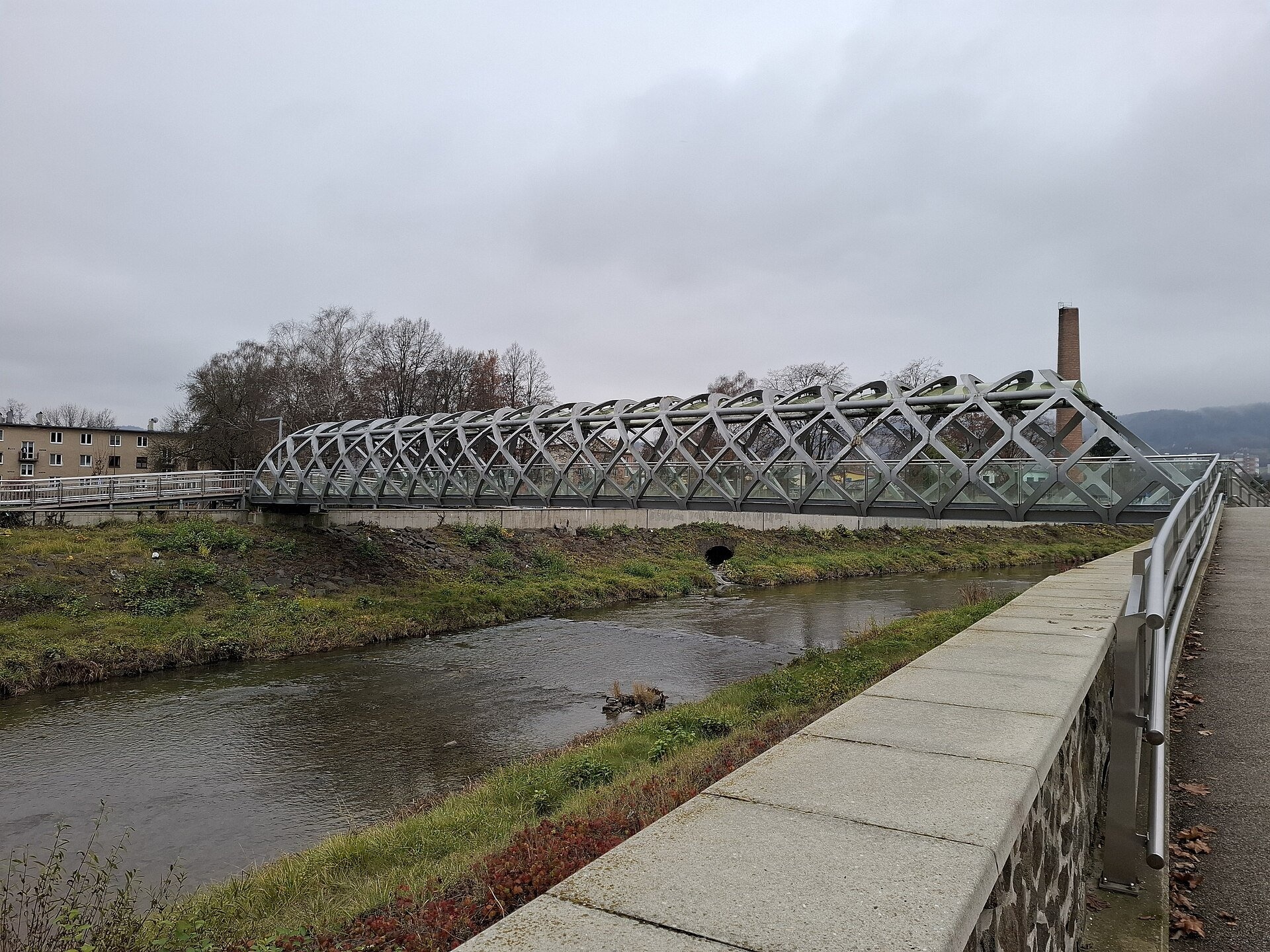
The towns of Bardejov, Giraltovce, Hanušovce nad Topľou and Vranov nad Topľou stand on the Topľa — the names of the last two contain the river's name. The Topľa's water is little used economically: only to supply settlements with drinking water and for a few small factories. In Bardejov the Oroszova lávka footbridge crosses the river.
Nature and safety
The upper Topľa is protected by two reserves — «Pramenisko Tople» around the springs and «Livovská jelšina» with alder forest along the bed. Like all Carpathian rivers, the Topľa rises quickly after downpours and during snowmelt, so keep away from undercut banks. Emergency numbers: 112, in the mountains HZS 18 300.
Nearby: peaks, trails, huts
The trail Livovská Huta – Minčol leads to the springs below Minčol, Sedlo Priehyby – Livov, junction crosses the upper valley, Hlinné – Ivanov Peak climbs from Hlinné to the ridge, and above Bardejov runs Bardejov, Mníchovský potok – Bardejov, Vinbarg.
Photos: Przykuta (talk), CC BY-SA 4.0, Wikimedia Commons; EfreetSK, CC BY-SA 4.0, Wikimedia Commons; Zberateľ, CC BY-SA 4.0, Wikimedia Commons.
Getting there from Ukraine
Border crossings
- Uzhhorod – Vyšné Nemecké — road, 24/7
- Malyi Bereznyi – Ubľa — road, 24/7 For cars and buses; pedestrians not confirmed by the Ukrainian border service, lorries up to 3.5 t.
- Mali Selmentsi – Veľké Slemence (pedestrian) — pedestrian, 09:00–21:00 Kyiv time Pedestrians and cyclists only; inconvenient for the Tatras without onward transport.
- Chop – Čierna nad Tisou (rail) — rail, 24/7
By car
From Uzhhorod ≈138 km, ≈2 h 30 min without queues: Uzhhorod – Vyšné Nemecké → I/19 to Michalovce → I/18 via Vranov nad Topľou towards Prešov → I/545 to Bardejov (≈133 km, ≈2 h 20 min from the border). From Lviv it is faster through Poland: M-10 → Krakovets – Korczowa → A4 to Dębica → DK73 to Jasło → DK28 to Gorlice → DW977 over the internal Schengen crossing Konieczna – Becherov → I/545 to Bardejov: ≈329 km, ≈5 h 10 min (≈251 km, ≈3 h 40 min from the border). Via the Uzhok Pass and Ubľa ≈345 km, ≈6 h 20 min.
Checked 23.10.2026; border crossing hours and timetables change — check before you travel.
Location on the map
Comments
Trails nearby
All trails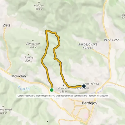 EasyOne-dayMarkedBardejov, Mníchovský potok Bardejov, VinbargElevation profile294–543 m10.2 kmascent 268 m≈ 3 h walkingunder 1 km from Topľa River
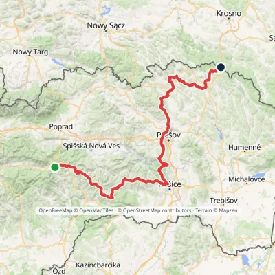 HardMulti-dayMarkedPred Čuntavou Dukliansky PassElevation profile227–1 293 m280.7 kmascent 8 346 munder 1 km from Topľa River
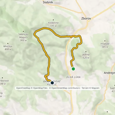 ModerateOne-dayMarkedBardejovské kúpele Dlhá LúkaElevation profile288–638 m11.3 kmascent 496 m≈ 4 h walking3.1 km from Topľa River
Nearby attractions
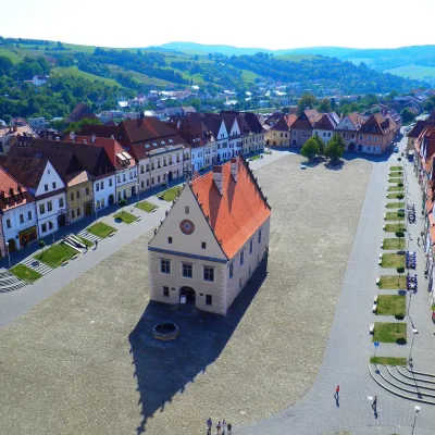 Historic siteBardejov: historic town centre and St Giles’ BasilicaBardejovunder 1 km from Topľa RiverBardejov lies in north-eastern Slovakia, in the Šariš region, on the river Topľa not far from the Polish border.
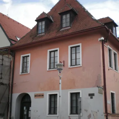 MuseumIcon Exhibition of the Šariš Museum, BardejovBardejovunder 1 km from Topľa RiverThe "Icons" exhibition of the Šariš Museum (Šarišské múzeum) in Bardejov is the only separate specialised exhibition of Eastern-rite icon painting in Slovakia.
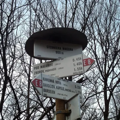 PeakStebnícka MaguraStebníkaltitude 900 m · Volcanic Carpathians range7.1 km from Topľa RiverStebnícka Magura is an 899.9 m summit in the Slovak part of the Low Beskid, in the Busov range. It rises above the village of Stebník about 6 km north of Bardejov and,...
Craft nearby
All craft places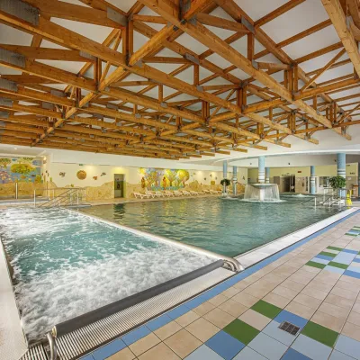 Water parks & thermal poolsBardejovské Kúpele: Wellness Spa Ozón and summer poolBardejov3.4 km from Topľa RiverBardejovské Kúpele is one of Slovakia’s oldest spas, a part of the town of Bardejov about 5 km from its centre, in a valley under the Magura massif that shelters it...
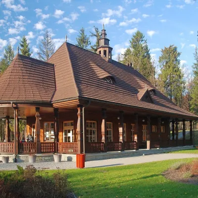 Water parks & thermal poolsWysowa-Zdrój spa: pump room, Franciszek and Henryk watersWysowa-Zdrój17 km from Topľa RiverWysowa-Zdrój is a quiet spa at the source of the Ropa river in the Beskid Niski, at 500–550 m, 20 km from Krynica-Zdrój and 25 km from Bardejovské Kúpele in Slovakia.
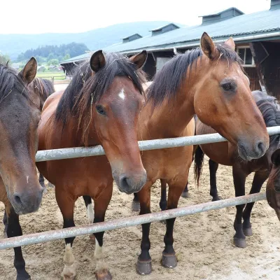 Horse ridingGładyszów Hucul Horse Stud, RegietówGładyszów25 km from Topľa RiverThe "Gładyszów" Hucul Horse Stud (Stadnina Koni Huculskich „Gładyszów”) in the Lemko village of Regietów is one of the largest places in the world where Hucul ponies...
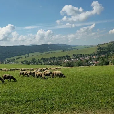 Cheese dairies & pasturesFarma Kamenica — Family Sheep Farm and Cheese Dairy in ŠarišKamenica25 km from Topľa RiverKamenica is a village in northern Šariš, in the valley of the Kameničanka stream, at about 483 m above sea level.
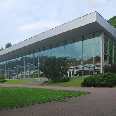 Water parks & thermal poolsKrynica-Zdrój pump rooms: tasting the mineral watersKrynica-Zdrój26 km from Topľa RiverKrynica-Zdrój grew up around its mineral springs, and the best way to feel the spa is to walk round its pump rooms and taste the local waters.
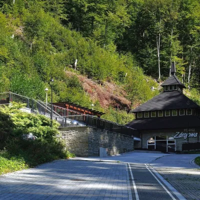 Water parks & thermal poolsŻegiestów-Zdrój spa: the Anna pump room and the Spa HouseŻegiestów34 km from Topľa RiverŻegiestów-Zdrój is a small spa in the narrow Poprad valley in the Beskid Sądecki, a kilometre and a half from the village of Żegiestów and a few kilometres from Muszyna.
