Bardejov
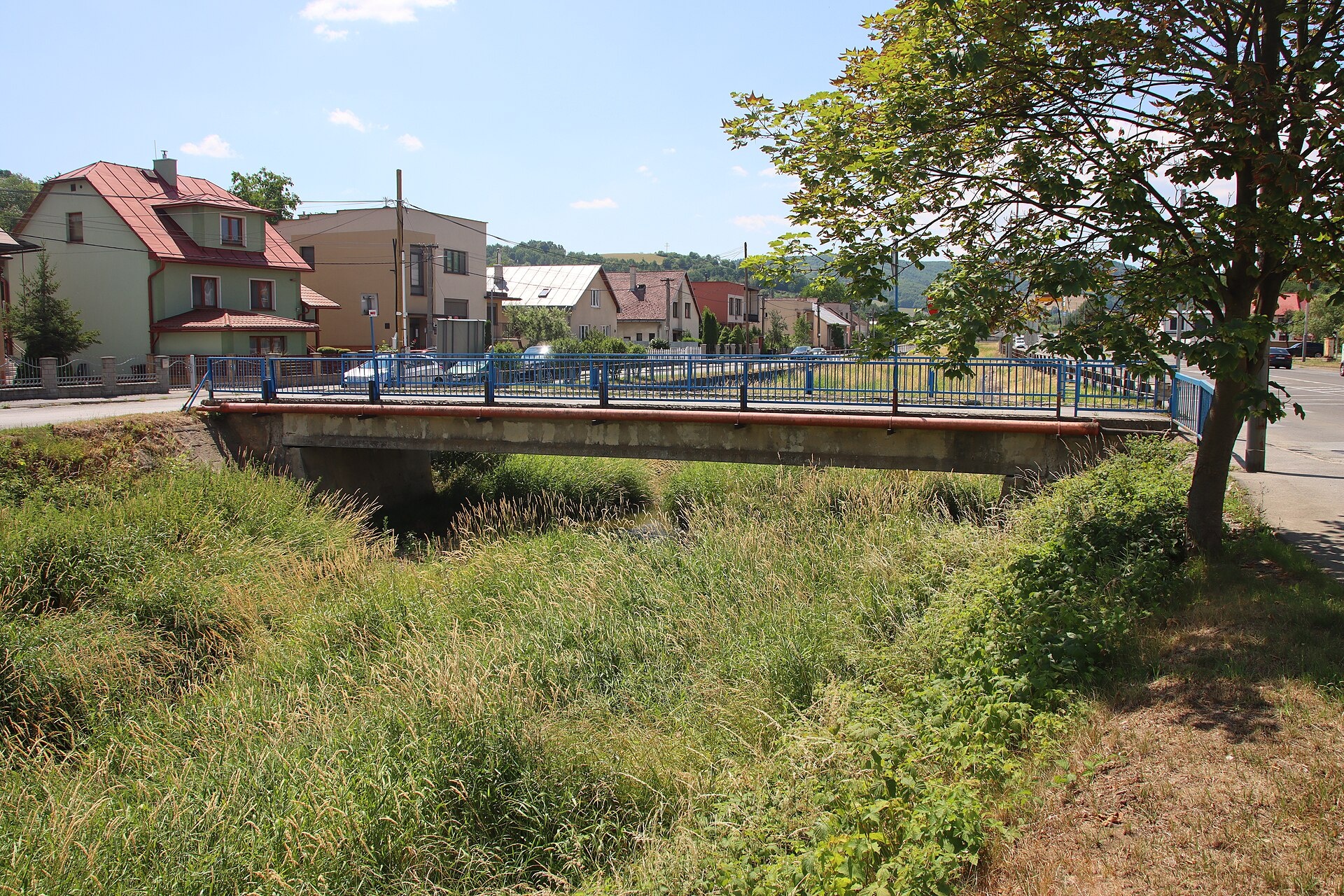
Photos: Doko Ing. Mgr. Jozef Kotulič, CC BY-SA 3.0 (Wikimedia Commons); Andrzej Otrębski, CC BY-SA 4.0 (Wikimedia Commons); Rakoon, CC0 (Wikimedia Commons); Leibniz-Institut für Ost- und Südosteuropaforschung (IOS) GeoPortOst, Public domain (Wikimedia Commons); Draceane, CC BY-SA 4.0 (Wikimedia Commons); EfreetSK, CC BY-SA 4.0 (Wikimedia Commons)
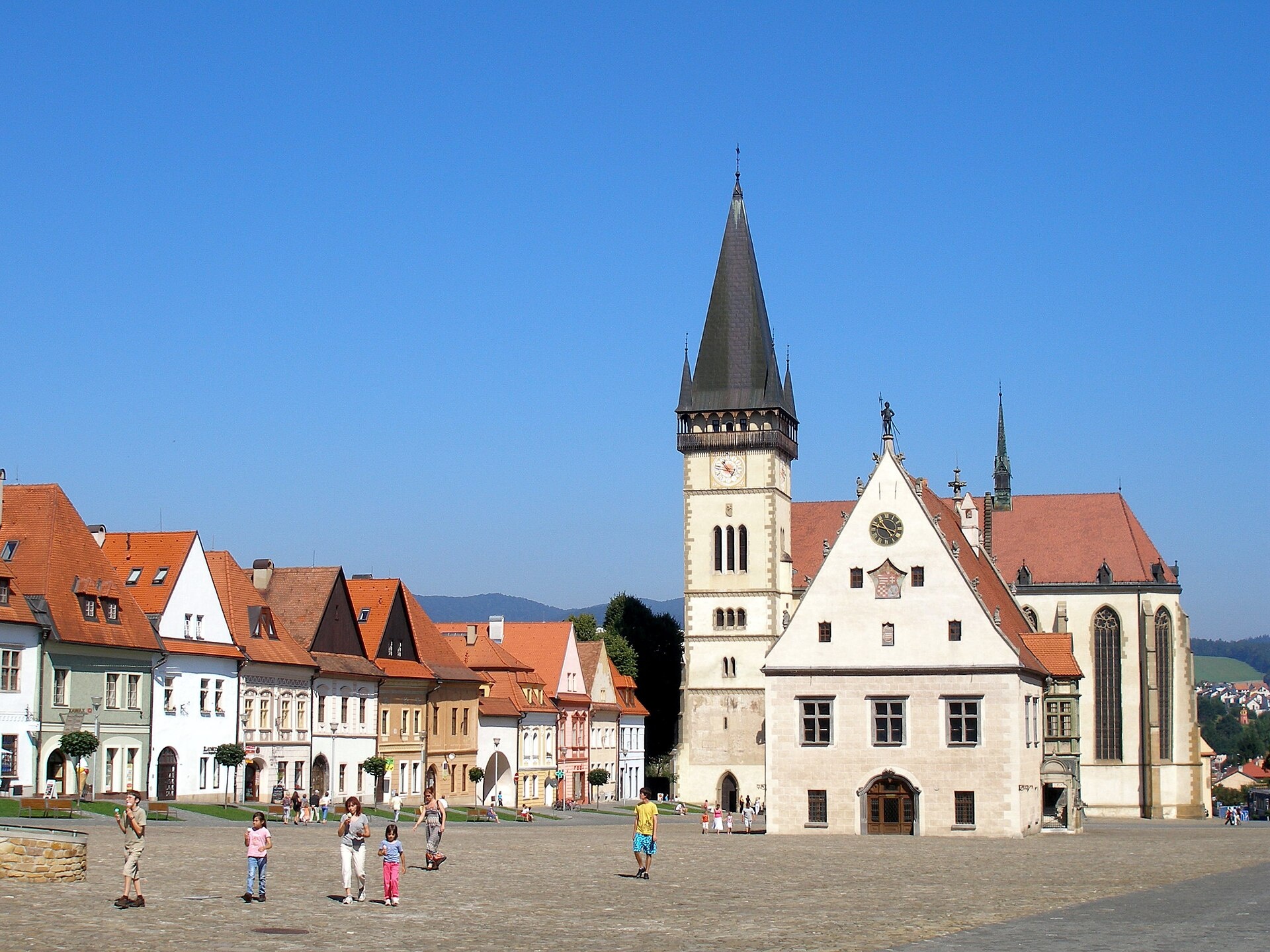
Bardejov is a town in eastern Slovakia, situated on the southern slopes of the Low Beskids, on the Topľa River, near the border with Poland. Located in the Prešov Region, Bardejov District, at an elevation of 323 m, the town is renowned for its authentic medieval center, which is almost entirely preserved. Bardejov is listed as a UNESCO World Heritage Site.
The first written mention of Bardejov dates back to 1241. The town was part of the Ruthenian Kingdom for a long time, joining the Kingdom of Hungary in 1321. In the 14th and 15th centuries, Bardejov became an important center for trade and crafts, reaching its peak in the 15th century. After a period of decline, the 20th century saw restoration efforts that brought European recognition to the town.
Bardejov is known for its historical center with medieval architecture, the 13th-century Basilica of St. Giles, a 16th-century town hall, and a complex of Jewish baths and synagogues. Nearby is the Bardejovské Kúpele spa and several wooden churches. The town is also famous for its cultural heritage, including the icon exhibition of the Šariš Museum.
Visitors can explore the historic center and the Basilica of St. Giles, the icon exhibition at the Šariš Museum, the open-air museum in Bardejovské Kúpele, and the wooden Church of St. Francis in Hervartov. There are 11 hiking trails in and around the town, such as Bardejov Spa – Dlhá Lúka or the route to Stebnícka Magura peak. For relaxation, Bardejovské Kúpele offers Wellness Spa Ozón and a summer swimming pool.
Getting there from Ukraine
From Uzhhorod ≈138 km, ≈2 h 30 min without queues: Uzhhorod – Vyšné Nemecké → I/19 to Michalovce → I/18 via Vranov nad Topľou towards Prešov → I/545 to Bardejov (≈133 km, ≈2 h 20 min from the border). From Lviv it is faster through Poland: M-10 → Krakovets – Korczowa → A4 to Dębica → DK73 to Jasło → DK28 to Gorlice → DW977 over the internal Schengen crossing Konieczna – Becherov → I/545 to Bardejov: ≈329 km, ≈5 h 10 min (≈251 km, ≈3 h 40 min from the border). Via the Uzhok Pass and Ubľa ≈345 km, ≈6 h 20 min.
Sources: Wikipedia, Wikidata, OpenStreetMap, Karpaty.rocks data. More on Wikipedia
Trails nearby
All trails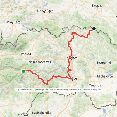 HardMulti-dayMarkedPred Čuntavou Dukliansky PassElevation profile227–1 293 m280.7 kmascent 8 346 munder 1 km from the centre
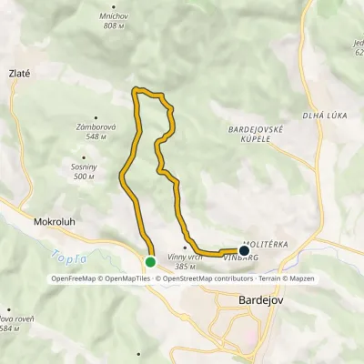 EasyOne-dayMarkedBardejov, Mníchovský potok Bardejov, VinbargElevation profile294–543 m10.2 kmascent 268 m≈ 3 h walking1.3 km from the centre
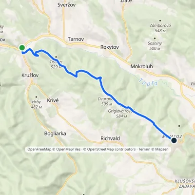 ModerateOne-dayMarkedKružlov MiháľovElevation profile343–608 m10.9 kmascent 309 m≈ 3.5 h walking3.5 km from the centre
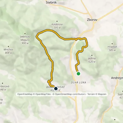 ModerateOne-dayMarkedBardejovské kúpele Dlhá LúkaElevation profile288–638 m11.3 kmascent 496 m≈ 4 h walking3.9 km from the centre
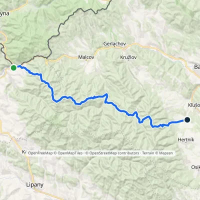 HardMulti-dayMarkedLeluchów ŠibaElevation profile378–1 054 m34.2 kmascent 1 373 m≈ 11.5 h walking7 km from the centre
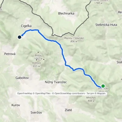 ModerateOne-dayMarkedCigeľka, lake, cottages Stebnicka MaguraElevation profile471–912 m11.6 kmascent 261 m≈ 3.5 h walking7.6 km from the centre
Peaks nearby
All peaks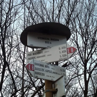
What to visit
All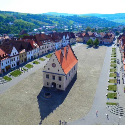 Historic siteBardejov: historic town centre and St Giles’ BasilicaBardejovunder 1 km from the centreBardejov lies in north-eastern Slovakia, in the Šariš region, on the river Topľa not far from the Polish border.
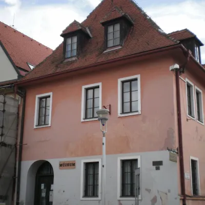 MuseumIcon Exhibition of the Šariš Museum, BardejovBardejovunder 1 km from the centreThe "Icons" exhibition of the Šariš Museum (Šarišské múzeum) in Bardejov is the only separate specialised exhibition of Eastern-rite icon painting in Slovakia.
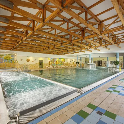 Water parks & thermal poolsBardejovské Kúpele: Wellness Spa Ozón and summer poolBardejov4.1 km from the centreBardejovské Kúpele is one of Slovakia’s oldest spas, a part of the town of Bardejov about 5 km from its centre, in a valley under the Magura massif that shelters it...
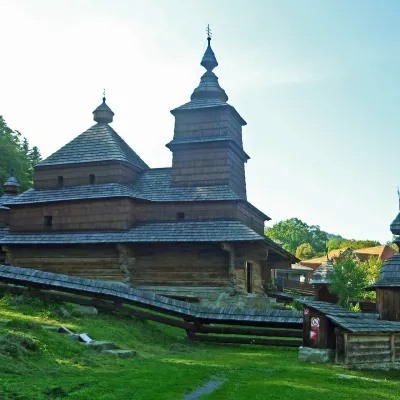 MuseumBardejovské Kúpele Open-Air Museum of Folk ArchitectureBardejov4.2 km from the centreThe Museum of Folk Architecture in the spa resort of Bardejovské Kúpele opened to visitors in 1965 — the first open-air museum in Slovakia.
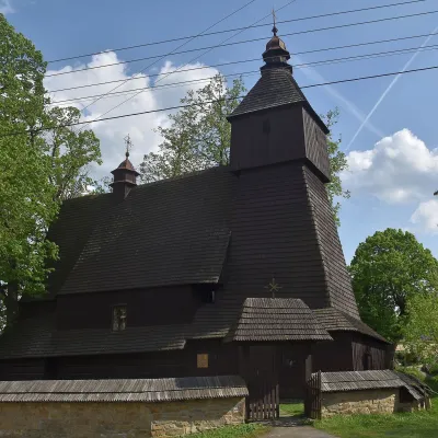 ChurchWooden Church of St Francis of Assisi, HervartovHervartov7.3 km from the centreIn the middle of the village, on a small rise, stands the Roman Catholic wooden Church of St Francis of Assisi, built at the end of the 15th century in the Gothic...
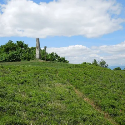 Mountain meadowThe meadow of Čergov's Minčol, the highest peak of the Čergov mountainsKyjovaltitude 1 157 m22 km from the centreČergov's Minčol (Minčol, 1,157 m) is the highest summit of the Čergov mountains in eastern Slovakia, where the districts of Bardejov, Sabinov and Stará Ľubovňa of the...
Craft nearby
All craft places
Spas and thermal pools nearby
Huts, shelters and springs nearby
Getting there from Ukraine
Border crossings
- Uzhhorod – Vyšné Nemecké — road, 24/7
- Malyi Bereznyi – Ubľa — road, 24/7 For cars and buses; pedestrians not confirmed by the Ukrainian border service, lorries up to 3.5 t.
- Mali Selmentsi – Veľké Slemence (pedestrian) — pedestrian, 09:00–21:00 Kyiv time Pedestrians and cyclists only; inconvenient for the Tatras without onward transport.
- Chop – Čierna nad Tisou (rail) — rail, 24/7
By car
From Uzhhorod ≈138 km, ≈2 h 30 min without queues: Uzhhorod – Vyšné Nemecké → I/19 to Michalovce → I/18 via Vranov nad Topľou towards Prešov → I/545 to Bardejov (≈133 km, ≈2 h 20 min from the border). From Lviv it is faster through Poland: M-10 → Krakovets – Korczowa → A4 to Dębica → DK73 to Jasło → DK28 to Gorlice → DW977 over the internal Schengen crossing Konieczna – Becherov → I/545 to Bardejov: ≈329 km, ≈5 h 10 min (≈251 km, ≈3 h 40 min from the border). Via the Uzhok Pass and Ubľa ≈345 km, ≈6 h 20 min.
Checked 23.10.2026; border crossing hours and timetables change — check before you travel.
