National Nature Park "Hutsulshchyna" Kosiv
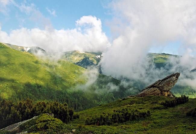
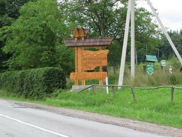
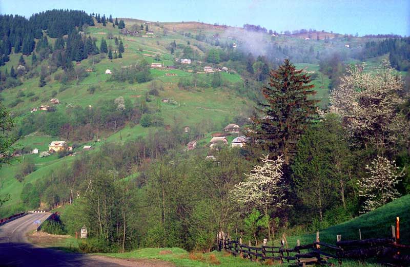
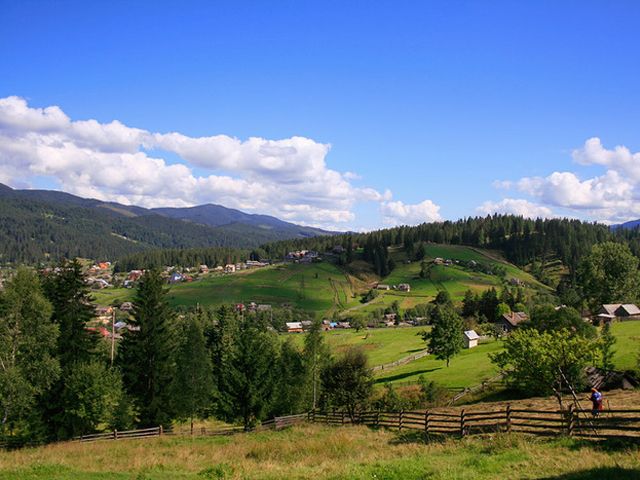
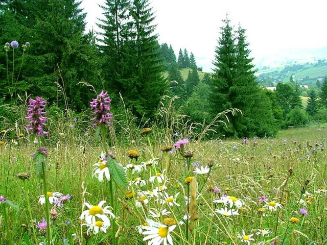
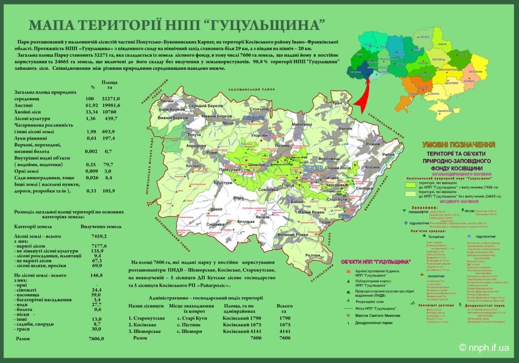
National Nature Park "Hutsulshchyna" is located within the Kosiv District of Ivano-Frankivsk region in the forested part of the Pokutsk-Bukovynian Carpathians. This area has preserved ancient crafts, customs, and rituals of the Hutsuls in the best way. To protect both nature and the local Hutsul culture, a nature reserve was established in 2002. The park stretches approximately 29 km from the northwest to the southeast and 20 km from the northeast to the southwest.
Before gaining its current status as a national park, several smaller objects of the local significance natural reserve fund operated within its territory. As a result, the large national park effectively absorbed the previously created natural reserves. However, their status is maintained within the national park.
The territory of the National Nature Park "Hutsulshchyna" includes the following objects of the natural reserve fund of Ukraine:
- Local significance reserve "Hrehit", landscape;
- Local significance reserve "Kam'yanyisty Khrebet", landscape;
- Local significance reserve "Kamenets", forest;
- Local significance natural monument "Modryny", botanical;
- Local significance natural monument "Etalon of beech planting", botanical;
- Local significance natural monument "Tsukhanivske", botanical;
- Protected area "Lebedyn";
- Protected area "Haivka";
- Protected area "Khomynske";
- Protected area "Dylok";
- Protected area "Kaminets";
- Protected area "Rotul";
- Protected area "Utoropy";
- Local significance natural monument "Waterfall on the river Rushir", hydrological;
- Local significance natural monument "Hydrogen sulfide spring", hydrological;
- Dendropark "Dendrarij".
The relief is complex and heterogeneous, formed over a long time through the uplift from the bottom of the former ocean of layers from different geological epochs, which took on their modern appearance under the influence of exogenous factors. Here, the foothill highland area - Pokutsk Precarpathia is distinguished with prevailing heights of 350-500 m above sea level, and the area of the Outer Carpathians. Low and middle mountain ridges stretch in parallel bands from the northwest to the southeast. The mountain ridges mostly have wide crests and relatively gentle slopes. Between them lie wide intermountain valleys. This type of relief contributes to the accessibility and convenience of recreational development of the Park territory.
The height of the mountain ridges ranges from 709 to 1476 meters above sea level. The main ridges are Kam'yanyisty, Karmatura, Khomensky, Brusny, Syhlyn, Sokil'sky, Plosky, Maksymets, Bukovets-Ritsky. In the western and southwestern directions, the heights increase and reach 1000 meters and more (Hrehit - 1471 m, Lysyna Kosmatska - 1464 m, Ihrets - 1374 m). The plain part is 300-450 m above sea level, the mountain part is 700-1000 m. The largest rivers flow across the ridges: Cheremosh (80 km), Pistin'ka (56 km), Rybnitsa (54 km), Lyuchka (24 km).
The highest peak of the National Nature Park "Hutsulshchyna" is Mount Hrehit, with an elevation of 1472 m above sea level. Its slopes are covered with stone debris, locally known as "hrehoty". On some ridges, particularly on Sokil'sky, cliffs rise to heights of 20-40 m. At its foot lies a unique spruce primeval forest. In general, the low mountain ranges are covered with beech-hornbeam forests, while higher up in the mountains grow spruces and beeches. In autumn, when the leaves begin to turn yellow, it is particularly beautiful here.
The territory of the park is interspersed with numerous rivers and mountain streams. The largest of them are Lyuchka, Pistin'ka, Rybnitsa, Cheremosh. There are also many small rivers and mountain brooks, such as the Pychniy stream. All of them are right tributaries of the Prut river. Three river systems - Rybnitsa, Lyuchka, and Pistin'ka occupy approximately equal areas within the district, averaging just over 25%, while the basin of the Cheremosh occupies slightly less area - about 20%, and the basins of the other two rivers - Tsutsulyna and Berezivka - 2.9% and 0.5% respectively.
The lake area of the National Nature Park "Hutsulshchyna" is insignificant. There are only six small lakes. Each of them is quite unique. The most common type of lake basin is the collapse-slump type. Four of the six existing lakes in the area belong to this type.
- Lake Lebedyn (Lebedyn) is located on the southern slope of the Lebedyn ridge, at an altitude of 650 m, among beech forest. The area of the water surface is 3500 m², and the shape of the lake resembles an obtuse triangle. The hypotheses regarding its karst or glacial origin found in popular scientific literature do not withstand any criticism. Upon detailed examination, it was found that the lake has an extraordinarily large depth for its modest size, reaching, according to unverified data, 28 m. (A 12-meter pole did not reach the bottom). The lake has a collapse origin. From the north side, a clearly defined collapse wall is visible along the ridge, about 100 m long along the crest. The slope above the lake is heavily exposed, rocky, and steep. The ridge of the ridge is asymmetric. Nearby, there are several other closed dry rocky depressions. The lake is drained. The drainage occurs into the Palytsky stream. Due to the large amount of precipitation, intensive decay processes occur in the lake, enriching the waters with hydrogen sulfide. The transparency of the water is low.
- Lake Mertve is located on the neighboring Karmatura ridge (Kormytura), practically on the very crest, at an altitude of over 800 m. The lake is small in size, pear-shaped, 30-60 m wide and about 70 m long. The lake is of collapse-slump type. A clear wall of detachment is visible from the northwest side. The lake is shallow, heavily overgrown with trees and shrubs. The entire middle of the lake is occupied by a large swampy island, leaving only the edges as the water surface. The lake is drained, with drainage occurring through the seepage of water through the rocky dam into the Korov'yek river. Apparently, in the past, the lake consisted of two unevenly leveled water basins and was larger in size. The upper basin represents a narrow, long dry ravine with a flat bottom.
- Lake Zipyakove formed relatively recently as a result of a large collapse that occurred on the southwestern slope of Mount Zinyakiv Verkh. The lake is very small but quite deep. Everywhere around are overturned trees, boulders, and the relief is very complex.
- Lake Dzyvnyachka is located on Mount Ovid, near Stary Kuty, at an altitude of about 600 m. The length of the lake is 8 m, width 7 m, depth 1.5-2 m. Apparently, the lake is also of collapse origin.
- Lake Viknyshchi (Viknyshcha) near the village of Lyuchi has, according to unverified data, a karst origin. The depth is up to 2 m, the banks are steep, surrounded on all sides by beech forest.
- Lake Bans'ke is located in Kosiv, on the territory of the former "Hutsulshchyna" factory. It formed in the place of an old salt mine - "banya". It has a technogenic-karst origin. The area of the water surface is 30000 m², and the depth reaches 10 m. Until 1938, there was a salt mine on its site, and until 1939, a health resort was based there. The lake is located in the western part of the town of Kosiv on the last high terrace of the left bank of the Rybnitsa river, at an altitude of 400 m above sea level. The lake is almost round in shape, with a very winding shoreline and a large number of shallow floodplains. This shallow coastal zone is heavily overgrown with reeds and bulrush. The southern part of the lake, located on the terrace towards the river, is shallower due to a larger area of overgrowth. The northern part, adjacent to the slope, where traces of a landslide from 15 years ago have been preserved, plunges more steeply into the depths, as the area of overgrowth here is insignificant. The slope itself is poorly forested, and in its eastern part above the lake, traces of an older landslide have been preserved. Under the turf layer, besides clays, thin layers of gypsum are found. The area of the water surface is 30 thousand m². Fish is found in the lake. Two bridges for fishermen have been arranged. The bottom is unexplored, so swimming is not allowed.
The relief of the foothill highland part of the region is favorable for the construction of ponds. According to survey materials, there are 83 ponds of various sizes in the region, with a total area of about 105 ha. The largest pond complex is built in the valley of the Voliytsia river - 7 ponds, with a total area of 30 ha. Also, 7 ponds, but of smaller area, are built on the Tsukhaniv river. Two large ponds with areas of 4 and 5 ha are built on the Chernyatyn river. The area of two ponds on the Nasarat river is 10 ha. Other ponds have insignificant areas. Many dug ponds are found in Rozhniv, on Verbivka, in Kobakakh, on the outskirts of Kosiv.
The territory of the "Hutsulshchyna" natural park is home to a wide variety of plants, 65 species of which are listed in the Red Book of Ukraine. There are also many representatives of fauna: bears, roe deer, deer. 16 species of animals and 4 species of insects are endangered.
The National Nature Park "Hutsulshchyna" has an extremely high recreational potential. It is located in the picturesque forested part of the Pokutsk-Bukovynian Carpathians, which is perhaps the most interesting region of Ukraine, where ancient original crafts, industries, traditions, and customs of the Hutsul ethnic group have been preserved distinctly and quite fully. The products of local craftsmen - carvers, furriers, egg-painters, brass workers, ceramicists, weavers, embroiderers, etc. are in great demand and popularity.
The park has a well-developed tourist-recreational infrastructure, with many recreation centers, resorts, and sanatoriums. The most famous of them are the tourist complex "Carpathian Stars" in Kosiv and the tourist base "Silver Waterfalls" in Sheshory. The Park has developed and marked 12 eco-educational trails. The routes lead to the most attractive corners and are accessible to all categories of visitors. Along the routes, there are places for short-term rest with forest furniture and information stands. Routes such as "To the observation platform on Mount Ostry", "To the hydrogen sulfide spring on the Voliytsia river", "To the pasture Rosokhata" and "To Lake Lebedyn", "To Mount Mykhalkiv" are particularly popular among tourists. Last year, a new comprehensive eco-educational trail "Four Roads" was established. The route includes trails of the Kosiv and Sheshory nature conservation research departments of the National Nature Park "Hutsulshchyna", including already existing ones - "Popid Kam'yanyisty", "To Klyfa" and two new ones - "To Zinyakiv Verkh", "To Sheshory Huks". Ski slopes with lifts operate on the outskirts of Kosiv and Sheshory.
In the construction of recreational facilities, elements of Hutsul architecture have been used, which organically blend with the natural landscapes, creating masterpieces of architectural-park art. The Hutsul architectural style is characterized by originality and high aesthetics. Hutsul churches - "hrazhdy", which can be seen in almost every village of the park, are known worldwide for their elegance and harmony.
Kosivshchyna is the artistic center of Hutsulshchyna - it is a center of original customs, everyday life, and culture of the Hutsuls, their decorative-applied arts. The products of local craftsmen: carvers, furriers, egg-painters, brass workers, ceramicists, weavers, embroiderers, etc. are in great demand and popularity. Original ancient crafts and industries, as well as colorful traditional clothing, original musical and song culture of the Hutsuls are of great interest and are a gem of Ukrainian and European culture.
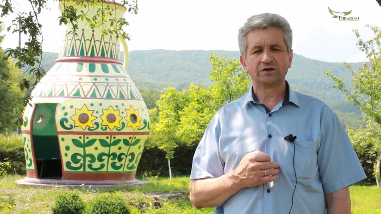
Since 2002, the project "Tourist-Recreational Complex "Saint Nicholas Estate" has been implemented on the territory of the National Nature Park "Hutsulshchyna". Today, the Saint Nicholas Estate is the largest recreational facility in the structure of the National Nature Park "Hutsulshchyna", which performs not only recreational but also educational, spiritual-ecological, and sports-health functions. The central object of the Estate is the Homestead of Saint Nicholas, where a post office, rooms, and the chamber of the Miracle Worker function, as well as a nature museum room, a room for New Year and Christmas toys, and a children's toy workshop. Near the Homestead of Nicholas, there are houses of folk artists, where various master classes are held during festivals. The territory of the Estate has a place for the Nicholas bonfire.
Around the fire, there are chairs representing twelve human virtues. Also, near Nicholas's house, a children's playground has been built, equipped with various slides, swings, ladders, and a sports ground with artificial turf. The territory of the Estate has gazebos and rest areas. Throughout the year, many interesting events are organized and held at the Saint Nicholas Estate. For example, on December 19, the festival "New Year-Christmas Toy" takes place, on May 22 - the Spring Nicholas holiday, during Christmas and Easter - the holidays of carols, nativity scenes, Easter eggs, and many other thematic competitions and celebrations. Various conferences, seminars, meetings with famous people, and other events on art and culture, education and science, and environmental conservation are also held at the Estate. Over the years of implementing the project, the "Saint Nicholas Estate" has gained not only national but also international recognition.
The megalithic sacred objects have great historical and educational significance for visitors and residents of the region. Professor M. Kuhutak (2007) described seven megalithic sanctuaries in the territory of Kosivshchyna, which are over three thousand years old. Among them, special attention should be paid to the calendar-astronomical sanctuary (an astronomical observatory, older than Stonehenge) with a center on Lysyna Kosmatska, as well as the Ternoshorsky sanctuary of fertility and the birth of the new year with a statue of a pregnant woman weighing over 100 tons and over 10 m high.
The river Cheremosh, which flows along the southeastern border of the park, is particularly popular among lovers of water recreation and sports. Many legends and tales are associated with it, and it has been sung by poets and bards. The picturesque Cheremosh is one of the hallmarks not only of the Hutsul region but also of the entire Ukrainian Carpathians.
A significant part of the park's territory is occupied by forests, primarily consisting of deciduous species. The most common are: beech, oak, hornbeam, and spruce. Currently, 874 species of higher vascular plants have been identified within the park, over 60 species are listed in the Red Book of Ukraine (mountain arnica, Heufel's saffron, cedar pine, yew, etc.).
The animal world of the park is also quite diverse, with over 50 species of mammals, about 172 species of birds, 14 species of amphibians, and others. Rare predators such as the brown bear, lynx, and wildcat can be found. In addition to the wild nature, "Hutsulshchyna" attracts tourists with its colorfulness and cultural heritage, ancient crafts, and trades. One of these is Hutsul ceramics, which has gained popularity far beyond Ukraine. The clay products of local craftsmen are famous for their unique painting and the unique production technology used by many generations of potters. In the information center of the national park, a number of museum rooms have been created, showcasing collections of medicinal plants, geological formations, insects, etc. The national park territory features the "Saint Nicholas Estate" with a museum of New Year and Christmas toys.
In "Hutsulshchyna", you can find many varieties of recreation and entertainment. Among the popular activities are: mountain hiking, mushroom and berry picking, horseback riding, rafting on the Cheremosh, visiting master classes and museums. The park has developed 7 ecological trails of varying lengths from 1 to 7 km. A number of thematic events and festivals are held in the territory: "New Year-Christmas Toy", "Mountain Rainbow", "Ludynye", "Painted Jug", and others.
The national park has its own apiary where honey and beekeeping products can be purchased. The tourist infrastructure of the National Nature Park "Hutsulshchyna", like that of the Carpathians in general, is well developed. In every settlement, there are various options for accommodation, dining establishments, and entertainment. Films such as "House of Flying Daggers" by Chinese director Zhang Yimou, "Iron Hundred" by Oles Yanchuk, as well as tourist and promotional videos have been shot in the park.
The National Nature Park "Hutsulshchyna" is a great place for relaxation. The administration of the reserve operates in Kosiv. You can reach the town from Ivano-Frankivsk by minibus.
Video 2
 Відео про НПП "Гуцульщина". 2017 рікПарк Гуцульщина
Location on the map
Comments
Places to stay nearby
All stays Homestead"Villa Diola" KosivKosivunder 1 km from National Nature Park "Hutsulshchyna" KosivPoolSPAFireplaceNearby: Kosivskyi Huk Waterfall 600 mCity Banske Lake 1.0 km8 trails
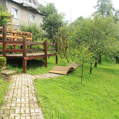 HomesteadHomestead "Horyanka" MykulychynKosiv1.3 km from National Nature Park "Hutsulshchyna" KosivPoolSaunaBBQNearby: City Banske Lake 200 mKosivskyi Huk Waterfall 600 m8 trails
 HomesteadHomestead "Pry Dorozi" MykulychynKosiv1.3 km from National Nature Park "Hutsulshchyna" KosivBBQKitchenParkingNearby: City Banske Lake 400 mKosivskyi Huk Waterfall 1000 m8 trails
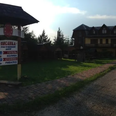 HotelGuest House "Pysanka" KosivKosiv1.3 km from National Nature Park "Hutsulshchyna" KosivBBQKitchenWi‑FiNearby: City Banske Lake 2.1 kmKosivskyi Huk Waterfall 2.3 km6 trails
 CottageVilla DarosoKosiv1.8 km from National Nature Park "Hutsulshchyna" KosivSPAKitchenNearby: Kosivskyi Huk Waterfall 600 mCity Banske Lake 1.2 km8 trails
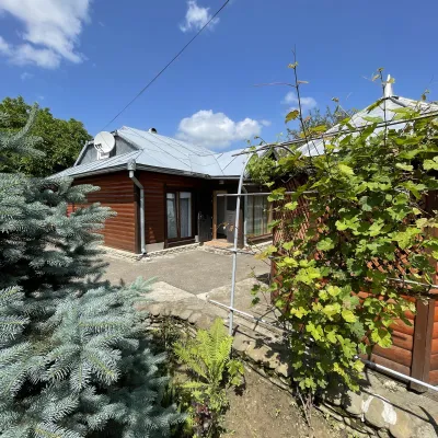 CottageCottage "Prykarpattia"Kosiv2.2 km from National Nature Park "Hutsulshchyna" KosivFireplaceParkingWi‑FiNearby: City Banske Lake 1.9 kmKosivskyi Huk Waterfall 2.5 km6 trails
Trails nearby
All trails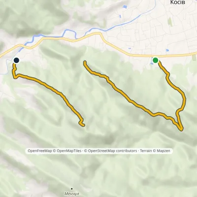 ModerateOne-dayMarkedMount Ostryi Mount Mykhalkiv (yellow trail)Elevation profile382–809 m7.7 kmascent 627 m≈ 3 h walkingunder 1 km from National Nature Park "Hutsulshchyna" Kosiv
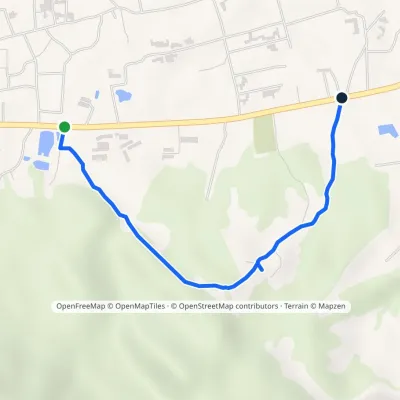 EasyOne-dayMarkedSpring KosivElevation profile369–474 m2.3 kmascent 89 m≈ 45 min walkingunder 1 km from National Nature Park "Hutsulshchyna" Kosiv
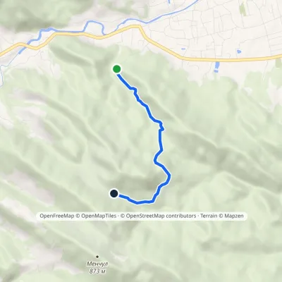 EasyOne-dayMarkedMount Ostryi Mount Mykhalkiv (blue trail)Elevation profile477–700 m3.4 kmascent 262 m≈ 1.5 h walking1.1 km from National Nature Park "Hutsulshchyna" Kosiv
Nearby attractions
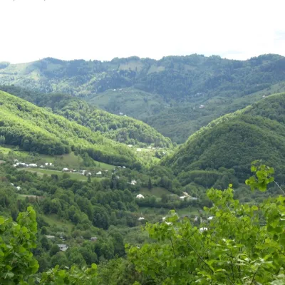 NatureRocky ridgeKosiv1.3 km from National Nature Park "Hutsulshchyna" KosivAt the foot of the ridge is the Rybnytsia River. The ridge has its name from the large number of sandstone stones and rocks.
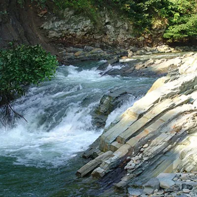 WaterfallKosivskyi Huk WaterfallKosiv1.3 km from National Nature Park "Hutsulshchyna" KosivKosivskyi Huk - one of the most beautiful waterfalls in the Ukrainian Carpathians (in the Pokuttya-Bukovyna Carpathians massif), a geological natural monument of local...
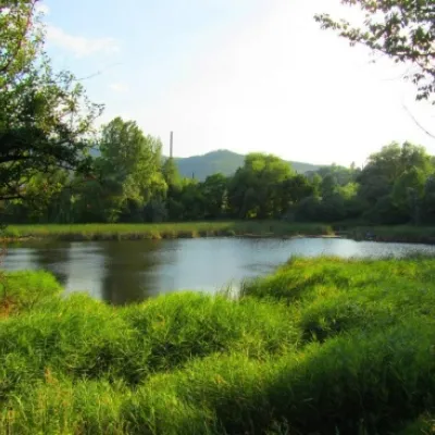 LakeCity Banske Lake (Kosiv)Kosiv1.5 km from National Nature Park "Hutsulshchyna" KosivThere are lakes of technogenic origin in the Hutsul mountains. One such lake is Banske Lake (near the former factory "Hutsulshchyna") in Kosiv.
Craft nearby
All craft places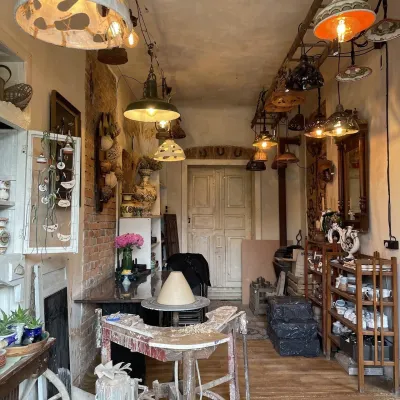 Craft shopsFiraworkshop author ceramics studio-shop, KosivKosiv1.2 km from National Nature Park "Hutsulshchyna" KosivFiraworkshop is a creative studio of author ceramics in Kosiv, at 213 Nezalezhnosti Street, where you can both buy finished pieces and try working with clay yourself.
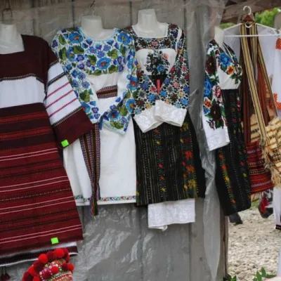 Markets & fairsKosiv Market (Smodnyansky Market), KosivKosiv1.3 km from National Nature Park "Hutsulshchyna" KosivKosiv (Smodnyansky) Market in Ivano-Frankivsk region is a treasure trove of folk traditions, a corner of Hutsulshchyna that tourists and guests should definitely visit...
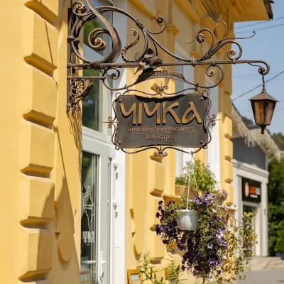 Craft shopsChichka shop of Hutsul handicrafts, KosivKosiv1.6 km from National Nature Park "Hutsulshchyna" KosivChichka is a shop of contemporary handmade Hutsul goods in the very centre of Kosiv, at 76 Nezalezhnosti Street.
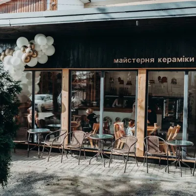 Crafts & workshopsGonchar Ceramics & Coffee Workshop, KosivKosiv1.9 km from National Nature Park "Hutsulshchyna" KosivA pottery where you drink coffee from cups made on site Gonchar is a small ceramics and coffee workshop in central Kosiv run by the Chornyi family of potters.
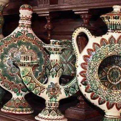 Crafts & workshopsKosiv Painted Ceramics Masterclass, KosivKosiv1.9 km from National Nature Park "Hutsulshchyna" KosivYellow deer, green birds, riders and flowers on a warm white background — Kosiv painted ceramics are recognisable at a glance.
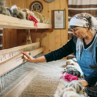 Crafts & workshopsLizhnyk Weaving Masterclass, KosivKosiv1.9 km from National Nature Park "Hutsulshchyna" KosivA lizhnyk of your own: what the masterclass is The Kosiv area is one of the main centres of Hutsul lizhnyk weaving, and the best way to understand the craft is to sit...