Iliašovce
Iliašovce is a village in Slovakia.
Elevation: about 520 m above sea level. Population: 999 (2025).
Here and nearby on the site: 1 trail.
Facts: Wikidata, OpenStreetMap. More on Wikipedia
Comments
Travellers’ experience: reports, tips, questions.
No one has written here yet. Be the first — your experience helps others.
What's nearby
Trails nearby
All trails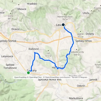 ModerateOne-dayMarkedSmižany Levoča, near Košická GateElevation profile451–660 m19.6 kmascent 406 m≈ 5.5 h walkingunder 1 km from the centre
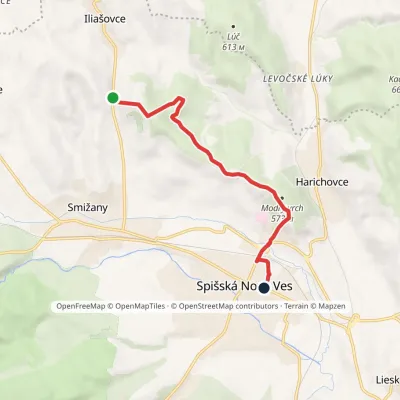 EasyOne-dayMarkedSpišská Nová Ves, square Pod ŠibeňomElevation profile461–624 m7 kmascent 110 m≈ 2 h walking1.4 km from the centre
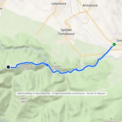 EasyOne-dayMarkedSmižany Kláštorisko, hutElevation profile484–839 m8.8 kmascent 377 m≈ 3 h walking3.8 km from the centre
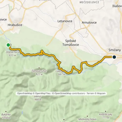 ModerateOne-dayMarkedSmižany, zastávka Hrdlo HornáduElevation profile483–667 m13.5 kmascent 422 m≈ 4 h walking4 km from the centre
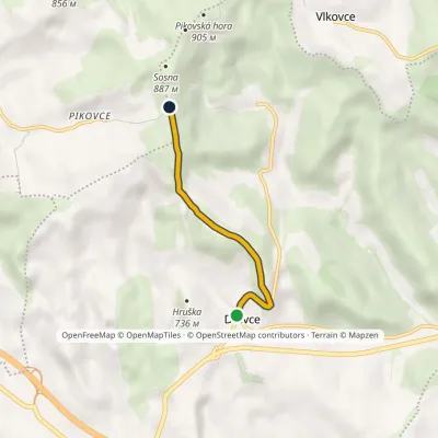 EasyOne-dayMarkedDravce SosnaElevation profile661–853 m3.2 kmascent 195 m≈ 1 h walking4.4 km from the centre
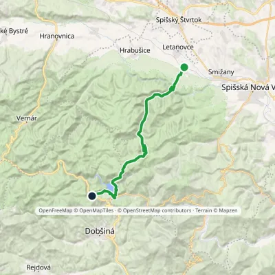 HardOne-dayMarkedSpišské Tomášovce, zastávka Pod ČižmouElevation profile515–1 092 m23 kmascent 866 m≈ 7 h walking4.7 km from the centre
Peaks nearby
All peaks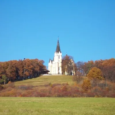 PeakMariánska hora (Marian Hill)Levočaaltitude 761 m8 km from the centreMariánska hora (Marian Hill; Hungarian Máriahegy) is a hill on the southern edge of the Levoča Hills, about 2 km north of the centre of the town of Levoča in eastern...
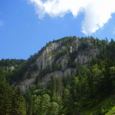 PeakHavrania skalaStratenáaltitude 1 156 m17 km from the centreHavrania skala (Raven Rock) is a 1,156 m summit, one of the highest in the Slovak Paradise. It stands in the southern part of the national park, about 3 km north of...
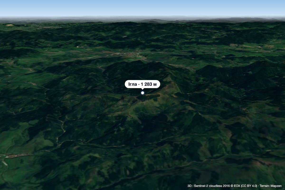 PeakIhla (Levoča Hills)Ihľanyaltitude 1 283 m23 km from the centreIhla (Slovak for "needle"; German Nadel) is a 1283 m summit in the Levoča Hills (Levočské vrchy) in eastern Slovakia, the third highest in the range.
What to visit
All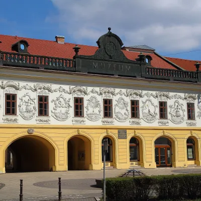 MuseumSpiš Museum in Spišská Nová Ves (Provincial House)Spišská Nová Ves5.9 km from the centreThe Spiš Museum (Múzeum Spiša) in Spišská Nová Ves is one of the most comprehensive regional museums in eastern Slovakia.
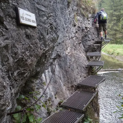 NatureHornád River Gorge (Prielom Hornádu)Hrabušice8.6 km from the centreThe Hornád Gorge (Prielom Hornádu) is, together with the Suchá Belá ravine and the Tomášovský výhľad viewpoint, the best-known place in Slovak Paradise National Park.
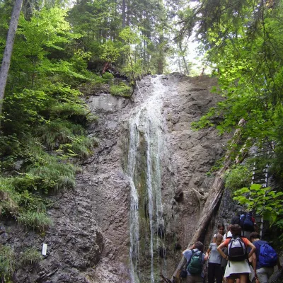 WaterfallKláštorská Gorge and its waterfallsLetanovce · Slovak Paradise8.8 km from the centreheight 13 m520 m above sea levelKláštorská roklina (Kláštorská Gorge) is one of the shortest but most picturesque gorges of the Slovak Paradise National Park in the Spiš region.
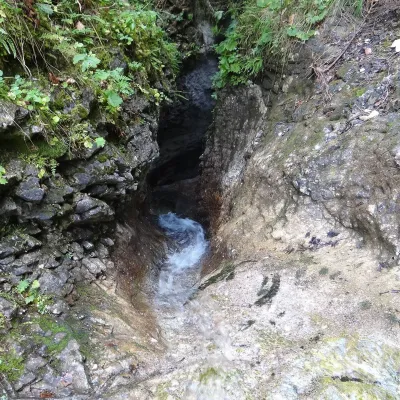 WaterfallKyseľ Gorge and its waterfalls: the ferrata, Malý and Veľký KyseľLetanovce · Slovak Paradise10 km from the centre750 m above sea levelKyseľ is one of the most characteristic and most visited gorges of Slovak Paradise National Park (Slovenský raj) in eastern Slovakia.
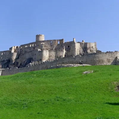 CastleSpiš CastleŽehra18 km from the centreA castle visible for dozens of kilometres Spiš Castle (Spišský hrad) is the ruin of a vast castle on top of a 634 m travertine rock that rises 200 m above the Spiš basin.
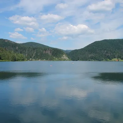 LakePalcmanská Maša reservoirDedinky · Slovak Paradise18 km from the centre786 m above sea levelarea 85–86.5 haPalcmanská Maša is the largest reservoir in the Slovak Paradise. It lies on the upper course of the Hnilec river, in a basin-like widening of the valley below the...
Craft nearby
All craft places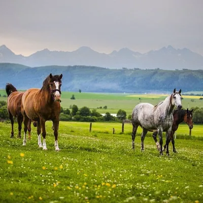 Horse ridingRanč u Trapera, Podlesok: Horse Rides in the Slovak ParadiseHrabušice11 km from the centreA little away from the main tourist bustle, below the forest, stands the family-run Ranč u Trapera, run by the Salaj family.
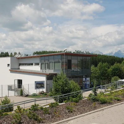 Water parks & thermal poolsThermal Park VrbovVrbov13 km from the centreThermal Park Vrbov is one of the best-known thermal baths in the Spiš region, on the southern edge of the village of Vrbov, about 6 km (as the crow flies) from...
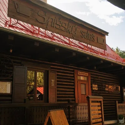 Koliby & Hutsul cuisineSpišský salaš below Spiš Castle: Spiš cooking since 1964Spišská Kapitula15 km from the centreBetween Spiš Castle and Spišská Kapitula, at the edge of the plain below the travertine mound of Sivá brada, stands the wooden Spišský salaš.
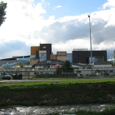 Water parks & thermal poolsAquaCity Poprad water parkPoprad18 km from the centreAquaCity Poprad is a large year-round water park and wellness complex in the town of Poprad, a few minutes from the centre; according to the complex, the High Tatras...
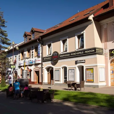 Craft beer & breweriesMinipivovar TATRAS, PopradPoprad18 km from the centreMinipivovar TATRAS is a brewpub on Poprad’s main square, Námestie sv. Egídia, housed in a building with a long brewing history.
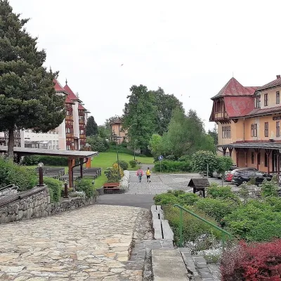 Water parks & thermal poolsClimatic spas of the High Tatras: Nový Smokovec, Polianka, KotlinaVysoké Tatry28 km from the centreNový Smokovec is the best known of the climatic spas of the High Tatras. It grew up in a spruce forest at about 1010 m, south-west of Starý Smokovec, with which it...
Spas and thermal pools nearby
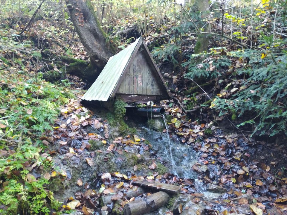
Water parks & thermal poolsThermal Park VrbovVrbov13 km from the centreThermal Park Vrbov is one of the best-known thermal baths in the Spiš region, on the southern edge of the village of Vrbov, about 6 km (as the crow flies) from...Water parks & thermal poolsAquaCity Poprad water parkPoprad18 km from the centreAquaCity Poprad is a large year-round water park and wellness complex in the town of Poprad, a few minutes from the centre; according to the complex, the High Tatras...Water parks & thermal poolsClimatic spas of the High Tatras: Nový Smokovec, Polianka, KotlinaVysoké Tatry28 km from the centreNový Smokovec is the best known of the climatic spas of the High Tatras. It grew up in a spruce forest at about 1010 m, south-west of Starý Smokovec, with which it...Huts, shelters and springs nearby
Getting there from Ukraine
Border crossings
- Uzhhorod – Vyšné Nemecké — road, 24/7
- Malyi Bereznyi – Ubľa — road, 24/7 For cars and buses; pedestrians not confirmed by the Ukrainian border service, lorries up to 3.5 t.
- Mali Selmentsi – Veľké Slemence (pedestrian) — pedestrian, 09:00–21:00 Kyiv time Pedestrians and cyclists only; inconvenient for the Tatras without onward transport.
- Chop – Čierna nad Tisou (rail) — rail, 24/7
By car
From Uzhhorod ≈182 km, ≈2 h 45 min without queues: Uzhhorod – Vyšné Nemecké → I/19 via Sobrance and Michalovce to Košice → D1 motorway via Prešov to the exit near Levoča → road 533 to Spišská Nová Ves (≈177 km, ≈2 h 30 min from the border). From Lviv via Uzhok and Ubľa ≈407 km, ≈6 h 40 min; through Poland (Kraków – Nowy Targ) ≈496 km, ≈6 h 20 min. The D1 requires an e-vignette (eznamka.sk).
Checked 23.10.2026; border crossing hours and timetables change — check before you travel.
