Capie pleso
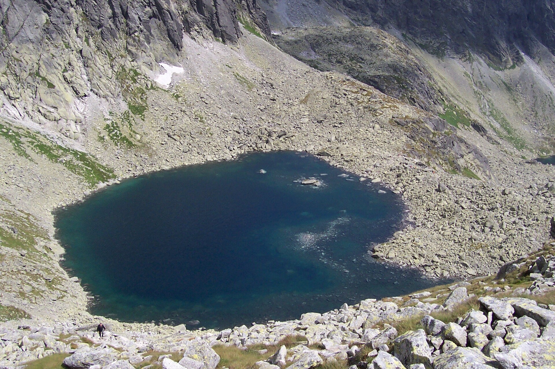
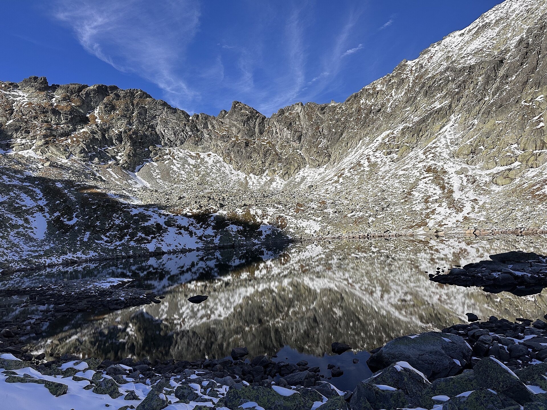
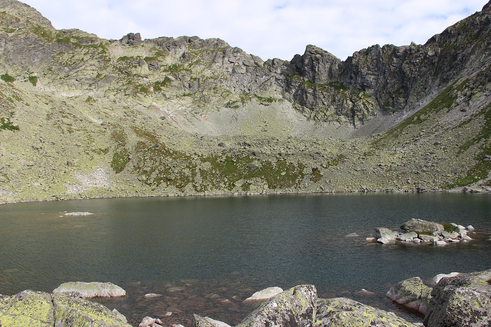
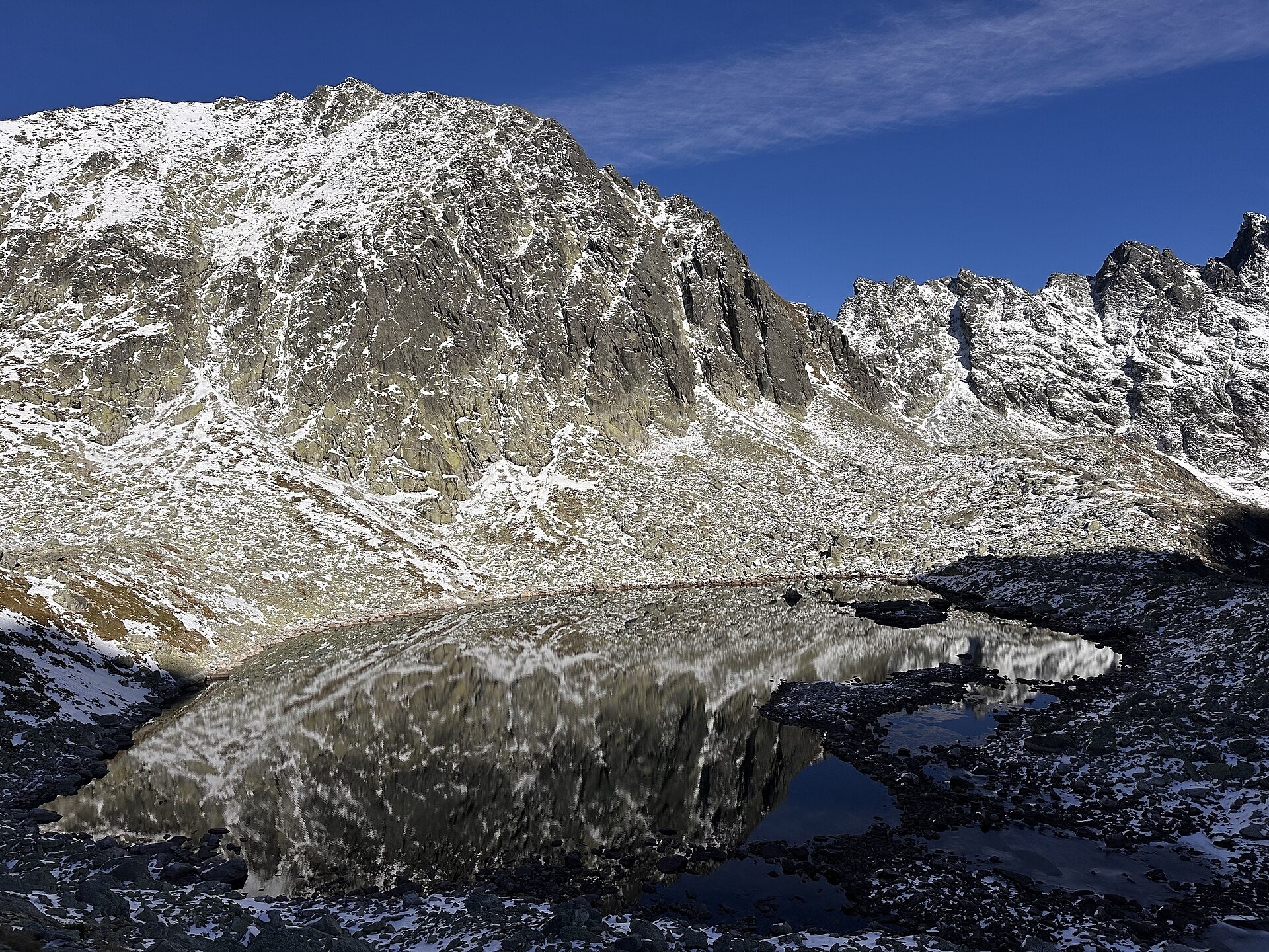
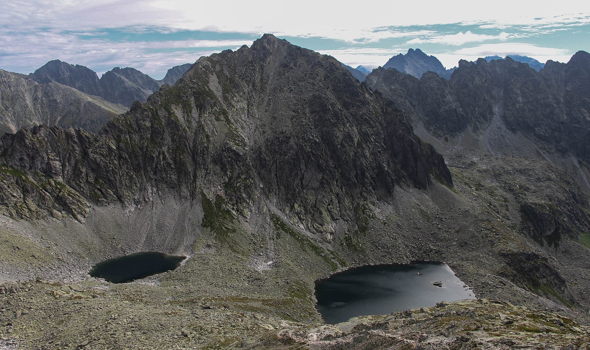
Capie pleso is the largest lake of Mlynická dolina in the western High Tatras, within Tatra National Park (TANAP). It fills a typical glacial basin in Capí kotol — one of the two cirques at the very top of the valley — at about 2,075 m. According to measurements by TANAP staff in 1961–1967 it covers about 3 ha, measures 246 by 175 m and is up to 17.5 m deep. Several stony islets rise from the water and turn into small peninsulas in dry spells. The tarn lies above a rock step strewn with moraine boulders, in a harsh landscape that looks as if the glacier left only yesterday.
The Slovak name comes from "cap" — the word for a male Tatra chamois, once very numerous in Mlynická dolina. The German and Hungarian names (Szentiványi-See) honour József Szentiványi (1817–1905), owner of the valley and founder of the Štrbské Pleso resort, thanks to whom a hiking path was built here. The names were proposed by the naturalist Martin Róth and approved by the Hungarian Carpathian Society.
Mlynická dolina is about 6 km long, stepped, with the pyramid of Štrbský štít at its head; since 1991 it has been a national nature reserve covering 704 ha. Near the rock step below the tarn, on 25 June 1979, one of the most tragic events in the history of Tatra mountain rescue took place: an Mi-8 helicopter flying to a lightly injured hiker crashed and exploded. Five Mountain Service rescuers and two crew members died; a memorial plaque at the crash site recalls them.
What to see and do
- The tarn with its islets below the walls of the Hrebeň bášt ridge with the Satan peak and the Solisko massif.
- Capie and Okrúhle pleso — from the climb to the Bystrá lávka saddle both lakes are visible; the higher Okrúhle pleso lies at 2,105 m.
- The loop around Solisko — over Bystrá lávka into Furkotská dolina and back to Štrbské Pleso: one of the finest days in the western High Tatras.
How to get there
The tarn lies on the yellow Štrbské Pleso – Junction below Furkotská Valley route. From Štrbské Pleso (1,346 m) the path passes the sports complex and Hotel FIS and climbs Mlynická dolina: to Skok Waterfall takes 1 h 30 min (1 h down), to Capie pleso 2 h 30 min (2 h down). By the Skok waterfall the path climbs a rock step with chains, so this is no longer a stroll but a mountain hike with about 730 m of ascent. From the tarn to the Bystrá lávka saddle takes 40 min (30 min down), then the path descends into Furkotská dolina. Crossing the saddle is allowed in both directions, but the recommended direction is from Mlynická to Furkotská dolina to avoid queues on the chains. The summits of Štrbský štít and Hrubý vrch can be climbed on unmarked paths only with a mountain guide.
Season and safety
The yellow trail from the Skok waterfall past Capie pleso to Bystrá lávka is closed from 1 November to 31 May (§ 4 of the TANAP Visitor Regulations, decree 26/2023), so you can visit the tarn from 1 June to 31 October. Entry to TANAP is free. You may walk only on marked trails and only in daylight; dogs are not allowed in Mlynická dolina (the path from Hotel FIS to Bystrá lávka), and drones are banned without a permit. In early summer snowfields still lie on the climb. Mountain Rescue Service HZS: 18 300, general emergency number 112.
Nearby
- Skok Waterfall — a 25-metre waterfall on the way to the tarn.
- Veľké Solisko — the summit above the valley.
- Veľké Hincovo pleso — the largest lake of the Slovak Tatras, in the neighbouring valley.
- Kriváň — the symbol of Slovakia, to the west.
Official website: tanap.sk
Photos: Paweł Pieńkowski, Public domain, Wikimedia Commons; Punteador, CC BY-SA 4.0, Wikimedia Commons; Michal Klajban, CC BY-SA 4.0, Wikimedia Commons; Jerzy Opioła, CC BY-SA 4.0, Wikimedia Commons.
Getting there from Ukraine
Border crossings
- Uzhhorod – Vyšné Nemecké — road, 24/7
- Malyi Bereznyi – Ubľa — road, 24/7 For cars and buses; pedestrians not confirmed by the Ukrainian border service, lorries up to 3.5 t.
- Mali Selmentsi – Veľké Slemence (pedestrian) — pedestrian, 09:00–21:00 Kyiv time Pedestrians and cyclists only; inconvenient for the Tatras without onward transport.
- Chop – Čierna nad Tisou (rail) — rail, 24/7
By car
Uzhhorod – Poprad ≈195 km, ≈2 h 55 min without queues: Uzhhorod – Vyšné Nemecké checkpoint → I/19 via Sobrance and Michalovce → Košice → D1 motorway via Prešov → Poprad (Liptovský Mikuláš is ≈56 km further on the D1, total ≈249 km). Košice – Poprad ≈112 km. The D1 requires an e-vignette (eznamka.sk). Note: from Lviv the fastest way to Poprad is through Poland — Krakovets – A4 – Kraków – Zakopane – Łysa Polana ≈468 km (≈5 h 50 min); via Uzhok and Malyi Bereznyi ≈419 km but slower (≈6 h 40 min). Zakopane – Poprad ≈69 km, Zakopane – Liptovský Mikuláš ≈80 km.
Checked 23.10.2026; border crossing hours and timetables change — check before you travel.
Location on the map
Comments
Trails nearby
All trails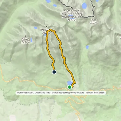 HardOne-dayMarkedŠtrbské Pleso Junction below Furkotská ValleyElevation profile1 349–2 298 m12.4 kmascent 945 m≈ 5 h walkingunder 1 km from Capie pleso
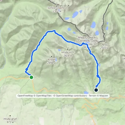 HardTwo-dayMarkedTri studničky, old forester's lodge Popradské Pleso, stopElevation profile1 105–2 142 m21.4 kmascent 1 142 m≈ 7.5 h walking1 km from Capie pleso
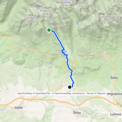 ModerateOne-dayMarkedŠkutnastá Meadow Štrba, stationElevation profile894–1 826 m9.8 kmascent 56 m≈ 2.5 h walking2.4 km from Capie pleso
Nearby attractions
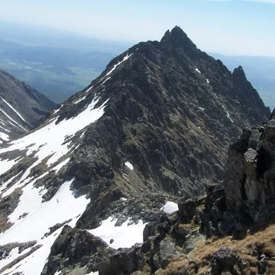 PeakVeľké Soliskoaltitude 2 412 munder 1 km from Capie plesoVeľké Solisko (Polish: Wielkie Solisko) is a 2,412 m peak in the Slovak High Tatras and the highest point of the Solisko ridge.
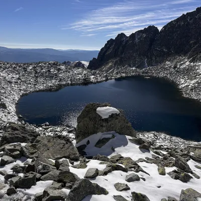 LakeWahlenbergove plesáunder 1 km from Capie plesoWahlenbergove plesá are two glacial lakes in the upper part of Furkotská dolina in the western High Tatras, within Tatra National Park (TANAP).
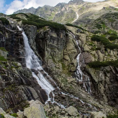 WaterfallSkok Waterfall1.8 km from Capie plesoSkok (Vodopád Skok) is one of the most beautiful waterfalls of the Slovak Tatras. Here the Mlynica stream drops over a rock step that blocks the middle part of the...
Craft nearby
All craft places Cheese dairies & pasturesShepherd's Hut on Rusinowa Polana11 km from Capie plesoRusinowa Polana is one of the most beautiful mountain glades in the Polish Tatras, and from May to October it is home to the bacówka (shepherd's hut) of baca Stanisław...
 Horse ridingKone vo Východnej: horse rides below the Tatras12 km from Capie plesoKone vo Východnej (“Horses in Východná”) is a small family horse farm on the meadows above the village of Východná in upper Liptov, with a sweeping view of the High...
 Cheese dairies & pasturesFurtek's Shepherd's Huts, Kuźnice and Kalatówki12 km from Capie plesoAbove Kuźnice — the southern edge of Zakopane where most hikes into the Western and High Tatras begin — the flocks are tended by baca Andrzej Staszel, nicknamed "Furtek".
 Koliby & Hutsul cuisineBąkowo Zohylina Wyźnio Highland Tavern14 km from Capie plesoBąkowo Zohylina Wyźnio is a regional highland tavern in Zakopane housed in a wooden "szałas" (shepherd-hut-style building) with a view of the Tatras.
 Water parks & thermal poolsTermy Zakopiańskie (Aqua Park Zakopane)15 km from Capie plesoTermy Zakopiańskie is a thermal water park right in Zakopane, on Jagiellońska Street, only a kilometre from Krupówki.
 Crafts & workshopsSztukomania Studio, Zakopane: handmade ceramics and pottery workshops15 km from Capie plesoSztukomania is a small ceramics and woodwork studio on Staszica street in Zakopane, a few minutes' walk from Krupówki.
