Bucșa Peak
Bucșa Peak (Rom. Vârful Bucșa) is a grassy summit at 1,848 m on the ridge connecting the Bucegi Mountains with the Leaota Mountains. It stands on the western section of this link between Muntele Sântilie (Leaota) and Strungile Mari (Bucegi), above the valleys of Brașov County. According to muntii-nostri.ro, the Bărbuețu river rises on the southern slopes here.
The nearest settlements are the village of Moieciu de Sus (about 7.4 km as the crow flies), Fundățica (about 9.1 km), Fundata (about 10.2 km), and Cheia (about 10.4 km). Just below the summit, less than 200 m away, is Spring below Bucșa (south-east slope), and another is Spring below Bucșa (north-east slope). The highest peak of Bucegi, Omu Peak, is about 8 km northeast in a straight line.
Getting there / routes
The shortest ascent is from the Bângăleasa valley (Valea Bângăleasa) above Moieciu de Sus. According to muntii-nostri.ro, the trail marked with a red triangle starts at an abandoned border post at the confluence of the Grohotișu and Bărbulețu valleys, follows the Bărbulețu valley for about 300 m, then climbs steeply up the Bucșa spur: 1–1.5 hours through forest, then along a corridor on the watershed. Around 1,650 m, the trail emerges onto alpine meadows and continues along the watershed to the summit. This is 3.1 km, about 2 hours and 663 m ascent; the route is rated as moderate to difficult, and heavy snow in winter can cause problems.
The longer red stripe route leads to Bucșa from Fundata village: according to muntii-nostri.ro, it climbs the slopes of Muntele Sântilie to the Curmătura Fiarelor saddle (1,794 m), skirts Sfințul Ilie peak (1,888 m), crosses the Dudele saddle, reaches Bucșa, and then via the Bucșa, Strungulița, and Strunga saddles arrives at Padina Hut hut. The total is 20.4 km, about 7 h 45 min, with 1,320 m ascent.
A popular loop from Moieciu de Sus (22 km, 790 m ascent, moderate) is described on the same site: from the barrier, follow the red triangle to Bucșa, then the red stripe to Șaua Strunga Hut and to the Gutzanu meadow, then again by red triangle down to Moieciu. The authors completed it at a relaxed pace in about 9 hours with breaks. There is also a short bypass trail (0.5 km, about 15 min) that skirts the summit from the northwest past the spring.
The view from the top
According to muntii-nostri.ro, these trails offer views of the Grohotiș escarpment (Abruptul Grohotiș) in Bucegi.
Safety, season and rules
In winter, route accessibility depends on snow depth and condition. The ridge is open and treeless: in fog, stick to the markings and check the forecast. If your route enters the Bucegi Natural Park, a ticket is required—10 lei per adult for three months, available online or from rangers (as of last check, see bucegipark.ro). Bears are common in the Romanian Carpathians: stay on marked trails, make noise, avoid dusk, and do not keep food in your tent; near sheepfolds, shepherd dogs may attack—do not run, stop and shield yourself with your backpack (advice from Salvamont România).
In case of emergency, call the national mountain rescue dispatcher 0SALVAMONT — 0725 826 668 or 112.
Getting there from Ukraine
Border crossings
- Porubne – Siret — road and pedestrian, 24/7
- Diakivtsi – Racovăț — road and pedestrian, 24/7 No freight traffic.
- Krasnoilsk – Vicovu de Sus — road and pedestrian, 08:00–20:00 Cars up to 3.5 t and pedestrians only; not 24/7.
- Solotvyno – Sighetu Marmației — road and pedestrian, 24/7 Passenger traffic only: vehicles up to 3.5 t with up to 9 seats, pedestrians.
- Diakove – Halmeu — road, 24/7 No pedestrian crossing.
By car
Chernivtsi – Bușteni ≈426 km, ≈7 h 32 min (via Diakivtsi – Racovăț); Rakhiv – Bușteni ≈454 km, ≈8 h 01 min (via Solotvyno – Sighetu Marmației); Uzhhorod – Bușteni ≈557 km, ≈9 h 15 min (via Diakove – Halmeu). Times without border queues, our road routing (GraphHopper, OSM).
Checked 03.11.2026; border crossing hours and timetables change — check before you travel.
Comments
Travellers’ experience: reports, tips, questions.
No one has reported on this trail yet. Been here lately? Tell others what it is like now.
Water and shelter nearby
- Spring below Bucșa (south-east slope)190 m · Not verified · 1 780 m
- Spring below Bucșa (north-east slope)1.1 km · Not verified · 1 447 m
- Spring below Strungile Mari (south slope)1.5 km · Not verified · 1 872 m
- Șaua Strunga Hut1.6 km · Not verified · 1 893 m
- Spring below Strungile Mari (north-west slope), 1 774 m1.6 km · Not verified · 1 774 m
- Spring below Vârful secundar Bucșa1.7 km · Not verified · 1 731 m
- Spring below Strungile Mari (north-west slope), 1 747 m1.7 km · Not verified · 1 747 m
- Vâlcelul Prăvalelor Spring1.7 km · Not verified · 1 746 m
- Spring below Strungile Mari (north-west slope), 1 738 m1.8 km · Not verified · 1 738 m
- Spring below Vârful Deleanu1.9 km · Not verified · 1 799 m
- Spring below Dudele Mari2.4 km · Not verified · 1 849 m
- Spring below Colții Țapului (south-east slope)2.7 km · Not verified · 1 970 m
- Spring below Strungile Mici2.7 km · Not verified · 1 710 m
Trails nearby
All trails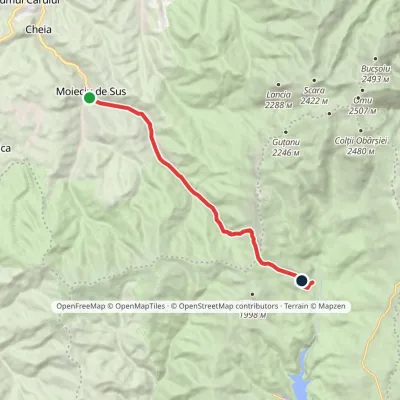 ModerateOne-dayMarkedMoieciu de Sus Padina HutElevation profile960–1 905 m12.8 kmascent 1 056 m≈ 5 h walking1.1 km from Bucșa Peak
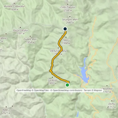 ModerateOne-dayMarkedPodu' cu Florile Hut Strungulița SaddleElevation profile1 582–1 930 m7.7 kmascent 428 m≈ 2.5 h walking1.3 km from Bucșa Peak
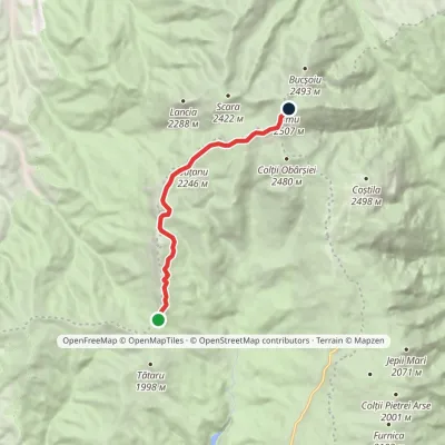 HardOne-dayMarkedStrunga Saddle Omu HutElevation profile1 904–2 502 m9.5 kmascent 761 m≈ 3.5 h walking1.6 km from Bucșa Peak
Nearby attractions
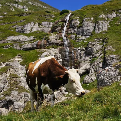 WaterfallObârșia Ialomiței Waterfall (Cascada Obârșia Ialomiței)Bușteni · Bucegi Mountains5.9 km from Bucșa Peakover 100 m high2 035 m above sea levelObârșia Ialomiței Waterfall (Cascada Obârșia Ialomiței; on maps also Cascada Obârșiei) lies in the Bucegi Mountains, at the head of the Obârșia valley, at about 2,000 m.
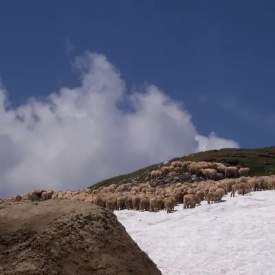 Mountain meadowBucegi PlateauBuștenialtitude 2 193 m6.8 km from Bucșa PeakThe Bucegi Plateau (Romanian: Platoul Bucegi) is a high grassy tableland in the Bucegi Mountains of Romania's Southern Carpathians.
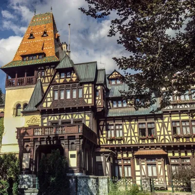 CastlePelișor Castle: Queen Marie's Art Nouveau dream house in SinaiaSinaia12 km from Bucșa PeakPelișor Castle (Castelul Pelișor) — the "little Peleș" — stands a few hundred metres from the main royal castle in Sinaia, on the same estate in the valley of the...
Craft nearby
All craft places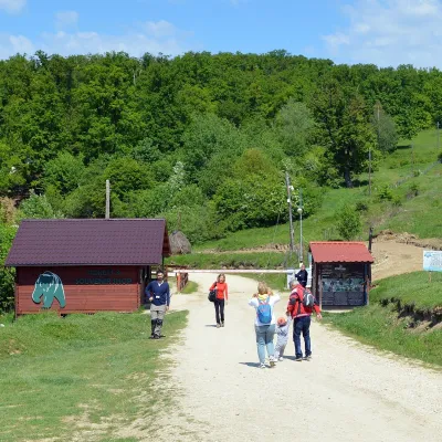 Wildlife parks & animal farmsLibearty Bear Sanctuary in Zărnești: a forest for rescued bearsVulcan23 km from Bucșa PeakThe AMP Libearty Bear Sanctuary lies near the town of Zărnești in Brașov County, at the edge of a forest below the Piatra Craiului massif.
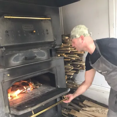 Craft producersDieter’s Bread in Câmpulung: wood-fired artisan breadCâmpulung28 km from Bucșa PeakCâmpulung (also called Câmpulung Muscel) is an old town in Argeș County at the foot of the Iezer-Păpușa Mountains, on the road to the Rucăr–Bran pass.
 Water parks & thermal poolsPucioasa: sulphur baths and inhalations in the Carpathian foothillsPucioasa35 km from Bucșa PeakPucioasa is a small spa town in Dâmbovița County, in the valley of the Ialomița river among the wooded hills of the Carpathian foothills, about 20 km north of the city...
