Yasinia — to Kvasy village, via Mount Tataruka, Mount Dohiaska, Mount Stih, Mount Blyznytsia
Unmarked trailmore
It may be partly marked. Unmarked trails have no information boards, signposts or auxiliary signs (water, campsite, etc.). The decision to walk the trail is entirely your own responsibility.
Trail map
Where to stay nearby
About the trail
Route Yasinia, via Mount Tataruka, Mount Dohiaska, Mount Stih and Mount Blyznytsia to Kvasy village. Along the route you will see: Strukivska (Ascension) Church, Yasinia, Mount Tataruka, Mount Trojaska, Lake Gereshaska (Dogyaska), Mount Dogyaska, Lake Vorozheskaya and 3 more.
At a glance
A multi-day route of 62.2 km with 2,811 m of ascent from Yasinia to Kvasy village. Estimated time: 3 days of 6–8 h of walking (about 20 h in total, not counting stops). Difficulty: hard. Waymarking is missing or partial.
Route stages
- 0–20 kmGentle ups and downs at 640–960 m
- 20–30 kmClimb of 710 m to Mount Tataruka (1,707 m)
- 30–48 kmAlong the ridge at 1,500–1,860 m, past Mount Dogyaska, Mount Velykyi Kotel, Mount Drahobrat, Mount Bliznytsia
- 48–62 kmDescent of 1,300 m to Kvasy village
Steepest kilometre: km 48–50, a descent of 280 m (≈27%).
Water and overnight stays
Springs near the trail: at km 10, 13, 16, 18, 22, 24, 25, 27, 29 and 33 etc.. There are no springs between km 0 and 10 — carry at least 1.5 l of water. Some springs run low or dry up in late summer.
Huts and shelters near the trail: Hut “At Semen's” (km 0), Forester's hut “Apshynets” (km 18), Forester's hut “Lisnycha” (km 18), Shepherds' hut (Chorna Tysa) (km 25), Hunters' lodge at Okole pass (km 25), Hut on Polonyna Zasovy (km 55), Hut (Trostyanets) (km 56), Hut (Trostyanets, 2) (km 57). Places to stay near the start: Yasinya; near the finish: Kvasy.
A possible split into days:
- Day 1: km 0–25, ≈7.5 h — overnight: Shepherds' hut (Chorna Tysa) (hut)
- Day 2: km 25–42, ≈6 h — overnight: no shelter nearby on the map, bring a tent
- Day 3: km 42–62, ≈6.5 h — finish
When to go
Best time: June to September. In winter only for experienced hikers with proper gear: avalanche danger is possible. About 22 km of the route runs above 1,500 m, where the weather changes quickly — check the forecast.
Getting there
Start: Yasinia. Most places to stay near the start are in Yasinya. This is a one-way route: the finish is 11 km from the start in a straight line, so plan your way back in advance.
FAQ
- How long does the route take?
- Estimated time: 3 days of 6–8 h of walking (about 20 h in total, not counting stops).
- Is there water on the route?
- Springs near the trail: at km 10, 13, 16, 18, 22, 24, 25, 27, 29 and 33 etc.. There are no springs between km 0 and 10 — carry at least 1.5 l of water. Some springs run low or dry up in late summer.
- Where can I stay overnight?
- Huts and shelters near the trail: Hut “At Semen's” (km 0), Forester's hut “Apshynets” (km 18), Forester's hut “Lisnycha” (km 18), Shepherds' hut (Chorna Tysa) (km 25), Hunters' lodge at Okole pass (km 25), Hut on Polonyna Zasovy (km 55), Hut (Trostyanets) (km 56), Hut (Trostyanets, 2) (km 57). Places to stay near the start: Yasinya; near the finish: Kvasy. Possible overnight stops: Shepherds' hut (Chorna Tysa) (km 25).
Water and shelter on the route
- Hut “At Semen's”km 0.1 from the start · 180 m off the path · Not verified · 645 m
- Spring (Chorna Tysa, 17)km 9.3 from the start · Not verified · 732 m
- Spring (Chorna Tysa, 12)km 12.6 from the start · Not verified · 793 m
- Spring (Chorna Tysa, 9)km 15.1 from the start · Not verified · 844 m
- Forester's hut “Apshynets”km 16.7 from the start · Not verified · 889 m
- Forester's hut “Lisnycha”km 16.7 from the start · Standing · 878 m
- Spring (Chorna Tysa, 5)km 16.7 from the start · Not verified · 896 m
- Spring (Chorna Tysa, 4)km 21.1 from the start · Not verified · 1 047 m
- Spring (Chorna Tysa, 3)km 21.8 from the start · Not verified · 1 078 m
- Source of the Chorna Tysa (spring)km 22.8 from the start · Not verified · 1 229 m
- Shepherds' hut (Chorna Tysa)km 23.9 from the start · Not verified · 1 198 m
- Hunters' lodge at Okole passkm 24 from the start · Standing · 1 192 m
- Spring (Chorna Tysa, 2)km 24 from the start · 130 m off the path · Not verified · 1 194 m
- Spring below Mount Tataruka (2)km 25.6 from the start · Not verified · 1 274 m
- Spring below Mount Tataruka (4)km 27.5 from the start · 260 m off the path · Not verified · 1 571 m
- Spring below Mount Troiaska (7)km 31.1 from the start · 250 m off the path · Not verified · 1 530 m
- Spring below Mount Dohiaska (11)km 32.3 from the start · 240 m off the path · Not verified · 1 622 m
- Spring below Mount Dohiaska (19)km 33.4 from the start · 120 m off the path · Not verified · 1 595 m
- Spring below Mount Dohiaska (26)km 34.7 from the start · 150 m off the path · Not verified · 1 682 m
- Spring below Mount Velykyi Kotel (3)km 36.1 from the start · Not verified · 1 480 m
- Spring below Mount Velykyi Kotel (5)km 36.5 from the start · 170 m off the path · Not verified · 1 513 m
- Spring below Mount Velykyi Kotel (7)km 37.5 from the start · Weak flow · 1 646 m
- Spring below Mount Velykyi Kotel (6)km 37.9 from the start · 230 m off the path · Not verified · 1 602 m
- Spring below Mount Stih (7)km 38.8 from the start · 170 m off the path · Not verified · 1 601 m
- Spring below Mount Stih (11)km 39.2 from the start · 110 m off the path · Not verified · 1 600 m
- Spring below Mount Stih (14)km 40 from the start · 220 m off the path · Not verified · 1 573 m
- Spring below Mount Stih (15)km 40.5 from the start · 270 m off the path · Weak flow · 1 558 m
- Spring below Mount Stih (16)km 41 from the start · 40 m off the path · Not verified · 1 534 m
- Spring below Mount Blyznytsia (3)km 44.1 from the start · 250 m off the path · Not verified · 1 581 m
- Spring below Mount Blyznytsia (5)km 46.1 from the start · 260 m off the path · Weak flow · 1 759 m
- Spring (Trostyanets, 18)km 47.8 from the start · Not verified · 1 504 m
- Spring (Trostyanets, 14)km 48.4 from the start · 100 m off the path · Not verified · 1 418 m
- Spring (Trostyanets, 12)km 49.3 from the start · 80 m off the path · Not verified · 1 303 m
- Spring (Trostyanets, 16)km 51.7 from the start · 270 m off the path · Not verified · 1 300 m
- Hut on Polonyna Zasovykm 51.9 from the start · 110 m off the path · Standing · 1 323 m
- Hut (Trostyanets)km 53.3 from the start · 70 m off the path · Not verified · 1 247 m
- Hut (Trostyanets, 2)km 54.4 from the start · 80 m off the path · Not verified · 1 073 m
- Mineral spring (Trostyanets)km 57.6 from the start · 170 m off the path · Not verified · 641 m
- Burkut springkm 58.9 from the start · 150 m off the path · Weak flow · 538 m
Comments
What to see on the trail
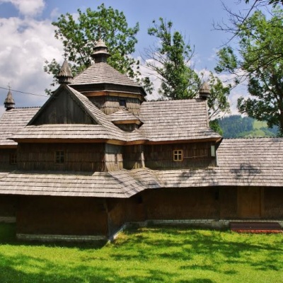 Strukivska (Ascension) Church, Yasiniaaltitude 663 mThe Church of the Ascension or Strukiv is the real pride of the village of Yasinia and the entire Hutsul region.
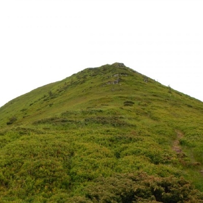 Mount Tatarukaaltitude 1 707 mMount Tataruka is the peak of the Ukrainian Carpathians, located in the northern part of the Svydovets mountain range.
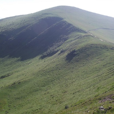 Mount Trojaskaaltitude 1 702 mThe mountain is located in Rakhiv district of Zakarpattia region within the central part of the Svydovets mountain range. ...
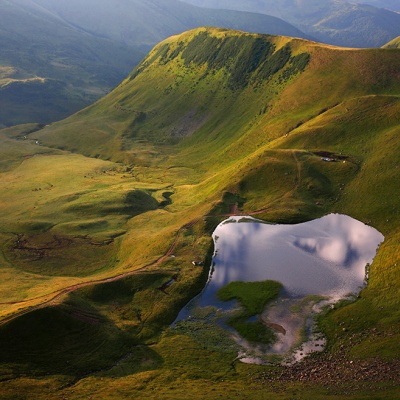 Lake Gereshaska (Dogyaska)altitude 1 577 mGerashaska (another name - Dogyaska ) is a high-mountain lake in the Ukrainian Carpathians, within the Rakhiv district of Zakarpattia region.
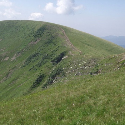 Mount Dogyaskaaltitude 1 761 mDogyaska is a peak in the Ukrainian Carpathians, located in the central part of the Svydovets mountain range.
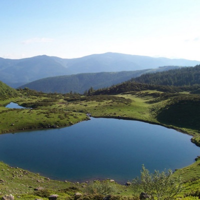 Lake Vorozheskayaaltitude 1 460 mThe real pearl of the Carpathians - Lake Vorozheska (other names - Vorozheska, Triton ) - is a hydrological natural monument of local importance, a...
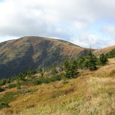 Mount Velykyi Kotelaltitude 1 771 mMount Velykyi Kotel is the peak of the Ukrainian Carpathians, which lies within the Svydovets mountain range.
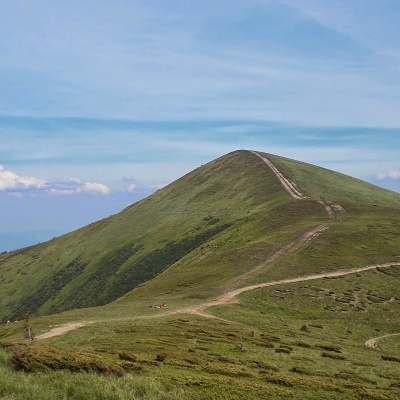 Mount Stih (Dragobrat)altitude 1 704 mStig (locally known as Stug) is a peak of the Ukrainian Carpathians, located in the Rakhiv district of Zakarpattia region in the northeastern part...
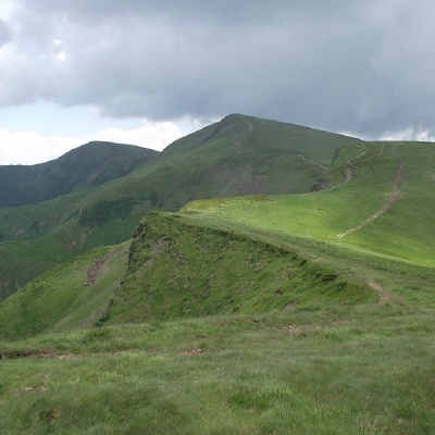 Mount Bliznytsiaaltitude 1 883 mBlyznytsia (also called Bliznytsia, Blyzhnytsia) are two mountains of the Ukrainian Carpathians, located in the eastern part of the Svydovets...
Trails nearby
All trails HardMulti-dayMarkedTranscarpathian Tourist TrailElevation profile198–2 031 m393.2 kmascent 30 283 m
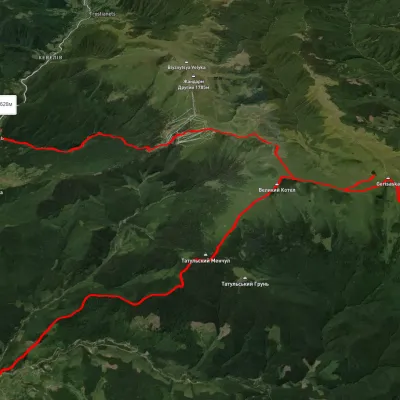 HardMulti-dayUnmarkedChorna Tysa village to Kvasy villagevia Dragobrat, Lake Vorozheska +3Elevation profile638–1 786 m36.6 kmascent 1 850 m≈ 13 h walking
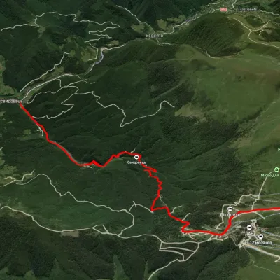 ModerateOne-dayUnmarkedYasinia to Mount Blyznytsiavia DragobratElevation profile638–1 860 m13.2 kmascent 1 407 m≈ 6 h walking