Wielka Przehyba
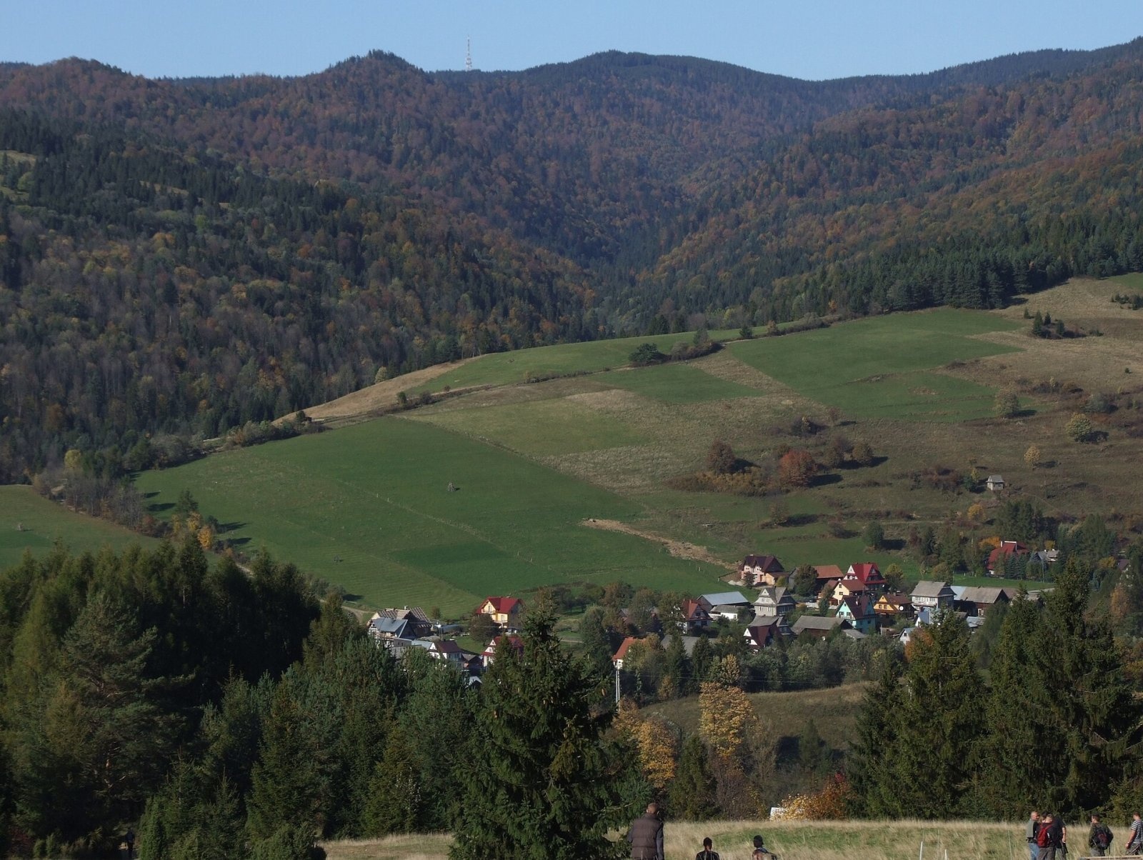
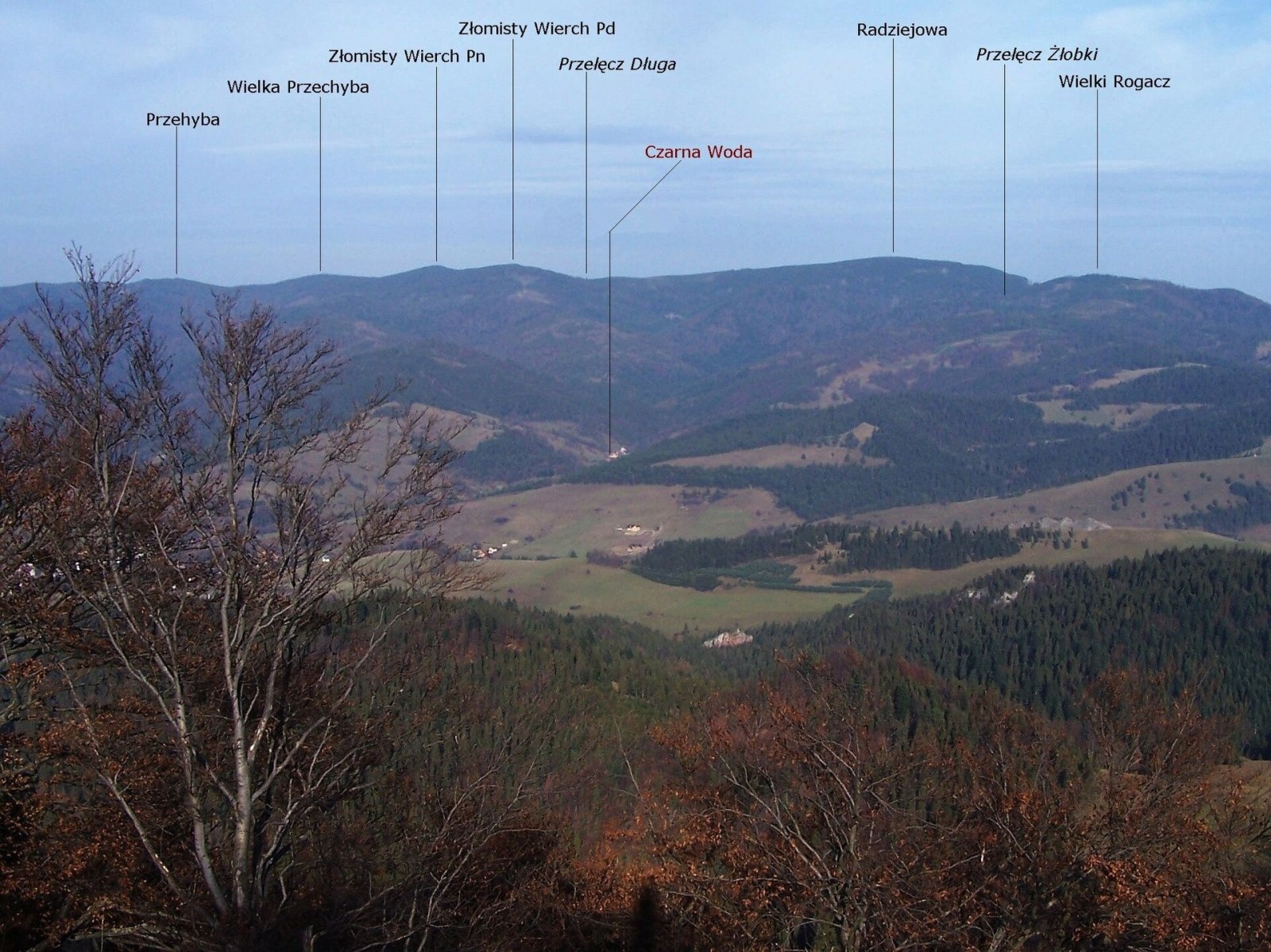
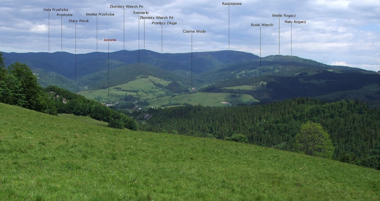
Wielka Przehyba (also Wielka Prehyba, Wierch Przechyba, Złamany Wierch, Złomnisty Wierch) is a wooded 1,191 m summit in the Sądecki Beskids, on the main ridge of the Radziejowa Range between Prehyba (1,175 m) and Złomisty Wierch Północny (1,226 m). It is a junction peak: a side ridge runs north from it via the Zwornik pass and splits into a north-western branch with the Zgrzypy top and a long north-eastern branch that descends via Wietrzne Dziury to the Poprad valley at Rytro. The boundaries of three localities meet on the summit — Gaboń and Roztoka Ryterska in Nowy Sącz County and Szlachtowa in Nowy Targ County.
How to get there / trails
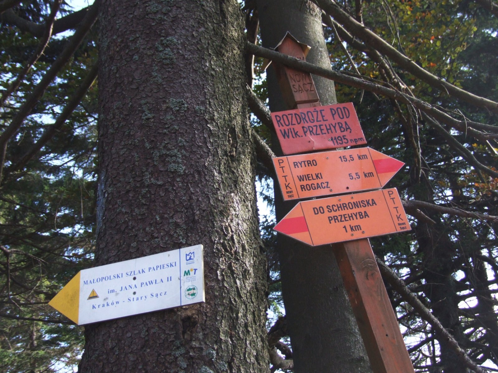
Three hiking trails and one ski trail pass near the summit, crossing at two junctions just below it — Zwornik and "Rozdroże pod Wielką Prehybą":
- the red Main Beskid Trail: Prehyba – junction below Wielka Prehyba – Złomiste Wierchy – Długa Przełęcz – Radziejowa;
- yellow: Stary Sącz – Tokarnia – Zgrzypy – Zwornik – Prehyba;
- blue: Szczawnica – Prehyba – Zwornik – Wietrzne Dziury – Wielka Roztoka valley – Rytro.
In winter a ski trail also runs here: Rytro – Wielka Roztoka valley – Hala Konieczna – Złomisty Wierch Południowy – Zwornik – junction below Wielka Prehyba – Prehyba.
A few hundred metres to the west stands neighbouring Prehyba with a PTTK hut and the 87 m tower of a radio and TV transmitter; an asphalt road leads there from Gaboń.
What you can see from the top
The summit itself is wooded, so there is no view from it. Views open from clearings and from neighbouring Prehyba, and from afar Wielka Prehyba is easy to spot next to the transmitter tower – for example from Jaworki or from below Durbaszka in the Little Pieniny.
Nature and history
Wielka Prehyba is one of the key nodes of the Radziejowa Range, which holds all the peaks of the Sądecki Beskids higher than 1200 m. The main ridge, which runs first south from the Dunajec and then east over Skałka and Prehyba, turns south right here – towards the twin summits of Złomisty Wierch, the Długa Pass and the highest peak, Radziejowa (1266 m). To the north the node sends out one of the range's largest side ridges, with Zgrzypy and Wietrzne Dziury. Clearings used to be far more common: in the late 19th century and between the wars every usable scrap of land was turned into pasture or fields, and the forests survived largely because much of them belonged to Count Adam Stadnicki. After the Lemkos were expelled in 1947 the mountain clearings were afforested or overgrew naturally, and after 1990 grazing almost stopped.
Interesting facts
- Wielka Prehyba is on the list of summits for the PTTK "Crown of the Sądecki Beskids" badge and the badge of the same name of the Polish Mountain Crowns Club.
- Its old names include Złamany Wierch and Złomnisty Wierch.
Safety, season and rules
The trails are easy and open all year, but the ridge is wooded and junctions are many — in fog follow the waymarks carefully; in winter deep snow lies here. Mountain rescue in the Beskids is provided by GOPR: 985 or +48 601 100 300, plus the general emergency number 112.
Photos: Jerzy Opioła, CC BY-SA 4.0; Jerzy Opioła, CC BY-SA 4.0; Jerzy Opioła, CC BY-SA 4.0; Jerzy Opioła, CC BY-SA 4.0 — Wikimedia Commons.
Getting there from Ukraine
Border crossings
- Krakovets – Korczowa — road, 24/7
- Shehyni – Medyka — road, 24/7 Pedestrian crossing is not confirmed by the Ukrainian border service — check dpsu.gov.ua before the trip.
- Smilnytsia – Krościenko — road, 24/7
- Hrushiv – Budomierz — road, 24/7
- Mostyska – Przemyśl (rail) — rail, 24/7
By car
Lviv – Szczawnica ≈384 km, ≈5 h 25 min without queues: M-10 → Krakovets – Korczowa → A4 to Brzesko (≈198 km) → DK75 to Nowy Sącz → DW969 via Stary Sącz and Łącko to Krościenko nad Dunajcem → Szczawnica. ≈306 km, ≈4 h from the border.
Checked 23.10.2026; border crossing hours and timetables change — check before you travel.
Location on the map
Water and shelter nearby
- Przehyba Hut1.1 km · Standing · 1 138 m
- Spring below Skałka (north-east slope), 1 049 m2.1 km · Not verified · 1 049 m
Comments
Trails nearby
All trails HardMulti-dayMarkedMain Trail of BeskidyElevation profile309–1 723 m499.9 kmascent 19 519 munder 1 km from Wielka Przehyba
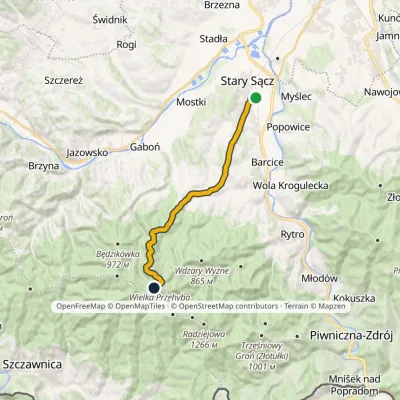 ModerateOne-dayMarkedStary Sącz PrzehybaElevation profile308–1 150 m14.7 kmascent 847 m≈ 5.5 h walkingunder 1 km from Wielka Przehyba
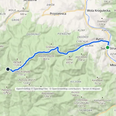 ModerateOne-dayMarkedRytro PrzehybaElevation profile347–1 175 m11.6 kmascent 859 m≈ 4.5 h walkingunder 1 km from Wielka Przehyba
Nearby attractions
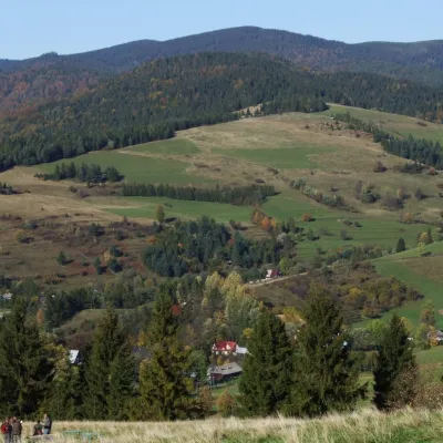 PeakZłomisty WierchJaworkialtitude 1 224 munder 1 km from Wielka PrzehybaZłomisty Wierch is a pair of wooded tops on the main ridge of the Radziejowa Range in the Sądecki Beskids, about 700 m apart.
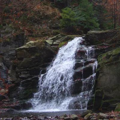 WaterfallWodospad Wielki in ObidzaObidza5.8 km from Wielka PrzehybaWodospad Wielki ("Great Waterfall") is a natural cascade 5 m high on the Majdan stream, also called Majdański Potok, in the village of Obidza in the Łącko commune of...
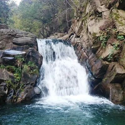 WaterfallZaskalnik FallsSzczawnica5.9 km from Wielka PrzehybaZaskalnik is a small but very picturesque waterfall on the Sopotnicki stream (Sopotnicki Potok) near the spa town of Szczawnica.
Craft nearby
All craft places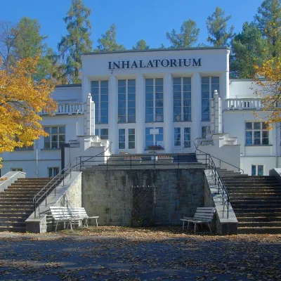 Water parks & thermal poolsSzczawnica spa: pump room, waters and the InhalatoriumSzczawnica7.4 km from Wielka PrzehybaThe Szczawnica spa (Uzdrowisko Szczawnica) is all about water and air: in the valley of the Grajcarek stream, between the Pieniny and the Beskid Sądecki at 430–500 m,...
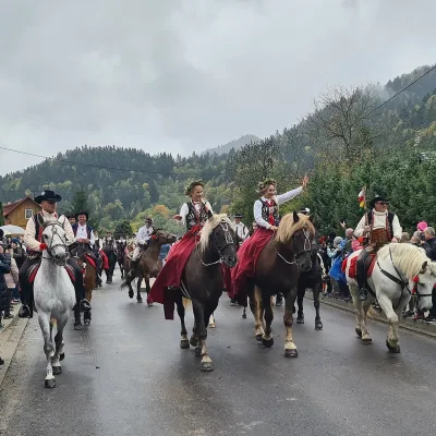 Markets & fairsAutumn Redyk in Szczawnica: sheep drive, oscypek and shepherdsSzczawnica9.5 km from Wielka PrzehybaRedyk is an old Carpathian shepherding custom: in spring the flocks are driven up to the mountain pastures (hale), and in autumn, after the cheese-making season, they...
 Craft beer & breweriesPersonall Kraft Brewpub, Stary SączStary Sącz13 km from Wielka PrzehybaPersonall Kraft is a family-run brewpub in Stary Sącz where the beer is brewed right in the dining hall: the big brewing vessels are visible from the tables.
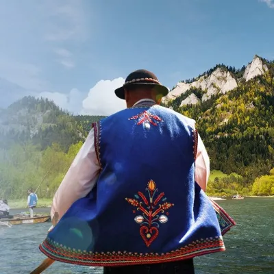 Ethno tours & guidesGoral raftsmen of Červený Kláštor: wooden-raft trip on the DunajecČervený Kláštor14 km from Wielka PrzehybaBetween Červený Kláštor and Lesnica the Dunajec cuts a deep, winding gorge through the limestone Pieniny, and here the river becomes the border between Slovakia and...
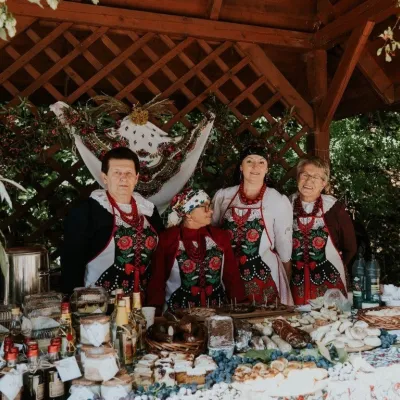 Markets & fairsFruit Harvest Festival in Łącko: village stands, fruit and folkloreŁącko15 km from Wielka PrzehybaŁącko, in the Dunajec valley between Stary Sącz and the Pieniny, is one of Poland's best-known fruit-growing areas: the slopes around are covered with apple, pear and...
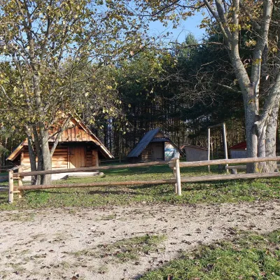 Cheese dairies & pasturesMajerz Meadow Shepherd's Hut, Pieniny National Park: oscypek and żętycaKrośnica17 km from Wielka PrzehybaMajerz meadow (hala) sits on a 689 m hill between Czorsztyn-Nadzamcze and the village of Hałuszowa, above Lake Czorsztyn.
