Zákamenné
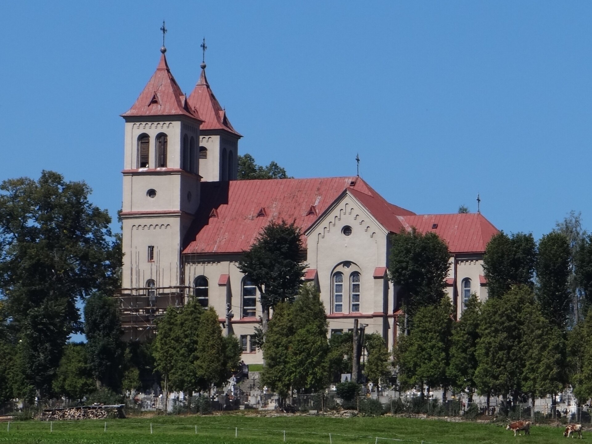
Photos: Jerzy Opioła, CC BY-SA 4.0 (Wikimedia Commons); Dibdo, CC BY-SA 3.0 (Wikimedia Commons)
Zákamenné is a village in Slovakia.
Elevation: about 703 m above sea level. Population: 5,738 (2025). Mountains nearby: Lesser Fatra.
Here and nearby on the site: 1 trail, 2 peaks.
Facts: Wikidata, OpenStreetMap. More on Wikipedia
What's nearby
Trails nearby
All trails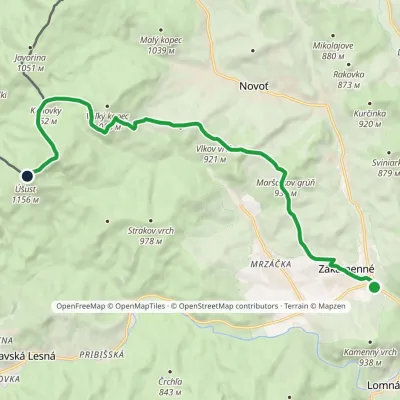 ModerateOne-dayMarkedTrail through Zákamenský ChotárElevation profile680–1 154 m14 kmascent 671 m≈ 5 h walkingunder 1 km from the centre
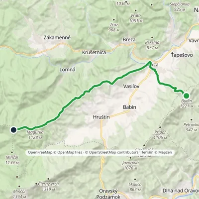 ModerateTwo-dayMarkedBudín PríslopecElevation profile623–1 258 m20.4 kmascent 708 m≈ 6.5 h walking5.2 km from the centre
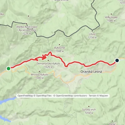 ModerateOne-dayMarkedVychylovka, Rycierky Oravská Lesná, UstrigElevation profile612–946 m15.9 kmascent 466 m≈ 5 h walking5.3 km from the centre
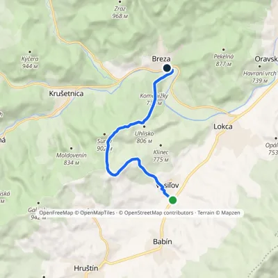 EasyOne-dayMarkedBreza VasiľovElevation profile639–885 m7.9 kmascent 255 m≈ 2.5 h walking5.4 km from the centre
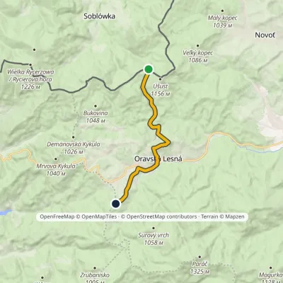 EasyOne-dayMarkedMacangov Beskyd PodúšustElevation profile780–977 m10.5 kmascent 350 m≈ 3.5 h walking7.4 km from the centre
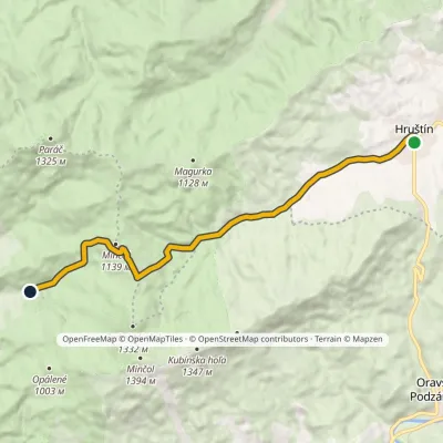 ModerateOne-dayMarkedZázrivá, Kozinská HruštínElevation profile693–1 144 m13.4 kmascent 450 m≈ 4.5 h walking8 km from the centre
Peaks nearby
All peaks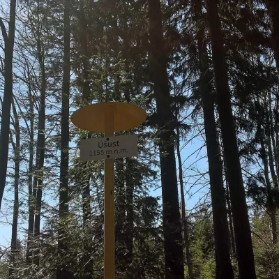 PeakÚšust (Oszus)Zákamennéaltitude 1 155 m8.1 km from the centreÚšust (Polish Oszus or Oszust) is a 1155 m summit in the Orava Beskids on the Slovak–Polish border. It rises above the village of Oravská Lesná (about 4.4 km), some 20...
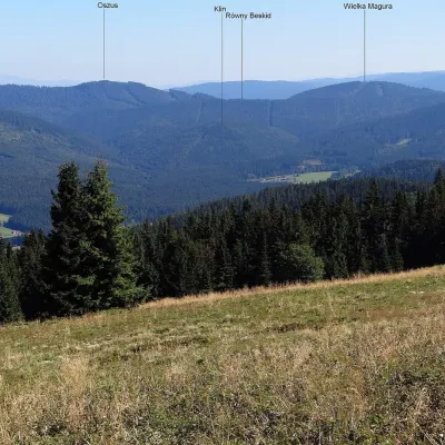 PeakVysoká MaguraZákamennéaltitude 1 115 m9.6 km from the centreVysoká Magura (Polish Wysoka Magura) is a 1115 m summit in the Orava Beskids (Oravské Beskydy) in northern Slovakia, which Polish geographers count as part of the...
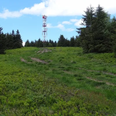 PeakMinčol (Oravská Magura)Dolný Kubínaltitude 1 394 m13 km from the centre1 trail to the topMinčol is the highest peak of the Oravská Magura range in northern Slovakia, 1394 m high. It lies in the south-western part of the range, in the Kubínska hoľa massif,...
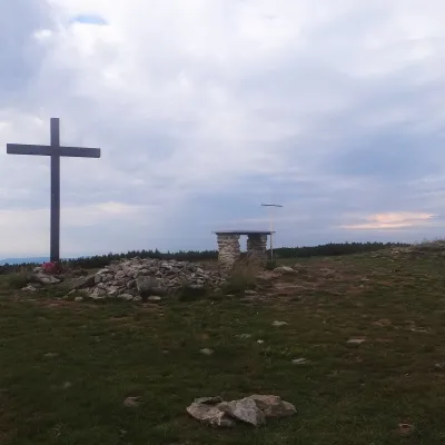 PeakPilskoOravské Veseléaltitude 1 557 m16 km from the centrePilsko is a massive 1,557 m mountain on the Slovak–Polish border, the second-highest in the Orava Beskids (in Polish, the Żywiec Beskids) after Babia hora.
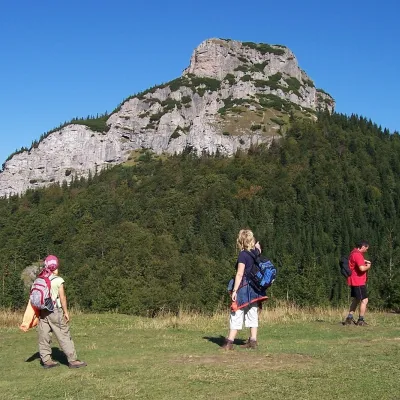 PeakMalý RozsutecTerchováaltitude 1 343 m21 km from the centre1 trail to the topMalý Rozsutec is a craggy limestone summit 1343 m high in the Malá Fatra (Lesser Fatra), Slovakia, in its Krivánska part.
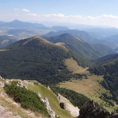 PeakOsnicaPárnicaaltitude 1 363 m22 km from the centreOsnica is a 1363 m summit in the north-eastern part of the Lesser Fatra (Malá Fatra) in Slovakia, about 9 km west of Dolný Kubín.
What to visit
All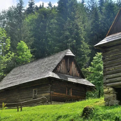 MuseumKysuce Village Museum and Forest Railway, VychylovkaNová Bystrica14 km from the centreThe Kysuce Village Museum (Múzeum kysuckej dediny) is an open-air museum in the Chmúra valley, in the Vychylovka part of the village of Nová Bystrica, in the far north...
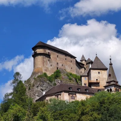 CastleOrava CastleOravský Podzámok15 km from the centreOrava Castle (Oravský hrad) stands on a sheer limestone rock above the Orava river in the village of Oravský Podzámok in northern Slovakia.
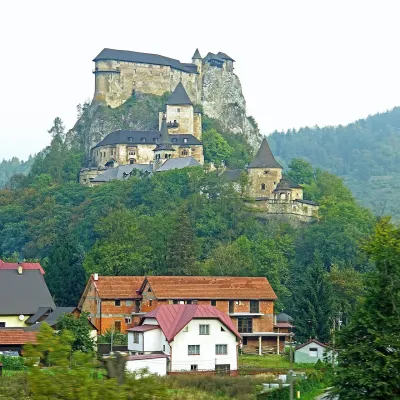 RiverOrava RiverOravský Podzámok15 km from the centreThe Orava is a right-bank tributary of the Váh in northern Slovakia and the main river of the historical region of the same name.
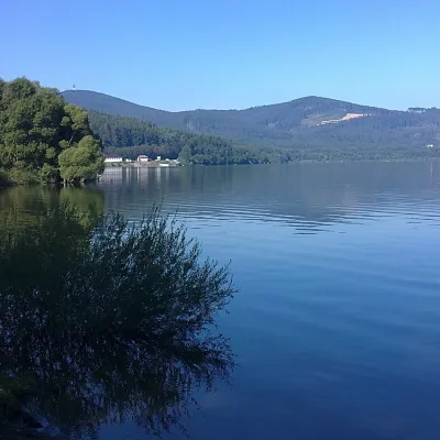 LakeOrava Reservoir and Slanica IslandNámestovo19 km from the centreOrava Reservoir (Oravská priehrada), jokingly called the “Orava Sea” by locals, lies in northern Slovakia, in the historic region of Orava, close to the Polish border.
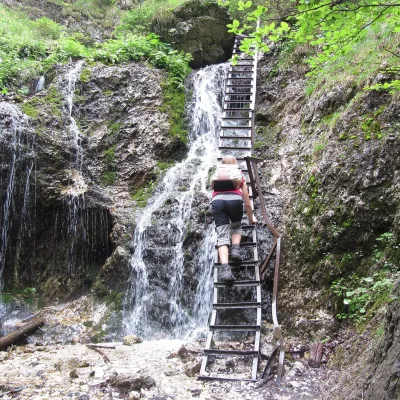 NatureJánošík's Holes (Jánošíkove diery)Terchová22 km from the centreJánošíkove diery (Jánošík’s Holes), or simply Diery, is a system of narrow gorges and canyons in the Krivánska Malá Fatra near the village of Terchová, birthplace of...
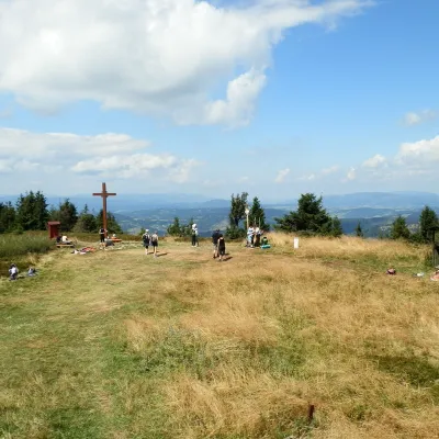 Mountain meadowThe summit hala of Veľká Rača, the highest peak of the Kysucké BeskydyKlubinaaltitude 1 236 m24 km from the centreVeľká Rača (Polish Wielka Racza, 1,236 m) is the highest mountain of the Kysucké Beskydy on the Slovak–Polish border, about 12 km east of the town of Čadca.
Craft nearby
All craft places Cheese dairies & pasturesSalaš Syrex in Zázrivá — Home of the Zázrivá Korbáčik CheeseZázrivá19 km from the centreZázrivá is a scattered mountain village on the border of Orava and the Malá Fatra, famous throughout Slovakia for its korbáčiky: thin strings of steamed cheese braided...
 Water parks & thermal poolsLúčky Spa and AQUA-VITAL ParkLúčky29 km from the centreLúčky Spa (Kúpele Lúčky) lies in a quiet valley beneath the Choč Mountains, in the village of Lúčky near Ružomberok.
Spas and thermal pools nearby
Huts, shelters and springs nearby
Getting there from Ukraine
Border crossings
- Uzhhorod – Vyšné Nemecké — road, 24/7
- Malyi Bereznyi – Ubľa — road, 24/7 For cars and buses; pedestrians not confirmed by the Ukrainian border service, lorries up to 3.5 t.
- Mali Selmentsi – Veľké Slemence (pedestrian) — pedestrian, 09:00–21:00 Kyiv time Pedestrians and cyclists only; inconvenient for the Tatras without onward transport.
- Chop – Čierna nad Tisou (rail) — rail, 24/7
By car
From Uzhhorod ≈275 km, ≈3 h 35 min without queues: Uzhhorod – Vyšné Nemecké → I/19 to Košice → D1 motorway via Prešov, Poprad and Liptovský Mikuláš to Ružomberok (≈270 km, ≈3 h 25 min from the border). From Lviv it is faster through Poland: M-10 → Krakovets – Korczowa → A4 to Kraków → S7/DK7 to the Chyżne – Trstená border → R3 and I/59 via Dolný Kubín to Ružomberok: ≈482 km, ≈6 h 15 min (via Uzhok and Ubľa ≈500 km, ≈7 h 30 min). The D1 requires an e-vignette (eznamka.sk).
Checked 23.10.2026; border crossing hours and timetables change — check before you travel.
