Pilsko
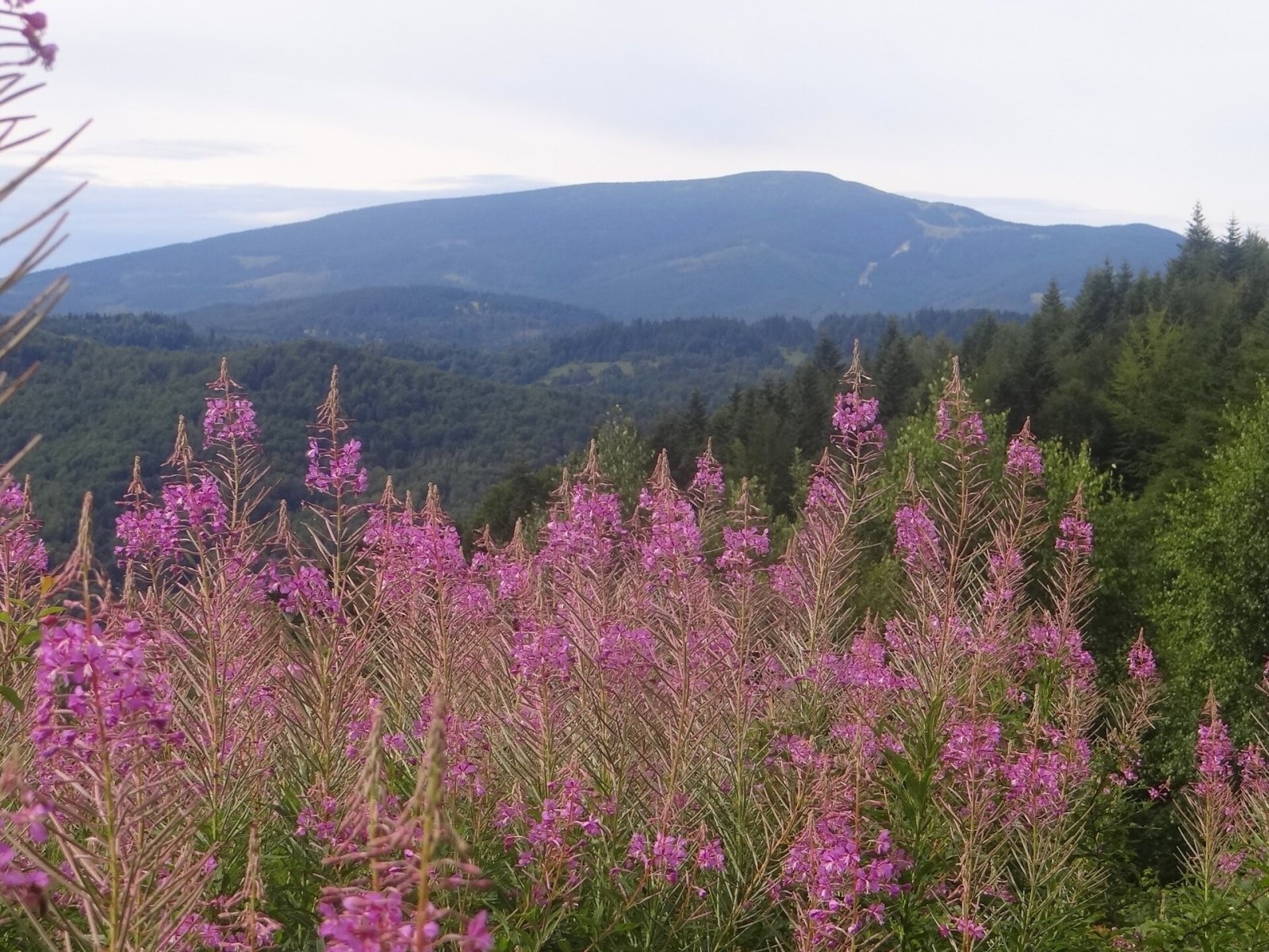
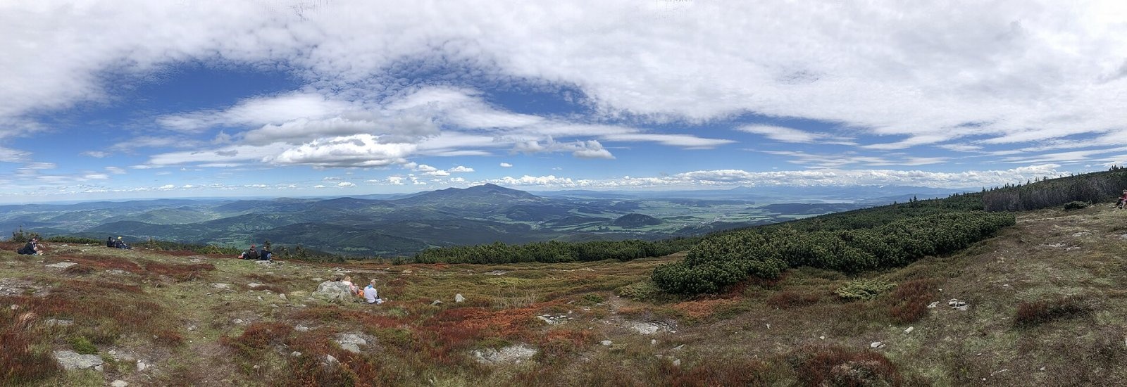
Pilsko is a massive 1,557 m mountain on the Slovak–Polish border, the second-highest in the Orava Beskids (in Polish, the Żywiec Beskids) after Babia hora. The main summit lies entirely in Slovakia — in the Žilina Region, about 16 km north-west of Námestovo, in the cadastres of Námestovo, Mútne and Oravské Veselé. The border runs some 400 m to the north, over a lower top the Poles call Góra Pięciu Kopców (1,543 m); the northern slopes of the massif belong to the Polish village of Korbielów in the Silesian Voivodeship. Pilsko rises 200–300 m above its neighbours and about 1,000 m above the surrounding valleys.
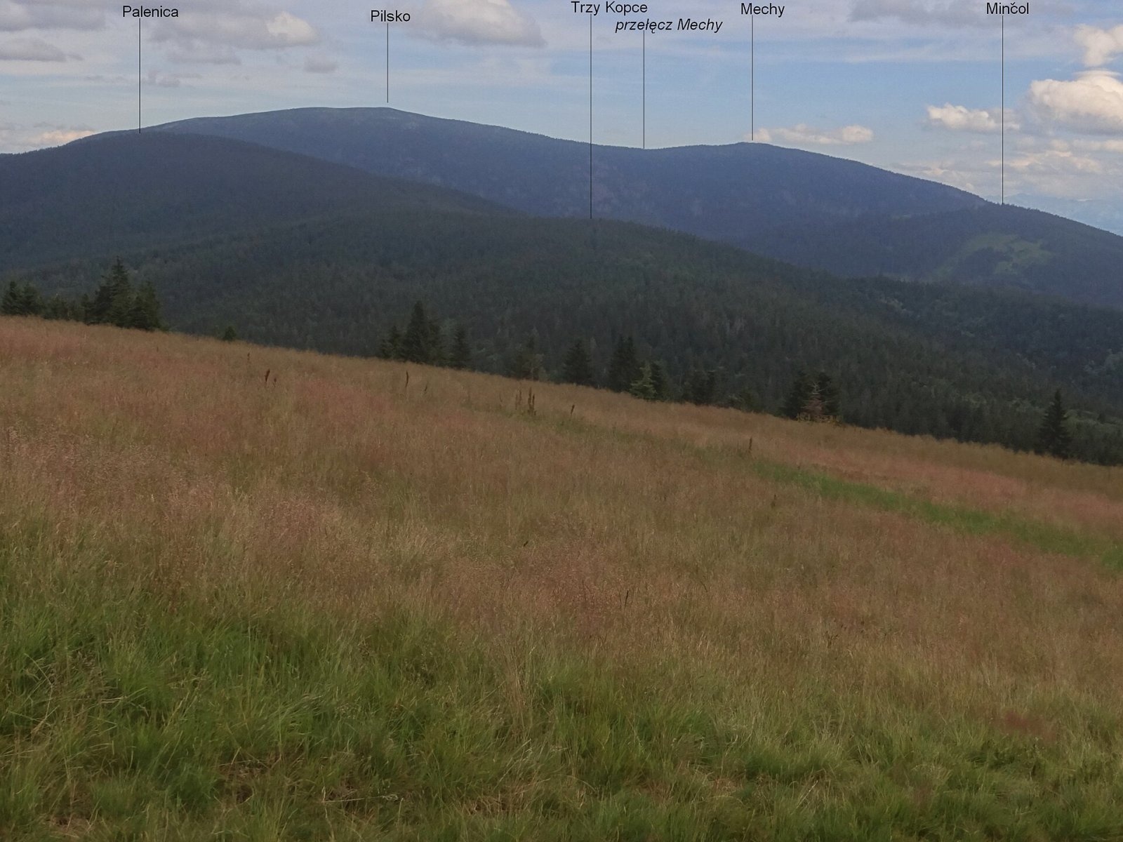
The European Watershed runs along the massif's crest: streams from the northern, Polish side flow via the Glinna to the Vistula and the Baltic, while those from the western, southern and eastern slopes go to the Orava and on to the Black Sea. Pilsko's neighbours are Polanica to the west, Minčol to the south-west, Mechy (1,479 m) to the south and Huńców to the north. The mountain is built of flysch — alternating sandstones and claystones (Magura sandstones); the northern slopes, where ancient glaciers were more active, are steeper than the southern ones.
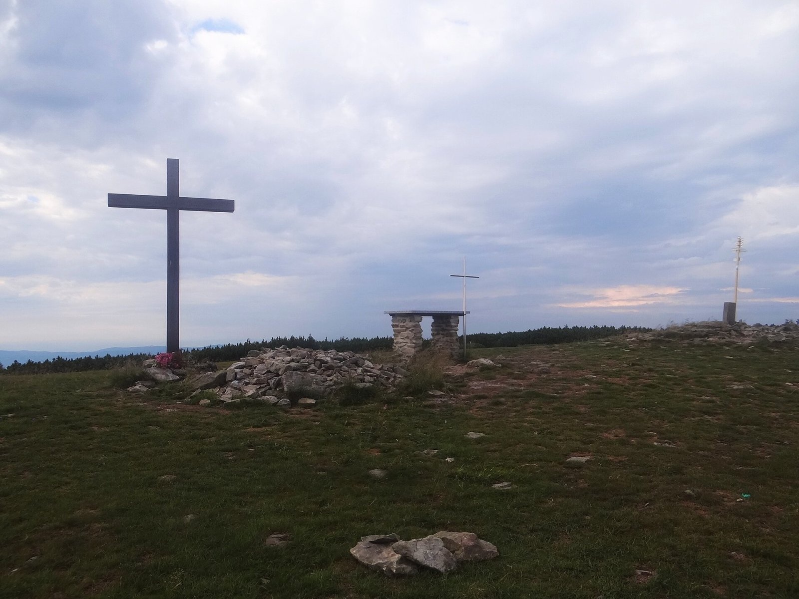
The summit dome is flat and broad, covered with grass, rock debris and clumps of natural dwarf pine. On the highest point the people of Mútne erected a field altar and a cross; every July the parish priest of Mútne celebrates Mass here. On the north-eastern slope of Góra Pięciu Kopców, by the yellow trail, stands a cross in memory of Border Defence Corps corporal Franciszek Basik, one of the first victims of the war, who fell here on 1 September 1939.
Getting there / trails
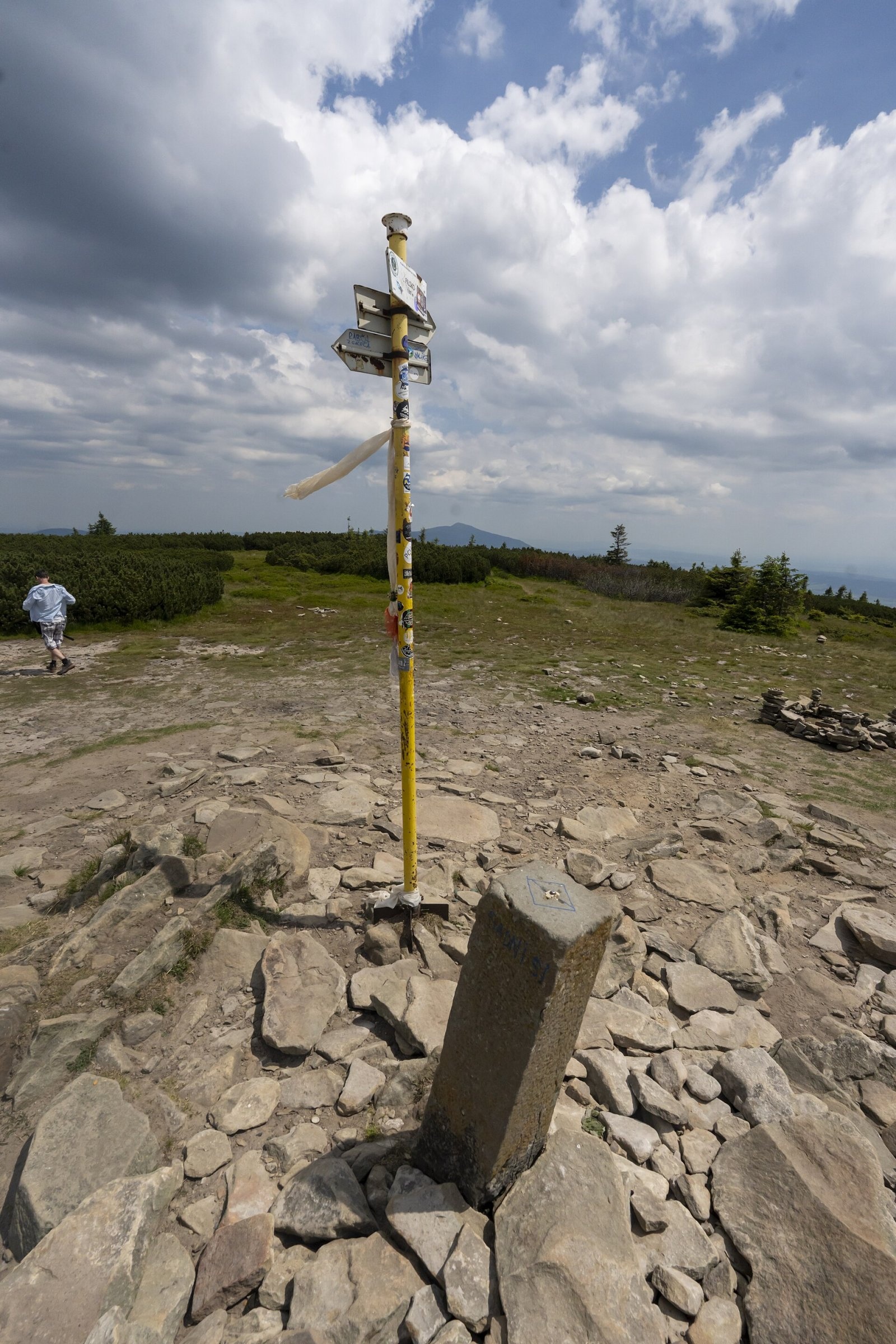
- From Slovakia marked trails lead to the summit from Oravské Veselé, from Sihelné, from Mútne via the Dudová junction, and along the ridge from the Hliny saddle (Polish Przełęcz Glinne).
- From Poland — several routes from Korbielów, mostly via Hala Miziowa, where a PTTK mountain hut stands at a trail junction at about 1,330 m.
In winter the northern slopes are one of Poland's biggest ski areas: the Pilsko resort in Korbielów is the highest-lying Polish ski centre after Kasprowy Wierch.
The view
The panorama is very wide: Babia hora and the neighbouring Beskids, the Silesian and Kysuce Beskids, the Krivánska Fatra, the Choč Mountains and the Tatras are especially clear. In good weather you can see the Martinské hole, the Low Tatras ridge, the northern Greater Fatra, the Moravian-Silesian Beskids, and in perfect visibility even the eastern Sudetes.
Name and history
The origin of the name is unclear. It is linked to the meadow of Pielsko, owned by a man named Piel, to «sawing» (a place where timber was cut), or to a legend about Orava highwaymen who gathered here to drink. Another theory says Pilsko is a distortion of the Slovak Poľsko (Poland). The name was first printed in 1721 by Father Gabriel Rzączyński, who is also regarded as the first recorded climber of the summit. In 1980 tragedy struck on Pilsko: a group of young athletes with their coach got lost in a blizzard and fog, and three boys died of hypothermia.
Nature
The massif is protected on both sides of the border: the Slovak reserve (1967, 809 ha) lies within the Horná Orava Protected Landscape Area, the Polish «Pilsko» reserve (1971, about 105 ha) within the Żywiec Landscape Park. Rare plants grow on the meadows, including Siberian chives and globeflower, and the dwarf pine shelters bilberry, alpine grasses and clubmosses.
Safety
The flat summit is disorienting in fog — the 1980 tragedy is a reminder that the weather here changes very quickly. On the Slovak side help comes from the Mountain Rescue Service (HZS): 18 300 (+421 18 300); on the Polish side from the Beskidy group of GOPR: 985 or +48 601 100 300; 112 works everywhere.
Photos: Jerzy Opioła, CC BY-SA 4.0; Jerzy Opioła, CC BY-SA 4.0; Jerzy Opioła, CC BY-SA 4.0; Krzysztof Popławski, CC BY 4.0; Krzysztof Popławski, CC BY 4.0 — Wikimedia Commons.
Getting there from Ukraine
Border crossings
- Uzhhorod – Vyšné Nemecké — road, 24/7
- Malyi Bereznyi – Ubľa — road, 24/7 For cars and buses; pedestrians not confirmed by the Ukrainian border service, lorries up to 3.5 t.
- Mali Selmentsi – Veľké Slemence (pedestrian) — pedestrian, 09:00–21:00 Kyiv time Pedestrians and cyclists only; inconvenient for the Tatras without onward transport.
- Chop – Čierna nad Tisou (rail) — rail, 24/7
By car
From Uzhhorod ≈275 km, ≈3 h 35 min without queues: Uzhhorod – Vyšné Nemecké → I/19 to Košice → D1 motorway via Prešov, Poprad and Liptovský Mikuláš to Ružomberok (≈270 km, ≈3 h 25 min from the border). From Lviv it is faster through Poland: M-10 → Krakovets – Korczowa → A4 to Kraków → S7/DK7 to the Chyżne – Trstená border → R3 and I/59 via Dolný Kubín to Ružomberok: ≈482 km, ≈6 h 15 min (via Uzhok and Ubľa ≈500 km, ≈7 h 30 min). The D1 requires an e-vignette (eznamka.sk).
Checked 23.10.2026; border crossing hours and timetables change — check before you travel.
Location on the map
Water and shelter nearby
- Spring below Pilsko180 m · Not verified · 1 525 m
- Spring below Góra Pięciu Kopców (west slope)350 m · Not verified · 1 530 m
- Spring below Góra Pięciu Kopców (east slope)500 m · Not verified · 1 493 m
- Hala Miziowa Hut1.4 km · Standing · 1 274 m
- Bacówka Shelter, 1 271 m1.4 km · Not verified · 1 271 m
- Spring below Dudová (north slope), 1 256 m2.2 km · Not verified · 1 256 m
- Szałas na Cudzichowej Hut2.5 km · Not verified · 1 229 m
- Hut on Polana Górowa2.5 km · Not verified · 1 172 m
- Drinking water below Buczynka (Hunców)2.5 km · Has water · 1 146 m
Comments
Trails nearby
All trails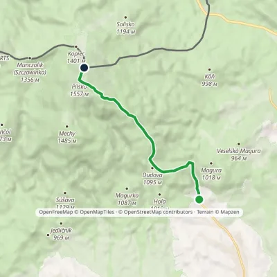 EasyOne-dayMarkedOravské Veselé PilskoElevation profile815–1 557 m6.5 kmascent 742 m≈ 3 h walkingunder 1 km from Pilsko
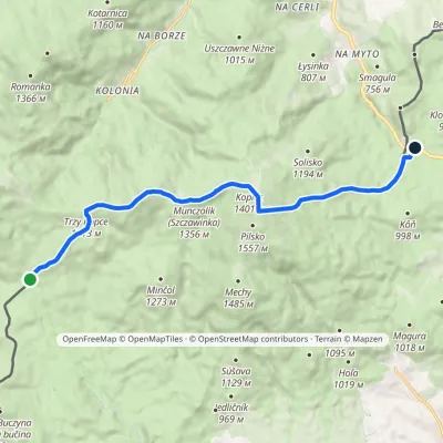 ModerateOne-dayMarkedPrzełęcz Bory Orawskie Hliny / Przełęcz GlinneElevation profile804–1 534 m12.1 kmascent 714 m≈ 4.5 h walkingunder 1 km from Pilsko
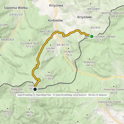 ModerateOne-dayMarkedPass under Beskid Krzyżowski Five Mounds MountainElevation profile602–1 534 m10.5 kmascent 932 m≈ 4.5 h walkingunder 1 km from Pilsko
Nearby attractions
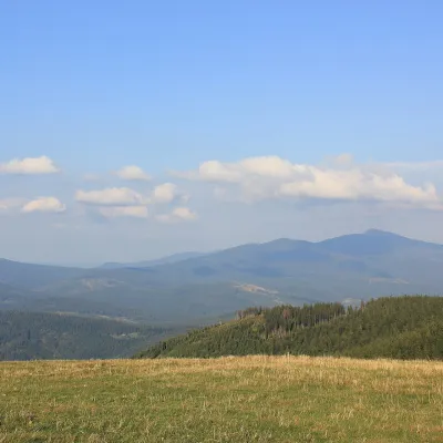 Mountain meadowHala MiziowaKorbielówaltitude 1 274 m1.4 km from PilskoHala Miziowa is a large mountain glade on the northern slope of Pilsko in the Żywiec Beskids, within the village of Korbielów in Jeleśnia commune, Silesian Voivodeship.
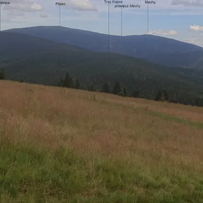 PeakPalenica (Żywiec Beskids)Sopotnia Wielkaaltitude 1 340 m2.7 km from PilskoPalenica (Slovak Polanica or Brts) is a summit about 1,340 m high in the Pilsko group of the Żywiec Beskids (in Slovakia this part of the mountains is called the Orava...
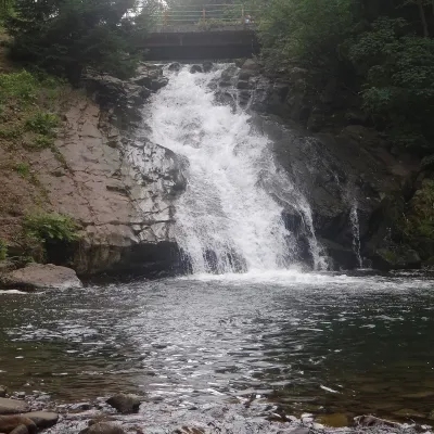 WaterfallSopotnia Wielka FallsSopotnia Wielka6.4 km from PilskoSopotnia Wielka Falls (Wodospad w Sopotni Wielkiej) is the largest waterfall in the Polish Beskids. It drops on the Sopotnia stream right in the centre of the village...
Craft nearby
All craft places Cheese dairies & pasturesBacówka na Bukowinie, Żabnica: sheep's cheese and alpacasWęgierska Górka16 km from PilskoBacówka na Bukowinie stands on a slope above the village of Żabnica, next to Węgierska Górka, where the Żywiec Beskids meet the Silesian Beskids.
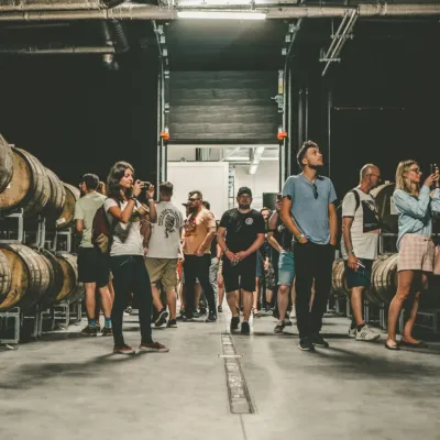 Craft beer & breweriesPINTA Brewery, Wieprz near Żywiec: tours and taproomWieprz17 km from PilskoPINTA is the brewery that Poles associate with the start of the “beer revolution”; it calls itself the country's first craft brewery.
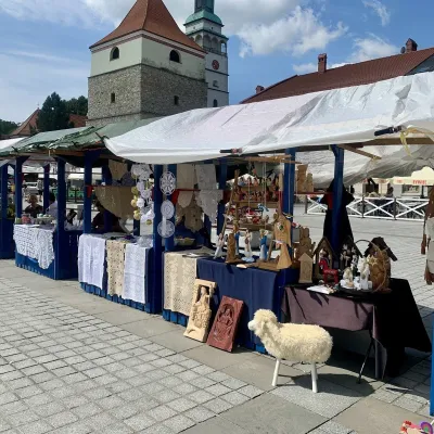 Markets & fairsFolk Art Fair in Żywiec during the Beskidy Week of CultureŻywiec20 km from PilskoThe Beskidy Highlanders' Week of Culture (Tydzień Kultury Beskidzkiej, TKB) is Poland's largest folklore festival: it was first held in Wisła in 1964, and today, at...
 Water parks & thermal poolsAquapark Leśna (Żywiec)Leśna20 km from PilskoAquapark Leśna (also called Aquapark Żywiec) is a swimming-pool complex in the village of Leśna, a few kilometres from Żywiec, in the Żywiec Basin, surrounded by the...
 Craft beer & breweriesBrowar Zarzecze in the Żywiec Basin: craft brewery shopZarzecze24 km from PilskoBrowar Zarzecze works in the village of Zarzecze near Pietrzykowice in the Żywiec Basin — a region where beer has been brewed since at least the 19th century and home...
 Cheese dairies & pasturesSalaš Syrex in Zázrivá — Home of the Zázrivá Korbáčik CheeseZázrivá33 km from PilskoZázrivá is a scattered mountain village on the border of Orava and the Malá Fatra, famous throughout Slovakia for its korbáčiky: thin strings of steamed cheese braided...
