Šiatorská Bukovinka
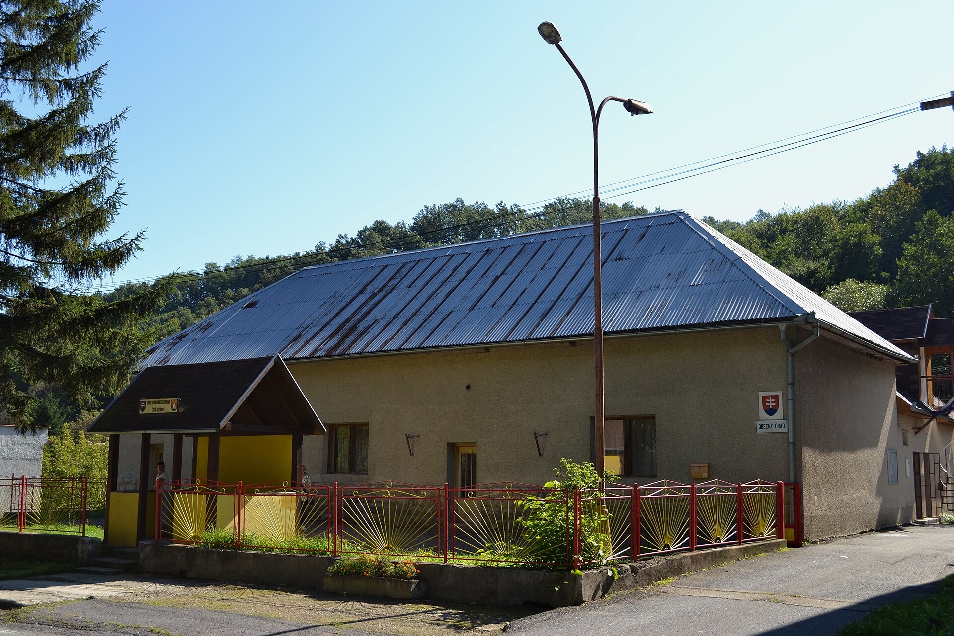
Photos: Ladislav Luppa, CC BY-SA 4.0 (Wikimedia Commons)
Šiatorská Bukovinka is a village in the Lučenec District of the Banská Bystrica Region, central Slovakia, in the Novohrad area. The settlement lies at an elevation of 305 metres, surrounded by the hills of the Börzsöny and Cserhát mountain ranges. The municipality covers an area of 21.64 km² and has a population of 262 as of 2025.
The first written mention of Šiatorská Bukovinka dates back to 1959, when it became a separate administrative unit.
The village is known for its natural setting near the Slovak-Hungarian border, at the foothills of Börzsöny and Cserhát. The landscape is predominantly rural, with forests and rolling hills that offer a peaceful environment for nature lovers. The area attracts hikers and those interested in exploring local historical sites.
Visitors to Šiatorská Bukovinka can enjoy several hiking trails, such as “Šiatorská Bukovinka – Ruins of Šomoška Castle”, “Šiatorská Bukovinka – Mačača – Obročná – Pogaňský Hrad”, “Šiatorská Bukovinka – Karancs”, and “Mária Szécsi Trail: Golcová – Fiľakovo”. The nearby Karancs peak is a popular destination for trekking. These routes lead through scenic spots and introduce travelers to the natural and cultural heritage of the region.
Getting there from Ukraine
From Uzhhorod to Brezno ≈274 km, ≈3 h 50 min without queues: Uzhhorod – Vyšné Nemecké → I/19 to Košice → D1 via Prešov and Poprad to the exit near Liptovský Hrádok → I/18 and I/72 over the Čertovica Pass to Brezno. To Banská Bystrica ≈322 km, ≈4 h 30 min: D1 to Ružomberok, then I/59 via Donovaly. From Lviv: to Brezno via Uzhok and Ubľa ≈498 km (≈7 h 45 min) or through Poland ≈554 km (≈7 h 05 min); to Banská Bystrica through Poland (Kraków – Chyżne – Trstená – Dolný Kubín – Ružomberok) ≈535 km, ≈7 h 15 min. The D1 requires an e-vignette (eznamka.sk).
Sources: Wikipedia, Wikidata, OpenStreetMap, Karpaty.rocks data. More on Wikipedia
Trails nearby
All trails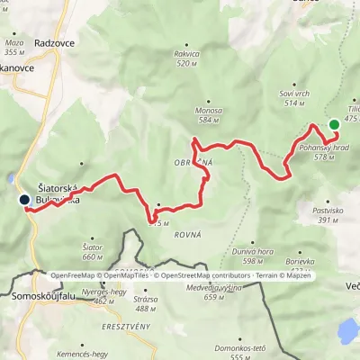 ModerateOne-dayMarkedŠiatorská Bukovinka Pohanský hradvia Mačacia, ObručnáElevation profile268–579 m14.8 kmascent 237 m≈ 4 h walkingunder 1 km from the centre
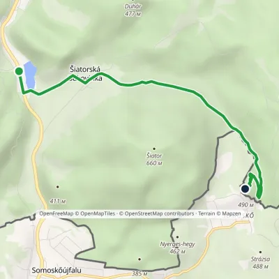 EasyOne-dayMarkedŠiatorská Bukovinka Ruins of Šomoška CastleElevation profile268–490 m5.1 kmascent 224 m≈ 1.5 h walkingunder 1 km from the centre
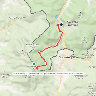 EasyOne-dayMarkedŠiatorská Bukovinka KarančElevation profile273–725 m7.1 kmascent 34 m≈ 2 h walkingunder 1 km from the centre
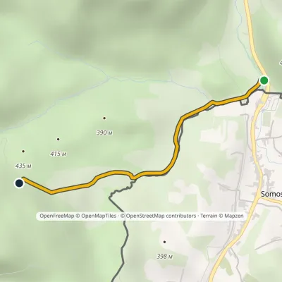 EasyOne-dayMarkedŠiatorská Bukovinka, state border MižeraElevation profile297–469 m2.3 kmascent 173 m≈ 60 min walking1.7 km from the centre
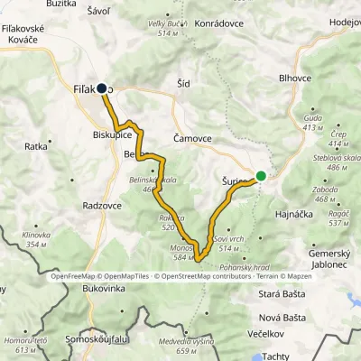 ModerateOne-dayMarkedFiľakovo Hajnáčkavia Belina, Saddle under Monika +1Elevation profile191–580 m18 kmascent 371 m≈ 5 h walking4.8 km from the centre
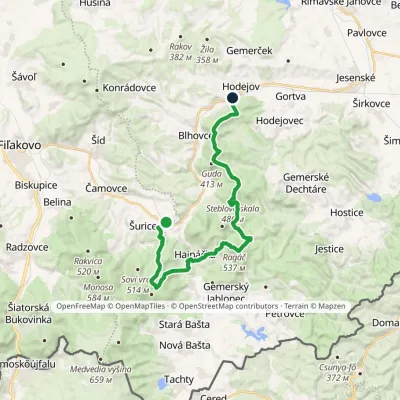 HardTwo-dayMarkedHodejov, railway station Hajnáčka, railway stationElevation profile197–578 m23.7 kmascent 1 039 m≈ 8 h walking7.2 km from the centre
Peaks nearby
All peaks
Huts, shelters and springs nearby
Getting there from Ukraine
Border crossings
- Uzhhorod – Vyšné Nemecké — road, 24/7
- Malyi Bereznyi – Ubľa — road, 24/7 For cars and buses; pedestrians not confirmed by the Ukrainian border service, lorries up to 3.5 t.
- Mali Selmentsi – Veľké Slemence (pedestrian) — pedestrian, 09:00–21:00 Kyiv time Pedestrians and cyclists only; inconvenient for the Tatras without onward transport.
- Chop – Čierna nad Tisou (rail) — rail, 24/7
By car
From Uzhhorod to Brezno ≈274 km, ≈3 h 50 min without queues: Uzhhorod – Vyšné Nemecké → I/19 to Košice → D1 via Prešov and Poprad to the exit near Liptovský Hrádok → I/18 and I/72 over the Čertovica Pass to Brezno. To Banská Bystrica ≈322 km, ≈4 h 30 min: D1 to Ružomberok, then I/59 via Donovaly. From Lviv: to Brezno via Uzhok and Ubľa ≈498 km (≈7 h 45 min) or through Poland ≈554 km (≈7 h 05 min); to Banská Bystrica through Poland (Kraków – Chyżne – Trstená – Dolný Kubín – Ružomberok) ≈535 km, ≈7 h 15 min. The D1 requires an e-vignette (eznamka.sk).
Checked 23.10.2026; border crossing hours and timetables change — check before you travel.
