Padiș Plateau
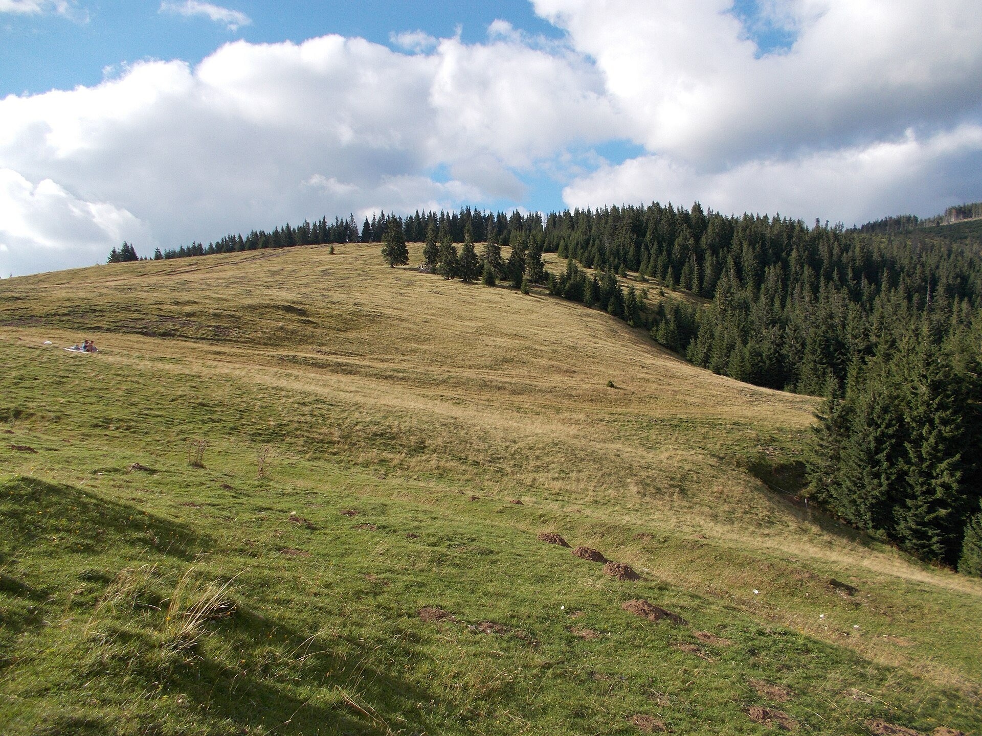
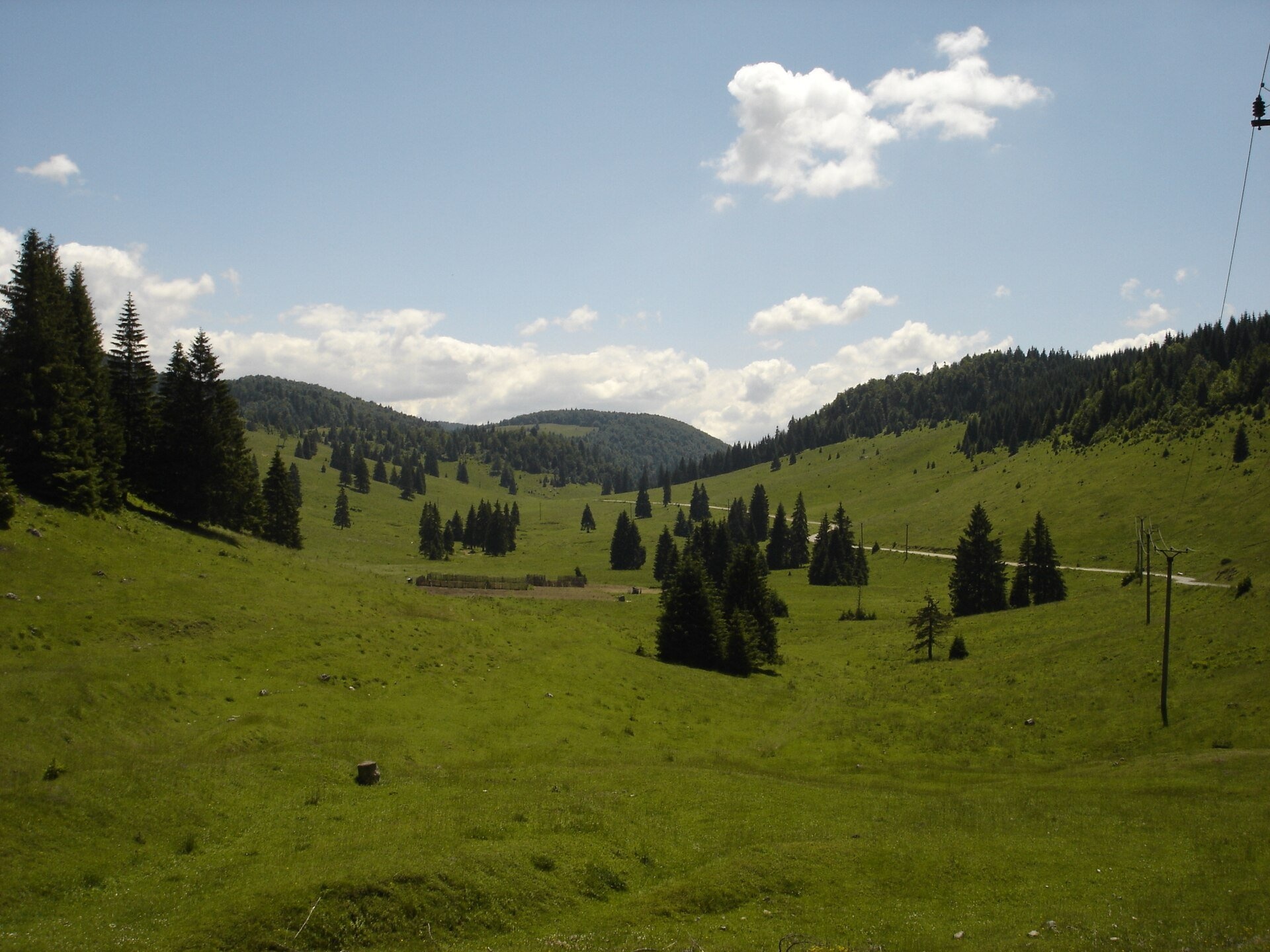
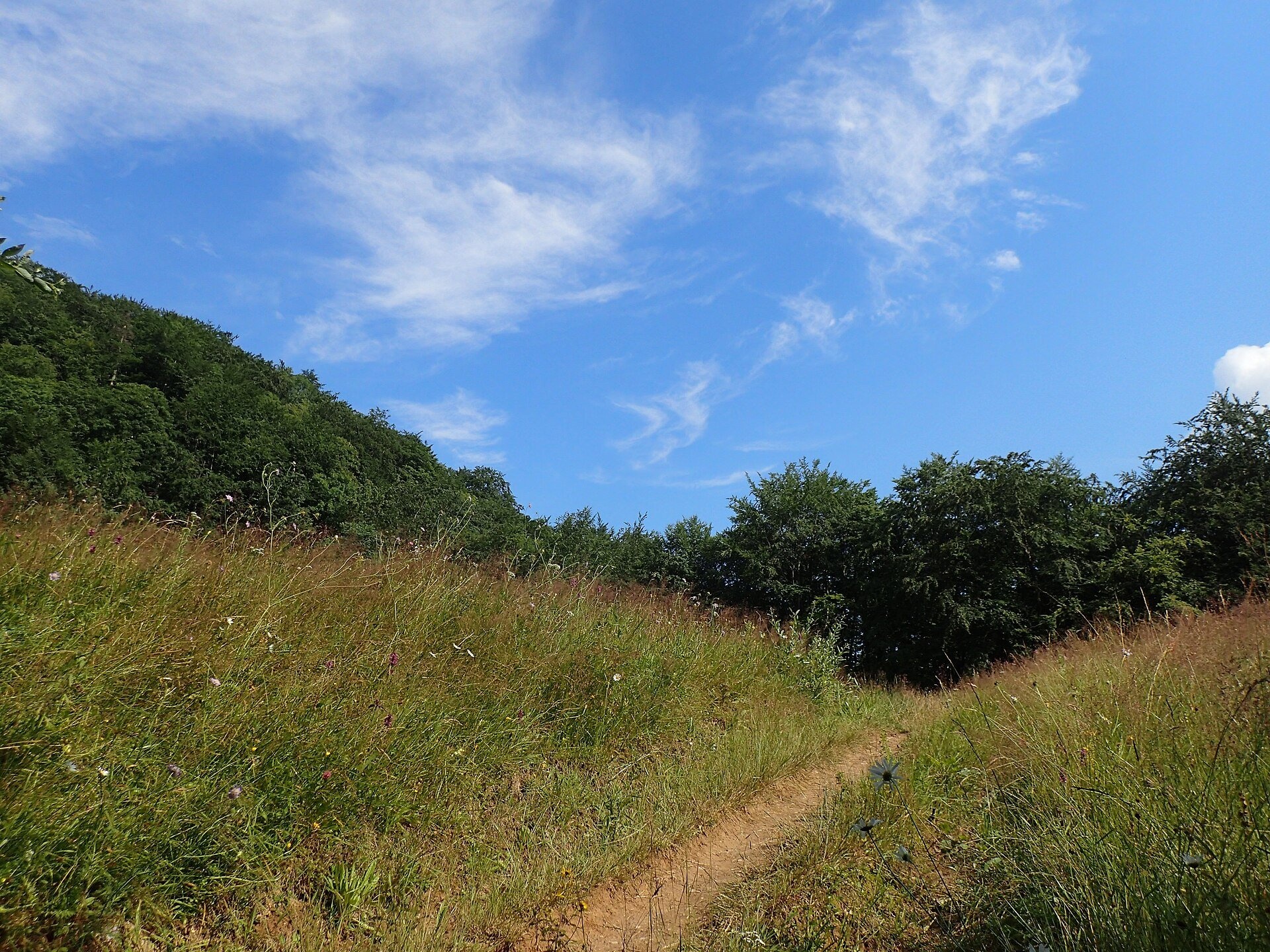
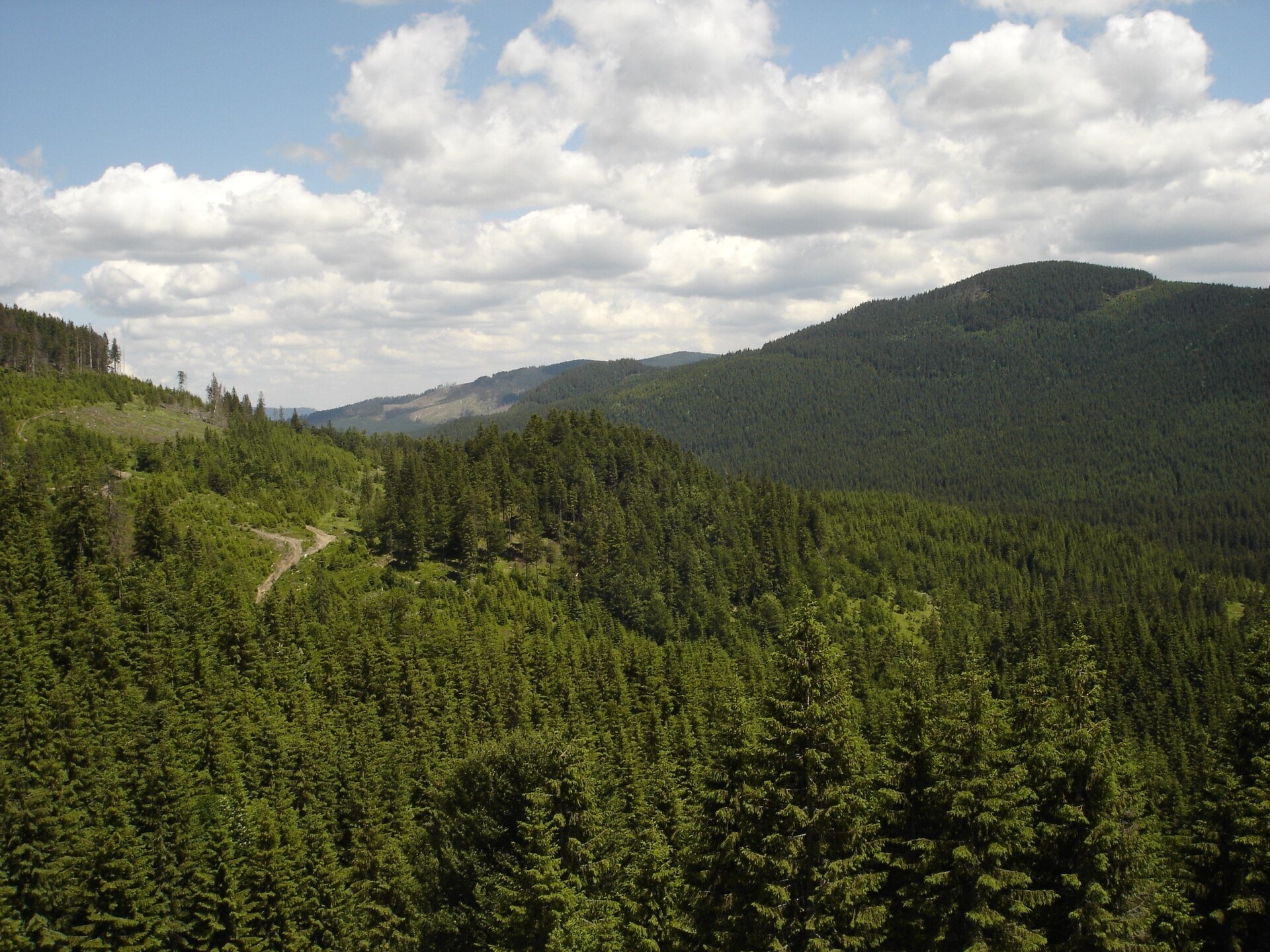
Padiș (Hungarian: Pádis) is a karst plateau in the Bihor Mountains, part of Romania's Apuseni (Western Romanian Carpathians), in the south-east of Bihor County. Romanian Wikipedia gives an average altitude of about 1,200 m, the Hungarian one 1,280 m. It is a closed basin with no surface outflow: streams cross the meadows, vanish into sinkholes and resurface in neighbouring valleys. The relief is made of dolines, rock walls, caves, shafts, gorges and meadows set among spruce forests.
Padiș is not a single pasture but several mountain meadows. The central plain is called Șesul Padiș; around it lie Poiana Ponor, Poiana Glăvoi, Poiana Vărășoaia, as well as the Bălileasa and Florilor meadows. Horses and sheep graze there in summer. The plateau belongs to Apuseni Natural Park (75,784 ha), and 39 ha form the floristic and landscape reserve "Padiș Karst Plateau", which protects, among others, the globeflower.
What to see and do
- The Cetățile Ponorului loop — blue dot, 11.3 km, about 6 h 30 min, difficult: across Poiana Ponor to the karst complex with a 74 m high portal. The route has cables and metal ladders and is not walked in winter.
- The Cetățile Rădesei loop — red dot, 5.6 km, about 2 h from the Vărășoaia hut; the cave is passable only in summer at low water.
- The Măgura Vânătă ridge (1,641 m) — yellow triangle, 7.7 km, about 3 h from Padiș to the Vărășoaia saddle, with views over the whole basin.
- Poiana Florilor — a flower meadow near the Galbena Gorge (Cheile Galbenei), crossed by the Galbena loop (11.1 km).
How to get there
From the west, drive from the town of Beiuș via Sudrigiu to the village of Pietroasa, then on road DJ763 through Boga up to the plateau; from the city of Oradea it is about 100 km. From the east the forest road Răchițele – Ic Ponor – Padiș (53 km through to Pietroasa) leads in; according to Romanian Wikipedia, the unpaved section from Poiana Horea is best driven in an off-road vehicle. Marked paths also reach the plateau from Stâna de Vale, the Vârtop saddle, Arieșeni (16 km) and Gârda de Sus.
Season, rules and safety
According to Hungarian Wikipedia, snow may fall on the plateau as early as November and lies until April, and the mean annual temperature is about 3 °C. The best time is June to September. Wild camping is banned in the park; ask the Apuseni park administration where tents are allowed (parcapuseni.ro). Keep away from the edges of sinkholes and shafts, and do not start the cable-equipped routes in rain.
Bears live in the Romanian Carpathians: stay on the marked paths, never leave food by a tent or a car, and near flocks do not run from the sheepdogs — stop and walk calmly around the herd. Salvamont mountain rescue: national dispatch 0SALVAMONT — 0725 826 668 or 112; advice for hikers is on salvamontromania.ro.
Nearby
Poiana Ponor and Poiana Glăvoi lie south of the central plain, Poiana Vărășoaia to the north. The highest summit of the Bihor Mountains is Cucurbăta Mare.
Photos: Nicu Farcaș, CC BY-SA 4.0, Wikimedia Commons; Tula, CC BY-SA 3.0, Wikimedia Commons; Mihai.cosmin.pascariu, CC BY-SA 4.0, Wikimedia Commons.
Getting there from Ukraine
Border crossings
- Porubne – Siret — road and pedestrian, 24/7
- Diakivtsi – Racovăț — road and pedestrian, 24/7 No freight traffic.
- Krasnoilsk – Vicovu de Sus — road and pedestrian, 08:00–20:00 Cars up to 3.5 t and pedestrians only; not 24/7.
- Solotvyno – Sighetu Marmației — road and pedestrian, 24/7 Passenger traffic only: vehicles up to 3.5 t with up to 9 seats, pedestrians.
- Diakove – Halmeu — road, 24/7 No pedestrian crossing.
By car
Rakhiv – Cluj-Napoca ≈219 km, ≈3 h 44 min (via Solotvyno – Sighetu Marmației); Ivano-Frankivsk – Cluj-Napoca ≈353 km, ≈6 h 04 min (via Solotvyno – Sighetu Marmației); Chernivtsi – Cluj-Napoca ≈343 km, ≈6 h 28 min (via Krasnoilsk – Vicovu de Sus). Times without border queues, our road routing (GraphHopper, OSM).
Checked 03.11.2026; border crossing hours and timetables change — check before you travel.
Location on the map
Water and shelter nearby
- Spring below Boghii900 m · Not verified · 1 268 m
- Spring below Vărășoaia (south-east slope)1.9 km · Not verified · 1 322 m
- Spring below Biserica Moțului (north slope)2 km · Not verified · 1 306 m
- Drinking water below Vărășoaia2 km · Not verified · 1 333 m
- Spring below Dealu Călciş (east slope), 1 095 m2.2 km · Not verified · 1 095 m
- Spring below Dealu Călciş (east slope), 1 114 m2.2 km · Not verified · 1 114 m
- Spring below Dealu Călciş (east slope), 1 091 m2.2 km · Not verified · 1 091 m
- Spring below Dealu Călciş (east slope), 1 091 m (2)2.2 km · Not verified · 1 091 m
- Spring «Izbucul Boga»2.3 km · Not verified · 705 m
- Spring below Măgura Mică (south-east slope), 1 533 m2.5 km · Not verified · 1 533 m
- Glăvoi Salvamont Hut2.6 km · Not verified · 1 088 m
- Drinking water below Varniţa2.6 km · Not verified · 1 088 m
- Spring below Vărășoaia (north slope)2.7 km · Not verified · 1 347 m
- Bulbuci Spring2.8 km · Not verified · 939 m
- Spring below Biserica Moțului (north-east slope)3 km · Not verified · 1 324 m
Comments
Trails nearby
All trails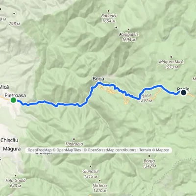 ModerateTwo-dayMarkedPietroasa PadișElevation profile322–1 298 m17.8 kmascent 1 068 m≈ 6.5 h walkingunder 1 km from Padiș Plateau
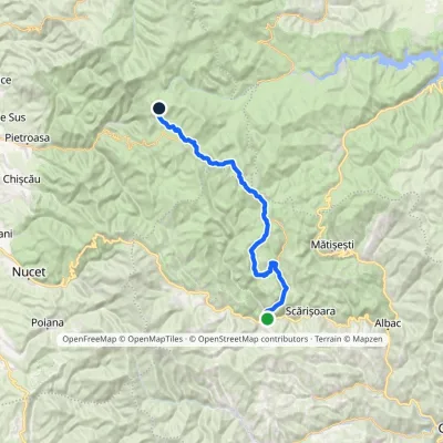 HardMulti-dayMarkedGârda de Sus Vărășoaia SaddleElevation profile727–1 436 m31.8 kmascent 1 186 m≈ 10.5 h walkingunder 1 km from Padiș Plateau
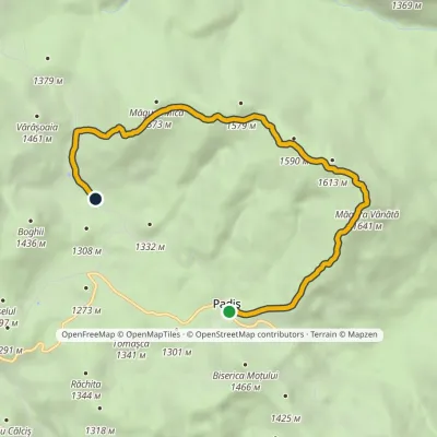 EasyOne-dayMarkedPadiș Vărășoaia SaddleElevation profile1 259–1 641 m8.9 kmascent 371 m≈ 3 h walking1 km from Padiș Plateau
Nearby attractions
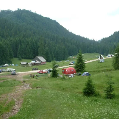 Mountain meadowPoiana GlăvoiBogaaltitude 1 086 m2.5 km from Padiș PlateauPoiana Glăvoi (Hungarian: Glavoj-rét) is a broad grassy meadow on the Padiș plateau in the Bihor Mountains (Apuseni), at about 1,090 m.
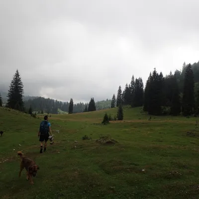 Mountain meadowPoiana VărășoaiaPadișaltitude 1 315 m2.5 km from Padiș PlateauPoiana Vărășoaia is a mountain meadow in the north of the Padiș plateau in the Bihor Mountains (Apuseni), at about 1,300 m.
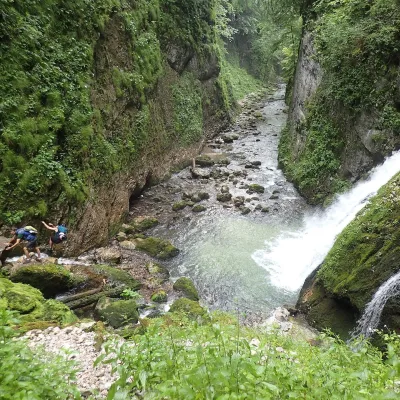 WaterfallEvantai Waterfall (Cascada Evantai)Boga5.7 km from Padiș PlateauEvantai Waterfall (Cascada Evantai, «the Fan») lies in the Galbena Gorge (Cheile Galbenei) in the Bihor Mountains, inside Apuseni Natural Park in Bihor County.
