Šíp
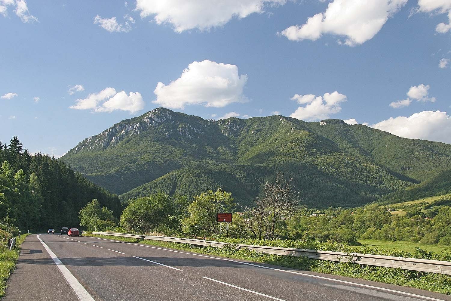
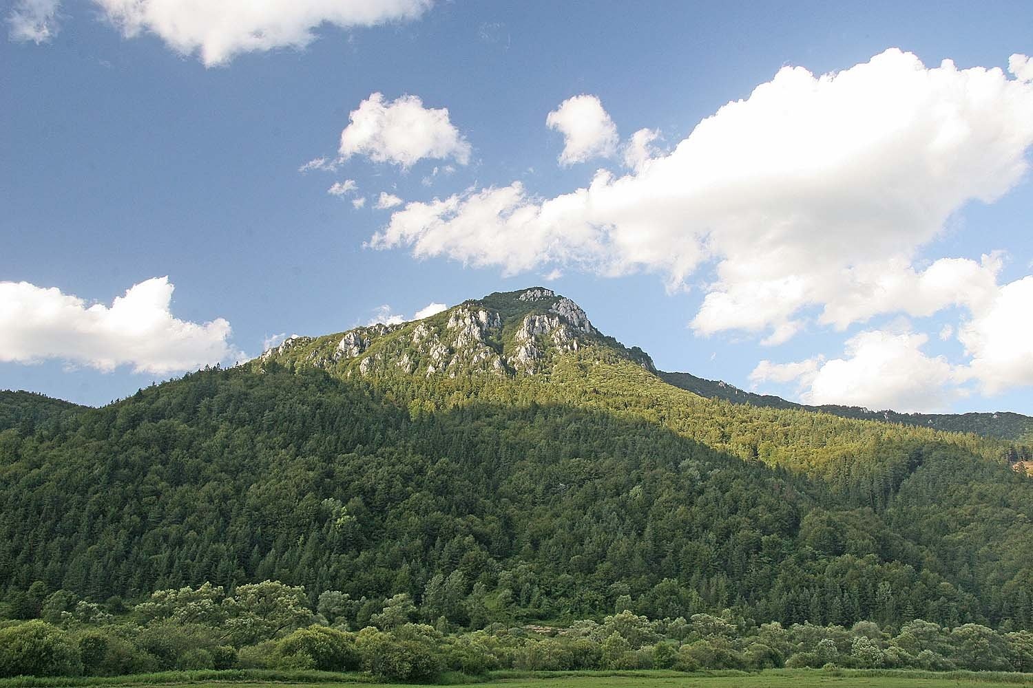
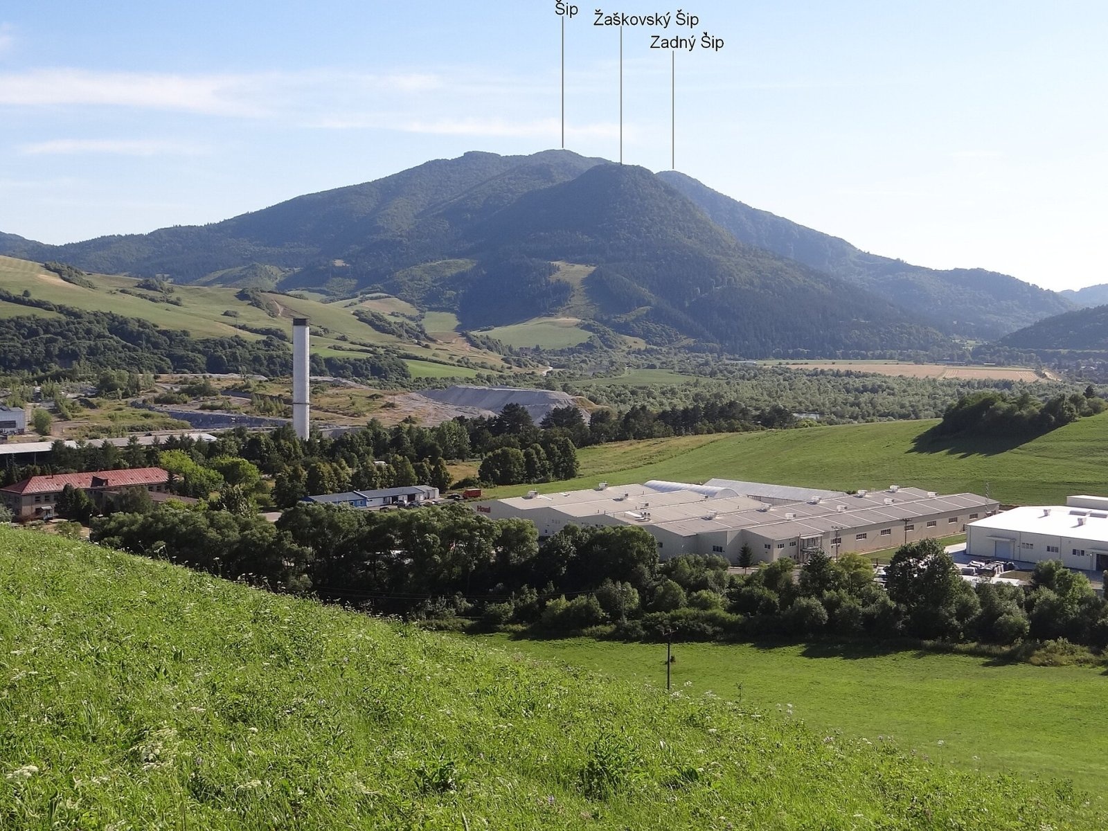
Šíp (Slovak for "thorn, spike, arrow") is a massive, broad, rocky mountain 1169 m high rising above the confluence of the Orava and Váh rivers in Slovakia. It belongs to the Greater Fatra (Veľká Fatra), specifically to its part on the north bank of the Váh which is named Šípska Fatra after the mountain; before 1978 Slovak geographers counted it as part of the Choč Mountains. Šíp lies in Ružomberok District, Žilina Region. The nearest villages are Stankovany (about 2 km), Žaškov (3 km), Párnica (3.5 km) and Kraľovany (4 km). Its prominence is about 555 m, one of the largest among Slovak peaks.
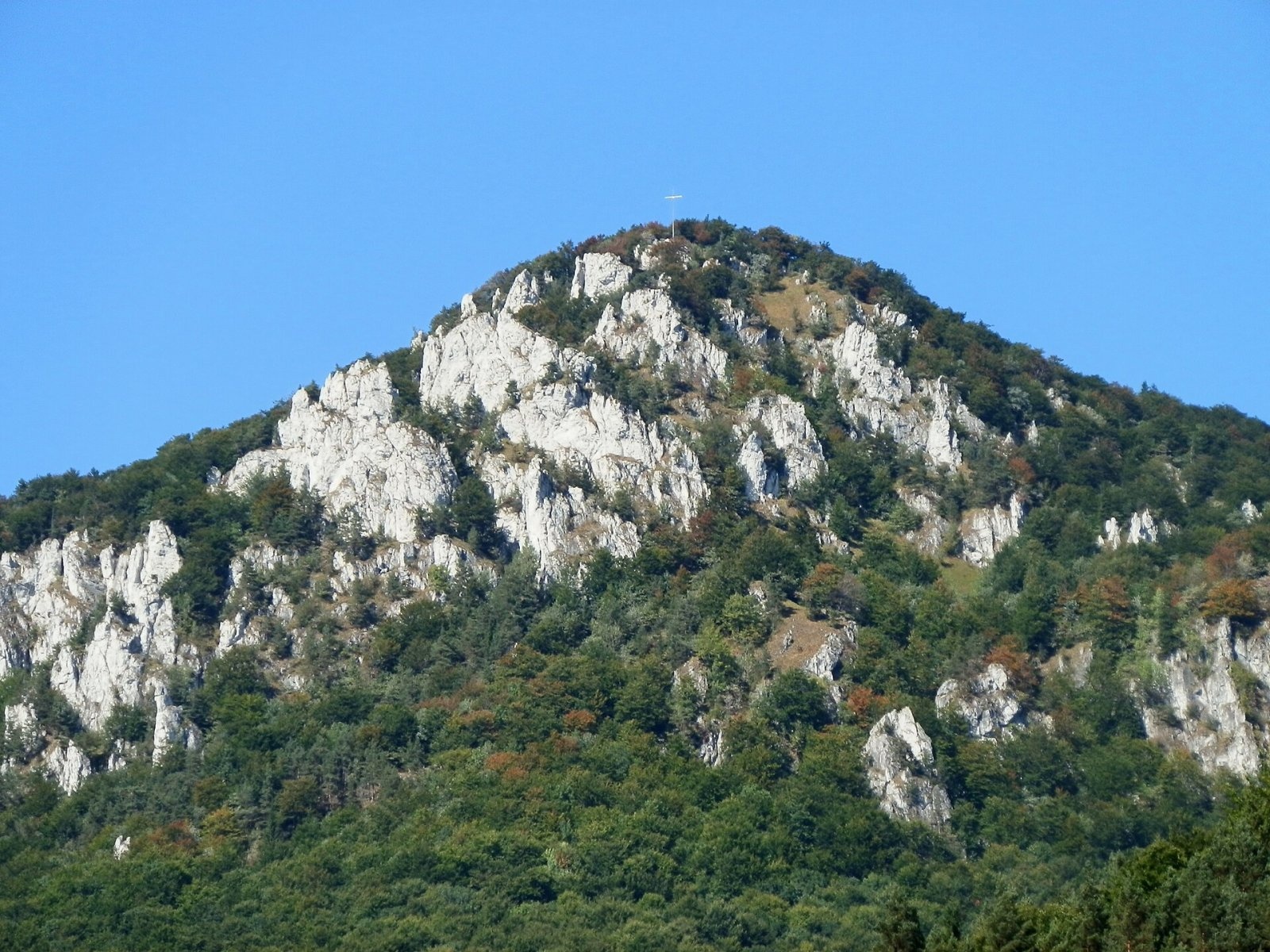
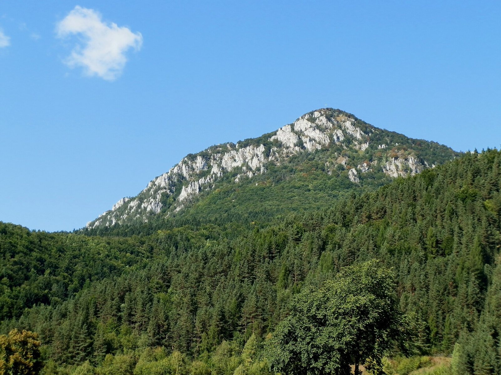
The massif fills the fork between the Váh and the Orava: to the north and west the Orava valley separates it from the Lesser Fatra, to the south the Váh valley from the main Greater Fatra ridge, and to the east the Žaškovský potok valley from the Choč Mountains. The massif has three tops: the main, eastern one (1169 m), fairly flat; Zadný Šíp (1143 m) about 900 m to the west – much rockier and topped by a tall wooden cross; and the fully forested Žaškovský Šíp (940 m) on the north-eastern spur. The sharp, pointed silhouette that probably gave the mountain its name is seen from the west, from the Váh–Orava confluence near Kraľovany.
How to get there / routes
The summit lies in a nature reserve, so stay on marked trails. The yellow trail from the Kraľovany railway stop to Stankovany crosses the top:
- From Stankovany – through the Škutova dolina and over the Žaškovské sedlo: about 2 h up, 1 h 20 min down.
- From the Kraľovany stop – via the Dierová recreation area, the Podšíp hamlet (760 m) and Zadný Šíp: 2¼–3 h up depending on the source, 1¾–2⅓ h down. The former very steep section between Podšíp and Zadný Šíp was replaced in 2009 by an easier route through the "Lazy" meadows.
- From Stankovany via "Rybka" to Podšíp, then the yellow trail: about 2 h 30 min up, 2 h down.
From Žaškov forest roads lead to Žaškovský Šíp and the main summit, but this way is not marked.
What you can see from the top
Šíp once offered an all-round panorama; according to Polish sources, growing forest now limits it to the south and east. You see the highest peaks of the Greater Fatra as far as Krížna, the Low Tatras with Chopok and Ďumbier, the deep Váh valley, the Veľký Choč massif with the other Choč peaks, and the Western Tatras. A treeless hump a little west of the main summit completes the view: from there you see both parts of the Lesser Fatra – the Kriváň part with Veľký Kriváň and rocky Veľký Rozsutec, and the Lúčanská part above the Váh gorge – and to the north Veľká Rača, Minčol and Pilsko in the Żywiec Beskids.
Nature and history
The lower part of the massif, up to about 700 m, consists of softer marls, marly limestones and shales of the Križná nappe, so the slopes there are gentler. Higher up lie resistant Middle Triassic dolomites and limestones of the Choč nappe, weathered into the typical rock towers. East of the summit, on the ridge, stands the prominent limestone block of Okrúhla skala (Jánošík's Table), with a small cave and a spring under its southern wall; the massif also hides the Ľadová jaskyňa (Ice Cave), which is closed to visitors.
The massif is almost entirely forested with beech and fir, higher up with spruce; near the summit grow sycamore, larch and dwarf pine, and on the warm southern slopes the whitebeam. The rock grasslands are very rich in rare species. For this reason 302 ha of the massif have been protected since 1980 as the Šíp national nature reserve, and the whole massif lies in the buffer zone of Malá Fatra National Park. Below Zadný Šíp lie the Podšíp meadows, once a lively sheep-farming centre; since the 1980s some of the huts have become holiday cottages.
Safety, season and rules
Šíp can be climbed all year, but the rocky parts near the main summit and Zadný Šíp are slippery in winter and after rain. In the reserve do not leave the trails or pick plants. Slovak Mountain Rescue Service (HZS): 18 300 (+421 18 300) or 112.
Interesting facts
- According to legend, a cross has stood on Zadný Šíp since the time of Saints Cyril and Methodius; it was last renewed in 2005 after a summer windstorm.
- A whole geomorphological unit – Šípska Fatra – is named after the mountain.
- Šíp is the dominant landmark around the Váh–Orava confluence.
Photos: Prazak, CC BY 2.5; Prazak, CC BY 2.5; Michal Jakubský, CC BY 3.0; Michal Jakubský, CC BY 3.0; Jerzy Opioła, CC BY-SA 3.0 — Wikimedia Commons.
Getting there from Ukraine
Border crossings
- Uzhhorod – Vyšné Nemecké — road, 24/7
- Malyi Bereznyi – Ubľa — road, 24/7 For cars and buses; pedestrians not confirmed by the Ukrainian border service, lorries up to 3.5 t.
- Mali Selmentsi – Veľké Slemence (pedestrian) — pedestrian, 09:00–21:00 Kyiv time Pedestrians and cyclists only; inconvenient for the Tatras without onward transport.
- Chop – Čierna nad Tisou (rail) — rail, 24/7
By car
From Uzhhorod ≈275 km, ≈3 h 35 min without queues: Uzhhorod – Vyšné Nemecké → I/19 to Košice → D1 motorway via Prešov, Poprad and Liptovský Mikuláš to Ružomberok (≈270 km, ≈3 h 25 min from the border). From Lviv it is faster through Poland: M-10 → Krakovets – Korczowa → A4 to Kraków → S7/DK7 to the Chyżne – Trstená border → R3 and I/59 via Dolný Kubín to Ružomberok: ≈482 km, ≈6 h 15 min (via Uzhok and Ubľa ≈500 km, ≈7 h 30 min). The D1 requires an e-vignette (eznamka.sk).
Checked 23.10.2026; border crossing hours and timetables change — check before you travel.
Location on the map
Water and shelter nearby
- Spring below Šíp1.1 km · Not verified · 808 m
- Škútova Spring1.2 km · Not verified · 725 m
- Perisko Spring1.3 km · Not verified · 742 m
- Spring below Zadný Šíp (north-west slope), 719 m1.4 km · Not verified · 719 m
- Spring below Zadný Šíp (north-west slope), 713 m1.4 km · Not verified · 713 m
- Spring below Hôrka (north slope), 654 m1.5 km · Not verified · 654 m
- Spring below Zadný Šíp (north-west slope), 704 m1.5 km · Not verified · 704 m
- Spring below Hôrka (north slope), 613 m1.5 km · Not verified · 613 m
- Spring below Hôrka (north slope), 618 m1.5 km · Not verified · 618 m
- Spring below Zadný Šíp (west slope), 751 m1.6 km · Not verified · 751 m
- Spring below Zadný Šíp (west slope), 735 m1.6 km · Not verified · 735 m
- Spring below Hôrka (north-west slope)1.7 km · Not verified · 559 m
- Spring below Zadný Šíp (north-west slope), 639 m1.7 km · Not verified · 639 m
- Spring below Zadný Šíp (north-west slope), 623 m1.7 km · Not verified · 623 m
- Spring below Hôrka (north slope), 662 m1.8 km · Not verified · 662 m
- Spring below Hôrka (north-east slope), 664 m1.8 km · Not verified · 664 m
Comments
Trails nearby
All trails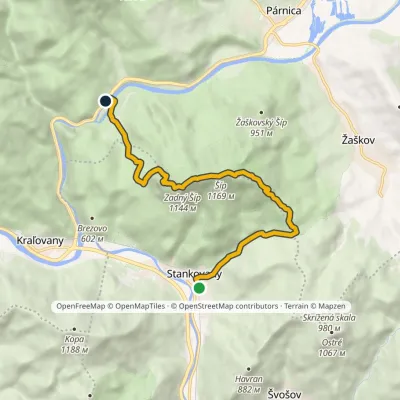 ModerateOne-dayMarkedStankovany Kraľovany, DierováElevation profile440–1 169 m9.9 kmascent 752 m≈ 4 h walkingunder 1 km from Šíp
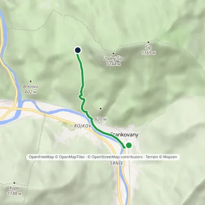 EasyOne-dayMarkedStankovany PodšípElevation profile433–754 m3 kmascent 322 m≈ 1.5 h walking1.6 km from Šíp
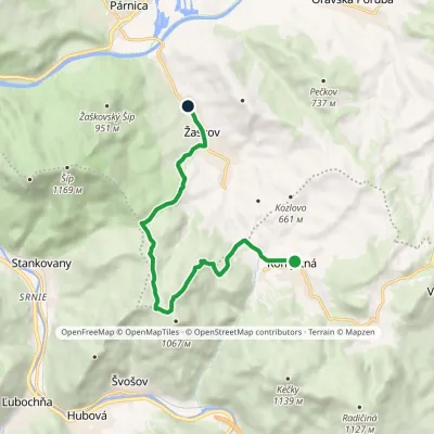 EasyOne-dayMarkedKomjatná Zaškovvia Saddle below OstrímElevation profile481–980 m9.9 kmascent 398 m≈ 3.5 h walking1.9 km from Šíp
Nearby attractions
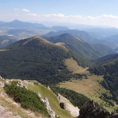 PeakOsnicaPárnicaaltitude 1 363 m7.2 km from ŠípOsnica is a 1363 m summit in the north-eastern part of the Lesser Fatra (Malá Fatra) in Slovakia, about 9 km west of Dolný Kubín.
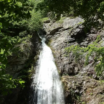 WaterfallŠútovo WaterfallŠútovo7.4 km from ŠípThe Šútovo Waterfall (Šútovský vodopád) is the highest waterfall in the Malá Fatra mountains and one of the highest in Slovakia: the water drops 38 m.
 Cheese dairies & pasturesSalaš Krajinka near RužomberokRužomberok7.5 km from ŠípSalaš Krajinka is a genuine sheep farm on the edge of Ružomberok in lower Liptov. It was founded in 1983 to keep a thousand sheep, and the owners have deliberately...
Craft nearby
All craft places Craft beer & breweriesURSUS craft brewery, Čutkovská valleyRužomberok11 km from ŠípURSUS craft brewery (Remeselný pivovar URSUS) is the first brewery of the town of Ružomberok, tucked away in the picturesque Čutkovská valley in lower Liptov.
 Cheese dairies & pasturesSalaš Syrex in Zázrivá — Home of the Zázrivá Korbáčik CheeseZázrivá12 km from ŠípZázrivá is a scattered mountain village on the border of Orava and the Malá Fatra, famous throughout Slovakia for its korbáčiky: thin strings of steamed cheese braided...
 Water parks & thermal poolsLúčky Spa and AQUA-VITAL ParkLúčky16 km from ŠípLúčky Spa (Kúpele Lúčky) lies in a quiet valley beneath the Choč Mountains, in the village of Lúčky near Ružomberok.
 Water parks & thermal poolsBešeňová Water ParkBešeňová21 km from ŠípBešeňová — the "thermal heart of Liptov" Bešeňová Water Park (Vodný park Bešeňová) lies on the edge of the village of the same name in the western part of the Liptov...
 Koliby & Hutsul cuisineSalaš Dechtáre above Liptovská MaraGalovany26 km from ŠípSalaš Dechtáre is a wooden koliba above the Liptovská Mara reservoir that is described as one of Slovakia’s first commercial salaš restaurants.
 Water parks & thermal poolsAquapark TatralandiaLiptovský Mikuláš29 km from ŠípAquapark Tatralandia is a large year-round water leisure complex near Liptovský Mikuláš, on the northern shore of the Liptovská Mara reservoir.
