Kopa Kondracka
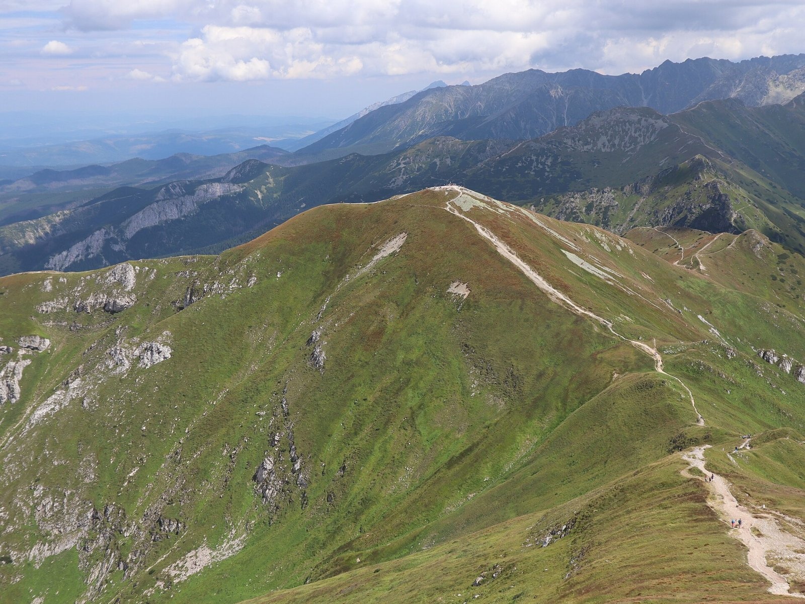
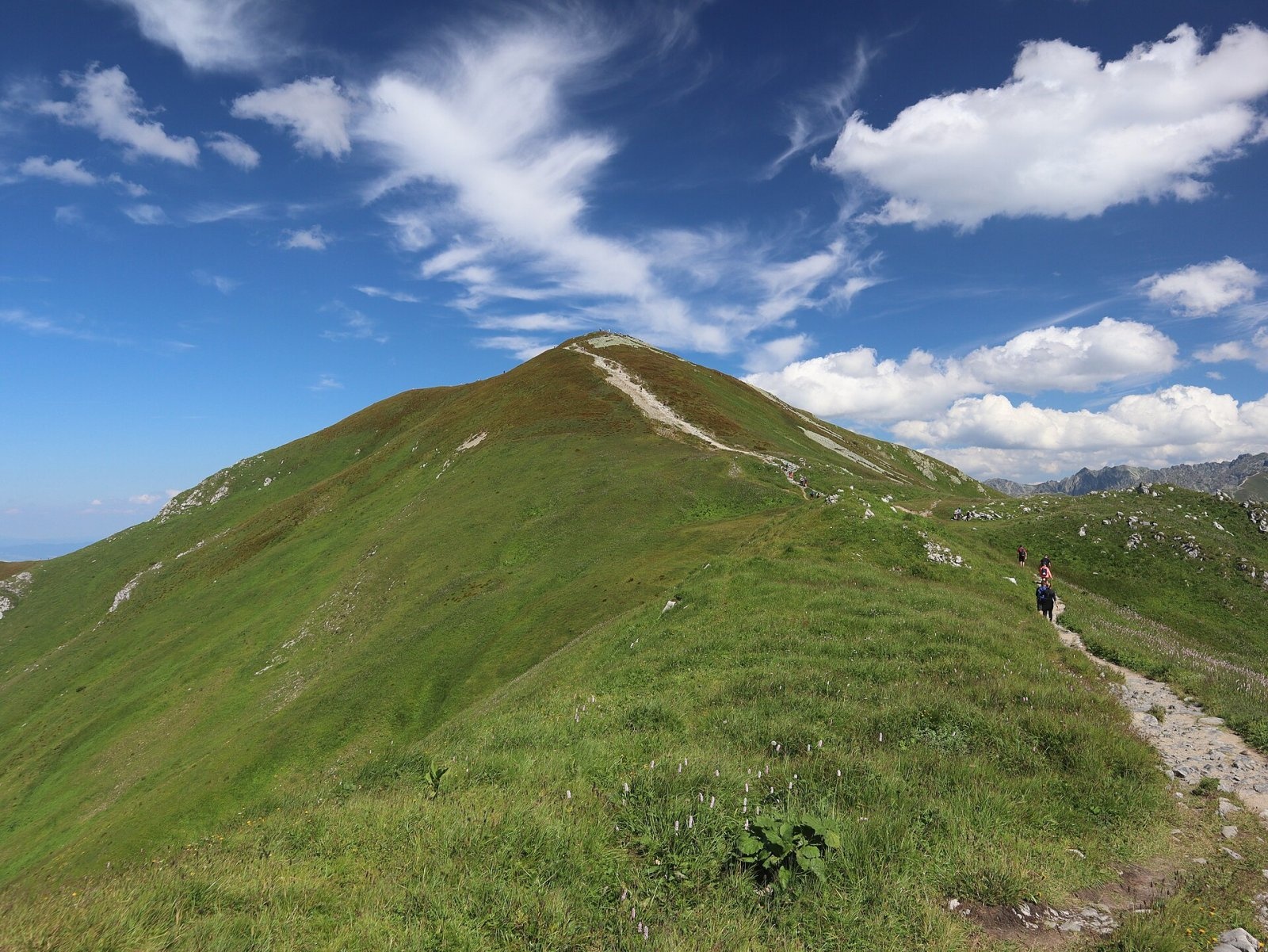
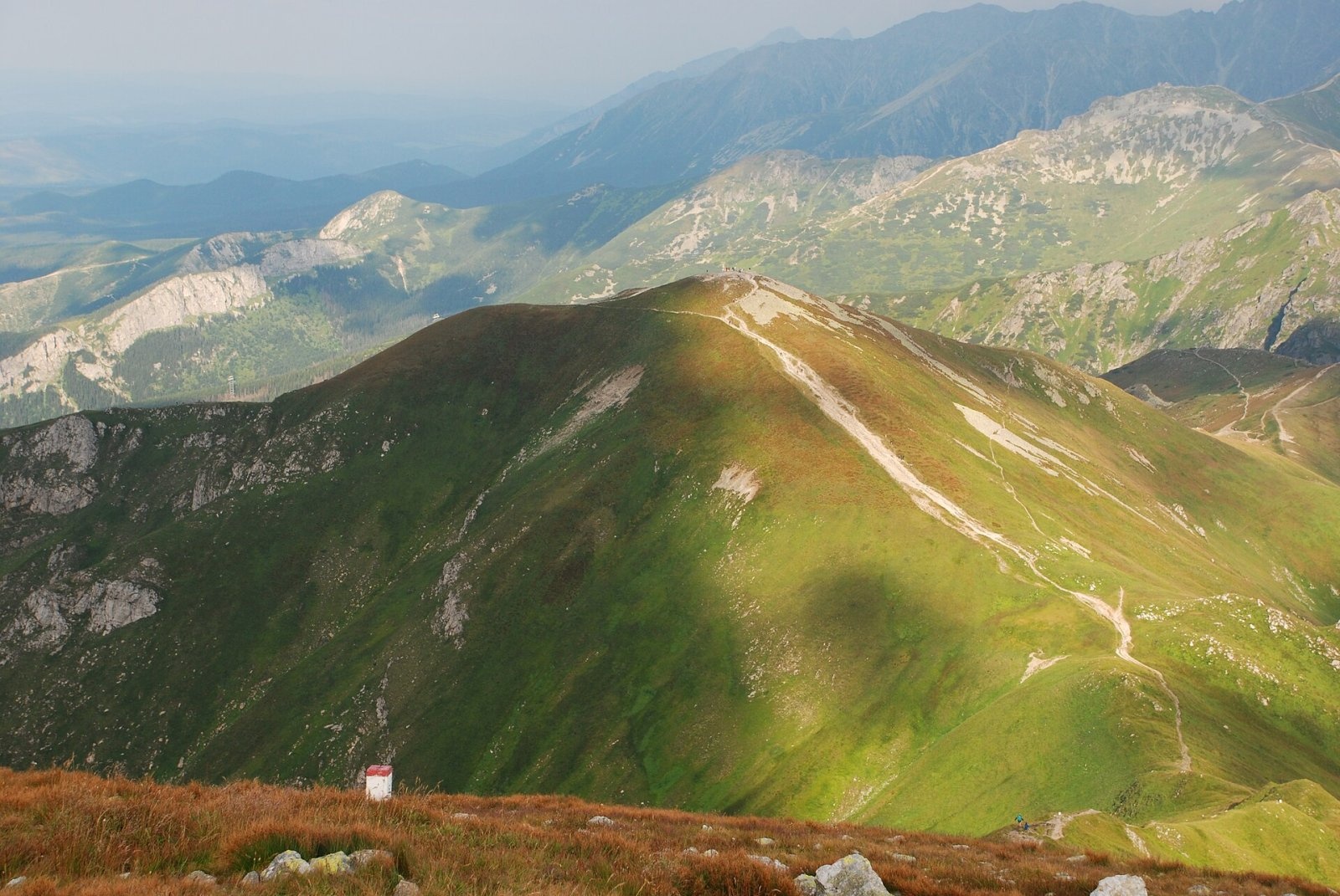
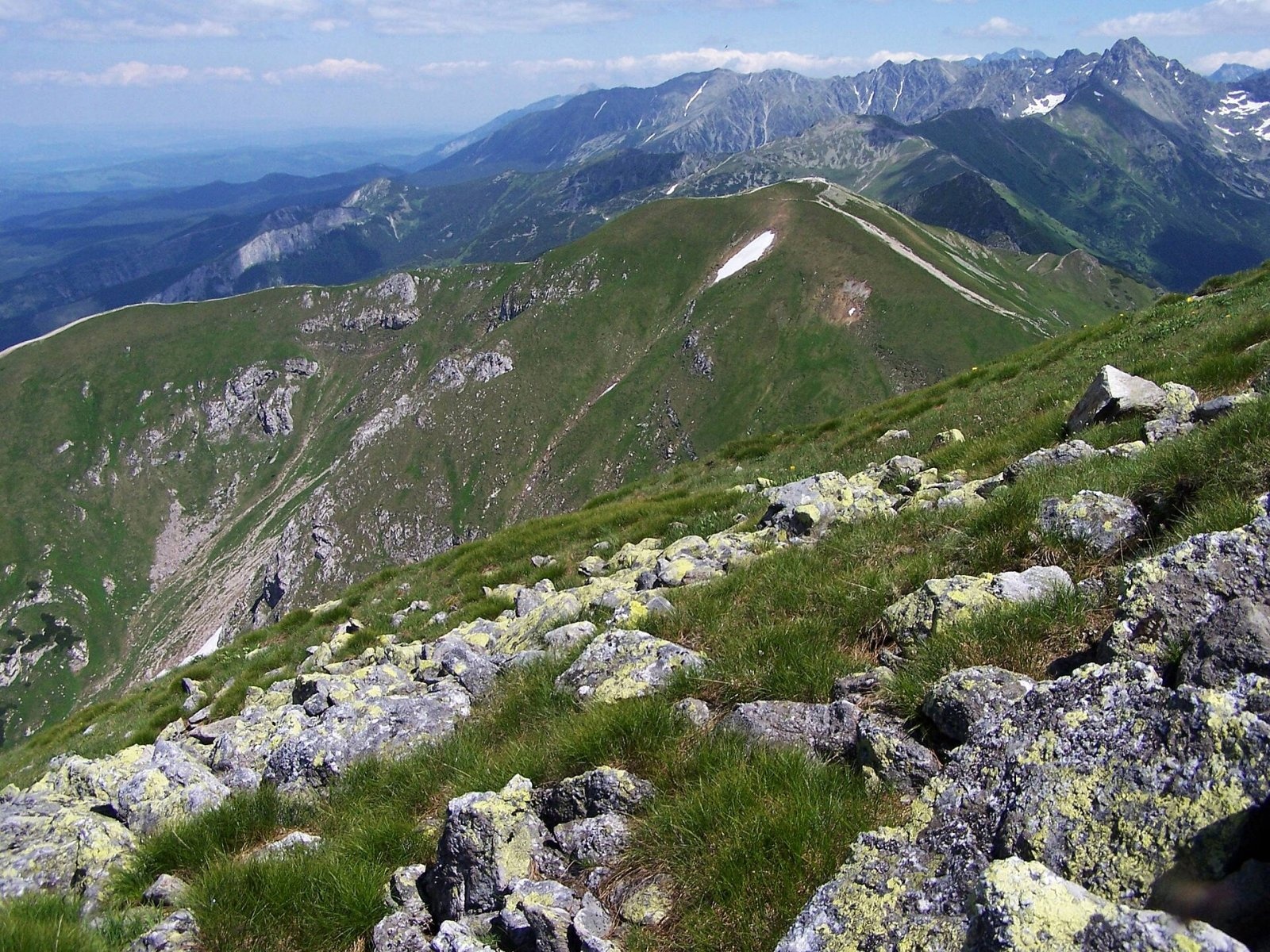
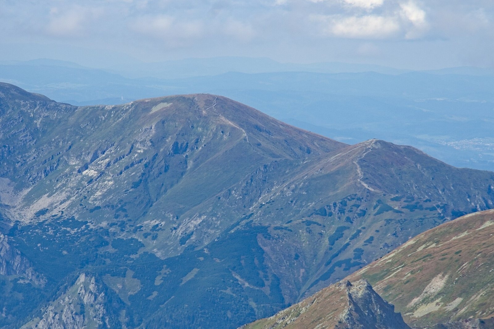
Kopa Kondracka (Slovak: Kondratova kopa) is a 2,005 m peak on the main ridge of the Tatras, on the border between Poland and Slovakia. It belongs to the Czerwone Wierchy group in the Western Tatras and is the lowest and easternmost of its four summits. To the west, beyond the Małołącka pass, stands Małołączniak; to the east, beyond the pass below Kopa Kondracka, is Suchy Wierch Kondracki; and a ridge runs north over the Kondracka pass to Giewont. The mountain rises above three valleys: the Polish Mała Łąka and Bystra valleys (the latter's upper storey is Dolina Kondratowa) and the Slovak Tichá valley. Kuźnice in Zakopane is about 5 km to the north-east and the centre of Zakopane about 7 km away. The summit lies in the Tatra National Park (TPN) on the Polish side and in TANAP on the Slovak side; the southern part of the ridge belongs to the Tichá dolina national nature reserve.
How to get there: routes
- Yellow trail — from the mouth of the Mała Łąka valley (Zakopane) via the Kondracka pass to the summit: about 4 hours up and 3 hours down.
- Red ridge trail along Czerwone Wierchy — from the Kościeliska valley over Ciemniak, Krzesanica and Małołączniak (about 1 h 10 min from Ciemniak to Kopa Kondracka) and on east to Kasprowy Wierch (about 1 h 55 min). A cable car runs from Kuźnice to Kasprowy Wierch, so you can let it do part of the climbing and continue along the ridge.
- From Dolina Kondratowa (the hut on Hala Kondratowa) — up to the Kondracka pass and then on the yellow trail to the top.
- From the Slovak side — the yellow trail from Podbanské through the Tichá valley and Suché sedlo to Kasprowy Wierch, then along the red ridge. This is a much longer approach.
None of these trails is technically difficult. The red and yellow trails on the ridge are also marked with wooden poles that help with navigation in winter, when the paint marks are buried in snow.
What you can see from the summit
The domed summit offers a wide view, with the High Tatras looking particularly impressive. Slovak sources note that in good visibility you can also see part of the Low Tatras, the Orava Beskids and the foothills on the Polish side. Below the mountain to the north lies Dolina Kondratowa with the Giewont massif, and to the south the deep Tichá valley.
Nature and history
Most of the mountain is built of sedimentary rocks — limestone and dolomite — with well-developed karst features; its north slope holds the Kondracka cave, among others. The summit area above roughly 1,930 m, however, like the other Czerwone Wierchy, is capped by metamorphic rocks and alaskites belonging to the Goryczkowa crystalline island. The slopes are grassy and gentle, the summit dome-shaped. The mix of granite and limestone soils makes the flora rich: plants that prefer acid soils grow on the crystalline cap, lime-loving communities lower down. Highland rush turns the slopes reddish by midsummer. Several plants that are very rare in Poland occur here, including creeping sibbaldia (Sibbaldia procumbens) and Hungarian fleabane.
Kopa Kondracka was once grazed right up to the summit: the eastern slopes belonged to the Kondratowa pasture, the western ones to the Mała Łąka pasture. The mountain was then grassier, because shepherds cut the dwarf pine, and also stonier, because overgrazing eroded the thin soil. Since it became part of the national park and grazing stopped, the slopes have gradually been reclaimed by dwarf pine. The first recorded ascent was made by Franciszek Herbich in 1832, although local shepherds and poachers had been climbing it much earlier. The first winter ascent is attributed to Karol Potkański, probably in 1894.
Safety, season and rules
Kopa Kondracka is one of the most visited peaks in the Tatras, and the crowds have left their mark: the trails in the Czerwone Wierchy area have turned into stony strips up to several tens of metres wide, and hikers have trodden extra shortcut paths that skirt the summit. Stay on the marked trails — it is both a rule of the Tatra National Park (TPN) and the best protection against erosion. TPN charges an entrance fee; walking on trails is banned from dusk to dawn between 1 March and 30 November, and from 1 December to the end of February trails are closed from 22:00 to 05:00. The Slovak approach through the Tichá valley lies in TANAP, where high-mountain trails are closed from 1 November to 31 May.
The gentle slopes are deceptive: in fog it is easy to go astray on the broad Czerwone Wierchy ridge, especially when descending towards the Mała Łąka or Tichá valleys, and winter brings avalanches and icy ground. Keep a close eye on the forecast and on thunderstorms.
Emergency numbers: TOPR 985 or +48 601 100 300, general emergency number 112; in Slovakia, HZS 18 300 (+421 18 300).
Interesting facts
- Kopa Kondracka is the lowest of the four Czerwone Wierchy, yet one of the most popular summits in the Tatras.
- This limestone mountain wears a "granite cap": metamorphic rocks cover only its top.
- At the summit a yellow trail branches off the main ridge trail and leads down to the Kondracka pass below Giewont.
Photos: Cybularny, CC0; Cybularny, CC0; Hubert Waguła, CC BY-SA 4.0; Opioła Jerzy, CC BY 2.5; Adrian Tync, CC BY-SA 4.0; Jerzy Opioła, CC BY-SA 4.0; Grazia Wrzos, CC BY-SA 4.0 — Wikimedia Commons.
Getting there from Ukraine
Border crossings
- Krakovets – Korczowa — road, 24/7
- Shehyni – Medyka — road, 24/7 Pedestrian crossing is not confirmed by the Ukrainian border service — check dpsu.gov.ua before the trip.
- Smilnytsia – Krościenko — road, 24/7
- Hrushiv – Budomierz — road, 24/7
- Mostyska – Przemyśl (rail) — rail, 24/7
By car
Lviv – Zakopane ≈421 km, ≈5 h 10 min without border queues. Route: M-10 Lviv – Krakovets → Krakovets – Korczowa checkpoint → A4 motorway (Rzeszów – Tarnów – Kraków) → Kraków southern bypass → S7/DK7 → DK47 ('Zakopianka') via Nowy Targ → Zakopane. The A4 Katowice – Kraków section (Balice and Mysłowice toll plazas) is tolled, but this route does not use it. In summer and at weekends the DK47 near Zakopane is often congested.
Checked 23.10.2026; border crossing hours and timetables change — check before you travel.
Location on the map
Comments
Trails nearby
All trails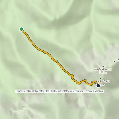 EasyOne-dayMarkedRówienki Kondracka PassElevation profile1 164–1 720 m3.1 kmascent 537 m≈ 2 h walking1.1 km from Kopa Kondracka
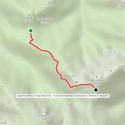 EasyOne-dayMarkedPass in Grzybowiec Wyżnia Kondracka PassElevation profile1 321–1 769 m2.3 kmascent 426 m≈ 1.5 h walking1.3 km from Kopa Kondracka
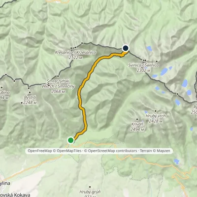 ModerateTwo-dayMarkedPodbanské Suché SaddleElevation profile928–1 946 m16.2 kmascent 1 013 m≈ 6 h walking2 km from Kopa Kondracka
Nearby attractions
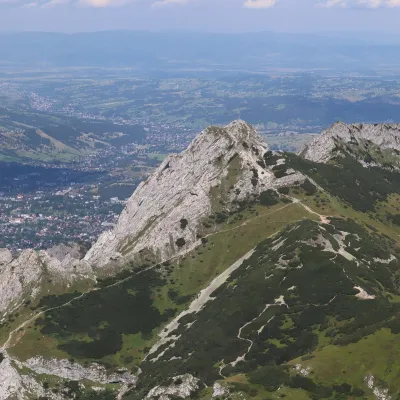 PeakGiewontaltitude 1 895 m1.6 km from Kopa KondrackaGiewont is a 1,895 m mountain massif in the Western Tatras, towering over Zakopane. Its main summit, Wielki Giewont, is usually regarded as the highest peak of the...
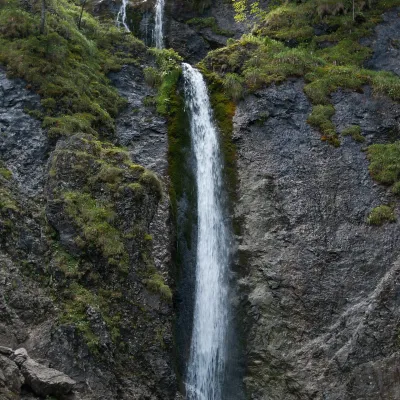 WaterfallSiklawica Waterfall2.5 km from Kopa KondrackaSiklawica (also Siklawica Strążyska) is a waterfall in the Western Tatras, in the upper part of the Strążyska Valley (strictly speaking in its branch called Mała...
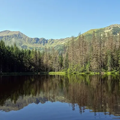 LakeSmreczyński Staw Lake5.2 km from Kopa KondrackaSmreczyński Staw is a small glacial lake in the upper part of the Kościeliska Valley, at the mouth of the Pyszniańska Valley, at 1,226 m.
Craft nearby
All craft places Cheese dairies & pasturesFurtek's Shepherd's Huts, Kuźnice and Kalatówki5.6 km from Kopa KondrackaAbove Kuźnice — the southern edge of Zakopane where most hikes into the Western and High Tatras begin — the flocks are tended by baca Andrzej Staszel, nicknamed "Furtek".
 Cheese dairies & pasturesShepherd's Hut in the Kościeliska Valley5.7 km from Kopa KondrackaJózef Słodyczka's bacówka (shepherd's hut) on the Wyżnia Kira Miętusia glade is probably the most easily reached shepherds' hut in the Polish Tatras.
 Koliby & Hutsul cuisineBąkowo Zohylina Wyźnio Highland Tavern5.8 km from Kopa KondrackaBąkowo Zohylina Wyźnio is a regional highland tavern in Zakopane housed in a wooden "szałas" (shepherd-hut-style building) with a view of the Tatras.
 Markets & fairsMarket under Gubałówka6.9 km from Kopa KondrackaThe market under Gubałówka (Targ pod Gubałówką) is Zakopane's best-known bazaar and probably the most photographed row of stalls in the Polish Tatras.
 Water parks & thermal poolsTermy Zakopiańskie (Aqua Park Zakopane)6.9 km from Kopa KondrackaTermy Zakopiańskie is a thermal water park right in Zakopane, on Jagiellońska Street, only a kilometre from Krupówki.
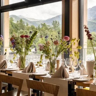 Craft beer & breweriesGwarno Restaurant & Brewery, Zakopane7 km from Kopa KondrackaGwarno is a restaurant with its own small brewery at the foot of Gubałówka in Zakopane. It stands on Na Gubałówkę street right next to the lower station of the...
