Condition
Not verifiedNo recent reports. Carry water and, if you pass by, tell us what you saw.
- 1 304 m
- Flows all year
- Marked as drinkable
About
Gorgany range, about 1 300 m above sea level. The nearest settlement is Osmoloda, about 11 km in a straight line. 8 of the site’s trails pass nearby, including “Osmoloda village, via Mount Ihrovets, Mount Syvulia, Bystrytsia village, Mount Bratkivska, Mount Ruska and Mount Dohiaska to Dragobrat”.
The spring is known to flow in summer too. The water is marked as drinkable on the map, but nobody guarantees its quality.
On the map
Coordinates: 48.49901, 24.11949
How to get there
Trails nearby
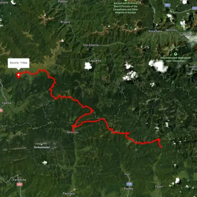 HardMulti-dayUnmarkedOsmoloda village to Dragobratvia Mount Ihrovets, Mount Syvulia +4Elevation profile687–1 824 m116.7 kmascent 4 557 m
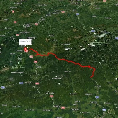 HardMulti-dayUnmarkedStara Huta village to Bilyn villagevia Mount Vysoka, Mount Syvulia +4Elevation profile481–1 850 m95.9 kmascent 5 130 m
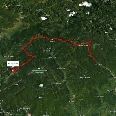 HardMulti-dayUnmarkedStara Huta village to Polianytsia villagevia Mount Syvulia, Legioniv Pass +4Elevation profile705–1 796 m67.5 kmascent 3 798 m
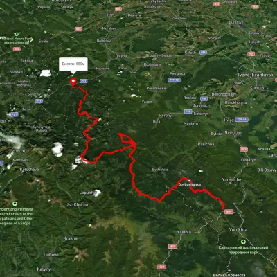 HardMulti-dayUnmarkedTatariv village to Myslivka villagevia Mount Syniak, Mount Dovbushanka +6Elevation profile671–1 792 m171.1 kmascent 9 973 m
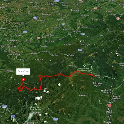 HardMulti-dayUnmarkedRakhiv to Osmoloda villagevia Mount Blyznytsia, Mount Troiaska +1Elevation profile437–1 858 m134.1 kmascent 7 086 m
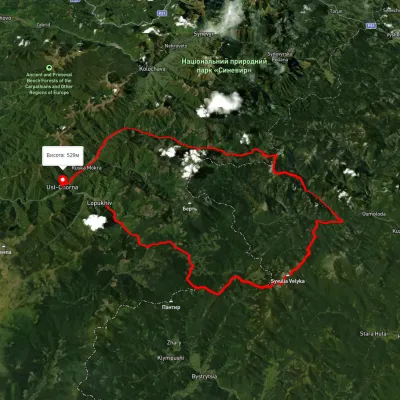 HardMulti-dayUnmarkedLopukhiv village to Ust-Chorna villagevia Legioniv Pass, Peklo tract +3Elevation profile522–1 809 m94.1 kmascent 3 095 m
Nearest settlement: Osmoloda, about 11 km in a straight line.
Report the condition
Been here recently? Tell us what you saw and add photos — your report appears on the page right away with today’s date.
No photos yet — send yours together with a condition report.
