Capra (Făgăraș)
Capra (Romanian: Vârful Capra, Hungarian: Zerge-csúcs, «Chamois Peak») is a 2,494 m summit in the Făgăraș Mountains of the Southern Carpathians, above Lake Bâlea and the Transfăgărășan road. The glacial Lake Capra lies at its foot and gave the peak its name. Next to it, on the same short spur north of the main ridge, stands Vânătarea lui Buteanu (2,507 m).
How to get there / routes
According to Romanian and Hungarian Wikipedia, Capra is easily climbed from Lake Bâlea via the Capra saddle (Șaua Caprei) above the lake of the same name. From the saddle the blue cross route leads north-east to the Văiuga saddle and Vânătarea lui Buteanu; it passes about 70 m from the summit of Capra. Hungarian Wikipedia also mentions approaches from the Capra refuge to Lake Capra and from the lake to Vânătarea lui Buteanu.
Munții Noștri describes the climb in more detail. From the Bâlea Lac hut the blue-triangle path passes the memorial to the victims of the 1977 avalanche and zigzags steeply over the screes of Văiuga and Iezerul Caprei to the Capra saddle (2,315 m) on the main ridge – about 300 m of ascent, up to an hour. From there the blue-cross path skirts Văiuga, drops to the Văiuga saddle and follows the slopes of Capra itself to the narrow notch between Capra and Vânătarea lui Buteanu. According to the same source there is no water on this route apart from the spring at Lake Capra.
What you can see from the summit
Below lie the glacial lakes Capra and Bâlea, next to it Vânătarea lui Buteanu, and to the west the Făgăraș ridge towards Lăițel and Negoiu.
Nature and history
According to Munții Noștri, Lake Bâlea belongs to the Bâlea nature reserve, bounded by Vânătarea lui Buteanu, Capra and Paltinu, the Buteanu ridge and Piscul Bâlea; rare plants grow here, including edelweiss. South of Capra, at 2,230 m, lie lakes Capra and Căprița, where the Capra valley begins between the Râiosul–Mușeteica ridge and the Transfăgărășan. By Lake Capra stands a memorial to four climbers killed in 1963 by an avalanche on their way to the Arpășel crest, and near neighbouring Văiuga, according to Hungarian Wikipedia, an avalanche killed 23 people in April 1977.
Safety, season and rules
Although the summit is not far from Lake Bâlea, this is exposed high ground above 2,400 m: thunderstorms and fog are common even in summer, and in winter the slopes above lakes Bâlea and Capra are avalanche-prone. The Făgăraș ridge is not a national park but the Natura 2000 site «Munții Făgăraș» (ROSCI0122) with its own regulations: stay on marked trails and take your litter with you. The high-mountain section of the Transfăgărășan road (DN7C) closes every cold season; as of November 2026 no reopening date has been announced — check CNAIR notices. In winter the high ridges carry a serious avalanche risk — follow the avalanche bulletin of Romania's National Meteorological Administration (ANM) on meteoromania.ro.
Bears are common in the Romanian Carpathians. Salvamont rescuers advise not to hike alone, to talk loudly so that an animal hears you in advance, to keep your distance and never feed wildlife, and to store food in sealed containers away from your tent; if you meet a bear, do not run and back away slowly without turning your back.
Near sheepfolds do not run from sheepdogs – shield yourself with your rucksack. In an emergency call the national dispatch 0SALVAMONT – 0725 826 668 or 112; advice on animal encounters is on the Salvamont România website.
Getting there from Ukraine
Border crossings
- Porubne – Siret — road and pedestrian, 24/7
- Diakivtsi – Racovăț — road and pedestrian, 24/7 No freight traffic.
- Krasnoilsk – Vicovu de Sus — road and pedestrian, 08:00–20:00 Cars up to 3.5 t and pedestrians only; not 24/7.
- Solotvyno – Sighetu Marmației — road and pedestrian, 24/7 Passenger traffic only: vehicles up to 3.5 t with up to 9 seats, pedestrians.
- Diakove – Halmeu — road, 24/7 No pedestrian crossing.
By car
Rakhiv – Sibiu ≈390 km, ≈5 h 33 min (via Solotvyno – Sighetu Marmației); Ivano-Frankivsk – Sibiu ≈524 km, ≈7 h 52 min (via Solotvyno – Sighetu Marmației); Chernivtsi – Sibiu ≈435 km, ≈8 h 00 min (via Diakivtsi – Racovăț). Times without border queues, our road routing (GraphHopper, OSM).
Checked 03.11.2026; border crossing hours and timetables change — check before you travel.
Water and shelter nearby
- Spring below Iezerul Caprei (north-east slope)610 m · Not verified · 2 289 m
- Spring below Iezerul Caprei (east slope)610 m · Not verified · 2 240 m
- Spring «Monument comemorativ și Fântâna Carmen»1.2 km · Not verified · 1 876 m
- Spring below Turnul Vârtopel (south slope), 1 821 m1.3 km · Not verified · 1 821 m
- Spring below Turnul Vârtopel (south slope), 1 785 m1.3 km · Not verified · 1 785 m
- Spring below Iezerul Caprei (south-east slope)1.3 km · Not verified · 1 907 m
- Refuge Balea Tunnel1.5 km · Not verified · 2 045 m
- Fereastra Zmeilor Hut, 2 050 m1.5 km · Not verified · 2 050 m
- Fereastra Zmeilor Hut, 2 047 m1.5 km · Not verified · 2 047 m
- Salvamont Argeș Hut1.5 km · Not verified · 1 945 m
- Drinking water below Piscul Bâlii1.6 km · Not verified · 2 037 m
- Spring below Paltinu (south slope), 2 268 m2.4 km · Not verified · 2 268 m
Wildlife nearby
AllComments
Nearby attractions
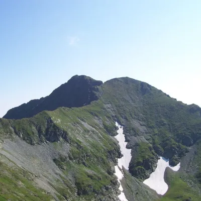 PeakVânătarea lui Buteanualtitude 2 507 munder 1 km from Capra (Făgăraș)Vânătarea lui Buteanu (Romanian: Vârful Vânătarea lui Buteanu, often also Vânătoarea lui Buteanu) is a 2,507 m summit in the Făgăraș Mountains of the Southern...
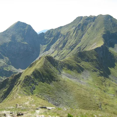 PeakArpașul Marealtitude 2 468 m3.5 km from Capra (Făgăraș)Arpașul Mare (Romanian Vârful Arpașul Mare, also Arpașu Mare or Vârtopul) is a 2,468 m summit on the main ridge of the Făgăraș Mountains, on the border of Sibiu and...
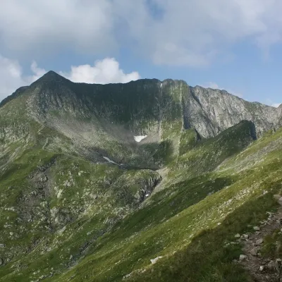 PeakMirciialtitude 2 470 m3.8 km from Capra (Făgăraș)Mircii (Romanian Vârful Mircii) is a 2,470 m summit in the central part of the Făgăraș Mountains, in Argeș County.
