Čadca, station – Makov, hut
Trail map
Route, springs and shelters: © OpenStreetMap contributors (ODbL) · elevation: Copernicus DEM © DLR e.V., © Airbus DS · Data & licences
About the trail
Route Čadca, station – Makov, hut. Has red marking (national route №0843, KST). Waymarking data: OpenStreetMap (© OpenStreetMap contributors, ODbL).
Officially marked national tourist route №0843. Marking is red, sign — horizontal stripe on a white background. Marked and maintained by: KST. Length of the route — 48.7 km. Location: mountain range — Yavornyky, Slovakia.
At a glance
A multi-day route of 48.7 km with 1,469 m of ascent from Čadca, station to Makov, hut. Estimated time: 2 days of 7–8 h of walking (about 14.5 h in total, not counting stops). Difficulty: hard. Waymarking: red.
Route stages
- 0–10 kmClimb of 340 m to Chotárny kopec (906 m)
- 10–35 kmGentle ups and downs at 690–910 m, past Vrchrieka, Jakubovský vrch, Kamenité
- 35–41 kmClimb of 180 m to Hut below Chrasťové
- 41–45 kmDescent of 250 m (down to 705 m)
- 45–49 kmGentle ups and downs at 610–710 m
Steepest kilometre: km 32–33, a climb of 160 m (≈16%).
Water and overnight stays
Springs near the trail: at km 1, 4, 18, 20, 28 and 33. There are no springs between km 34 and 49 — carry at least 2.5 l of water.
Huts and shelters near the trail: Hut below Čerenka (km 38), Hut below Chrasťové (km 40).
A possible split into days:
- Day 1: km 0–24, ≈7.5 h — overnight: no shelter nearby on the map, bring a tent
- Day 2: km 24–49, ≈7.5 h — finish
When to go
The route can be walked most of the year; it is most comfortable from April to October.
Getting there
Start: Čadca, station. This is a one-way route: the finish is 25 km from the start in a straight line, so plan your way back in advance.
FAQ
- How long does the route take?
- Estimated time: 2 days of 7–8 h of walking (about 14.5 h in total, not counting stops).
- Is there water on the route?
- Springs near the trail: at km 1, 4, 18, 20, 28 and 33. There are no springs between km 34 and 49 — carry at least 2.5 l of water.
- Where can I stay overnight?
- Huts and shelters near the trail: Hut below Čerenka (km 38), Hut below Chrasťové (km 40).
Water and shelter on the route
- Drinking water below Čupeľkm 0.8 from the start · 70 m off the path · Not verified · 423 m
- Spring below Briavakm 4.2 from the start · Not verified · 738 m
- Spring below Jakubovský vrchkm 17.6 from the start · 240 m off the path · Not verified · 795 m
- Spring below Grapa (south slope)km 20.1 from the start · Not verified · 762 m
- Spring below Kraviarskakm 27.7 from the start · Not verified · 726 m
- Spring on Polovejkm 33.1 from the start · Not verified · 883 m
- Spring below Lubykm 33.6 from the start · Not verified · 873 m
- Hut below Čerenkakm 38.2 from the start · Not verified · 949 m
- Hut below Chrasťovékm 40.1 from the start · Not verified · 940 m
Comments
Trails nearby
All trails
Craft nearby
All craft places Cheese dairies & pasturesRaková farm in Kysuce: bryndza, žinčica and cheese cakesRaková3.3 km from the trailKysuce is a hilly region in north-western Slovakia, near the Polish and Czech borders, with scattered hillside hamlets (“kopanice”) and an old tradition of keeping...
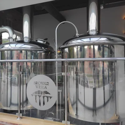 Craft beer & breweriesBrowar Wisła: craft brewpub in Wisła's old railway stationWisła24 km from the trailBrowar Wisła is a brewpub in the heart of the Silesian Beskids, in the spa town of Wisła, where Poland's longest river of the same name rises.
 Cheese dairies & pasturesFarma Brezany near Žilina: hand-stretched cheese and a distilleryBrezany29 km from the trailBrezany is a village a few kilometres south of Žilina, on the edge of the Žilina basin and the foothills leading towards the Rajec valley and the Strážov Hills.
 Cheese dairies & pasturesBacówka na Bukowinie, Żabnica: sheep's cheese and alpacasWęgierska Górka30 km from the trailBacówka na Bukowinie stands on a slope above the village of Żabnica, next to Węgierska Górka, where the Żywiec Beskids meet the Silesian Beskids.
 Cheese dairies & pasturesSalaš Syrex in Zázrivá — Home of the Zázrivá Korbáčik CheeseZázrivá30 km from the trailZázrivá is a scattered mountain village on the border of Orava and the Malá Fatra, famous throughout Slovakia for its korbáčiky: thin strings of steamed cheese braided...
 Water parks & thermal poolsUstroń spa: brine, peat and brine poolsUstroń31 km from the trailUstroń is the only spa of the Silesian Beskids: the town lies where the Vistula valley leaves the mountains, between the ridges of Równica (884 m) and Czantoria Wielka...
