Yasinia — to Vorokhta, via Mount Petros, Mount Hoverla, Mount Kukul
Unmarked trailmore
It may be partly marked. Unmarked trails have no information boards, signposts or auxiliary signs (water, campsite, etc.). The decision to walk the trail is entirely your own responsibility.
Trail map
Where to stay nearby
About the trail
Route Yasinia, via Mount Petros, Mount Hoverla and Mount Kukul to Vorokhta. Along the route you will see: Strukivska (Ascension) Church, Yasinia, Mount Petrosul, Mount Petros, Mount Hoverla, Polonyna Kukul (Kukul), Voronenko, Mount Kukul and 3 more.
At a glance
A multi-day route of 46.4 km with 2,788 m of ascent from Yasinia to Vorokhta. Estimated time: 2 days of 7–9 h of walking (about 16.5 h in total, not counting stops). Difficulty: hard. Waymarking is missing or partial.
Route stages
- 0–14 kmClimb of 1,300 m to Mount Petros (2,020 m)
- 14–20 kmDescent of 470 m to Eco point “Peremychka”
- 20–23 kmClimb of 500 m to Mount Hoverla (2,061 m)
- 23–28 kmDescent of 820 m (down to 1,192 m)
- 28–34 kmClimb of 230 m to Shepherds' hut on Polonyna Kukul
- 34–46 kmDescent of 680 m to Vorokhta
Steepest kilometre: km 14–16, a descent of 430 m (≈39%), near Mount Petros.
Water and overnight stays
Springs near the trail: at km 2, 4, 6, 7, 10, 16, 17, 20, 22 and 24 etc.. Some springs run low or dry up in late summer.
Huts and shelters near the trail: Hut “At Semen's” (km 0), Hut on Polonyna Shysa (km 7), Hut (Luhy) (km 18), Eco point “Peremychka” (hut) (km 20), “Carpathian Highlands” information and tourist centre (shelter) (km 20), Eco point “At the foot of Hoverla” (hut) (km 22), Shepherds' hut on Polonyna Kukul (km 34). Places to stay near the start: Yasinya; near the finish: Vorokhta.
A possible split into days:
- Day 1: km 0–20, ≈7.5 h — overnight: “Carpathian Highlands” information and tourist centre (shelter) (hut)
- Day 2: km 20–46, ≈8.5 h — finish
When to go
Best time: June to September. In winter only for experienced hikers with proper gear: avalanche danger is possible. About 14 km of the route runs above 1,500 m, where the weather changes quickly — check the forecast.
Getting there
Start: Yasinia. Most places to stay near the start are in Yasinya. This is a one-way route: the finish is 16 km from the start in a straight line, so plan your way back in advance.
FAQ
- How long does the route take?
- Estimated time: 2 days of 7–9 h of walking (about 16.5 h in total, not counting stops).
- Is there water on the route?
- Springs near the trail: at km 2, 4, 6, 7, 10, 16, 17, 20, 22 and 24 etc.. Some springs run low or dry up in late summer.
- Where can I stay overnight?
- Huts and shelters near the trail: Hut “At Semen's” (km 0), Hut on Polonyna Shysa (km 7), Hut (Luhy) (km 18), Eco point “Peremychka” (hut) (km 20), “Carpathian Highlands” information and tourist centre (shelter) (km 20), Eco point “At the foot of Hoverla” (hut) (km 22), Shepherds' hut on Polonyna Kukul (km 34). Places to stay near the start: Yasinya; near the finish: Vorokhta. Possible overnight stops: “Carpathian Highlands” information and tourist centre (shelter) (km 20).
Water and shelter on the route
- Hut “At Semen's”km 0 from the start · 220 m off the path · Not verified · 645 m
- Spring (Yasinya, 10)km 2.1 from the start · 50 m off the path · Not verified · 870 m
- Spring (Yasinya, 12)km 3.2 from the start · 150 m off the path · Not verified · 921 m
- Spring (Yasinya, 11)km 5.5 from the start · 270 m off the path · Not verified · 1 107 m
- Hut on Polonyna Shysakm 6.8 from the start · 100 m off the path · Standing · 1 240 m
- Spring (Yasinya, 9)km 6.8 from the start · 210 m off the path · Not verified · 1 252 m
- Spring (Yasinya, 14)km 7.3 from the start · Not verified · 1 297 m
- Spring (Yasinya, 16)km 8.7 from the start · Not verified · 1 479 m
- Spring (Yasinya, 17)km 9.5 from the start · Not verified · 1 475 m
- Spring below Mount Petros (4)km 14.4 from the start · 50 m off the path · Not verified · 1 544 m
- Spring below Mount Petros (6)km 14.8 from the start · 50 m off the path · Not verified · 1 544 m
- Spring below Mount Petros (10)km 15.8 from the start · Not verified · 1 544 m
- Spring (Luhy)km 16.6 from the start · Not verified · 1 523 m
- Hut (Luhy)km 16.6 from the start · 170 m off the path · Not verified · 1 470 m
- Spring (Luhy, 2)km 18 from the start · Not verified · 1 540 m
- Eco point “Peremychka” (hut)km 18.2 from the start · Standing · 1 536 m
- “Carpathian Highlands” information and tourist centre (shelter)km 18.3 from the start · Standing · 1 534 m
- Spring below Mount Hoverla (2)km 18.6 from the start · 70 m off the path · Not verified · 1 577 m
- Spring below Mount Hoverla (5)km 19.7 from the start · Has water · 1 748 m
- Spring below Mount Hoverla (6)km 20.1 from the start · 90 m off the path · Not verified · 1 802 m
- Eco point “At the foot of Hoverla” (hut)km 20.1 from the start · Standing · 1 832 m
- Spring below Mount Velyka Kozmeska (2)km 22.1 from the start · Not verified · 1 620 m
- Spring below Mount Velyka Kozmeska (6)km 25.8 from the start · 90 m off the path · Not verified · 1 168 m
- Spring below Mount Kukulkm 27.1 from the start · 50 m off the path · Not verified · 1 158 m
- Spring on Polonyna Kukul (3)km 30.5 from the start · Not verified · 1 357 m
- Shepherds' hut on Polonyna Kukulkm 30.8 from the start · Standing · 1 365 m
- Spring below Mount Kukul (7)km 31.9 from the start · Not verified · 1 363 m
- Spring below Mount Kukul (8)km 32.5 from the start · 70 m off the path · Not verified · 1 248 m
- Spring (Vorokhta, 3)km 34.5 from the start · Not verified · 1 141 m
- Spring (Vorokhta, 4)km 35.4 from the start · Not verified · 1 056 m
- Spring (Vorokhta, 2)km 38 from the start · Not verified · 879 m
Comments
What to see on the trail
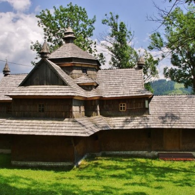 Strukivska (Ascension) Church, Yasiniaaltitude 663 mThe Church of the Ascension or Strukiv is the real pride of the village of Yasinia and the entire Hutsul region.
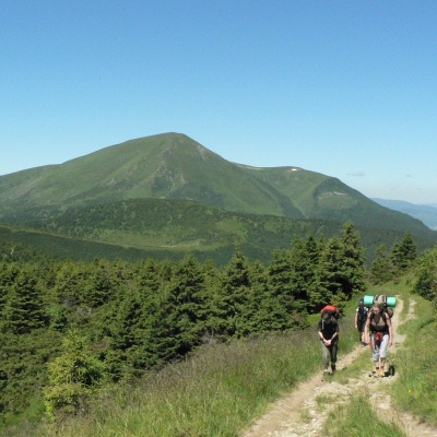 Mount Petrosulaltitude 1 855 mPetrosul is an 1855-meter peak of the Ukrainian Carpathians, which is the "neighboring mountain" of Petros, as it is located "at arm's length" from...
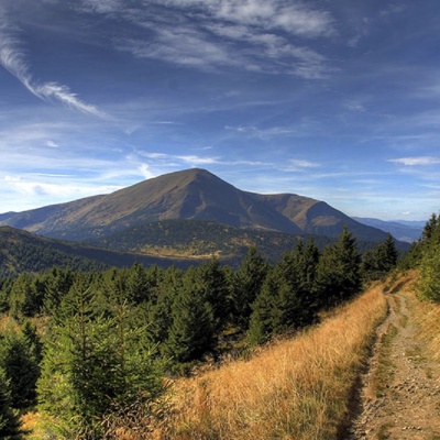 Mount Petrosaltitude 2 020 mMount Petros is the fourth highest (2020 m) peak of the Ukrainian Carpathians after Hoverla (2061), Brebeneskul (2035 m) and Pop Ivan Chornohirsky ...
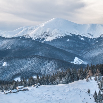 Mount Hoverlaaltitude 2 061 mMount Hoverla has a difficult route and you need to prepare for the climb in advance. You need an experienced friend, company, or guide to go...
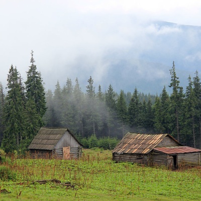 Polonyna Kukul (Kukul), Voronenkoaltitude 1 440 mPolonyna Kukul is a mountain meadow in the Ukrainian Carpathians, within the Kukul ridge (Kukul mountain - 1539 m), administratively located within...
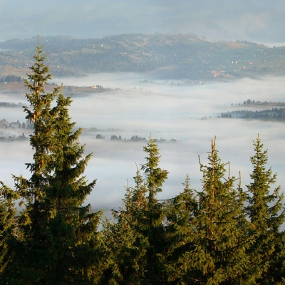 Mount Kukulaltitude 1 539 mKukul (another name - Kukul) is a 1539-meter peak in the Ukrainian Carpathians, which is located in the northern direction of the Chornohora...
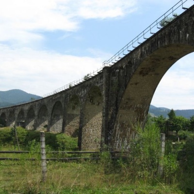 Austrian viaduct bridge, Vorokhtaaltitude 754 mThe Austrian Viaduct Bridge in Vorokhta is an engineering marvel that connects the two banks of the Prut River.
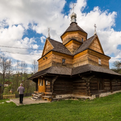 Church of the Nativity of the Virgin Mary XVII-XVIII, Vorokhtaaltitude 754 mThe Church of the Nativity of the Virgin Mary in Vorokhta of the seventeenth and eighteenth centuries is a traditional Hutsul church built without...
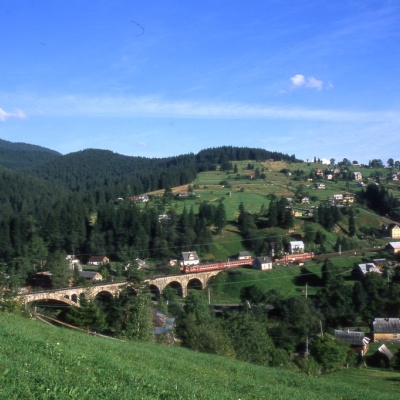 Museum of History and Local Lore, Vorokhtaaltitude 754 mThe museum was inaugurated on January 21, 2007. The museum reveals the processes of the settlement's emergence, the Oprishka movement in the...
Trails nearby
All trails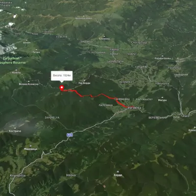 ModerateOne-dayMarkedVorokhta Mount Kukulvia Perehslyp tractElevation profile738–1 518 m11.7 kmascent 1 108 m≈ 5 h walking
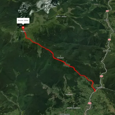 ModerateOne-dayUnmarkedYasinia Mount PetrosElevation profile631–2 023 m12.5 kmascent 1 467 m≈ 6 h walking
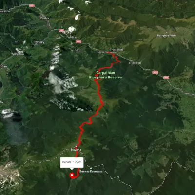 HardMulti-dayUnmarkedKvasy village to Zaroslyak basevia Mount Petros, Mount HoverlaElevation profile549–2 059 m28.9 kmascent 2 395 m≈ 12 h walking