Verkhovyna — to Mykulychyn village, via Mount Bila Kobyla, Mount Khorde, Mount Lisniv
Unmarked trailmore
It may be partly marked. Unmarked trails have no information boards, signposts or auxiliary signs (water, campsite, etc.). The decision to walk the trail is entirely your own responsibility.
Trail map
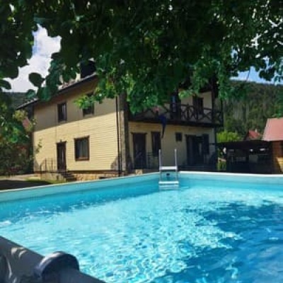
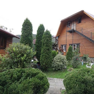
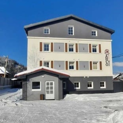
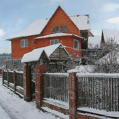
Where to stay nearby
About the trail
Route Verkhovyna, via Mount Bila Kobyla, Mount Khorde and Mount Lisniv to Mykulychyn village. Along the route you will see: House-museum of the movie "Shadows of Forgotten Ancestors", Verkhovyna, Museum of Hutsul Life and Art "At the Trembitard", Verkhovyna, Mount Bila Kobyla, Mount Gregit, Mount Khorde, Mount Lisniv and 2 more.
At a glance
A route of 41.3 km with 1,564 m of ascent from Verkhovyna to Mykulychyn village. Estimated walking time: about 13 h, not counting stops — a very long day, so it is easier split into 2 days. Difficulty: hard. Waymarking is missing or partial.
Route stages
- 0–8 kmClimb of 750 m (up to 1,366 m)
- 8–11 kmDescent of 110 m to Hut below Mount Bubenska
- 11–34 kmGentle ups and downs at 1,180–1,400 m, past Mount Munchelyk, Mount Khorde, Mount Lisniv
- 34–41 kmDescent of 630 m to Mykulychyn village
Steepest kilometre: km 6–7, a climb of 180 m (≈17%).
Water and overnight stays
Springs near the trail: at km 5, 7, 8, 10, 11, 12, 14, 16, 19 and 21 etc.. Some springs run low or dry up in late summer.
Huts and shelters near the trail: Hut below Mount Bubenska (2) (km 11), Hut below Mount Vesnarka (km 12), Mountain shelter on Polonyna Kramy (km 14), Hut below Mount Rotylo (km 16), Hut on Polonyna Munchelyk (km 19), Hut “Foresters' Cabin” (km 20), Hut below Mount Khorde (km 22), Hut on Polonyna Hordishyrka (km 22) etc.. Places to stay near the start: Verkhovyna; near the finish: Mykulychyn.
A possible split into days:
- Day 1: km 0–19, ≈6.5 h — overnight: Hut on Polonyna Munchelyk (hut)
- Day 2: km 19–41, ≈6.5 h — finish
When to go
Best time: May to October. In winter deep snow is possible, so experience and winter gear are needed.
Getting there
Start: Verkhovyna. This is a one-way route: the finish is 31 km from the start in a straight line, so plan your way back in advance.
FAQ
- How long does the route take?
- Estimated walking time: about 13 h, not counting stops — a very long day, so it is easier split into 2 days.
- Is there water on the route?
- Springs near the trail: at km 5, 7, 8, 10, 11, 12, 14, 16, 19 and 21 etc.. Some springs run low or dry up in late summer.
- Where can I stay overnight?
- Huts and shelters near the trail: Hut below Mount Bubenska (2) (km 11), Hut below Mount Vesnarka (km 12), Mountain shelter on Polonyna Kramy (km 14), Hut below Mount Rotylo (km 16), Hut on Polonyna Munchelyk (km 19), Hut “Foresters' Cabin” (km 20), Hut below Mount Khorde (km 22), Hut on Polonyna Hordishyrka (km 22) etc.. Places to stay near the start: Verkhovyna; near the finish: Mykulychyn. Possible overnight stops: Hut on Polonyna Munchelyk (km 19).
Water and shelter on the route
- Spring below Mount Bila Kobyla (8)km 4.5 from the start · Not verified · 898 m
- Spring below Mount Bila Kobyla (6)km 6.4 from the start · 80 m off the path · Not verified · 1 138 m
- Spring below Mount Bila Kobyla (5)km 7.6 from the start · Not verified · 1 322 m
- Spring below Mount Bila Kobyla (4)km 9.5 from the start · Not verified · 1 318 m
- Spring below Mount Bubenska (5)km 10.2 from the start · Not verified · 1 276 m
- Hut below Mount Bubenska (2)km 10.8 from the start · Not verified · 1 269 m
- Spring (Volova, 12)km 10.8 from the start · 80 m off the path · Not verified · 1 262 m
- Hut below Mount Vesnarkakm 12.1 from the start · 170 m off the path · Standing · 1 263 m
- Spring below Mount Hrehit (4)km 12.2 from the start · 190 m off the path · Not verified · 1 256 m
- Spring below Mount Hrehit (5)km 13.4 from the start · Not verified · 1 283 m
- Spring below Mount Hrehit (3)km 13.9 from the start · 90 m off the path · Not verified · 1 313 m
- Mountain shelter on Polonyna Kramykm 13.9 from the start · 80 m off the path · Standing · 1 288 m
- Hut below Mount Rotylokm 15.9 from the start · Poor condition · 1 366 m
- Spring below Mount Rotylo (4)km 15.9 from the start · 100 m off the path · Not verified · 1 359 m
- Spring (Volova, 10)km 18.4 from the start · 290 m off the path · Not verified · 1 291 m
- Hut on Polonyna Munchelykkm 18.7 from the start · 110 m off the path · Not verified · 1 284 m
- Hut “Foresters' Cabin”km 19.1 from the start · 40 m off the path · Not verified · 1 300 m
- Spring below Mount Khorde (17)km 19.2 from the start · Not verified · 1 314 m
- Spring below Mount Khorde (16)km 21 from the start · Not verified · 1 337 m
- Hut below Mount Khordekm 21.5 from the start · Not verified · 1 311 m
- Hut on Polonyna Hordishyrkakm 21.5 from the start · 50 m off the path · Not verified · 1 304 m
- Hut below Mount Khorde (2)km 21.5 from the start · 110 m off the path · Not verified · 1 302 m
- Spring below Mount Khorde (13)km 21.6 from the start · Not verified · 1 320 m
- Spring below Mount Khorde (9)km 22.2 from the start · Not verified · 1 340 m
- Spring below Mount Khorde (7)km 23.1 from the start · 170 m off the path · Not verified · 1 284 m
- Mountain shelter below Mount Khordekm 23.2 from the start · 50 m off the path · Not verified · 1 313 m
- Spring (Volova, 5)km 25.9 from the start · 50 m off the path · Not verified · 1 299 m
- Mountain shelter (Tatariv)km 27.1 from the start · Not verified · 1 240 m
- Spring (Tatariv, 12)km 27.5 from the start · Not verified · 1 204 m
- Spring (Tatariv, 11)km 28.5 from the start · Not verified · 1 211 m
- Spring (Tatariv, 10)km 30.4 from the start · 160 m off the path · Not verified · 1 166 m
- Hut below Mount Kuniklyvakm 31.6 from the start · Not verified · 1 175 m
- Hut below Mount Lisniv (3)km 31.6 from the start · Not verified · 1 188 m
- Spring below Mount Lisniv (8)km 31.6 from the start · 70 m off the path · Not verified · 1 166 m
- Spring below Mount Lisniv (7)km 32.2 from the start · 100 m off the path · Not verified · 1 226 m
- Hut below Mount Lisnivkm 33.6 from the start · 190 m off the path · Standing · 1 172 m
- Spring below Mount Lisniv (6)km 33.7 from the start · 140 m off the path · Not verified · 1 167 m
- Spring below Mount Lisniv (5)km 34.6 from the start · Not verified · 1 149 m
- Spring below Mount Lisniv (3)km 35 from the start · 210 m off the path · Not verified · 1 090 m
- Spring (Mykulychyn, 23)km 37.5 from the start · Not verified · 813 m
- Hut (Mykulychyn, 7)km 38.2 from the start · Not verified · 731 m
- Mountain shelter (Mykulychyn, 2)km 40.2 from the start · 220 m off the path · Not verified · 588 m
Comments
What to see on the trail
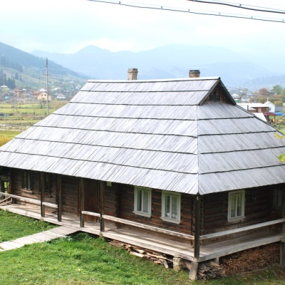 House-museum of the movie "Shadows of Forgotten Ancestors", Verkhovynaaltitude 610 mThe museum was founded and opened in 2000 in the Hutsul hut of Petro and Yevdokiya Soriuks, where the famous film director Sergei Parajanov lived...
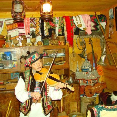 Museum of Hutsul Life and Art "At the Trembitard", Verkhovynaaltitude 610 mAt the Museum of Hutsul Life and Art "At the Trembitard" in the Verkhovyna village of Shveykovo, you will learn about the origin of the Hutsuls,...
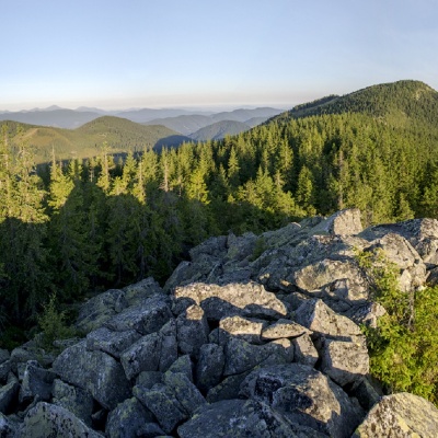 Mount Bila Kobylaaltitude 1 477 mMount Bila Kobyla is a peak in the Ukrainian Carpathians, which is located within the Pokutsko-Bukovyna mountain range.
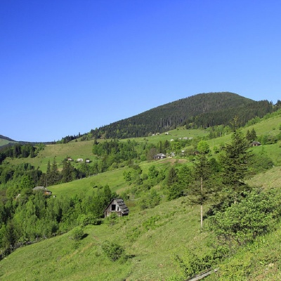 Mount Gregitaltitude 1 472 mMount Gregit is a 1472-meter peak in the Ukrainian Carpathians, which lies within the Pokutsko-Bukovyna Carpathians.
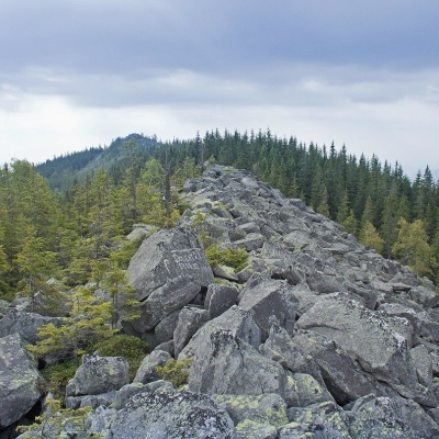 Mount Khordealtitude 1 479 mMount Khorde is a 1479-meter peak of the Ukrainian Carpathians, which is located within the Pokutsko-Bukovyna Carpathians.
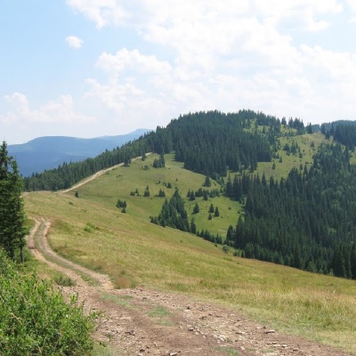 Mount Lisnivaltitude 1 257 mMount Lisniv is a 1257-meter peak of the Ukrainian Carpathians, which is located on the territory of the Pokutsko-Bukovyna mountain range.
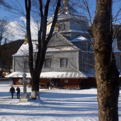 Trinity Church, Mykulychynaltitude 622 mThe church is made entirely of wood in the Hutsul style. The temple is remarkable for its power.
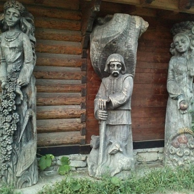 Museum of customary symbols of the Hutsul region (Mykulychyn)altitude 622 mDid you know that the Museum of Customary Symbols of the Hutsul Region (Mykulychyn) and its exhibition are housed in three rooms of an old hut?
Trails nearby
All trails HardMulti-dayMarkedEast Carpathian Tourist TrailElevation profile635–1 819 m278.1 kmascent 14 105 m
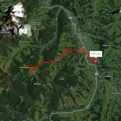 EasyOne-dayUnmarkedMount Bila Kobyla VerkhovynaElevation profile619–1 466 m9.5 kmascent 35 m≈ 2.5 h walking
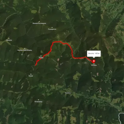 ModerateOne-dayMarkedTo Mount RotyloElevation profile1 210–1 453 m8.5 kmascent 646 m≈ 3.5 h walking