Tămașul Mare
Tămașul Mare (Rom. Vârful Tămașul Mare) is a 1,735 m peak on the western edge of the Piatra Craiului massif, in the Piatra Craiului National Park. Here, the main ridge route of the Făgăraș Mountains, the red stripe ("Olt Valley — Podrăgului Saddle — Lerești Saddle — Plaiul Foii hut"), which coincides with the European E8 trail, enters the massif. Settlements are far away: Peștera, Măgura, Șirnea, and Sătic are all about 11–12 km in a straight line. The highest peak of the massif, La Om, is about 5.1 km to the southeast.
Getting there / routes
The shortest ascent is from Plaiul Foii hut following the yellow stripe marking. According to muntii-nostri.ro, the trail branches off from the red stripe about 150 m from the hut, climbs to a plateau with several holiday cottages near a signpost, turns southwest and follows a forest path along the slope of Plaiul Runcului. After about 300 m of elevation gain, it reaches the ridge, continues 500–550 m along the edge of a regrowing clearing, and then through the forest to the first Plaiul Runcului meadow. From there, about 300 m up the meadow to 1,310 m altitude, then a steeper climb through forest; after 20–25 minutes, the second meadow is reached, where markings disappear. The path leads up between low bushes through sparse firs to the edge of the coniferous forest (about 1,450 m), then, with sparse markings, steeply up to the summit (1,690 m). The route is 4.2 km, about 3.5 hours, and 880 m ascent; the authors recommend caution near the summit, where markings are weak.
According to the same source, Plaiul Foii hut is the main base for routes on the western slope of Piatra Craiului; it was once a border post, now a cozy wooden hut with a terrace above the river, so it's best to arrange accommodation in advance.
From the summit, a marked trail leads via Tămașului Saddle to Curmătura Foii Saddle, and then to Tămașel Saddle under the cliffs of Umerii Pietrei Craiului (6.9 km, about 3.5 hours, 491 m ascent, moderate to difficult). Near Tămașel Saddle, a yellow dot trail branches off along the Pičorul Tămașel ridge to the Garofița Pietrei Craiului Hut hut. The nearest springs marked on the site are Spring below Țânțăreanu and Oțețelei Spring (both 3–3.6 km away).
Safety, season and rules
Tămașul Mare lies within Piatra Craiului National Park: a ticket is required — 10 lei per person for seven days (for visitors over 14); tickets can be bought online, at vending machines in Zărnești and Plaiul Foii, or by SMS (as of the date checked, see pcrai.ro). The summit route is rarely used and markings are weak near the top — have an offline map. Bears are common in the Romanian Carpathians: stay on marked trails, make noise, avoid dusk, and don't keep food in your tent; near sheepfolds, shepherd dogs may attack — don't run, stop and shield yourself with your backpack (advice from Salvamont România).
In case of emergency, call the national mountain rescue dispatcher 0SALVAMONT — 0725 826 668 or 112.
Getting there from Ukraine
Border crossings
- Porubne – Siret — road and pedestrian, 24/7
- Diakivtsi – Racovăț — road and pedestrian, 24/7 No freight traffic.
- Krasnoilsk – Vicovu de Sus — road and pedestrian, 08:00–20:00 Cars up to 3.5 t and pedestrians only; not 24/7.
- Solotvyno – Sighetu Marmației — road and pedestrian, 24/7 Passenger traffic only: vehicles up to 3.5 t with up to 9 seats, pedestrians.
- Diakove – Halmeu — road, 24/7 No pedestrian crossing.
By car
Chernivtsi – Bușteni ≈426 km, ≈7 h 32 min (via Diakivtsi – Racovăț); Rakhiv – Bușteni ≈454 km, ≈8 h 01 min (via Solotvyno – Sighetu Marmației); Uzhhorod – Bușteni ≈557 km, ≈9 h 15 min (via Diakove – Halmeu). Times without border queues, our road routing (GraphHopper, OSM).
Checked 03.11.2026; border crossing hours and timetables change — check before you travel.
Comments
Travellers’ experience: reports, tips, questions.
No one has reported on this trail yet. Been here lately? Tell others what it is like now.
Trails nearby
All trails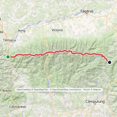 HardMulti-dayMarkedFăgăraș main ridge: Olt Valley Tămașului SaddleElevation profile358–2 525 m93.1 kmascent 6 545 munder 1 km from Tămașul Mare
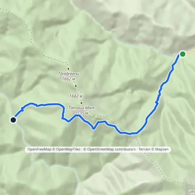 ModerateOne-dayMarkedPlaiul Foii Hut RăchitaElevation profile842–1 525 m9.3 kmascent 681 m≈ 3.5 h walkingunder 1 km from Tămașul Mare
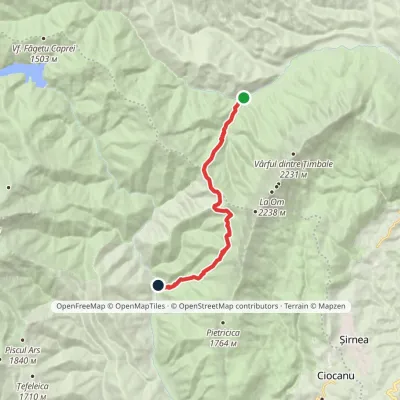 ModerateOne-dayMarkedPlaiul Foii Hut CojocaruElevation profile842–1 467 m12 kmascent 693 m≈ 4 h walking2.2 km from Tămașul Mare
Nearby attractions
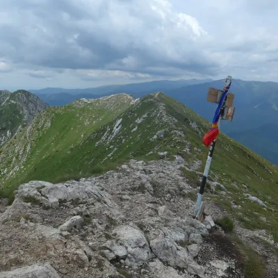 PeakLa OmPeșteraaltitude 2 238 m5.1 km from Tămașul Mare1 trail to the topLa Om (Romanian Vârful La Om, also Piscul Baciului – “the shepherd's peak”) is the highest summit of the Piatra Craiului massif in the Southern Carpathians of Romania,...
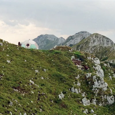 PeakAscuțitZărneștialtitude 2 133 m6.1 km from Tămașul MareVârful Ascuțit, "Sharp") is a 2,133 m peak in the northern part of the limestone ridge of Piatra Craiului, in Piatra Craiului National Park.
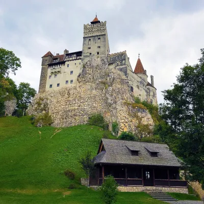 CastleBran Castle — "Dracula's Castle": pass fortress and Queen Marie's homeBran17 km from Tămașul MareBran Castle (Castelul Bran) stands on a rock above the village of Bran in Brașov County, between the Bucegi and Piatra Craiului massifs.
Craft nearby
All craft places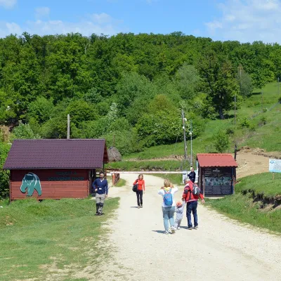 Wildlife parks & animal farmsLibearty Bear Sanctuary in Zărnești: a forest for rescued bearsVulcan19 km from Tămașul MareThe AMP Libearty Bear Sanctuary lies near the town of Zărnești in Brașov County, at the edge of a forest below the Piatra Craiului massif.
 Craft producersDieter’s Bread in Câmpulung: wood-fired artisan breadCâmpulung30 km from Tămașul MareCâmpulung (also called Câmpulung Muscel) is an old town in Argeș County at the foot of the Iezer-Păpușa Mountains, on the road to the Rucăr–Bran pass.
