Judele
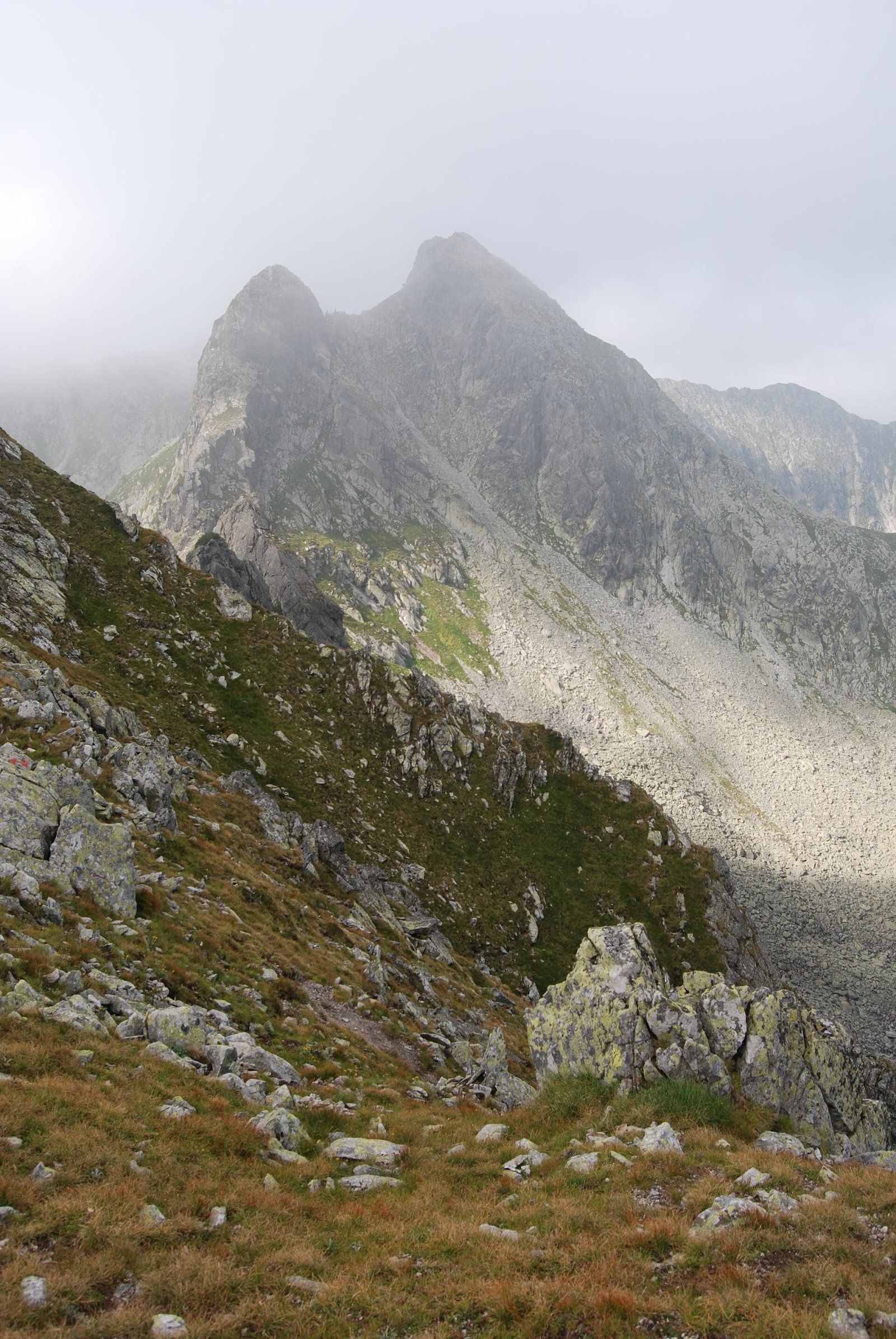
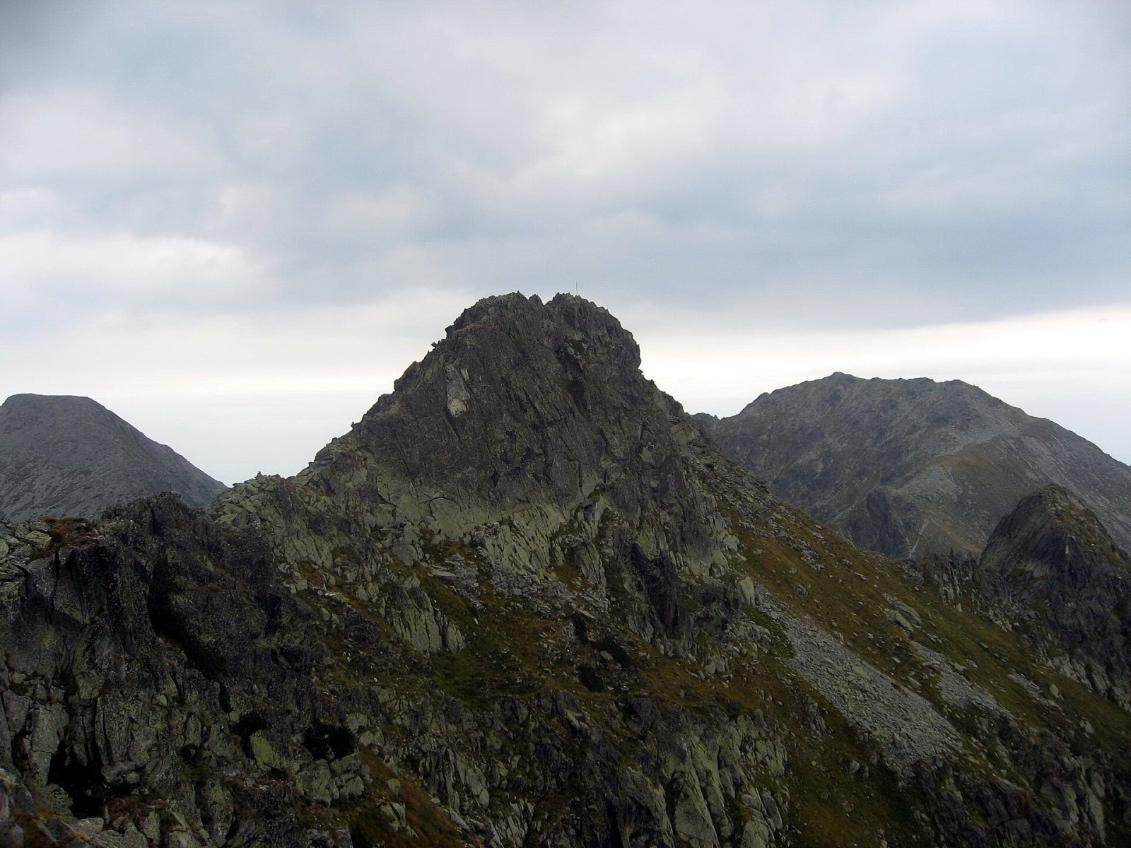
Judele (Rom. Vârful Judele) is a 2,398 m peak in the central part of the Retezat Mountains, Hunedoara County. It stands above two of the massif’s most famous glacial lakes—Bucura and Zănoaga—on the ridge between them; according to Romanian Wikipedia, the summit is accessed from Judele Saddle. Neighboring peaks are very close: Bucura (Retezat) is about 1.1 km to the northeast, Retezat Peak is 2.6 km to the north, and Peleaga, the highest peak of Retezat, is 3.2 km to the east.
The nearest settlement is the village of Râușor (about 6.8 km as the crow flies). By the lakes there are mountain rescue huts: Bucura Salvamont Hut (about 1.9 km from the summit) and Zănoaga Salvamont Hut (about 2.7 km), as well as nearby Bucura Camp Site and Zănoaga Camp Site campsites. Just below the summit, about 500 m away, is Spring below Vârful Judele.
Getting there / routes
Judele is crossed by a marked red dot trail from Lake Zănoaga via the summit and Judele Saddle to Lake Porții and further to Lake Bucura. From Zănoaga, a red triangle trail also leads up from below, starting at Gura Zlata via the La Pâr locality.
According to muntii-nostri.ro, the most popular loop starts at Poiana Pelegii, where you’ll find Salvamont Poiana Pelegii Hut and Poiana Pelegii Camp Site. First, follow the blue stripe marking up the wide valley to Lake Bucura, then west on the blue stripe and red triangle up to Judele, keeping to the ridge line. From the summit, the trail follows the red stripe ridge marking west, then a well-marked branch (red triangle) descends into the cirque to Lake Zănoaga, and from there the blue cross leads southeast down the valley back to Poiana Pelegii. This is 22.9 km, about 12 h 50 min and 1,548 m ascent—a demanding route. The authors call it one of the most varied in the Greater Retezat: glacial lakes, broad ridges, and sweeping panoramas.
For a shorter day, you can ascend Judele from Lake Bucura and return the same way; camping is convenient by the lakes at the designated tent sites.
Safety, season and rules
The peak lies within Retezat National Park. Entry is ticketed: according to the administration, a ticket costs 10 lei and is valid for 7 days, sold at bilete.retezat.ro; you must stay on marked trails, open fires are forbidden, and dogs must be kept on a leash (park rules, as of last check). The Retezat ridges are exposed, weather changes quickly, and in winter slopes above the treeline are avalanche-prone—only experienced and well-equipped hikers should go then. Bears are common in the Romanian Carpathians: do not leave marked trails, make noise, avoid dusk, and do not keep food in your tent; near sheepfolds, shepherd dogs may attack—do not run, stop and shield yourself with your backpack (advice from Salvamont România).
In case of emergency, call the national mountain rescue dispatcher 0SALVAMONT — 0725 826 668 or 112.
Photos: Thalpha, CC BY 3.0; Dezidor, CC BY 3.0 — Wikimedia Commons.
Getting there from Ukraine
Border crossings
- Porubne – Siret — road and pedestrian, 24/7
- Diakivtsi – Racovăț — road and pedestrian, 24/7 No freight traffic.
- Krasnoilsk – Vicovu de Sus — road and pedestrian, 08:00–20:00 Cars up to 3.5 t and pedestrians only; not 24/7.
- Solotvyno – Sighetu Marmației — road and pedestrian, 24/7 Passenger traffic only: vehicles up to 3.5 t with up to 9 seats, pedestrians.
- Diakove – Halmeu — road, 24/7 No pedestrian crossing.
By car
Rakhiv – Petroșani ≈450 km, ≈6 h 36 min (via Solotvyno – Sighetu Marmației); Ivano-Frankivsk – Petroșani ≈584 km, ≈8 h 55 min (via Solotvyno – Sighetu Marmației); Chernivtsi – Petroșani ≈539 km, ≈9 h 19 min (via Krasnoilsk – Vicovu de Sus). Times without border queues, our road routing (GraphHopper, OSM).
Checked 03.11.2026; border crossing hours and timetables change — check before you travel.
Comments
Travellers’ experience: reports, tips, questions.
No one has reported on this trail yet. Been here lately? Tell others what it is like now.
Location on the map
Water and shelter nearby
- Spring below Vârful Judele500 m · Not verified · 2 183 m
- Spring below Bucura I860 m · Not verified · 2 094 m
- Spring below Vârful lui Stirb (north slope)1.6 km · Not verified · 1 997 m
- Bucura Salvamont Hut1.9 km · Not verified · 2 051 m
- Spring below Custura Bucurei (south slope), 2 046 m1.9 km · Not verified · 2 046 m
- Spring below Bucura II2 km · Not verified · 2 067 m
- Spring below Custura Bucurei (south slope), 2 126 m2.2 km · Not verified · 2 126 m
- Spring below Custura Bucurei (south-east slope)2.4 km · Not verified · 2 142 m
- Drinking water below Vârful lui Stirb2.4 km · Not verified · 1 832 m
- Spring below Vârful lui Stirb (north-east slope)2.5 km · Not verified · 1 819 m
- Spring below La Clince2.6 km · Not verified · 2 044 m
- Zănoaga Salvamont Hut2.7 km · Not verified · 1 993 m
- Spring below Vârful Radeșu Mare (south-east slope)2.9 km · Not verified · 2 011 m
Trails nearby
All trails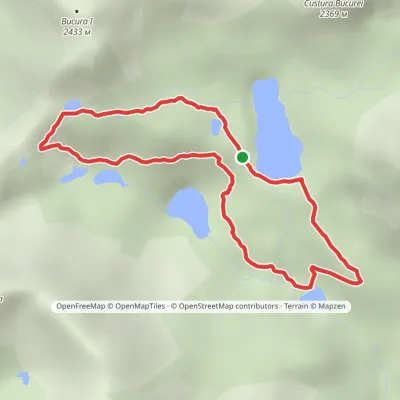 HardOne-dayMarkedBucura Lakes CircuitElevation profile1 903–2 209 m4.9 kmascent 294 m≈ 1.5 h walkingunder 1 km from Judele
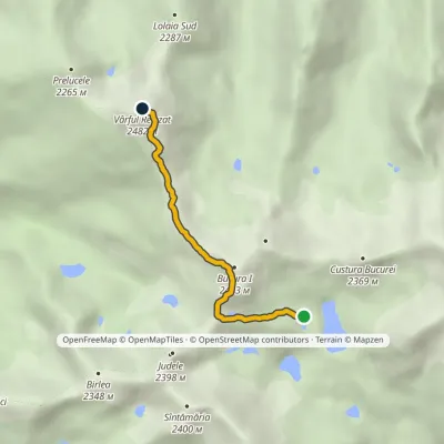 HardOne-dayMarkedLake Bucura Retezat Peakvia Bucura PeakElevation profile2 073–2 482 m3.8 kmascent 586 m≈ 2 h walkingunder 1 km from Judele
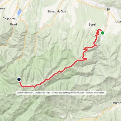 HardTwo-dayMarkedHobița Retezat Peakvia PeleagaElevation profile533–2 509 m35.3 kmascent 2 905 m≈ 13.5 h walking1.1 km from Judele
Nearby attractions
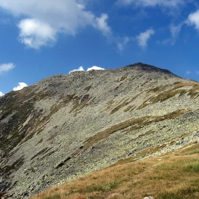 PeakBucura (Retezat)Râușoraltitude 2 433 m1.1 km from Judele2 trails to the topBucura (Romanian: Vârful Bucura, Hungarian: Bukura-csúcs) is a massive double summit on the northern main ridge of the Retezat Mountains in the Southern Carpathians,...
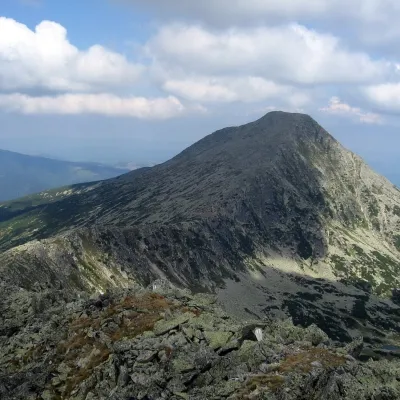 PeakRetezat PeakRâușoraltitude 2 482 m2.6 km from Judele4 trails to the topRetezat Peak (Romanian: Vârful Retezat, Hungarian: Retyezát-csúcs) is a 2,482 m summit in the northern part of the Retezat Mountains in the Southern Carpathians, in...
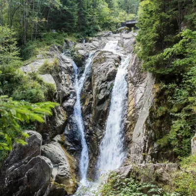 WaterfallLolaia Waterfall (Cascada Lolaia)Nucșoara · Retezat Mountains8.3 km from Judeleheight 15 m1 085 m above sea levelLolaia Waterfall (Cascada Lolaia) lies in the northern part of Retezat National Park, in Hunedoara County, on one of the park's busiest routes — the road from the...
