Gropșoarele
Gropșoarele (Rom. Vârful Gropșoarele) is a 1,883 m peak in the Ciucaș Mountains, on the border of Prahova and Brașov Counties. It stands on a ridge branching off from the main massif towards the summit of Zăganu—just 0.8 km to the southeast, so both peaks are usually climbed together. The highest peak of the range, Ciucaș Peak, is about 5.2 km northwest in a straight line.
The nearest settlement is the resort village of Cheia (about 4.4 km direct), then Babarunca (about 10.8 km) and Vama Buzăului (about 12 km). Near the summit, the site marks Hut below Zăganu and Hut below Colții Boncuței (both about 1.5 km away), as well as Spring below Muntele Roșu.
Getting there / routes
The direct route is the red cross from Cheia through Gropșoarele to the Vârful Ciucaș Hut hut. According to muntii-nostri.ro, it starts in the village center near the "Cheia" hotel, passes the Cheia monastery to the DN1A highway, and there, by a signpost, enters the spruce forest and crosses the Zaganu stream. The whole route to the hut below Ciucaș is 12.8 km, about 5 hr 45 min and 1,163 m ascent, of medium to difficult grade.
Another option is from the Muntele Roșu hut (Cabana Muntele Roșu, 1,280 m). According to the same source, the red triangle trail climbs Muntele Roșu, skirts its summit (1,766 m), and reaches La Răscruce (1,805 m), where several routes meet. From there to Gropșoarele saddle (1,663 m), the trail, marked by metal posts, descends through alpine meadows for 1.1 km; to Curmătura Stânii saddle, the whole segment is 6 km and about 3 hours. Hikers on one trip made a loop from Muntele Roșu via La Răscruce, Gropșoarele, and Zaganu to the Ciucaș hut: 14.3 km, about 4.5 hours, 791 m ascent.
From the south, from the Poiana Stânii clearing, a steep route leads along the Gropșoarele ridge to Zaganu (3.3 km, 2 hr 15 min, 755 m ascent). According to the description, from the hunting lodge at the clearing, the route follows the blue stripe for about 500 m, then a forest road up the Pârâul Alb valley; after 1.6 km, at about 1,160 m altitude, near the remains of a hunting tower, the yellow triangle branches off into the Pârâul Alb gorge. Our route instead ascends the dry valley of the Sterp stream with a slope of about 40%, past a temporary spring: after a kilometer of ascent (406 m elevation gain), it leads into a cirque overgrown with tall shrubs, and from there, via narrow switchbacks, to the ridge.
Safety, season and rules
The Gropșoarele–Zaganu ridge is exposed, so in fog or storms it is uncomfortable: check the forecast and stick to the markings. In winter, these routes are suitable only for experienced and well-equipped hikers. Bears are common in the Romanian Carpathians: do not leave marked trails, make noise, avoid dusk, and do not keep food in your tent; near sheepfolds, shepherd dogs may attack—do not run, stop and shield yourself with your backpack (advice from Salvamont România).
In case of emergency, call the national mountain rescue dispatcher 0SALVAMONT — 0725 826 668 or 112.
Getting there from Ukraine
Border crossings
- Porubne – Siret — road and pedestrian, 24/7
- Diakivtsi – Racovăț — road and pedestrian, 24/7 No freight traffic.
- Krasnoilsk – Vicovu de Sus — road and pedestrian, 08:00–20:00 Cars up to 3.5 t and pedestrians only; not 24/7.
- Solotvyno – Sighetu Marmației — road and pedestrian, 24/7 Passenger traffic only: vehicles up to 3.5 t with up to 9 seats, pedestrians.
- Diakove – Halmeu — road, 24/7 No pedestrian crossing.
By car
Chernivtsi – Brașov ≈395 km, ≈7 h 03 min (via Diakivtsi – Racovăț); Rakhiv – Brașov ≈419 km, ≈7 h 24 min (via Solotvyno – Sighetu Marmației); Uzhhorod – Brașov ≈522 km, ≈8 h 39 min (via Diakove – Halmeu). Times without border queues, our road routing (GraphHopper, OSM).
Checked 03.11.2026; border crossing hours and timetables change — check before you travel.
Comments
Travellers’ experience: reports, tips, questions.
No one has reported on this trail yet. Been here lately? Tell others what it is like now.
Water and shelter nearby
- Hut below Zăganu1.5 km · Not verified · 1 472 m
- Hut below Colții Boncuței1.5 km · Not verified · 1 596 m
- Spring below Muntele Roșu2.2 km · Not verified · 1 615 m
- Spring below Piatra Laptelui (south slope)2.3 km · Not verified · 1 491 m
- Prof. Nicolae Ioan Spring2.5 km · Not verified · 1 396 m
- Stâna lui Cojocaru Hut3 km · Not verified · 1 405 m
Nearby attractions
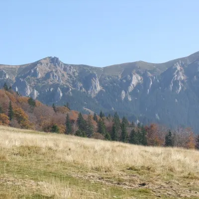 PeakZăganuCheiaaltitude 1 817 munder 1 km from GropșoareleZăganu (Romanian Vârful Zăganu, Hungarian Zagán or Zákányos) is a 1,817 m summit and also the name of a whole rocky ridge in the Ciucaș Mountains, in the Curvature...
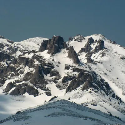 PeakCiucaș PeakCheiaaltitude 1 954 m5.2 km from GropșoareleCiucaș Peak (Romanian Vârful Ciucaș, Hungarian Csukás, German Krähenstein) is the highest summit of the Ciucaș Mountains, at 1,954 m.
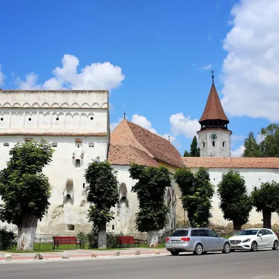 ChurchPrejmer Fortified Church: UNESCO peasant fortressPrejmer30 km from GropșoareleThe fortified church in the village of Prejmer (German Tartlau, Hungarian Prázsmár) is the largest and best-preserved peasant fortress in Transylvania.
Craft nearby
All craft places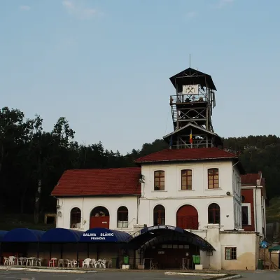 Water parks & thermal poolsSlănic Salt Mine: a 208 m deep microclimate and salt lakesSlănic28 km from GropșoareleThe Slănic Salt Mine (Salina Slănic), or the Unirea mine (Mina Unirea), is one of Romania's best-known show salt mines.
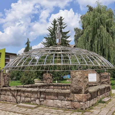 Water parks & thermal poolsCovasna: resort of a thousand springs, mofettes and heart careCovasna42 km from GropșoareleCovasna is a spa town in Covasna County, at the south-eastern edge of the Eastern Carpathians, where the mountains bend round in the Curvature Carpathians.
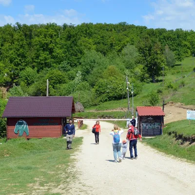 Wildlife parks & animal farmsLibearty Bear Sanctuary in Zărnești: a forest for rescued bearsVulcan47 km from GropșoareleThe AMP Libearty Bear Sanctuary lies near the town of Zărnești in Brașov County, at the edge of a forest below the Piatra Craiului massif.
