Ciucaș Peak
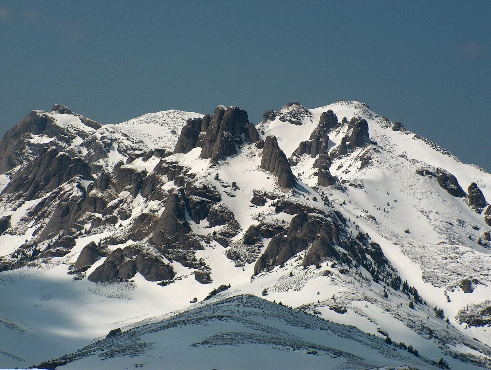
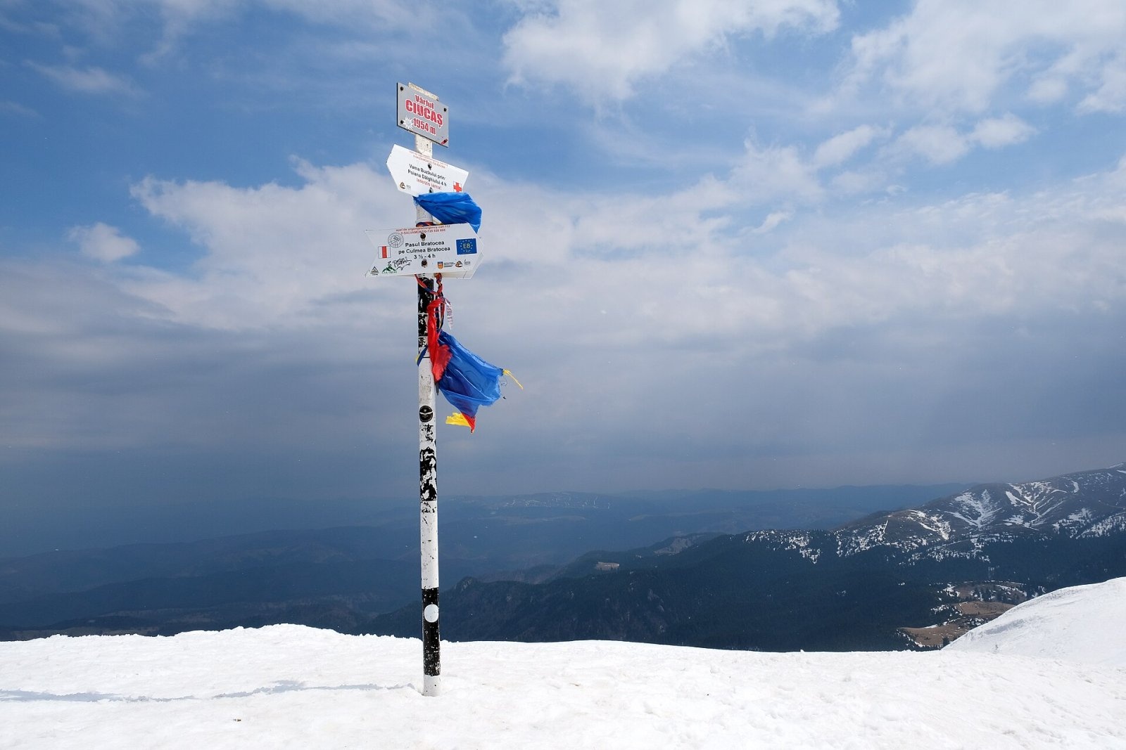
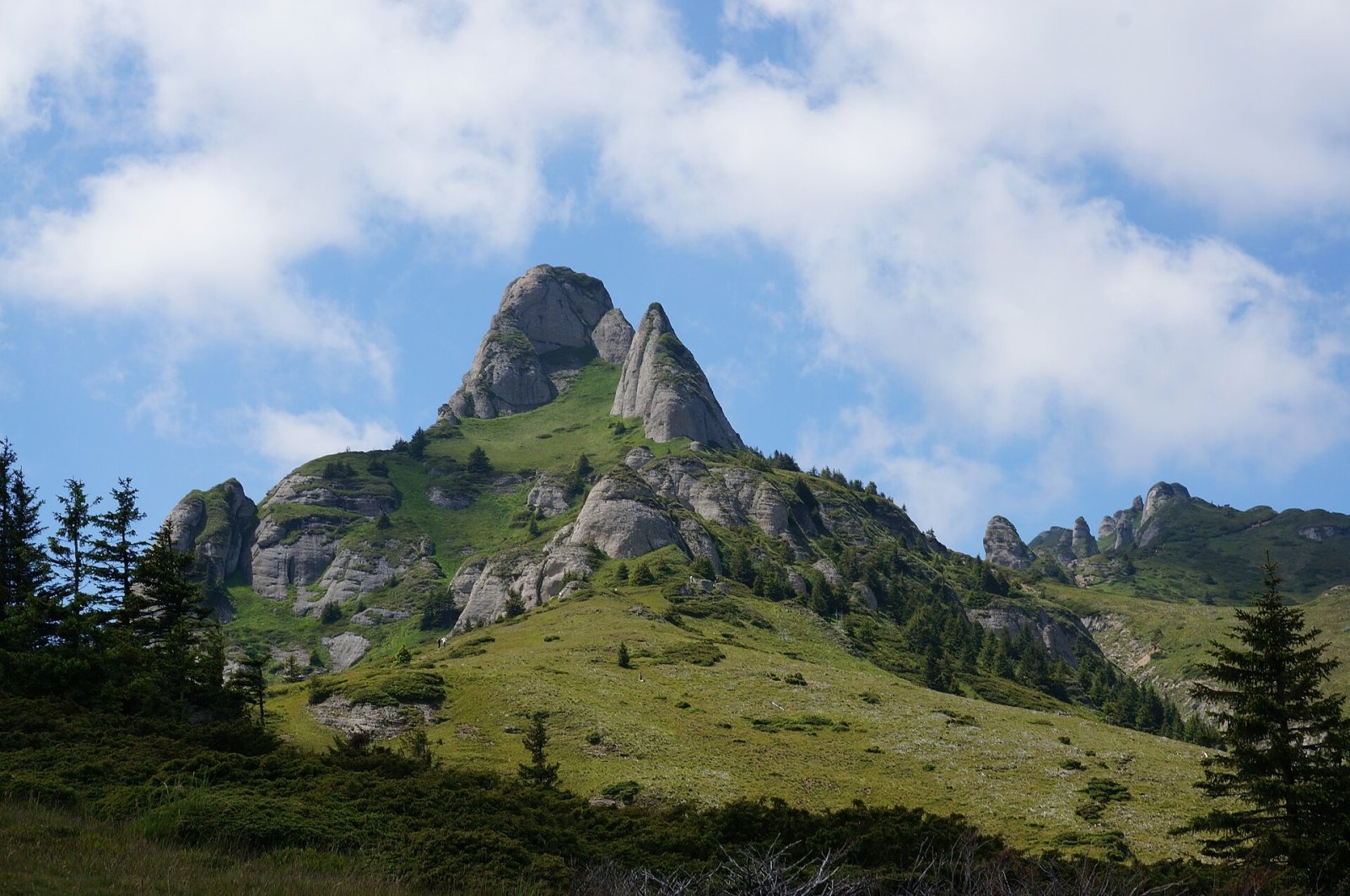
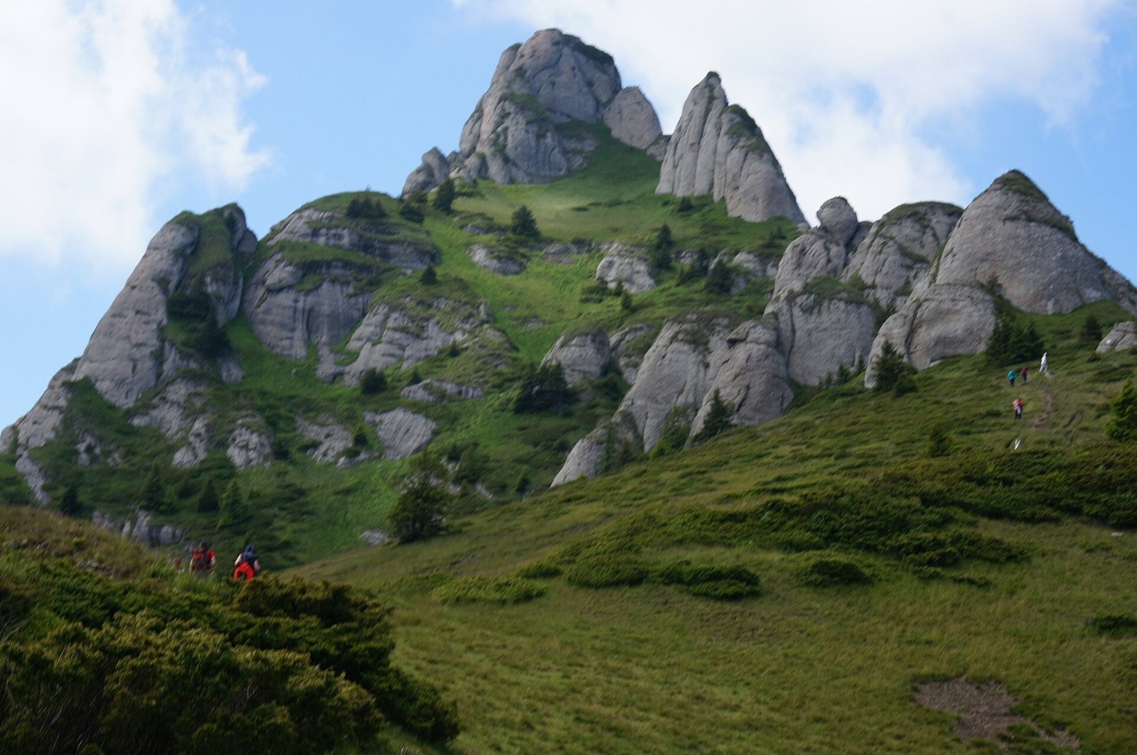
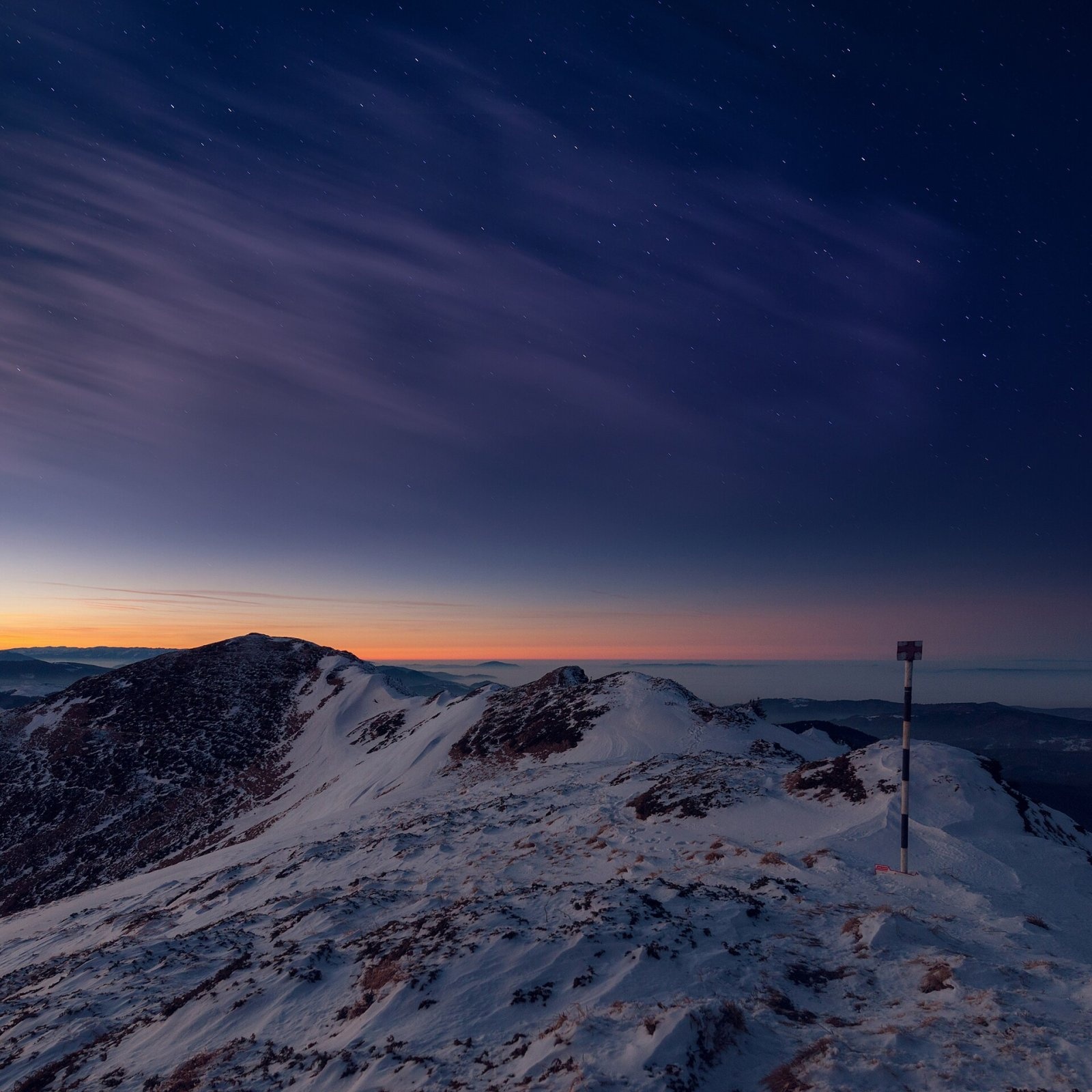
Ciucaș Peak (Romanian Vârful Ciucaș, Hungarian Csukás, German Krähenstein) is the highest summit of the Ciucaș Mountains, at 1,954 m. This small but very picturesque massif belongs to the Curvature Carpathians – part of the Eastern Carpathians in Romania – and lies east of the upper Teleajen and Tărlung rivers, between Brașov and the Prahova valley. The peak stands in the north of Prahova County, near the Brașov County border: the mountain resort of Cheia is about 7 km away and the village of Vama Buzăului about 10 km. Its prominence reaches 919 m, so it stands out clearly among the neighbouring mountains.
The massif consists of two ridges. The western one, Ciucaș – Bratocea, runs from south-west to north-east and is divided by the Tigăilor saddle into two parts: the northern one with Ciucaș Peak and the southern Bratocea, more than 5 km long. The second ridge, Gropșoarele – Zăganu, runs from north-west to south-east and is joined to the first by the saddle of Mount Chirușca. Other notable peaks are Gropșoare (1,883 m), Tigăile Mari (1,844 m) and Zăganu (1,817 m).
How to get there / trails
The most popular approach follows the red stripe from the Bratocea pass on the DN1A Ploiești – Brașov road: the trail runs along the ridge past the Colții Bratocei rocks and over the Tigăilor saddle to the summit, then continues to the Tabla Buții pass. From the north-east, from Vama Buzăului via the Dălghiu clearing and the Ciucaș saddle, a red cross leads to the top. The European long-distance path E8 also crosses the summit.
From the resort of Cheia, according to Romanian Wikipedia, a trail marked with a blue cross climbs the Berii valley (Valea Berii, “Beer Valley”) on a forest road past the Nicolae Ioan spring, where it crosses the yellow stripe from Muntele Roșu, then to a sheepfold and up onto the alpine meadows, and from there to the Ciucaș hut on the Chirușca saddle. This medium-difficulty route takes 3–3½ hours, is open all year and needs no special equipment. The forest road up the Berii valley is passable only for four-wheel-drive vehicles: its last part has steep, tight hairpins.
What you can see from the summit
According to Romanian and German Wikipedia, the summit offers a fine view of the Burzenland with Brașov and of the Cheia resort. Czech Wikipedia also describes Ciucaș as a place with far-reaching views.
Nature and history
The highlight of the massif is its bizarre conglomerate rocks, which form a so-called ruiniform relief; according to Czech Wikipedia, the summit itself is made of them. These formations are protected by a nature reserve, and the massif is part of the Natura 2000 network as the Ciucaș site. Bilberry, juniper, rhododendron, dwarf mountain pine and edelweiss grow on the pastures and among the rocks. Muntele Roșu (“Red Mountain”), according to German Wikipedia, got its name because its slopes turn strikingly red when the rhododendron is in bloom.
Bear, wild boar, red deer, lynx, fox, marten, squirrel, wildcat and chamois live in the Ciucaș Mountains. Birds include the golden eagle and the hawk, and reptiles the common adder and the viviparous lizard. On Muntele Roșu, next to the tourist complex, there is a seismic station. Near the Chirușca saddle stands the rebuilt Ciucaș mountain hut, formerly the Alexandru Vlahuță hut – a landmark on the routes from Cheia.
Safety, season and rules
The trails to Ciucaș are technically easy, but the ridges are open: they are dangerous in fog, thunderstorms and strong wind, and in winter snow and ice make the rocky sections treacherous. Salvamont advises checking the forecast for the next 24 hours before setting out, taking windproof and warm clothing, a torch, a map and a charged phone, not hiking alone and telling family or others about your route.
Bears are common here. Stay on the marked paths, walk in a group and talk, do not hike in the evening or at night, keep dogs on a leash, do not leave food in or near your tent, and move away at once from a bear cub. Sheepdogs near sheepfolds may rush at hikers – do not run, shield yourself with your rucksack. In an emergency call the national dispatch 0SALVAMONT – 0725 826 668 or 112; advice on animal encounters is on the Salvamont România website.
Photos: Mlefter (talk), CC BY-SA 3.0; kallerna, CC BY-SA 4.0; George Admin (luxdes…, CC BY 3.0; George Admin (luxdes…, CC BY 3.0; David Marcu davidmarcu, CC0 — Wikimedia Commons.
Getting there from Ukraine
Border crossings
- Porubne – Siret — road and pedestrian, 24/7
- Diakivtsi – Racovăț — road and pedestrian, 24/7 No freight traffic.
- Krasnoilsk – Vicovu de Sus — road and pedestrian, 08:00–20:00 Cars up to 3.5 t and pedestrians only; not 24/7.
- Solotvyno – Sighetu Marmației — road and pedestrian, 24/7 Passenger traffic only: vehicles up to 3.5 t with up to 9 seats, pedestrians.
- Diakove – Halmeu — road, 24/7 No pedestrian crossing.
By car
Chernivtsi – Brașov ≈395 km, ≈7 h 03 min (via Diakivtsi – Racovăț); Rakhiv – Brașov ≈419 km, ≈7 h 24 min (via Solotvyno – Sighetu Marmației); Uzhhorod – Brașov ≈522 km, ≈8 h 39 min (via Diakove – Halmeu). Times without border queues, our road routing (GraphHopper, OSM).
Checked 03.11.2026; border crossing hours and timetables change — check before you travel.
Location on the map
Water and shelter nearby
- Vârful Ciucaș Hut2.1 km · Standing · 1 595 m
- Prof. Nicolae Ioan Spring2.8 km · Not verified · 1 396 m
Comments
Nearby attractions
 PeakZăganuCheiaaltitude 1 817 m5.9 km from Ciucaș PeakZăganu (Romanian Vârful Zăganu, Hungarian Zagán or Zákányos) is a 1,817 m summit and also the name of a whole rocky ridge in the Ciucaș Mountains, in the Curvature...
 PeakPiatra MareTimișu de Josaltitude 1 843 m23 km from Ciucaș PeakPiatra Mare (Romanian Vârful Piatra Mare, “the Great Stone”, German Hohenstein, Hungarian Nagykőhavas) is the highest summit of the small massif of the same name south...
 PeakPostăvarulPoiana Brașovaltitude 1 799 m28 km from Ciucaș PeakPostăvarul (Romanian Vârful Postăvarul, popularly Postăvaru, German Schuler, Hungarian Keresztényhavas) is a 1,799 m summit, the highest peak of the small Postăvarul...
