Frumoasa
Frumoasa (Rom. Vârful Frumoasa, "Beautiful") is a 2,152 m peak in the Cindrel Mountains (Southern Carpathians), in Sibiu County. It stands on the main ridge of the massif, 2 km west of the highest peak, Cindrel Peak; further southeast lies Șteflești Peak (about 5.9 km). According to muntii-nostri.ro, the boundary of the "Iezerele Cindrelului" nature reserve—glacial lakes below Cindrel—runs across the summit of Frumoasa.
The European hiking trail E8 and the main ridge red stripe route "Cisnădie – Cindrel peak – Oașa hut" both cross the summit. The nearest shelter listed is Cindrel Hut (about 3.2 km), and the nearest spring is Spring below Cindrel (about 3 km).
Getting there / routes
The shortest ascent is from the Frumoasa Valley. According to muntii-nostri.ro, just above the Miercurea forest post, a left turn from the forest road in the valley leads onto another forest road—there is an old signpost for Frumoasa peak. The trail climbs up the Luy-Blaga stream valley, passes a hut for astronomical observations after a few minutes, and about 25 minutes later, at a fork, you keep right through the forest. Soon the road narrows, becomes steep and rocky; after about an hour, it leaves the forest. From there, it continues through pasture along the forest edge, through wide dwarf pine thickets and across the slope. Just over two hours from the start, the path joins the ridge routes (red and blue stripes), and from there it's five minutes to the summit. The route is 6.2 km, about 3 hours, with 677 m ascent; it is rated as easy.
A longer route leads to Frumoasa from the village of Jina: according to muntii-nostri.ro, it's about 20 km on a cart track through picturesque pastures and hayfields between the Dobra valley and Negru stream, under the peaks of Căptanu Mic, Căptanu Mare, Guga Mare, and Guga Mică (here the markings are sparser), passing through the hamlet of Crinț and the Șipotul Dezertorilor spring, then on to the peaks of Frumoasa and Cindrel. In total: 33.5 km, about 14 hours, 1,817 m ascent, difficult.
The view from the top
Authors describing the ascent from Frumoasa Valley mention a wonderful panorama from the summit.
Safety, season and rules
The Cindrel ridge is high and treeless: in storms and fog it is exposed, so check the forecast and stick to the markings. In the "Iezerele Cindrelului" reserve, do not camp or leave litter. In winter, slopes above the tree line can be avalanche-prone—go only with experience and proper gear. Bears are common in the Romanian Carpathians: stay on marked trails, make noise, avoid dusk, and don't keep food in your tent; near sheepfolds, shepherd dogs may attack—don't run, stop and shield yourself with your backpack (advice from Salvamont România).
In case of emergency, call the national mountain rescue dispatcher 0SALVAMONT — 0725 826 668 or 112.
Getting there from Ukraine
Border crossings
- Porubne – Siret — road and pedestrian, 24/7
- Diakivtsi – Racovăț — road and pedestrian, 24/7 No freight traffic.
- Krasnoilsk – Vicovu de Sus — road and pedestrian, 08:00–20:00 Cars up to 3.5 t and pedestrians only; not 24/7.
- Solotvyno – Sighetu Marmației — road and pedestrian, 24/7 Passenger traffic only: vehicles up to 3.5 t with up to 9 seats, pedestrians.
- Diakove – Halmeu — road, 24/7 No pedestrian crossing.
By car
Rakhiv – Sibiu ≈390 km, ≈5 h 33 min (via Solotvyno – Sighetu Marmației); Ivano-Frankivsk – Sibiu ≈524 km, ≈7 h 52 min (via Solotvyno – Sighetu Marmației); Chernivtsi – Sibiu ≈435 km, ≈8 h 00 min (via Diakivtsi – Racovăț). Times without border queues, our road routing (GraphHopper, OSM).
Checked 03.11.2026; border crossing hours and timetables change — check before you travel.
Comments
Travellers’ experience: reports, tips, questions.
No one has reported on this trail yet. Been here lately? Tell others what it is like now.
Nearby attractions
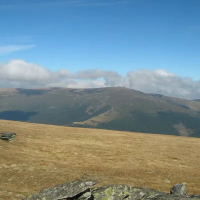 PeakCindrel Peakaltitude 2 244 m2 km from FrumoasaCindrel Peak (Romanian Vârful Cindrel, also Cândrel) is the highest summit of the Cindrel Mountains, at 2,244 m (some sources give 2,245 m), in the centre of the...
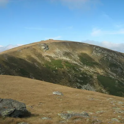 PeakȘteflești Peakaltitude 2 242 m5.9 km from FrumoasaȘteflești Peak (Romanian Vârful Șteflești) is the highest summit of the Lotru Mountains, at 2,242 m, in the Southern Carpathians of Romania.
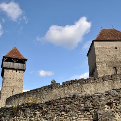 CastleCâlnic Fortress: a count's castle turned peasant strongholdCâlnic35 km from FrumoasaFrom a count's residence to a village refuge The village of Câlnic (German: Kelling, Hungarian: Kelnek) lies in a hilly valley in the south of Alba County, at the foot...
Craft nearby
All craft places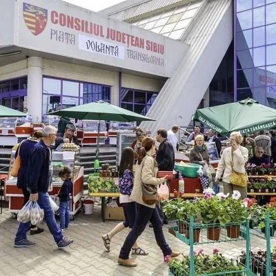 Markets & fairsTransylvania Farmers’ Market in Sibiu: Saturday producers’ marketSibiu37 km from FrumoasaThe Transylvania Farmers’ Market (Piața Țărănească Transilvania) is an open-air Saturday market next to the Transilvania sports hall in Sibiu.
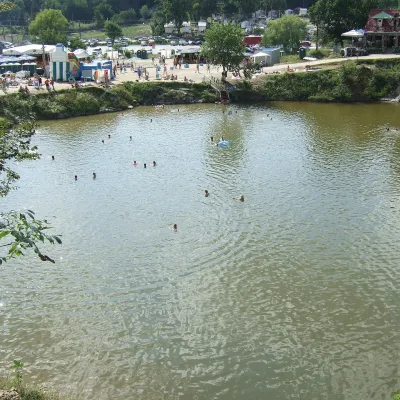 Water parks & thermal poolsOcna Sibiului spa: salt lakes and healing mudOcna Sibiului40 km from FrumoasaOcna Sibiului is a small spa town in Sibiu County, 15 km north-west of Sibiu, on the southern edge of the Transylvanian hill basin.
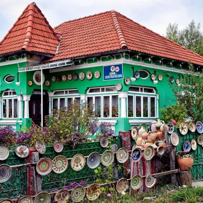 Crafts & workshopsOlari Street, Horezu: the UNESCO potters’ workshopsOlari50 km from FrumoasaThe heart of the craft is Olari Street (Strada Olari) in the part of town of the same name, about 2 km from the centre.
