Biserica Moțului
Biserica Moțului (Rom. Vârful Biserica Moțului, “Church of the Moți”) is a 1,466 m peak in the northern part of the Bihor Mountains (Western Romanian Mountains, Apuseni), in Bihor County, on the lands of Pietroasa commune. It dominates the karstic Padiș plateau—one of the most famous tourist areas in the Apuseni: the settlement of Padiș lies just about 0.8 km away as the crow flies. Further on are Casa de Piatră (about 7.1 km) and Boga (about 7.2 km).
The summit itself is a nature reserve covering 3 ha, declared by Law No. 5 of March 6, 2000 (IUCN category IV, mixed type). It is part of the Apuseni Nature Park and overlaps with the Natura 2000 ornithological site “Apuseni Mountains – Vlădeasa.”
Nature and history
According to Romanian Wikipedia, the reserve covers a slope overlooking the Padiș plateau: cliffs, hay meadows, and forests of spruce and beech. Among the grasses grow species protected by the European Habitats Directive 92/43/EEC, so picking plants and leaving the trail is not recommended.
Getting there / routes
The peak is an easy and short walk from Padiș. According to muntii-nostri.ro, a branch of the marked blue triangle trail is about 1 km long, climbs 125 m, and takes about 45 minutes; right near the summit, just above the cliff, there is a viewpoint overlooking Padiș. A short marked blue circle trail also leads to the summit from the county road DJ763.
It is most convenient to stay on the plateau: 600 m from the summit is Camping Spot, and nearby are Glăvoi Salvamont Hut and Cetățile Ponorului Hut near the karst complex Cetățile Ponorului. Water can be drawn from springs below the summit: Spring below Biserica Moțului (north-east slope) and Spring below Biserica Moțului (north slope).
From Padiș, it is easy to combine the ascent of Biserica Moțului with other plateau routes—to karst features marked on the site map near the peak. For bad weather, it is useful to know about other shelters nearby: Weather shelter below Boghii (about 2.5 km from the summit) and Weather shelter below Picioru Bătrânei (about 2.9 km). Another spring is Spring below Dealu Cuibuleț, about 2.2 km away.
Safety, season and rules
According to the Apuseni Nature Park administration, camping is only allowed in designated places: in the Sighiștel valley, in Padiș, Ic Ponor, and Gârda de Sus (parcapuseni.ro, as of date checked). The reserve area is subject to protected zone restrictions: do not leave the trail and do not litter. Weather on the plateau is changeable, and in fog, karst fields and forest clearings look alike. Bears are common in the Romanian Carpathians: do not leave marked trails, make noise, avoid dusk, and do not keep food in your tent; near sheepfolds, shepherd dogs may attack—do not run, stop and shield yourself with your backpack (advice from Salvamont România).
In case of emergency, call the national mountain rescue dispatcher 0SALVAMONT — 0725 826 668 or 112.
Getting there from Ukraine
Border crossings
- Porubne – Siret — road and pedestrian, 24/7
- Diakivtsi – Racovăț — road and pedestrian, 24/7 No freight traffic.
- Krasnoilsk – Vicovu de Sus — road and pedestrian, 08:00–20:00 Cars up to 3.5 t and pedestrians only; not 24/7.
- Solotvyno – Sighetu Marmației — road and pedestrian, 24/7 Passenger traffic only: vehicles up to 3.5 t with up to 9 seats, pedestrians.
- Diakove – Halmeu — road, 24/7 No pedestrian crossing.
By car
Rakhiv – Cluj-Napoca ≈219 km, ≈3 h 44 min (via Solotvyno – Sighetu Marmației); Ivano-Frankivsk – Cluj-Napoca ≈353 km, ≈6 h 04 min (via Solotvyno – Sighetu Marmației); Chernivtsi – Cluj-Napoca ≈343 km, ≈6 h 28 min (via Krasnoilsk – Vicovu de Sus). Times without border queues, our road routing (GraphHopper, OSM).
Checked 03.11.2026; border crossing hours and timetables change — check before you travel.
Comments
Travellers’ experience: reports, tips, questions.
No one has reported on this trail yet. Been here lately? Tell others what it is like now.
Water and shelter nearby
- Spring below Biserica Moțului (north-east slope)880 m · Not verified · 1 324 m
- Spring below Biserica Moțului (north slope)1.1 km · Not verified · 1 306 m
- Spring below Dealu Cuibuleț2.2 km · Not verified · 1 138 m
- Poiana Ponor Spring2.3 km · Not verified · 1 091 m
- Izbucul Ursului Spring2.3 km · Not verified · 1 115 m
- Spring below Gudapu (east slope), 1 292 m2.4 km · Not verified · 1 292 m
- Spring below Gudapu (east slope), 1 312 m2.5 km · Not verified · 1 312 m
- Tap Water «Izvorul Rece», 1 089 m2.8 km · Not verified · 1 089 m
- Glăvoi Salvamont Hut2.8 km · Not verified · 1 088 m
- Spring below Dealu Călciş (east slope), 1 091 m (2)2.8 km · Not verified · 1 091 m
- Drinking water below Varniţa2.8 km · Not verified · 1 088 m
- Spring below Boghii2.8 km · Not verified · 1 268 m
- Spring below Dealu Călciş (east slope), 1 091 m2.9 km · Not verified · 1 091 m
- Spring below Dealu Călciş (east slope), 1 095 m2.9 km · Not verified · 1 095 m
- Spring below Dealu Călciş (east slope), 1 114 m2.9 km · Not verified · 1 114 m
Trails nearby
All trails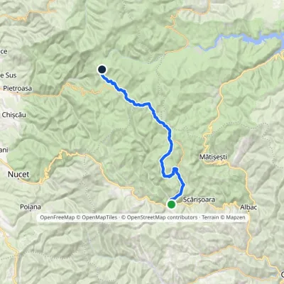 Hard1–2 daysMarkedGârda de Sus Vărășoaia SaddleElevation profile727–1 436 m31.8 kmascent 1 186 m≈ 10 h walkingunder 1 km from Biserica Moțului
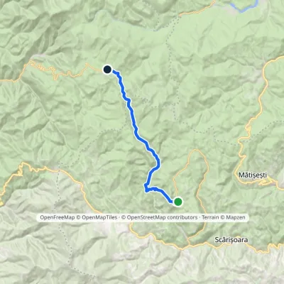 ModerateOne-dayMarkedGhețar PadișElevation profile821–1 354 m18.3 kmascent 690 m≈ 5.5 h walkingunder 1 km from Biserica Moțului
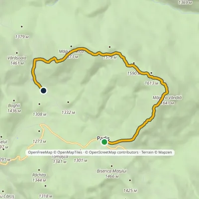 EasyOne-dayMarkedPadiș Vărășoaia SaddleElevation profile1 259–1 641 m8.9 kmascent 371 m≈ 3 h walkingunder 1 km from Biserica Moțului
Nearby attractions
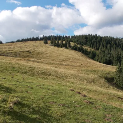 Mountain meadowPadiș PlateauPadișaltitude 1 235 m2.5 km from Biserica MoțuluiPadiș (Hungarian: Pádis) is a karst plateau in the Bihor Mountains, part of Romania's Apuseni (Western Romanian Carpathians), in the south-east of Bihor County.
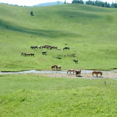 Mountain meadowPoiana PonorBogaaltitude 1 085 m2.6 km from Biserica MoțuluiPoiana Ponor (Hungarian: Ponor-rét) is a closed karst depression on the Padiș plateau in the Bihor Mountains (Apuseni), at about 1,085 m.
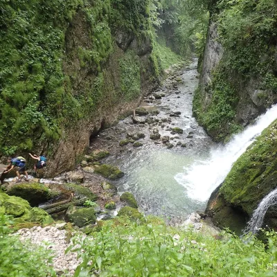 WaterfallEvantai Waterfall (Cascada Evantai)Boga · Bihor-Vlădeasa Mountains6 km from Biserica Moțuluiheight 7–10 m758 m above sea levelEvantai Waterfall (Cascada Evantai, «the Fan») lies in the Galbena Gorge (Cheile Galbenei) in the Bihor Mountains, inside Apuseni Natural Park in Bihor County.
Craft nearby
All craft places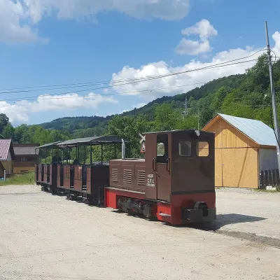 Heritage transportApuseni Narrow-Gauge Train: Câmpeni–Abrud ride in Moți LandVârși36 km from Biserica MoțuluiThe narrow-gauge railway along the Arieș valley was officially opened on 20 June 1912. It linked the town of Turda with mountain Abrud in Țara Moților, the Moți Land —...
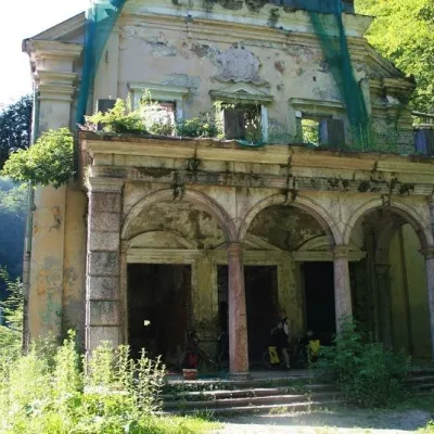 Water parks & thermal poolsMoneasa: warm mesothermal waters in the Codru-Moma MountainsMoneasa39 km from Biserica MoțuluiMoneasa is a small mountain spa in Arad County in western Romania, in the valley of the Moneasa River at the foot of the Codru-Moma Mountains (the western part of the...
