Condition
Not verifiedNo recent reports. Bring a tent and, if you pass by, tell us what you saw.
- 823 m
About
Gorgany range, about 820 m above sea level. Mount Khomiak (1 542 m) is about 2.4 km away. The nearest settlement is Tatariv, about 7.4 km in a straight line. 8 of the site’s trails pass nearby, including “Zhenets tract (Mykulychyn village), via Zhenetskyi Huk Waterfall, Khomiakiv polonyna, Mount Syniak and Mount Malyi Horhan to Polianytsia village”.
The nearest known spring is 250 m away.
On the map
Coordinates: 48.38888, 24.50408
How to get there
Trails nearby
 HardTwo-dayUnmarkedZhenets tract (Mykulychyn village) to Polianytsia villagevia Zhenetskyi Huk Waterfall, Khomiakiv polonyna +2Elevation profile646–1 664 m22.6 kmascent 1 352 m≈ 8.5 h walking
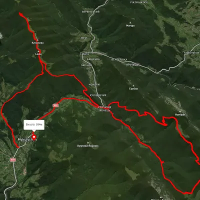 HardMulti-dayUnmarkedMykulychyn village loopvia Mount Yahidna, Mount Lisniv +3Elevation profile590–1 339 m52.6 kmascent 2 052 m
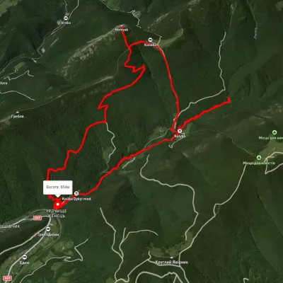 ModerateTwo-dayUnmarkedZhenets tract loopvia Mount Khomiak, Huk WaterfallElevation profile670–1 575 m18 kmascent 1 157 m≈ 7 h walking
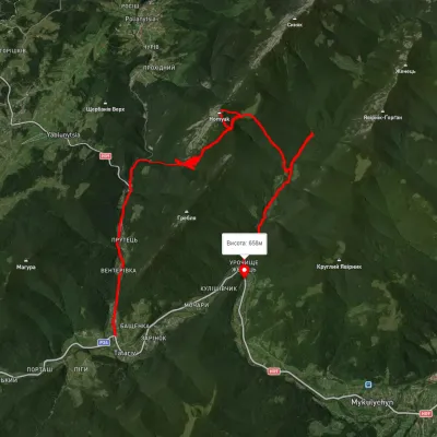 HardTwo-dayUnmarkedTatariv village to Zhenets tract (Mykulychyn village)via Mount Khomiak, Zhenetskyi Huk WaterfallElevation profile645–1 523 m21.9 kmascent 1 124 m≈ 7.5 h walking
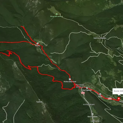 HardTwo-dayUnmarkedZhenets tract loopvia Mount Khomiak, Zhenetskyi Huk WaterfallElevation profile566–1 541 m21.3 kmascent 1 889 m≈ 9 h walking
 HardMulti-dayUnmarkedZhenets tract loopvia Huk Waterfall, Mount Khomiak +1Elevation profile641–1 664 m32.9 kmascent 1 746 m≈ 11.5 h walking
Nearest settlement: Tatariv, about 7.4 km in a straight line.
Report the condition
Been here recently? Tell us what you saw and add photos — your report appears on the page right away with today’s date.
No photos yet — send yours together with a condition report.
