Condition
Not verifiedNo recent reports. Bring a tent and, if you pass by, tell us what you saw.
- 136 m
About
Volcanic Carpathians range, about 140 m above sea level. The nearest settlement is Kamianytsia, about 1.1 km in a straight line. 7 of the site’s trails pass nearby, including “Vorochovo village, via Antalovetska Poliana to Kamianytsia village”.
The nearest known spring is 630 m away.
On the map
Coordinates: 48.68490, 22.40555
How to get there
Trails nearby
 ModerateTwo-dayUnmarkedVorochovo village to Kamianytsia villagevia Antalovetska PolianaElevation profile127–959 m17.5 kmascent 1 171 m≈ 6.5 h walking
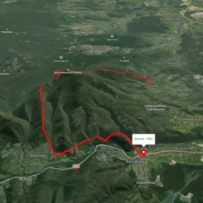 HardTwo-dayUnmarkedYarok village to Nevytske villagevia Antalovetska PolianaElevation profile145–960 m19.9 kmascent 1 081 m≈ 7 h walking
 ModerateTwo-dayUnmarkedKamianytsia village loopvia Mount PlishkaElevation profile129–687 m15.4 kmascent 677 m≈ 5 h walking
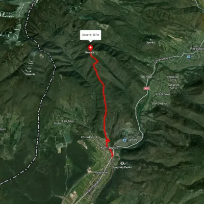 EasyOne-dayUnmarkedKamianytsia village Mount PlishkaElevation profile141–695 m7.2 kmascent 572 m≈ 3 h walking
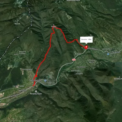 ModerateOne-dayUnmarkedKamianytsia village to Perechyn villagevia Mount PlishkaElevation profile140–694 m12.2 kmascent 601 m≈ 4.5 h walking
 ModerateTwo-dayUnmarkedPerechyn village to Kamianytsia villagevia Antalovetska PolianaElevation profile148–966 m20.6 kmascent 931 m≈ 7 h walking
Nearest settlement: Kamianytsia, about 1.1 km in a straight line.
Report the condition
Been here recently? Tell us what you saw and add photos — your report appears on the page right away with today’s date.
No photos yet — send yours together with a condition report.
