Kamenitsa
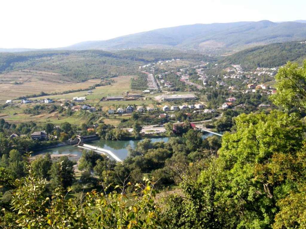
Kamianytsia village is located in the north of Uzhhorod district. The council's territory borders on the village of Novoselytsia to the north, the village of Vorochevo to the northeast, the village of Orikhovytsia to the southeast, and the village of Nevytske to the south.
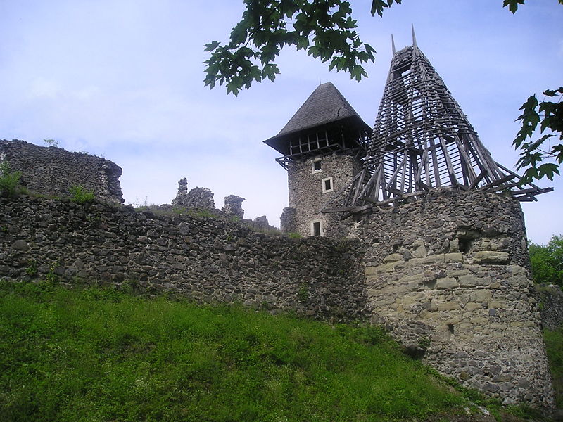
In the historical sources of the XV-XVII centuries, the village of Kamianytsia is known as "Kemenze". The name of the village definitely came from the word "stone," which was quarried here a long time ago, not only for the construction of the Nevytsky castle, but also for export to other places.
Archaeologists claim that on the territory of Kamianytsia village there were campsites of primitive people who lived here in the Mesolithic period (14-5 thousand years ago). The first written mention dates back to 1451. Apparently, the village was founded in the second half of the fourteenth and early fifteenth centuries on the basis of the so-called Voloskyi Law. During this period, Kamianytsia was the property of the counts Druget, who owned the Nevytsky castle.
In 1567, there were only 3 peasant households in Kamianytsia, and in 1599 there were already 15 peasant households and one scholastic household in the village. In 1915, due to devastation, only 7 peasant farms remained in the village. The first train from the city of Uzhhorod through the village of Kamianytsia to the village of Velykyi Bereznyi was in 1893. In 1934, after the construction of the dam on the Uzh River was completed, water was transported from Kamianytsia village to the city of Uzhhorod through a canal, which still drives the turbine of the Onokivska hydroelectric power plant. Even then, Kamyanytsia received electricity.
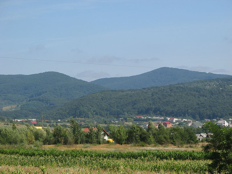
The village is located in the valley of the Uzh River at an altitude of 100 meters above sea level. The village is surrounded by the slopes of the Vyrhlat-Hutyn and Uzhhorod-Khust volcanic ranges. Traces of volcanic activity can be seen almost everywhere. These are the craters of extinct volcanoes on Mount Antalovetska Polyana (968 meters above sea level) and the Eagle's Nest rocks (738 meters above sea level), as well as volcanic lava outcrops in the area of Nevytskyi Castle and on the territory of the Kamianytsia Quarry Management.
In addition, the high mountains of the Vygorlat-Gutynsky ridge in the northwest rise to an altitude of 900-1000 meters (Sokolova Skala - 959 m, Kreminka - 995 m, Wind Rock - 1024 m above sea level). The alpine flowers and grasses of the meadow on Mount Plishka (699 meters above sea level) are pleasing to the eye and heart, and there is also an opportunity to go skiing here.


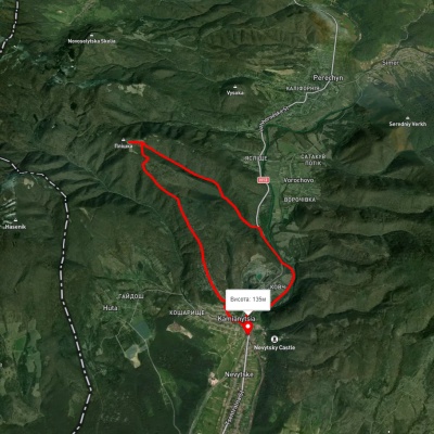
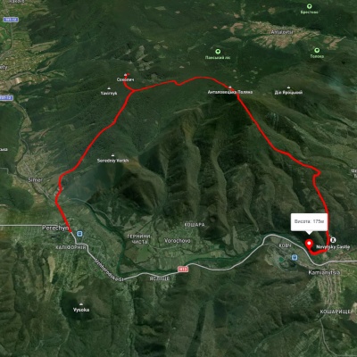
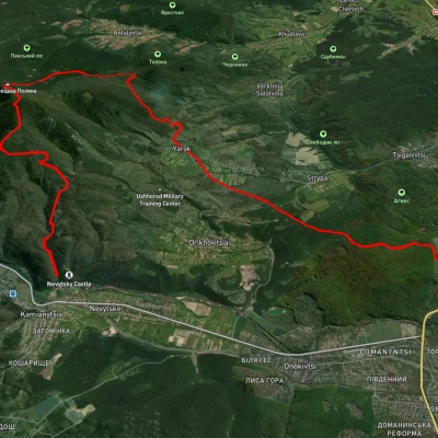
Які туристичні (пішохідні) маршрути проходять через/біля Kamenitsa?
Пропонуємо пройти такі туристичні (пішохідні) маршрути через/біля Kamenitsa: с. Кам'яниця – г. Плішка – с. Кам'яниця, с. Перечин, через Анталовецьку Поляну до с. Кам'яниця, с. Кам'яниця, через Анталовецьку Поляну, с. Ярок до м. Ужгород, с. Ворочево, через Анталовецьку Поляну до с. Кам'яниця, с. Кам'яниця – Анталовецька Поляна – с. Кам'яниця, с. Ярок, через Анталовецьку Поляну до с. Невицьке