Kiczory
Nowy Targ County · Lesser Poland Voivodeship · Poland
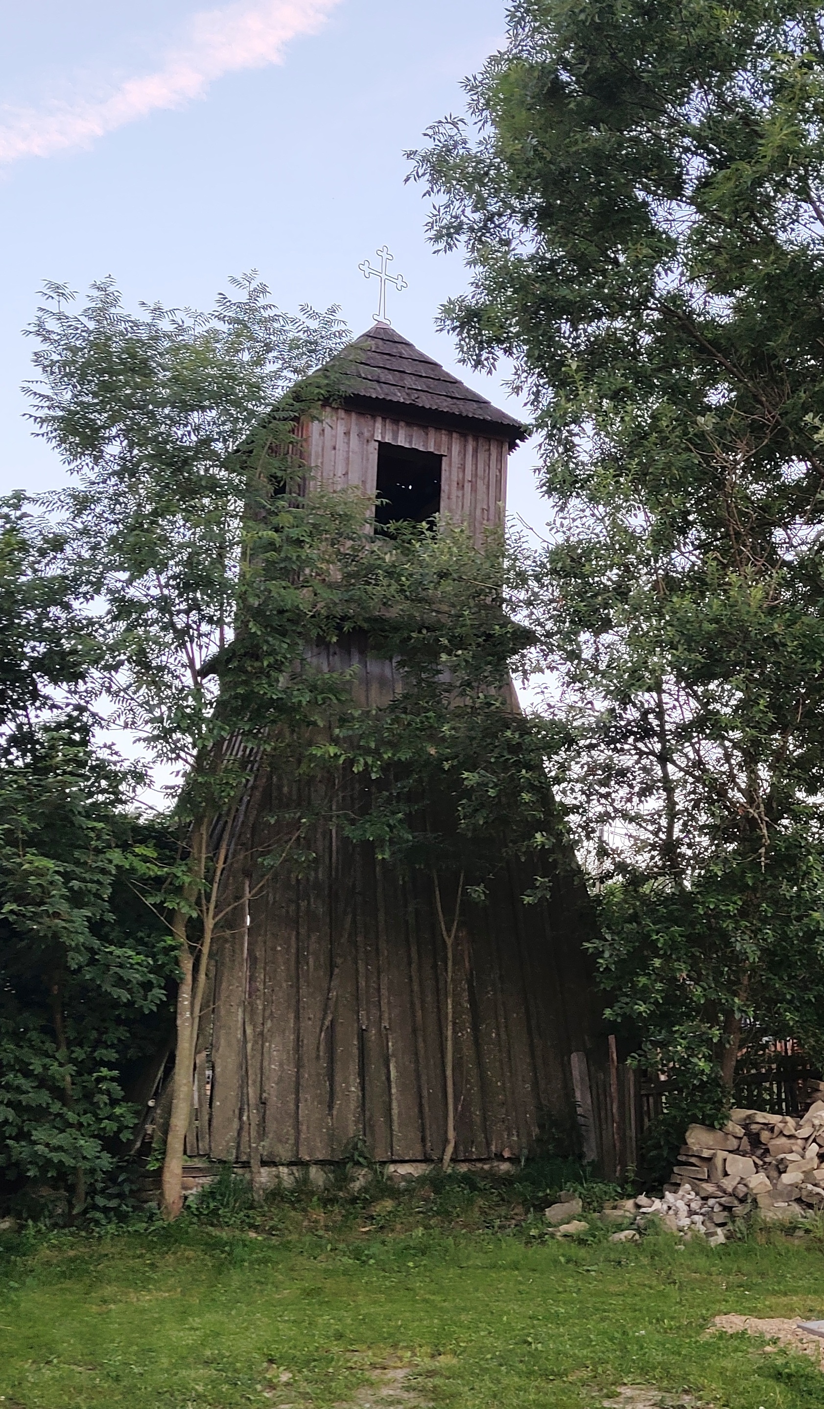
Photos: Kurapazurem, CC BY-SA 4.0 (Wikimedia Commons)
Kiczory is a village in Poland.
Elevation: about 750 m above sea level. Population: 688 (2021). Mountains nearby: Western Carpathians.
Here and nearby on the site: 1 trail, 1 mountain hut or shelter.
Facts: Wikidata, OpenStreetMap. More on Wikipedia
Trails nearby
All trails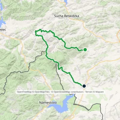 HardMulti-dayMarkedSidzina JabłonkaElevation profile507–1 723 m74.1 kmascent 3 189 munder 1 km from the centre
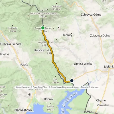 ModerateOne-dayMarkedStańcowe Siodło WiniarczykówkaElevation profile620–939 m12.5 kmascent 272 m≈ 3.5 h walking3.7 km from the centre
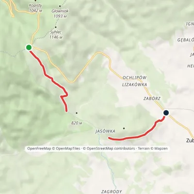 EasyOne-dayMarkedEducational Path "At the Sources of the Black Sea"Elevation profile752–1 026 m4.3 kmascent 80 m≈ 1 h walking4.1 km from the centre
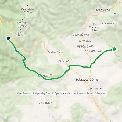 EasyOne-dayMarkedKrowiarki Pass Zubrzyca GórnaElevation profile737–1 026 m9.3 kmascent 377 m≈ 3 h walking4.1 km from the centre
 HardMulti-dayMarkedMain Trail of BeskidyElevation profile309–1 723 m499.9 kmascent 19 519 m5.9 km from the centre
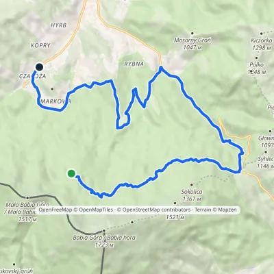 ModerateTwo-dayMarkedZawoja Czatoża Markowe SzczawinyElevation profile684–1 230 m19.1 kmascent 352 m≈ 5.5 h walking6.3 km from the centre
Peaks nearby
All peaks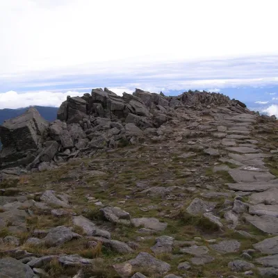 PeakGówniakZawojaaltitude 1 644 m6.2 km from the centreGówniak (also Główniak, Głowniak or Wołowe Skałki — «Ox Rocks») is a 1644 m top on the north-eastern ridge of the Babia Góra massif, in the Babia Góra range.
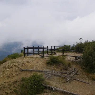 PeakSokolica (Babia Góra)Zawojaaltitude 1 367 m6.3 km from the centre1 trail to the topSokolica is a 1,367 m viewpoint on the north-eastern ridge of the Babia Góra massif in the Żywiec Beskids, in Poland close to the Slovak border.
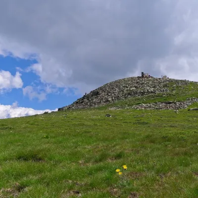 PeakBabia GóraZawojaaltitude 1 723 m6.4 km from the centreBabia Góra (Slovak Babia hora) is a massif on the Polish–Slovak border in the Western Beskids, and also the usual name of its highest summit, Diablak ("Devil's Peak"),...
 PeakMała Babia Góraaltitude 1 517 m8.6 km from the centreMała Babia Góra, also called Cyl (Slovak: Malá Babia hora), is a summit of about 1,517 m in the Babia Góra massif on the Polish–Slovak border.
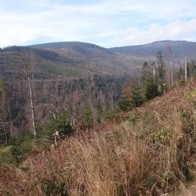 PeakCzernicZubrzyca Górnaaltitude 1 317 m9.5 km from the centreCzernic (on hiking maps also Czyrniec) is a 1317 m summit in the Polica Range in southern Poland. In Jerzy Kondracki's classic physical-geographic division the range...
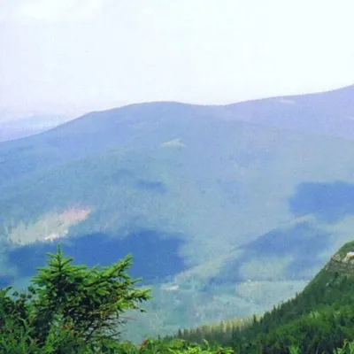 PeakKiczorka (Cyl Hali Śmietanowej)Zawojaaltitude 1 298 m10 km from the centreKiczorka (in guidebooks and on maps Cyl Hali Śmietanowej) is a 1298 m summit in the western part of the Polica Range, west of Polica itself.
What to visit
All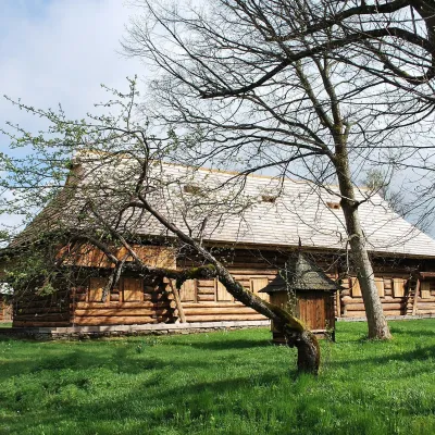 MuseumOrava Ethnographic Park in Zubrzyca GórnaZubrzyca Górna5.5 km from the centreThe Orava Ethnographic Park in Zubrzyca Górna is an open-air museum devoted to the culture of the Polish part of Orava, a historic region on the border with Slovakia.
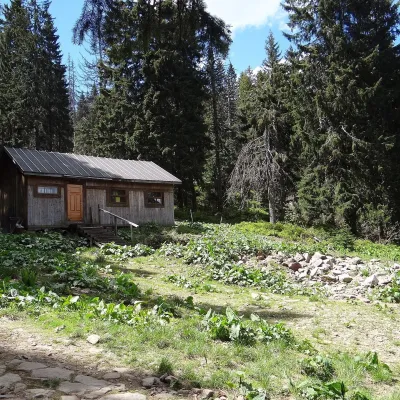 Mountain meadowMarkowe SzczawinyZawojaaltitude 1 180 m8.3 km from the centreMarkowe Szczawiny is a small meadow on the northern slopes of Babia Góra at about 1,180 m, in the commune of Zawoja in Sucha County, within Babia Góra National Park ...
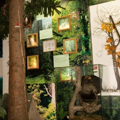 MuseumBabia Góra National Park Permanent Exhibition, ZawojaZawoja10 km from the centreThe permanent exhibition of the Babia Góra National Park (Wystawa Stała Babiogórskiego Parku Narodowego) is housed in the park's headquarters in Zawoja, in the part of...
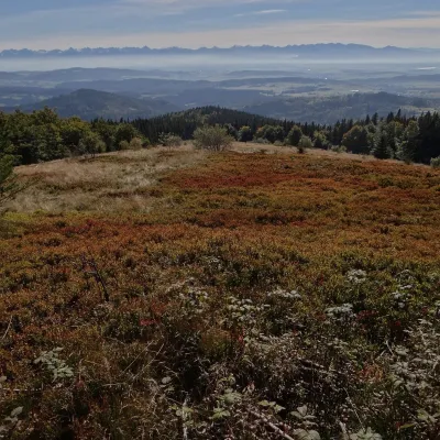 Mountain meadowHala KrupowaSidzinaaltitude 1 152 m11 km from the centreHala Krupowa is a former pasture in the Polica Range (Pasmo Policy) of the Żywiec Beskids (in the newer regionalisation, the Żywiec-Orawa Beskids), above the village...
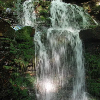 WaterfallWaterfall on the Mosorny PotokZawoja11 km from the centreThe waterfall on the Mosorny Potok (Wodospad na Mosornym Potoku), also called Mosorczyk, is one of the highest natural waterfalls of the Polish Beskids.
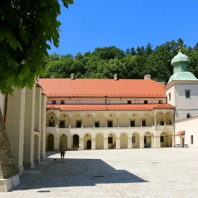 CastleSucha Beskidzka Castle (Little Wawel)Sucha Beskidzka24 km from the centreSucha Castle in the town of Sucha Beskidzka is a Renaissance magnate residence at the foot of Mount Jasień, near the point where the Stryszawka flows into the Skawa.
Craft nearby
All craft places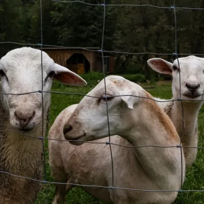 Eco farmsOrawskie Ranczo Educational Farm, Harkabuz: animals and craft workshopsHarkabuz18 km from the centreOrawskie Ranczo is a small family educational farm (zagroda edukacyjna) in the village of Harkabuz near Raba Wyżna, where Orawa meets Podhale.
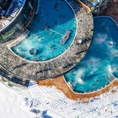 Water parks & thermal poolsChochołowskie TermyChochołów26 km from the centreChochołowskie Termy stand in the village of Chochołów in the Podhale region, north-west of Zakopane and not far from the Slovak border.
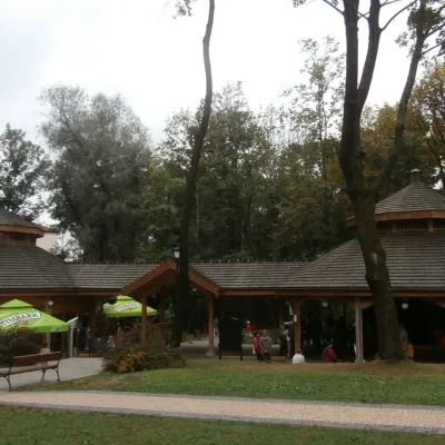 Water parks & thermal poolsRabka-Zdrój spa: brine graduation tower, pump rooms, treatmentsRabka-Zdrój28 km from the centreRabka-Zdrój is a spa in the Raba valley between the Gorce, the Beskid Wyspowy and the Beskid Makowski, halfway from Kraków to Zakopane.
Spas and thermal pools nearby
Water parks & thermal poolsChochołowskie TermyChochołów26 km from the centreChochołowskie Termy stand in the village of Chochołów in the Podhale region, north-west of Zakopane and not far from the Slovak border.Water parks & thermal poolsRabka-Zdrój spa: brine graduation tower, pump rooms, treatmentsRabka-Zdrój28 km from the centreRabka-Zdrój is a spa in the Raba valley between the Gorce, the Beskid Wyspowy and the Beskid Makowski, halfway from Kraków to Zakopane.Huts, shelters and springs nearby
Getting there from Ukraine
Border crossings
- Krakovets – Korczowa — road, 24/7
- Shehyni – Medyka — road, 24/7 Pedestrian crossing is not confirmed by the Ukrainian border service — check dpsu.gov.ua before the trip.
- Smilnytsia – Krościenko — road, 24/7
- Hrushiv – Budomierz — road, 24/7
- Mostyska – Przemyśl (rail) — rail, 24/7
By car
Lviv – Żywiec ≈412 km, ≈5 h 30 min without queues or tolls: M-10 → Krakovets – Korczowa → A4 to Kraków (≈249 km) → DK52 via Wadowice → DW781 and DW946 to Żywiec. ≈333 km, ≈4 h from the border. Alternative via the tolled A4 Kraków – Katowice and the S1 via Tychy and Bielsko-Biała: ≈457 km, ≈5 h 25 min.
Checked 23.10.2026; border crossing hours and timetables change — check before you travel.
