Condition
Not verifiedNo recent reports. Carry water and, if you pass by, tell us what you saw.
- 1 337 m
- Dries out in summer or drought
About
Pokuttia-Bukovina Carpathians range, about 1 340 m above sea level. Mount Khorde (1 479 m) is about 680 m away. The nearest settlement is Volova, about 4.2 km in a straight line. 6 of the site’s trails pass nearby, including “Mykulychyn village, via Mount Khorde, Mount Pozhyzhevska, Mount Hoverla and Mount Kukul to Voronenko village”.
This spring dries out in summer or in dry years, so do not rely on it as your only water.
On the map
Coordinates: 48.27514, 24.71265
How to get there
Trails nearby
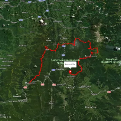 HardMulti-dayUnmarkedMykulychyn village to Voronenko villagevia Mount Khorde, Mount Pozhyzhevska +2Elevation profile585–2 036 m93 kmascent 4 482 m
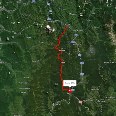 HardMulti-dayUnmarkedVerkhovyna to Tatariv villagevia Mount Bila Kobyla, Mount KhordeElevation profile611–1 461 m38.3 kmascent 1 485 m≈ 12.5 h walking
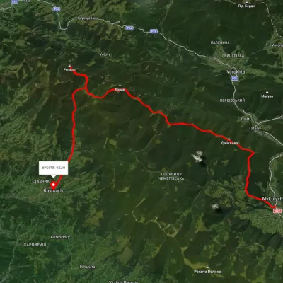 HardMulti-dayUnmarkedMykulychyn village to Kosmach villagevia Mount Khorde, Mount RotyloElevation profile592–1 448 m39.7 kmascent 1 591 m≈ 13 h walking
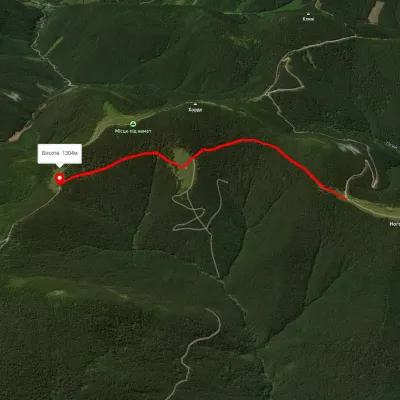 EasyOne-dayMarkedMount Hordia traverse (green)Elevation profile1 270–1 375 m2.5 kmascent 323 m≈ 1.5 h walking
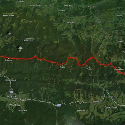 HardMulti-dayUnmarkedVerkhovyna to Mykulychyn villagevia Mount Bila Kobyla, Mount Khorde +1Elevation profile587–1 396 m41.3 kmascent 1 564 m≈ 13.5 h walking
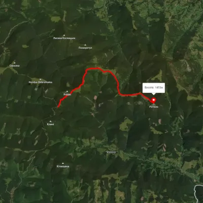 ModerateOne-dayMarkedTo Mount RotyloElevation profile1 210–1 453 m8.5 kmascent 646 m≈ 3.5 h walking
Nearest settlement: Volova, about 4.2 km in a straight line.
Report the condition
Been here recently? Tell us what you saw and add photos — your report appears on the page right away with today’s date.
No photos yet — send yours together with a condition report.
