Spring
Spring below Czarna Turnia
Poland · Western Tatras range · 1 201 m
Condition
Not verifiedNo recent reports. Carry water and, if you pass by, tell us what you saw.
Last edited on the OSM map 07.05.2018
- 1 201 m
- Dries out in summer or drought
About
Western Tatras range, about 1 200 m above sea level. Mount Giewont (1 895 m) is about 1.4 km away. 4 of the site’s trails pass nearby, including “Strążyska Valley – Przełęcz w Grzybowcu”.
This spring dries out in summer or in dry years, so do not rely on it as your only water.
On the map
Coordinates: 49.26023, 19.92064
How to get there
Trails nearby
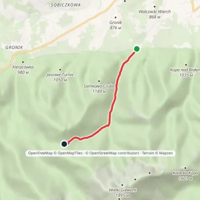 EasyOne-dayMarkedStrążyska Valley Przełęcz w GrzybowcuElevation profile910–1 321 m3.1 kmascent 410 m≈ 1.5 h walking
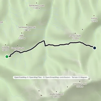 EasyOne-dayMarkedPrzełęcz w Grzybowcu Hala Białevia Polana StrążyskaElevation profile1 032–1 321 m2.8 kmascent 245 m≈ 1 h walking
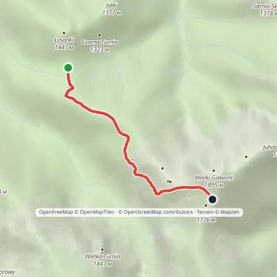 ModerateOne-dayMarkedPass in Grzybowiec Wyżnia Kondracka PassElevation profile1 321–1 769 m2.3 kmascent 448 m≈ 1.5 h walking
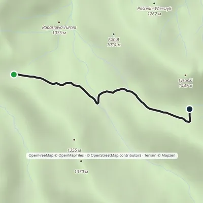 EasyOne-dayMarkedPrzysłop Miętusi Przełęcz w GrzybowcuElevation profile1 167–1 342 m2.1 kmascent 166 m≈ 45 min walking
Report the condition
Been here recently? Tell us what you saw and add photos — your report appears on the page right away with today’s date.
No photos yet — send yours together with a condition report.
