Condition
Not verifiedNo recent reports. Carry water and, if you pass by, tell us what you saw.
- 1 187 m
- Dries out in summer or drought
- Marked as drinkable
About
Borzhava range, about 1 190 m above sea level. Mount Veliky Verkh (1 598 m) is about 1.5 km away. The nearest settlement is Podobovets, about 4.6 km in a straight line. 8 of the site’s trails pass nearby, including “Mizhhiria, via Mount Zhyd-Mahura, Mount Hemba and Mount Velykyi Verkh to Volovets village”.
This spring dries out in summer or in dry years, so do not rely on it as your only water. The water is marked as drinkable on the map, but nobody guarantees its quality.
On the map
Coordinates: 48.64484, 23.25022
How to get there
Trails nearby
 HardMulti-dayUnmarkedMizhhiria to Volovets villagevia Mount Zhyd-Mahura, Mount Hemba +1Elevation profile423–1 597 m55.2 kmascent 2 752 m
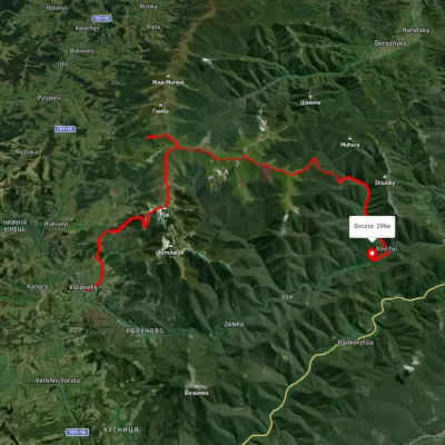 HardMulti-dayUnmarkedVolovets to Vovchyi villagevia Mount Velykyi Verkh, Mount StiyElevation profile285–1 649 m35 kmascent 2 080 m≈ 13 h walking
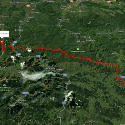 HardMulti-dayUnmarkedSkotarske village to Vilshanske reservoirvia Borzhava polonyna, Palenyi Hrun polonynaElevation profile315–1 504 m72.3 kmascent 3 487 m
 ModerateTwo-dayUnmarkedShypit Waterfall to Volovetsvia Mount Velykyi VerkhElevation profile489–1 570 m15.8 kmascent 1 044 m≈ 6 h walking
 HardTwo-dayUnmarkedVolovets to Shypit Waterfallvia Mount Velykyi VerkhElevation profile525–1 627 m17.6 kmascent 1 639 m≈ 7.5 h walking
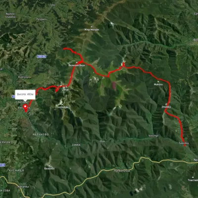 HardMulti-dayUnmarkedSasivka village to Volovetsvia Mount Ivolove, Mount Stiy +3Elevation profile240–1 670 m51.1 kmascent 2 798 m
Nearest settlement: Podobovets, about 4.6 km in a straight line.
Report the condition
Been here recently? Tell us what you saw and add photos — your report appears on the page right away with today’s date.
No photos yet — send yours together with a condition report.
