Condition
Not verifiedNo recent reports. Carry water and, if you pass by, tell us what you saw.
- 928 m
- Dries out in summer or drought
About
Gorgany range, about 930 m above sea level. Mount White Stone Rock (538 m) is about 1.8 km away. The nearest settlement is Yaremche, about 3.5 km in a straight line. 6 of the site’s trails pass nearby, including “Dora hamlet – Bilyi Kamin rock – Mount Syniachka – Shchivka polonyna – Dora hamlet”.
This spring dries out in summer or in dry years, so do not rely on it as your only water.
On the map
Coordinates: 48.49712, 24.54082
How to get there
Trails nearby
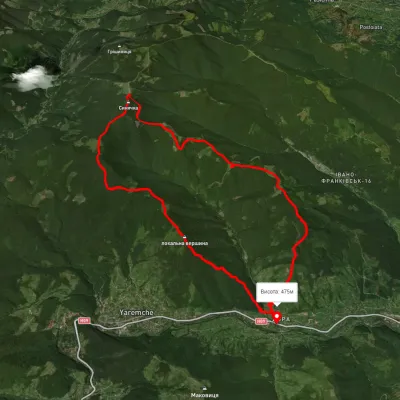 HardTwo-dayMarkedDora hamlet loopvia Bilyi Kamin rock, Mount Syniachka +1Elevation profile476–1 386 m23 kmascent 1 558 m≈ 9 h walking
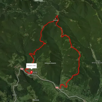 HardMulti-dayUnmarkedDora village to Yaremchevia Mount Syniachka, Chornohorytsia polonynaElevation profile486–1 398 m26.1 kmascent 1 090 m≈ 8.5 h walking
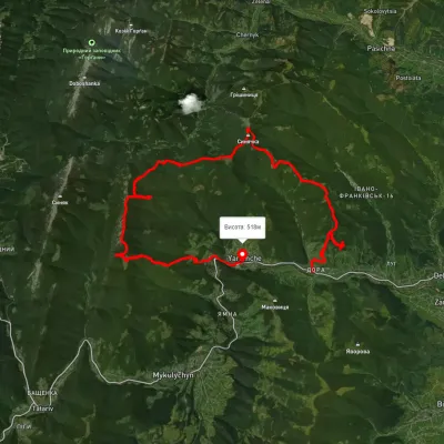 HardMulti-dayUnmarkedDora village to Yaremchevia Mount Syniachka, Pereslip Pass +2Elevation profile476–1 455 m50.1 kmascent 2 345 m
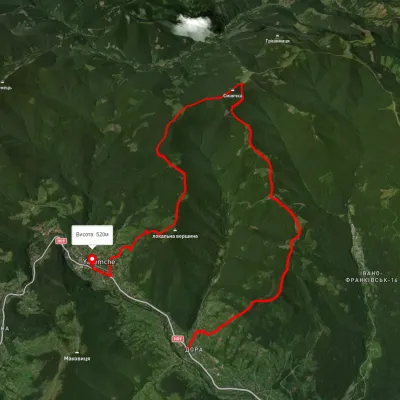 HardTwo-dayUnmarkedDora village to Yaremchevia Mount Syniachka, the Chornohorytsia ridgeElevation profile368–1 396 m22.5 kmascent 1 325 m≈ 8.5 h walking
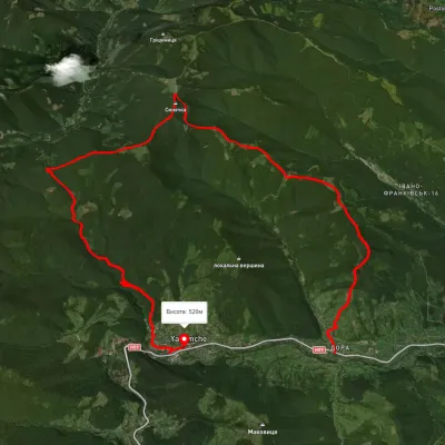 HardMulti-dayUnmarkedDora village to Yaremchevia Mount Syniachka, Pereslip PassElevation profile432–1 402 m24.6 kmascent 1 333 m≈ 9 h walking
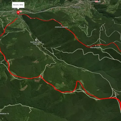 HardTwo-dayUnmarkedDora village loopvia Mount Bilyi Kamin, Mount SyniachkaElevation profile514–1 404 m23 kmascent 996 m≈ 7.5 h walking
Nearest settlement: Yaremche, about 3.5 km in a straight line.
Report the condition
Been here recently? Tell us what you saw and add photos — your report appears on the page right away with today’s date.
No photos yet — send yours together with a condition report.
