Condition
Not verifiedNo recent reports. Carry water and, if you pass by, tell us what you saw.
- 1 300 m
- Dries out in summer or drought
- Marked as drinkable
About
Gorgany range, about 1 300 m above sea level. Mount Moloda (1 723 m) is about 2 km away. The nearest settlement is Synevyr, about 12 km in a straight line. 8 of the site’s trails pass nearby, including “Osmoloda village, via Mount Popadia, Mount Koretvyna, Mount Grofa, Mount Moloda and Mount Yayko-Ilemske to Myslivka village”.
This spring dries out in summer or in dry years, so do not rely on it as your only water. The water is marked as drinkable on the map, but nobody guarantees its quality.
On the map
Coordinates: 48.65002, 23.83981
How to get there
Trails nearby
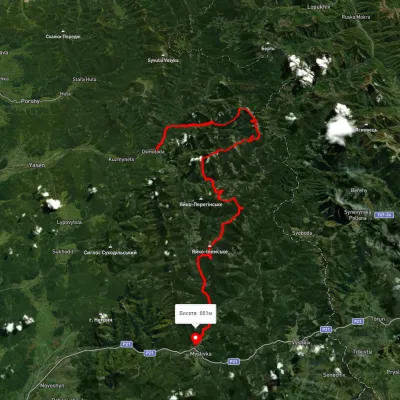 HardMulti-dayUnmarkedOsmoloda village to Myslivka villagevia Mount Popadia, Mount Koretvyna +3Elevation profile660–1 731 m74.8 kmascent 3 739 m
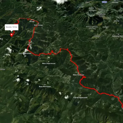 HardMulti-dayUnmarkedMyslivka village to Osmoloda villagevia Mount Yayko-Ilemske, Mount Moloda +2Elevation profile629–1 740 m61.3 kmascent 3 821 m
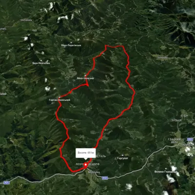 HardMulti-dayUnmarkedMyslivka village loopvia Mount Yayko-Ilemske, Mount Horhan-IlemskyiElevation profile648–1 656 m47.2 kmascent 2 092 m
 HardMulti-dayMarkedEast Carpathian Tourist TrailElevation profile635–1 819 m278.1 kmascent 14 105 m
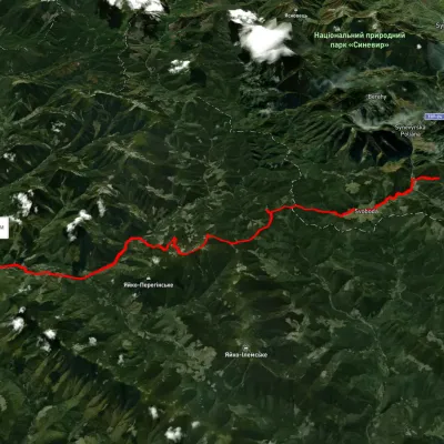 HardMulti-dayUnmarkedLake Synevyr to Osmoloda villagevia Svoboda village, Hycha polonyna +1Elevation profile722–1 712 m32.9 kmascent 1 198 m≈ 10.5 h walking
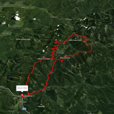 HardMulti-dayUnmarkedMyslivka village loopvia the Arshytsia ridge, Mount Moloda +1Elevation profile645–1 716 m68.8 kmascent 2 965 m
Nearest settlement: Synevyr, about 12 km in a straight line.
Report the condition
Been here recently? Tell us what you saw and add photos — your report appears on the page right away with today’s date.
No photos yet — send yours together with a condition report.
