Condition
Not verifiedNo recent reports. Carry water and, if you pass by, tell us what you saw.
- 700 m
- Dries out in summer or drought
About
Volcanic Carpathians range, about 700 m above sea level. Mount Antalovetska Polyana (968 m) is about 2.1 km away. The nearest settlement is Antalovtsi, about 3.4 km in a straight line. 2 of the site’s trails pass nearby, including “Kamianytsia village, via Antalovetska Poliana and Yarok village to Uzhhorod”.
This spring dries out in summer or in dry years, so do not rely on it as your only water.
On the map
Coordinates: 48.65621, 22.49537
How to get there
Trails nearby
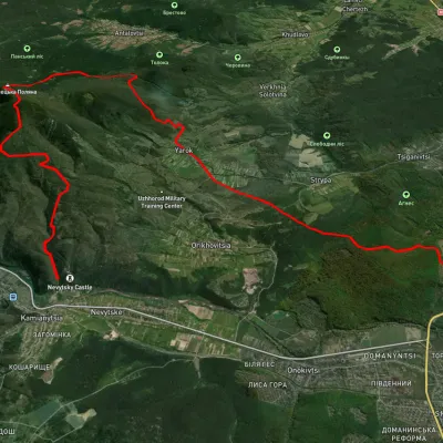 HardMulti-dayUnmarkedKamianytsia village to Uzhhorodvia Antalovetska Poliana, Yarok villageElevation profile118–967 m28.9 kmascent 923 m≈ 9 h walking
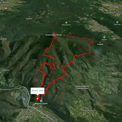 HardTwo-dayUnmarkedKamianytsia village loopvia Antalovetska PolianaElevation profile179–961 m22.8 kmascent 965 m≈ 7.5 h walking
Nearest settlement: Antalovtsi, about 3.4 km in a straight line.
Report the condition
Been here recently? Tell us what you saw and add photos — your report appears on the page right away with today’s date.
No photos yet — send yours together with a condition report.
