Kamianytsia villageloop, via Antalovetska Poliana
Unmarked trailmore
It may be partly marked. Unmarked trails have no information boards, signposts or auxiliary signs (water, campsite, etc.). The decision to walk the trail is entirely your own responsibility.
Trail map
Where to stay nearby
About the trail
Route Kamianytsia village – Antalovetska Poliana – Kamianytsia village. Along the route you will see: Nevytsky Castle, Mount Antalovetska Polyana.
At a glance
A one-day loop route of 22.8 km with 965 m of ascent, starting and finishing at Kamianytsia village. Estimated walking time: about 7.5 h, not counting stops. Difficulty: hard. Waymarking is missing or partial.
Route stages
- 0–3 kmClimb of 350 m (up to 544 m)
- 3–5 kmGentle ups and downs at 520–560 m
- 5–9 kmClimb of 420 m (up to 955 m)
- 9–12 kmDescent of 390 m (down to 567 m)
- 12–20 kmGentle ups and downs at 410–620 m
- 20–23 kmDescent of 230 m to Nevytsky Castle
Steepest kilometre: km 9–11, a descent of 220 m (≈22%).
Water and overnight stays
Springs near the trail: at km 6, 9, 11, 14 and 15. Some springs run low or dry up in late summer.
Places to stay near the start: Uzhhorod.
When to go
The route can be walked most of the year; it is most comfortable from April to October.
Getting there
Start: Kamianytsia village. Most places to stay near the start are in Uzhhorod. This is a loop: it brings you back to the start.
FAQ
- How long does the route take?
- Estimated walking time: about 7.5 h, not counting stops.
- Is there water on the route?
- Springs near the trail: at km 6, 9, 11, 14 and 15. Some springs run low or dry up in late summer.
- Where can I stay overnight?
- Places to stay near the start: Uzhhorod.
Water and shelter on the route
- Spring Masarykakm 5.6 from the start · 260 m off the path · Not verified · 597 m
- Spring below Mount Antalovetska Polianakm 8.5 from the start · 60 m off the path · Not verified · 890 m
- Spring below Mount Antalovetska Poliana (3)km 10.8 from the start · 260 m off the path · Not verified · 700 m
- Spring (Yarok, 11)km 13.5 from the start · Not verified · 610 m
- Spring (Yarok, 8)km 15.3 from the start · 280 m off the path · Not verified · 625 m
Comments
What to see on the trail
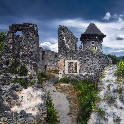 Nevytsky Castlealtitude 132 mNevytsky Castle begins its history in the 12th century, and historical facts indicate that Nevytsky Castle had royal status in 1274.
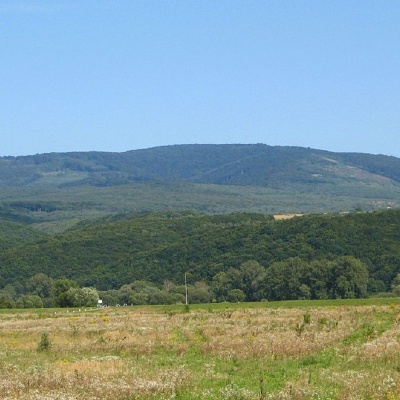 Mount Antalovetska Polyanaaltitude 968 mMount Antalovetska Polyana is a 968-meter high peak of the Ukrainian Carpathians, located in the western part of the Makovets mountain range on the...
Trails nearby
All trails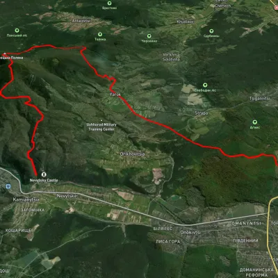 HardMulti-dayUnmarkedKamianytsia village to Uzhhorodvia Antalovetska Poliana, Yarok villageElevation profile118–967 m28.9 kmascent 923 m≈ 9 h walking
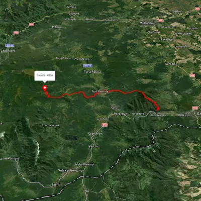 HardMulti-dayMarkedLumshory Nevytske CastleElevation profile176–943 m40.9 kmascent 2 234 m
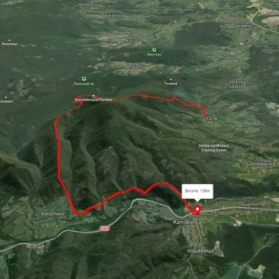 HardTwo-dayUnmarkedYarok village to Nevytske villagevia Antalovetska PolianaElevation profile145–960 m19.9 kmascent 1 081 m≈ 7 h walking