Condition
StandingLatest report: standing, usable as a shelter.
- 1 502 m
- Has a stove
- Sleeps up to 16
- Sometimes locked
About
Chornohora range, about 1 500 m above sea level. Mount Pogrebina (1 605 m) is about 530 m away. The nearest settlement is Khutir Burkut, about 3.1 km in a straight line. 3 of the site’s trails pass nearby, including “Shepit village, via Mount Yarovytsia, Mount Pnivie and Mount Masnyi Pryslip to Shybene village”.
It is a forester’s hut. Inside: a stove, bunks or plank beds. Sleeps up to about 16 people. The nearest known spring is 90 m away. It is sometimes locked. In summer shepherds or foresters may live here — ask for permission.
On the map
Coordinates: 47.93851, 24.73865
How to get there
Trails nearby
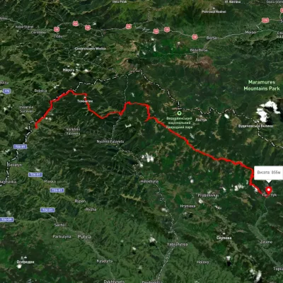 HardMulti-dayUnmarkedShepit village to Shybene villagevia Mount Yarovytsia, Mount Pnivie +1Elevation profile851–1 579 m73.4 kmascent 2 571 m
 HardMulti-dayUnmarkedMount Chyvchyn to Stovpni Horishni villagevia the Pnivie ridge, the Vatunarka ridge +1Elevation profile1 001–1 575 m32.5 kmascent 1 618 m≈ 11.5 h walking
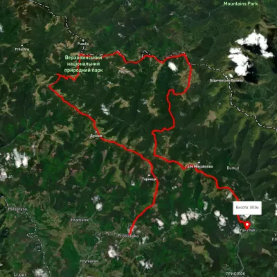 HardMulti-dayUnmarkedProbiinivka village to Shybene villagevia Mount Tarnytsia, Mount Pnivie +1Elevation profile793–1 749 m68.4 kmascent 2 917 m
Nearest settlement: Khutir Burkut, about 3.1 km in a straight line.
Report the condition
Been here recently? Tell us what you saw and add photos — your report appears on the page right away with today’s date.
No photos yet — send yours together with a condition report.
