Shepit village — to Shybene village, via Mount Yarovytsia, Mount Pnivie, Mount Masnyi Pryslip
Unmarked trailmore
It may be partly marked. Unmarked trails have no information boards, signposts or auxiliary signs (water, campsite, etc.). The decision to walk the trail is entirely your own responsibility.
Trail map
Where to stay nearby
About the trail
Route Shepit village, via Mount Yarovytsia, Mount Pnivie and Mount Masnyi Pryslip to Shybene village. Along the route you will see: Church of St. Elijah, Shepit, Carpathian Pamir, Sarata, Mount Yarovytsia, Mount Pnivie, Mount Baba Liudova, Mount Masny Prislip.
At a glance
A multi-day route of 73.4 km with 2,571 m of ascent from Shepit village to Shybene village. Estimated time: 3 days of 6–9 h of walking (about 22.5 h in total, not counting stops). Difficulty: hard. Waymarking is missing or partial.
Route stages
- 0–17 kmClimb of 680 m to Mount Tomnatyk (1,565 m)
- 17–23 kmGentle ups and downs at 1,390–1,560 m, past Mount Yarovytsia
- 23–33 kmDescent of 530 m (down to 947 m)
- 33–36 kmClimb of 550 m to Mount Pryluchna (1,646 m)
- 36–66 kmGentle ups and downs at 1,370–1,580 m, past Mount Pnivie, Mount Baba Liudova, Mount Masny Prislip
- 66–73 kmDescent of 660 m to Shybene village
Steepest kilometre: km 33–34, a climb of 260 m (≈24%).
Water and overnight stays
Springs near the trail: at km 11, 14, 17, 20, 24, 31, 33, 34, 37 and 42 etc.. There are no springs between km 0 and 11 — carry at least 2 l of water.
Huts and shelters near the trail: Shepherds' hut below Mount Tomnatyk (km 17), Border guards' hut on Mount Tomnatyk (km 18), Hut below Mount Malyi Temnatyk (km 20), Hut on Polonyna Preluchnyi (km 34), Preluchnyi tourist shelter (km 35), Hut on Polonyna Hlystovata (km 42), Mountain shelter (Hramotne, 2) (km 55), Hut (Hramotne) (km 55) etc.. Places to stay near the start: Shepit.
A possible split into days:
- Day 1: km 0–20, ≈6 h — overnight: Hut below Mount Malyi Temnatyk (hut)
- Day 2: km 20–42, ≈7.5 h — overnight: Hut on Polonyna Hlystovata (hut)
- Day 3: km 42–73, ≈9 h — finish
When to go
Best time: May to October. In winter deep snow is possible, so experience and winter gear are needed. About 17 km of the route runs above 1,500 m, where the weather changes quickly — check the forecast.
Getting there
Start: Shepit village. Most places to stay near the start are in Shepit. This is a one-way route: the finish is 40 km from the start in a straight line, so plan your way back in advance.
FAQ
- How long does the route take?
- Estimated time: 3 days of 6–9 h of walking (about 22.5 h in total, not counting stops).
- Is there water on the route?
- Springs near the trail: at km 11, 14, 17, 20, 24, 31, 33, 34, 37 and 42 etc.. There are no springs between km 0 and 11 — carry at least 2 l of water.
- Where can I stay overnight?
- Huts and shelters near the trail: Shepherds' hut below Mount Tomnatyk (km 17), Border guards' hut on Mount Tomnatyk (km 18), Hut below Mount Malyi Temnatyk (km 20), Hut on Polonyna Preluchnyi (km 34), Preluchnyi tourist shelter (km 35), Hut on Polonyna Hlystovata (km 42), Mountain shelter (Hramotne, 2) (km 55), Hut (Hramotne) (km 55) etc.. Places to stay near the start: Shepit. Possible overnight stops: Hut below Mount Malyi Temnatyk (km 20), Hut on Polonyna Hlystovata (km 42).
Water and shelter on the route
- Spring (Sarata, 10)km 10 from the start · 50 m off the path · Not verified · 1 229 m
- Spring (Sarata, 9)km 13.4 from the start · 150 m off the path · Not verified · 1 454 m
- Shepherds' hut below Mount Tomnatykkm 15.2 from the start · 60 m off the path · Standing · 1 501 m
- Spring (Sarata, 8)km 15.5 from the start · 110 m off the path · Not verified · 1 501 m
- Border guards' hut on Mount Tomnatykkm 16.3 from the start · Not verified · 1 539 m
- Hut below Mount Malyi Temnatykkm 18.1 from the start · Standing · 1 403 m
- Spring below Mount Yarovytsia (4)km 18.1 from the start · Not verified · 1 406 m
- Spring below Mount Yarovytsia (2)km 21.9 from the start · 160 m off the path · Not verified · 1 481 m
- Spring (Sarata, 5)km 28.9 from the start · Not verified · 1 018 m
- Mineral spring (Sarata)km 29.6 from the start · Not verified · 1 044 m
- Spring (Sarata)km 30.2 from the start · Not verified · 1 061 m
- Spring below Mount Pryluchna (3)km 31.6 from the start · Not verified · 1 358 m
- Hut on Polonyna Preluchnyikm 31.8 from the start · 40 m off the path · Not verified · 1 353 m
- Preluchnyi tourist shelterkm 31.9 from the start · Not verified · 1 370 m
- Spring below Mount Pryluchnakm 34.1 from the start · 60 m off the path · Not verified · 1 539 m
- Hut on Polonyna Hlystovatakm 38.9 from the start · 60 m off the path · Not verified · 1 442 m
- Spring (Holoshyna)km 38.9 from the start · 250 m off the path · Not verified · 1 451 m
- Spring “Hutsul”km 41.2 from the start · 230 m off the path · Not verified · 1 472 m
- Spring (Hramotne, 4)km 50.3 from the start · Not verified · 1 403 m
- Mountain shelter (Hramotne, 2)km 50.6 from the start · 230 m off the path · Not verified · 1 417 m
- Hut (Hramotne)km 51 from the start · 220 m off the path · Not verified · 1 453 m
- Spring (Hramotne, 2)km 51.9 from the start · Not verified · 1 491 m
- Spring below Mount Baba-Liudova (2)km 52.4 from the start · Not verified · 1 526 m
- Spring below Mount Baba-Liudovakm 54.5 from the start · 280 m off the path · Not verified · 1 503 m
- Spring below Mount Masnyi Pryslipkm 56.1 from the start · 100 m off the path · Not verified · 1 454 m
- Hut at Ozirnyikm 57.9 from the start · 230 m off the path · Not verified · 1 426 m
- Spring below Mount Pohrebyna (2)km 58.8 from the start · Not verified · 1 515 m
- Forester's hut on Polonyna Mykhailovakm 58.9 from the start · Standing · 1 502 m
- Spring below Mount Pohrebynakm 61.9 from the start · 130 m off the path · Not verified · 1 432 m
- Hut on Polonyna Lukvytsiakm 62 from the start · 60 m off the path · Standing · 1 436 m
- Hut (Khutir Burkut)km 62 from the start · 80 m off the path · Not verified · 1 434 m
Comments
What to see on the trail
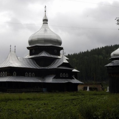 Church of St. Elijah, Shepitaltitude 974 mElias Church, is located in the village of Shepit in the middle of the Bukovinian Carpathians.
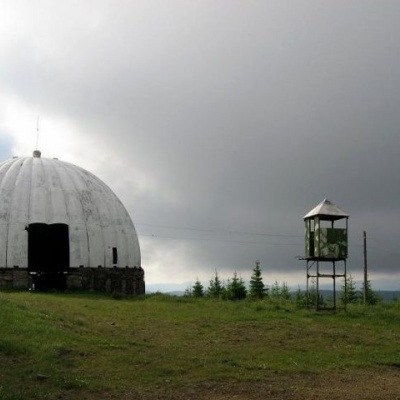 Carpathian Pamir, Sarataaltitude 1 188 mFrom the 1960s until the mid-1990s, a secret radar station operated on one of the highest peaks of the Bukovyna Carpathians, Mount Tomnatyk.
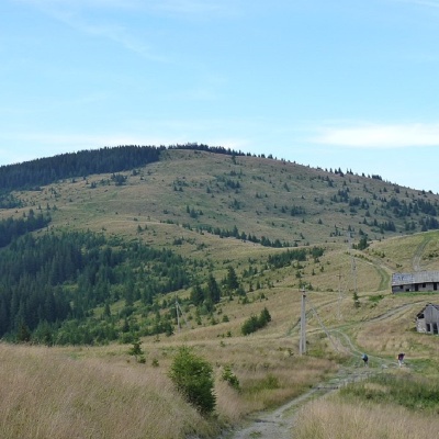 Mount Yarovytsiaaltitude 1 566 mYarovytsia is the peak of the Yalovychora Mountains in the Ukrainian Carpathians, located on the Yarovets Ridge , which is one of the southernmost...
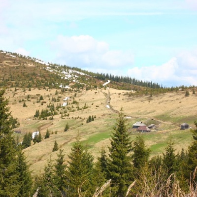 Mount Pniviealtitude 1 586 mPnivie (also known as Pnevi and Pnevie) is a 1586-meter peak in the Hryniavskyi mountain range of the Ukrainian Carpathians, located in the...
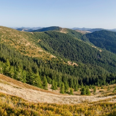 Mount Baba Liudovaaltitude 1 582 mBaba Liudova (also known as Baba Ludova) is a peak on the Pneve ridge, which is located in the Hryniavsky Mountains of the Ukrainian Carpathians.
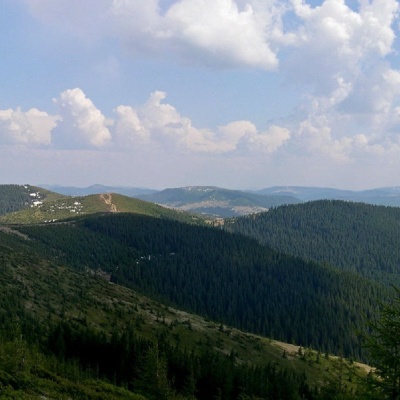 Mount Masny Prislipaltitude 1 581 mMasnyi Pryslip is a peak of the Ukrainian Carpathians, which is located within the Hryniava mountain range.
Trails nearby
All trails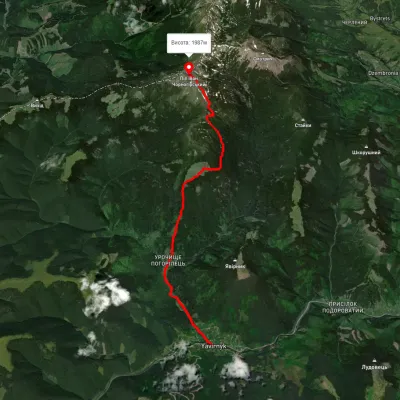 ModerateOne-dayMarkedShybene village Mount Pip Ivanvia Vesnarka polonyna, Lake MaricheikaElevation profile856–2 002 m11 kmascent 1 565 m≈ 6 h walking
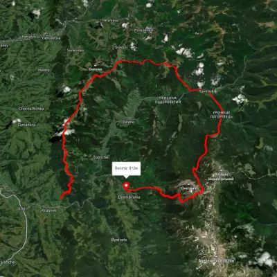 HardMulti-dayUnmarkedKrasnyk village to Dzembronia villagevia Mount Krynta, Mount Zmiinska +3Elevation profile741–1 799 m48.9 kmascent 2 606 m
 HardMulti-dayUnmarkedShybene village to Zaroslyak basevia Mount Pip Ivan Chornohirskyi, Mount Brebeneskul +1Elevation profile845–2 019 m30.9 kmascent 1 876 m≈ 11.5 h walking