Carpathian Pamir, Sarata
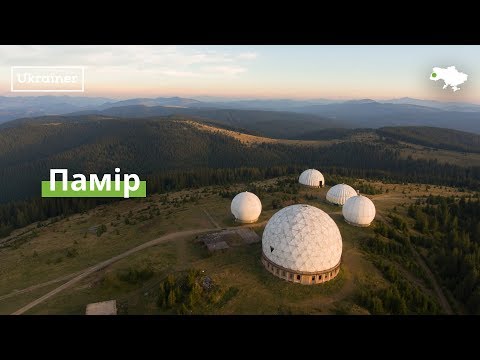
From the 1960s until the mid-1990s, a secret radar station operated on one of the highest peaks of the Bukovyna Carpathians, Mount Tomnatyk. The secret military facility was located at an altitude of 1565 meters in the mountains for a reason. The border with Romania runs nearby. At the height of the Cold War with the Western world, the USSR built a military station that was supposed to provide radar coverage of a vast territory, from the Turkish coast to the Baltic Sea.
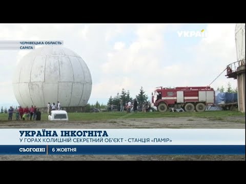
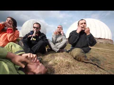
On November 5, 1995, the Pamir military base ceased to exist. Today, only a few tourists walk the territory of the abandoned military facility, and animals are also frequent "guests" here. Local authorities have only recently paid attention to the tourist potential of this area. And for the second time, they held an annual ethnic festival here, which brought together about a thousand guests and tourists.
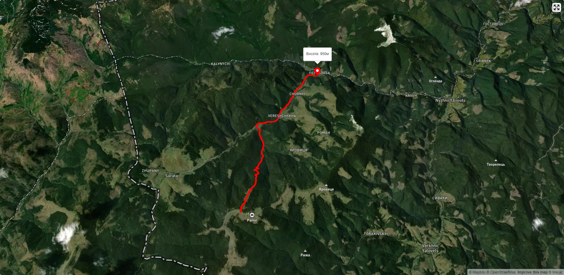
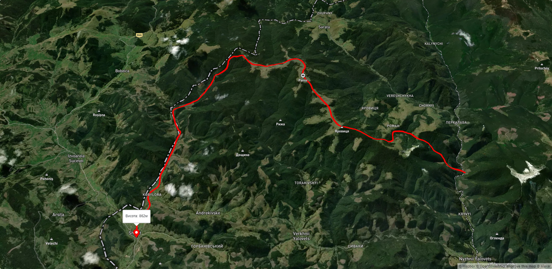
About 15 kilometers of mountain road leads from Shepot to the former Pamir radar station. An ordinary car or tourist bus will not be able to cover this distance. Here you can transfer to a truck. Some tourists hire off-road vehicles from local residents. It takes about two hours to drive along the mountain road.
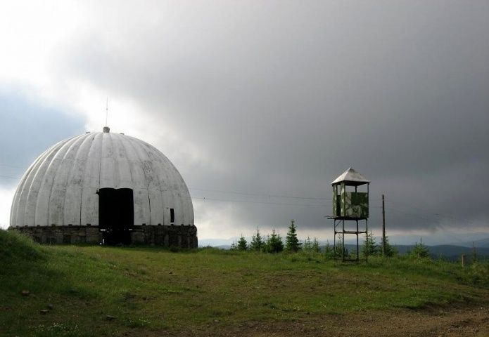
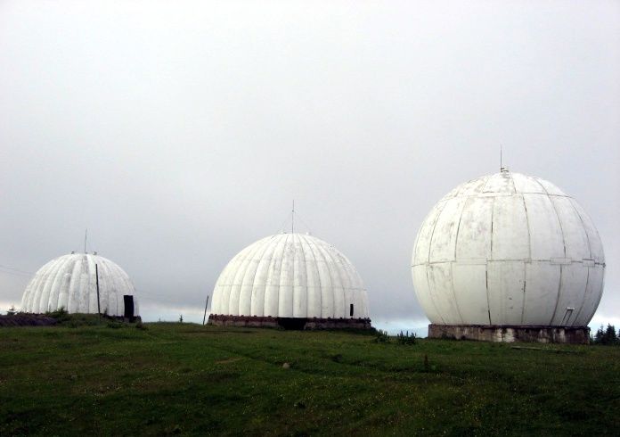
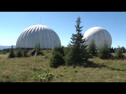
About a kilometer before the station , a clearingoffers an amazing view of an abandoned military facility - 5 white domes. Already at the entrance to the station itself, the military domes, which housed radar antennas, impress with their scale and abandonment at the same time.
Traces of cattle grazing are visible everywhere on the territory of the former station. And the cattle themselves sometimes went in and out of the abandoned domes. Two domes of the former radar station are painted in the colors of Ukrainian ornamentation. Regional officials promise to paint three more domes in the coming years.
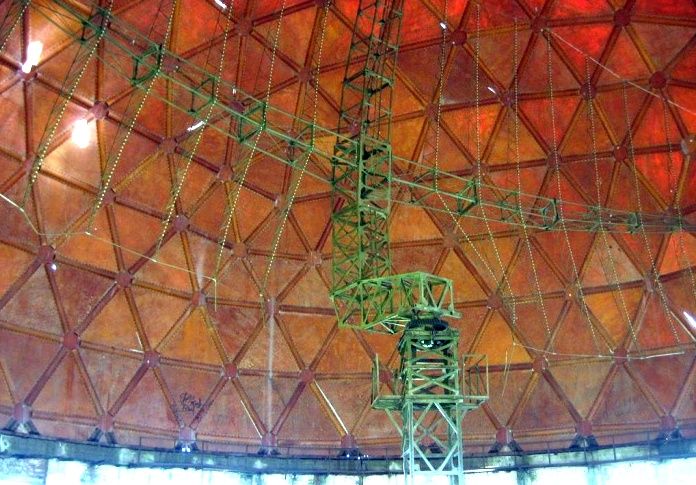
"The station was on combat duty around the clock. The largest dome housed Dubrava-5N84 (one of the most powerful mobile radar stations in the Soviet Union's air defense - author's note)," says the former military man. "The far dome housed P-18 (a long-range aircraft detection station, in service with the Soviet army since 1971, and in service with the Russian army until 2007 - author's note). The other two domes housed an altimeter, and the smallest dome housed operators who made friend-or-foe requests. A little further, we had a shop, a small hotel, an officer's house, and a barracks. There were 60-70 soldiers on duty and living here all the time. We were always understaffed. There should have been about 120 people," Vitalii Novikov continues his story, "We had vehicles here - ATC-59G tractors (a Soviet tracked high-speed artillery tractor, discontinued in the 1980s - author), a GT-S vehicle (a Soviet tracked snowmobile transporter - author), a T-75 tractor that cleared the road. We also had three ZIL trucks, one for water, another for shopping, and another for flatbeds.
We had our own diesel power plant here. We ran on our own diesel engines. When the power went out due to weather conditions or for some other reason, we continued to work. There were separate diesel engines that served the officers' houses, checkpoints, and the entire military camp. And in special bunkers, there were diesel engines that ensured the operation of the station. I was a driver-mechanic of the ATC-59G tracked tractor and a diesel engineer at the diesel power plant. I had a utility room, and sometimes I slept there near the diesel power plant. As soon as I saw that the power was out, I would immediately turn on the diesel engines."
After the collapse of the Soviet Union, Ukraine became not only independent, but also responsible for the enormous military legacy of the "red empire." Dealing with this Soviet legacy was too difficult for the then-collapsed Ukrainian economy. So gradually, the Pamir radar station ceased to operate. The military facility was closed and the equipment was taken away.
Only empty, abandoned domes and one huge P-14 Lena antenna remained. And dilapidated administrative buildings. By the way, Jamala, the winner of the 2016 Eurovision Song Contest, filmed a music video for her song "1944" at the Domes. Last year, the Chernivtsi Regional State Administration launched an annual ethnic festival here.
"Now we are in one of the most beautiful places not only in our region, but probably in the whole country - on Mount Tomnatyk," says Volodymyr Furdyga, head of the Tourism Department of the Chernivtsi Regional State Administration. "Despite the difficult and long way to the former Pamir radar station, more and more tourists are learning about this amazing place and coming here.
If hostels and hotels were built here, and a road were made, many tourists would come here, because there is so much to see. We just need to put everything in order.
A trip to the Pamirs, to the village of Sarata in the Putyla district of the Chernivtsi region, could become a popular tourist route in the future. Though not for everyone, but only for a certain caste of daredevils who want something new and extreme. In two days, you can see several remarkable tourist sites: Mount Tomnatyk, the Pamir radar station, Rudolf's Gap, Gorny Oko Lake, and the almost completed hydroelectric power plants on the White Cheremosh and its tributaries.
Traditionally, tourists travel to the Pamirs by jeep, as there is no bus service, and only very brave people and strong "steel horses" can travel the roads. The roads on the Chernivtsi side are slightly better than on the Frankivsk side.
Tourist sites that can be seen on the route to Pamir
- Tomnatyk (altitude 1565.3) is a mountain in the Ukrainian Carpathians, in the Yalovychorski Mountains. It is located within the Putyla district of Chernivtsi region, northeast of the village of Sarata. On the top of the mountain is an abandoned Soviet air defense base - "Pamir". The peak is unforested, the slopes are relatively gentle; the foot of the mountain is covered with forest. The mountain offers magnificent 360-degree views - the highest peaks of the Romanian Mountains are visible.
- The Pamir radar (1950-1995 ) is a radio-location military station that was created in the USSR to accurately determine the angle of the target and its height in the sky. It is located on Mount Tomnatyk. The largest of the domes still has a radar antenna "P-14 Lena". Half a century ago, it was a top secret miracle of technology, but even now the principle of operation of the radar itself is considered a state secret!
- MountainEye (Bukovynian Eye ) is a lake in the Ukrainian Carpathians, in the Yalovychorska Mountains. It is located within the Putyla district of Chernivtsi region, about 1.5 km east of the village of Nyzhniy Yalovets. The lake lies at an altitude of 1000 m above sea level. It has an oval shape and is about 100 m long. The maximum depth of the lake is 6 m. It was formed due to a landslide of clay rocks that blocked the channel of a small stream, a tributary of the Yalovychora River. Lots of newts
- Klausa "Crown Prince Rudolf " is a picturesque lake located in Perkalaba. Nearby there is also a hydrogen sulfide spring with healing and very tasty water. The depth of the lake is about 1-1.5 meters, so you can sail on rafts or catamarans without any problems.
- Chornyi Dil is a ridge in the Yalovychorskie Mountains, within the Putyla district. It stretches from south to north between the Perkalab and Sarata rivers (the source of the White Cheremosh). The Ukrainian-Romanian border runs along the southern part of the ridge. The highest points of the Bukovyna Carpathians are located here - the mountains Yarovytsia (1574 m), Zhupany (1488 m), Chornyi Dil (1452 m), and Lungul (1377 m).
- "The Molochni Braty is the second deepest cave in Bukovyna (depth - 38 m, length - 56 m). It is a geological reserve of national importance. It is located in the south of the Putyla district of Chernivtsi region, west of the village of Saraty, in the Chornyi Dil massif of the Yalovychora Mountains.
In this wonderful remote corner of Bukovyna, the very edge of the Ukrainian Carpathians, you can gather in a circle of like-minded people to pick mushrooms, berries, herbs and relax in the bosom of wild nature. Here, in the mountains, nothing has changed significantly: shepherds continue to live their usual mountain life, and the silent white balloons once again remind us of the difficult and harsh past of former conscripts who once lived here, at an altitude of more than 1500 meters...
Despite the fact that in recent years the Pamir Radar has gradually turned into a shelter from the weather for sheep and tourists, various events are periodically held here on the top of Mount Tomnatik. In particular, the Pamir FEST tourist festival, which features live music, a night disco, a fair, Bukovinian cuisine, intellectual and entertaining games, and much more. In general, the range of tourism types that could be successfully developed in the Ukrainian Carpathians is very wide. It is primarily a matter of investment and a balanced advertising policy.
Accommodation around Carpathian Pamir, Sarata:

Які маршрути проходять повз Carpathian Pamir, Sarata?
Пропонуємо пройти такі туристичні (пішохідні) маршрути через/біля Carpathian Pamir, Sarata: с. Нижній Яловець, через г. Яровиця до с. Шипіт, с. Шепіт – г. Яровиця, с. Шепіт, через г. Яровиця, г. Пнів'є, г. Масний Присліп до с. Шибене, с. Шепіт, через г. Яровиця, г. Пнів'є, г. Тарниця до с. Пробійнівка, Перкалаба - Томнатик, Верещиха - г. Яровиця

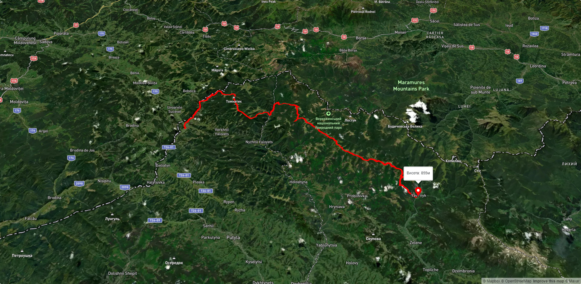
с. Нижній Яловець, через г. Яровиця до с. Шипіт
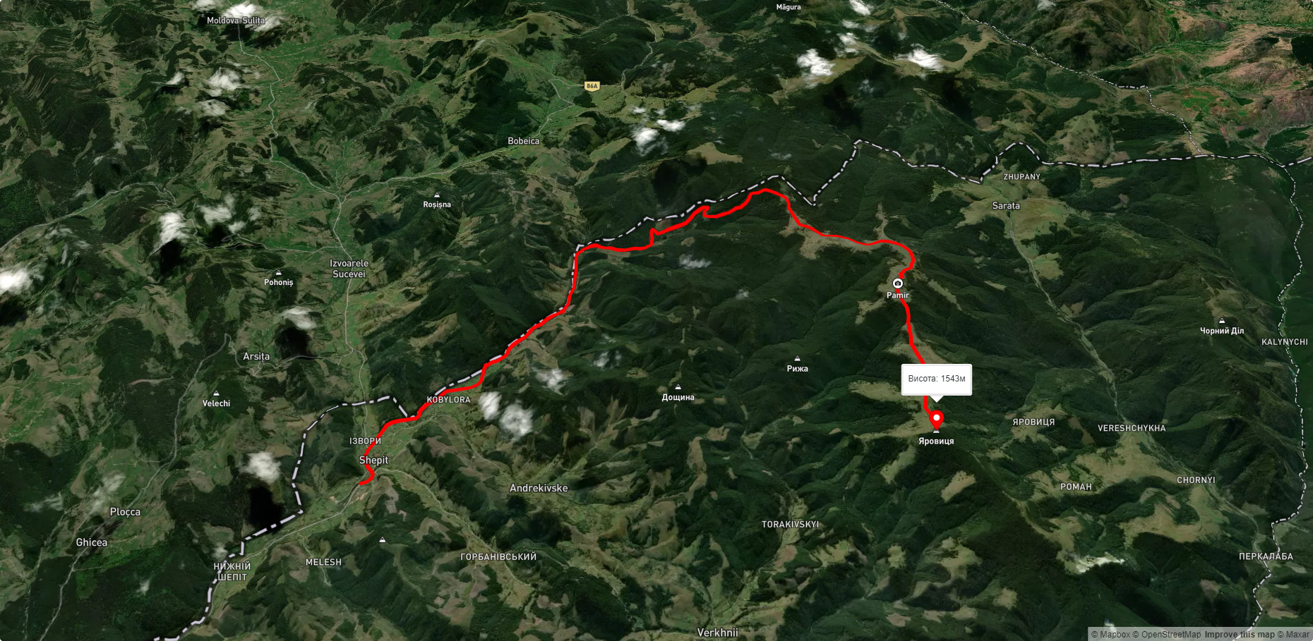
с. Шепіт – г. Яровиця
с. Шепіт, через г. Яровиця, г. Пнів'є, г. Масний Присліп до с. Шибене
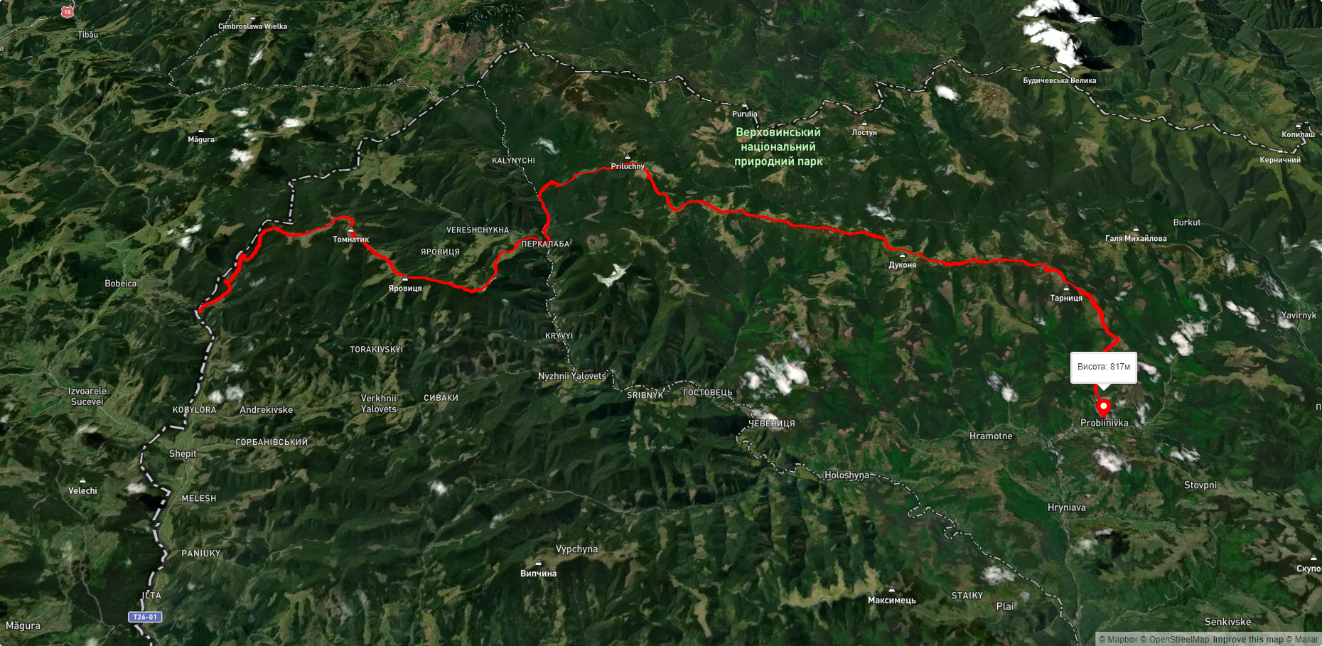
с. Шепіт, через г. Яровиця, г. Пнів'є, г. Тарниця до с. Пробійнівка