Condition
Weak flowWeak flow — slow to fill, may disappear in hot weather.
- 1 526 m
- Dries out in summer or drought
- Marked as drinkable
About
Marmarosy range, about 1 530 m above sea level. The nearest settlement is Breboia, about 9.3 km in a straight line. 8 of the site’s trails pass nearby, including “Yasinia, via Mount Petros, Mount Hoverla, Mount Pip Ivan Chornohirskyi and Mount Mika-Mare to Bohdan village”.
This spring dries out in summer or in dry years, so do not rely on it as your only water. The flow is weak: filling a bottle takes time. The water is marked as drinkable on the map, but nobody guarantees its quality.
On the map
Coordinates: 47.96833, 24.42258
How to get there
Trails nearby
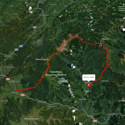 HardMulti-dayUnmarkedYasinia to Bohdan villagevia Mount Petros, Mount Hoverla +2Elevation profile528–2 042 m79.3 kmascent 3 765 m
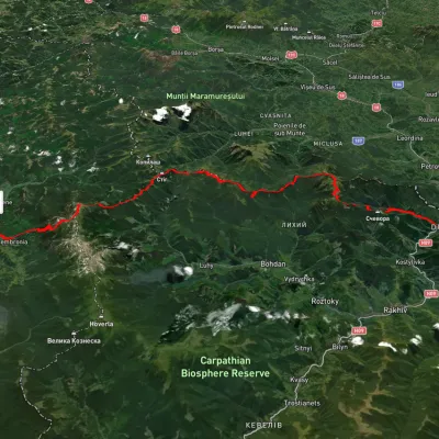 HardMulti-dayUnmarkedDilove village to Dzembronia villagevia Mount Pip Ivan Marmaroskyi, Mount Pip Ivan ChornohirskyiElevation profile356–2 015 m71.7 kmascent 3 720 m
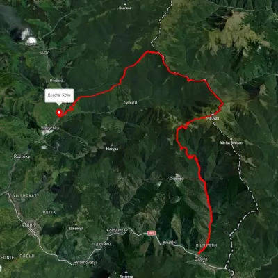 HardMulti-dayUnmarkedDilove village to Bohdan villagevia Mount Pip Ivan MarmaroskyiElevation profile354–1 903 m42.4 kmascent 2 158 m
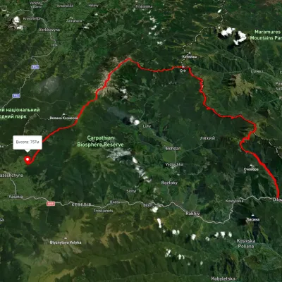 HardMulti-dayUnmarkedDilove village to Lazeshchyna villagevia Mount Pip Ivan Marmaroskyi, Mount Mika-Mare +2Elevation profile354–2 002 m88.8 kmascent 4 087 m
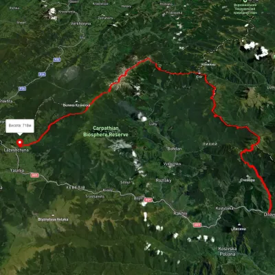 HardMulti-dayUnmarkedDilove village to Lazeshchyna villagevia Mount Pip Ivan Marmaroskyi, Mount Pip Ivan Chornohirskyi +1Elevation profile362–2 013 m107.6 kmascent 4 329 m
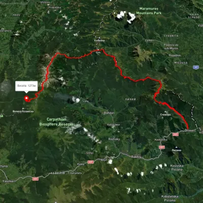 HardMulti-dayUnmarkedDilove village to Zaroslyak basevia Mount Pip Ivan Marmaroskyi, Mount Pip Ivan Chornohirskyi +1Elevation profile358–2 008 m75.1 kmascent 4 023 m
Nearest settlement: Breboia, about 9.3 km in a straight line.
Report the condition
Been here recently? Tell us what you saw and add photos — your report appears on the page right away with today’s date.
No photos yet — send yours together with a condition report.
