Buila Peak
Buila Peak (rom. Vârful Buila) is a 1,848 m summit in the limestone Buila-Vânturarița massif, part of the Căpățânii Mountains (Southern Carpathians), in Vâlcea County. On the same ridge nearby stands Vânturarița Mare. The closest villages are Pietreni (about 7.1 km as the crow flies), Gurguiata (about 8 km), Bistrița and Bărbătești (about 8.5 km). About 1.2 km below the summit, the map shows Curmătura Builei Hut and Piscul cu Brazi Hut.
Getting there / routes
The main ridge route of the massif is marked with a red stripe: “Prislop valley — Cacova mountain — Piatra peak — Curmătura Builei saddle — Vânturarița Mare peak”. According to muntii-nostri.ro, it is of increased difficulty: over 1,000 m elevation gain, and in winter it is forbidden due to very exposed sections. The start is in the Prislop valley (Costești), above the Izvorul Priboiului spring, where there is a shelter, a spring, and an information board. An old tractor road leads through spruce-pine, then beech forest, reaching the plateau in 30 minutes, passing a spring, and after another 30 minutes — below the rocks of Cacova mountain, onto the ridge where routes meet (the red triangle comes from Pietreni). Below, you can see three sheepfolds near karst sinkholes with small lakes.
The route then follows only the ridge to the northeast, with the cliff line as a landmark; the markings are painted on rocks, often close to the ground, and for most of the ridge, there is no visible path. Passing Cacova mountain and the Pleșuva ridge, the trail reaches the Cacova summit in 20 minutes, and after another 30 minutes — the Piatra summit (1,643 m), from where you get a view of Buila, the Zenoaga and Netedu ridges, the Zmeuret and Lespezi peaks, and the endless Subcarpathian hills to the south. Soon the ridge drops off with cliffs on three sides, and about 150 m below you can see the ruined log shelter of Curmătura Builei (in summer, a sheepfold); you can descend to the saddle via one of two couloirs. The whole section is 7.2 km, about 5 hours.
A popular day loop starts from Pahomie Hermitage (muntii-nostri.ro): follow the blue dot to Ștevioara saddle (3 h 30 min), the red stripe via Buila Peak to Curmătura Builei saddle (1 h 15 min), optionally ascend Vânturarița (45 min up, 20 min down), then blue cross and yellow dot to Patrunsa Hermitage (1 h 15 min), and red cross back to Pahomie Hermitage (1 hour). The route sheet lists 13.6 km and 1,010 m ascent, but the authors mention 20 km and about 7.5 hours walking. You can reach Pahomie Hermitage by DJ654 road from Valea Cheii village; 10 km are unpaved but passable for any car.
Safety, season and rules
Near Curmătura Builei saddle and at Patrunsa Hermitage, there are reportedly springs with clean water. At the sheepfold in the saddle, many dogs are kept: the authors met them without problems, but it’s good to be aware. The ridge is rocky and exposed — do not hike it in rain, storms, or in winter. Bears are common in the Romanian Carpathians: stay on marked trails, make noise, avoid dusk, and don’t keep food in your tent; at sheepfolds, shepherd dogs may charge — don’t run, stop and shield yourself with your backpack (advice from Salvamont România).
In case of emergency, call the national mountain rescue dispatcher 0SALVAMONT — 0725 826 668 or 112.
Getting there from Ukraine
Border crossings
- Porubne – Siret — road and pedestrian, 24/7
- Diakivtsi – Racovăț — road and pedestrian, 24/7 No freight traffic.
- Krasnoilsk – Vicovu de Sus — road and pedestrian, 08:00–20:00 Cars up to 3.5 t and pedestrians only; not 24/7.
- Solotvyno – Sighetu Marmației — road and pedestrian, 24/7 Passenger traffic only: vehicles up to 3.5 t with up to 9 seats, pedestrians.
- Diakove – Halmeu — road, 24/7 No pedestrian crossing.
By car
Rakhiv – Petroșani ≈450 km, ≈6 h 36 min (via Solotvyno – Sighetu Marmației); Ivano-Frankivsk – Petroșani ≈584 km, ≈8 h 55 min (via Solotvyno – Sighetu Marmației); Chernivtsi – Petroșani ≈539 km, ≈9 h 19 min (via Krasnoilsk – Vicovu de Sus). Times without border queues, our road routing (GraphHopper, OSM).
Checked 03.11.2026; border crossing hours and timetables change — check before you travel.
Comments
Travellers’ experience: reports, tips, questions.
No one has reported on this trail yet. Been here lately? Tell others what it is like now.
Water and shelter nearby
- Curmătura Builei Hut1.2 km · Not verified · 1 559 m
- Piscul cu Brazi Hut1.2 km · Not verified · 1 596 m
- Spring below Țucla (north slope)1.3 km · Not verified · 1 518 m
- Bonovanul cu Apa Spring1.3 km · Not verified · 1 450 m
- Spring1.4 km · Not verified · 1 504 m
- Spring below Țucla (north-west slope)1.5 km · Not verified · 1 474 m
- Spring below Cracul Piciorul Mărului (north-west slope)1.8 km · Not verified · 999 m
- Spring below Cracul Piciorul Mărului (west slope), 1 023 m1.9 km · Not verified · 1 023 m
- Spring below Cracul Piciorul Mărului (west slope), 1 025 m2.1 km · Not verified · 1 025 m
- Pahomie Spring2.2 km · Not verified · 868 m
- Spring below Piatra2.3 km · Not verified · 1 536 m
- Spring below Cracul Seciului2.4 km · Not verified · 857 m
Nearby attractions
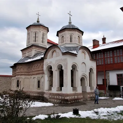 ChurchArnota Monastery: Matei Basarab's mountain mausoleumPietreni6.4 km from Buila PeakArnota Monastery (Mănăstirea Arnota) sits on a small plateau of Mount Arnota above the Bistrița river valley, within Bistrița village in Costești commune, Vâlcea County.
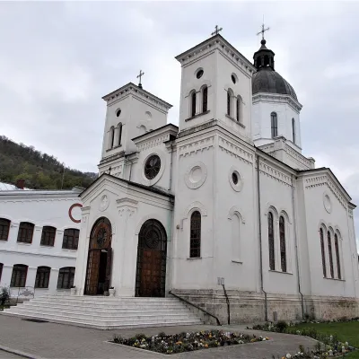 ChurchBistrița Monastery (Vâlcea): relics of St GregoryBistrița7.3 km from Buila PeakBistrița Monastery (Mănăstirea Bistrița) in Vâlcea County stands in the valley of the river of the same name, at the mouth of the Bistrița gorge, in Bistrița village...
Craft nearby
All craft places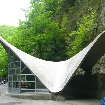 Water parks & thermal poolsBăile Olănești: sulphur and iodine springs of VâlceaBăile Olănești12 km from Buila PeakBăile Olănești is a mineral-water spa in Vâlcea County, in the valley of the Olănești river, at about 450 m and roughly 20 km north-west of the town of Râmnicu Vâlcea.
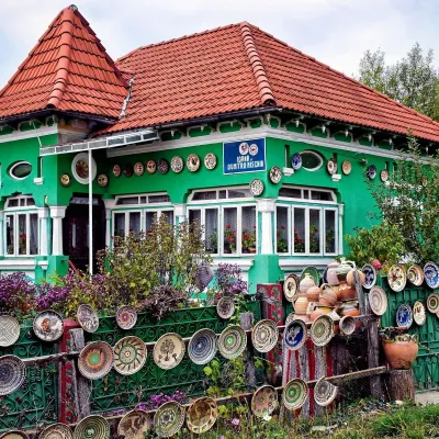 Crafts & workshopsOlari Street, Horezu: the UNESCO potters’ workshopsOlari13 km from Buila PeakThe heart of the craft is Olari Street (Strada Olari) in the part of town of the same name, about 2 km from the centre.
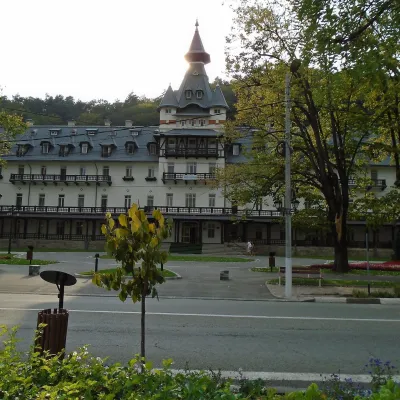 Water parks & thermal poolsCălimănești-Căciulata: thermal pools and springs in the Olt gorgePăușa18 km from Buila PeakCălimănești-Căciulata is one of Romania's best-known spas, stretching along both banks of the Olt where the river enters its gorge between the Cozia massif and the...
