Wysoki Wierch
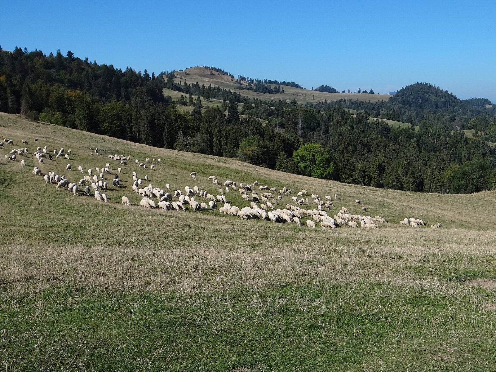
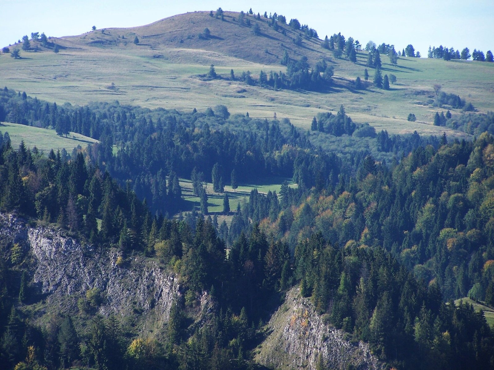
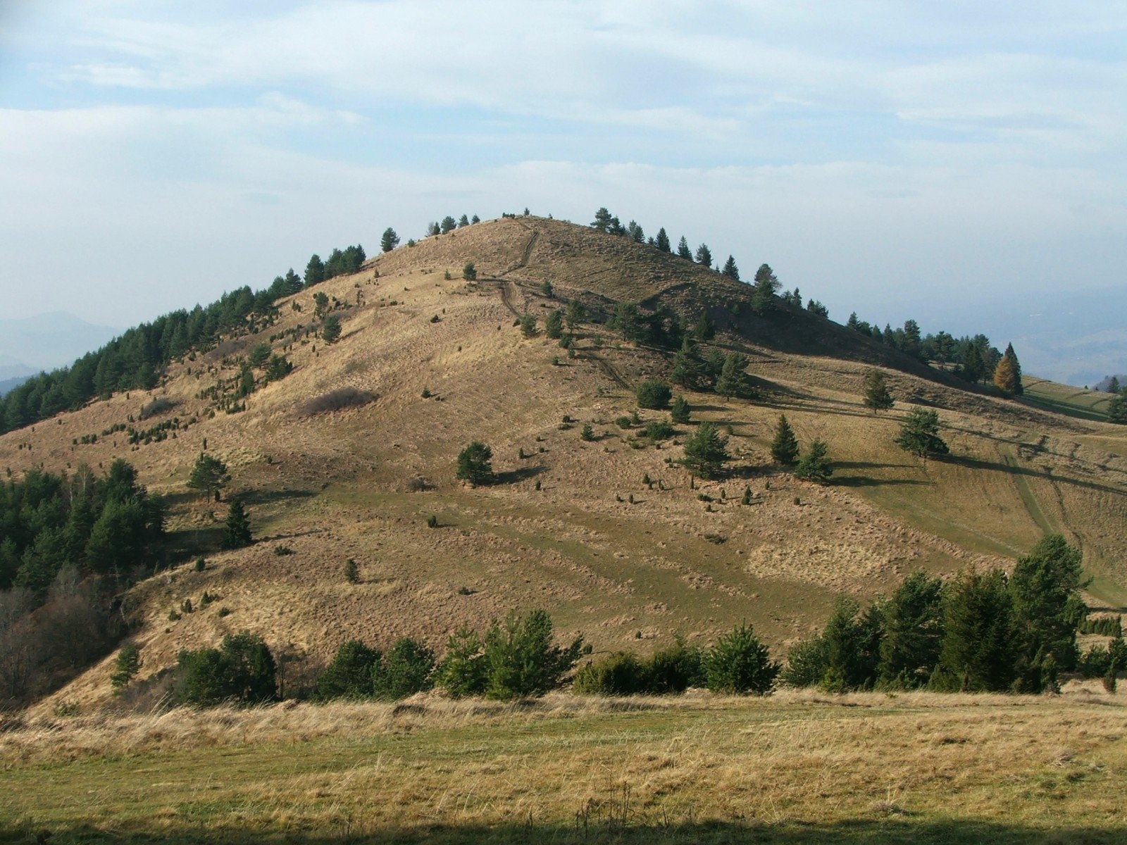
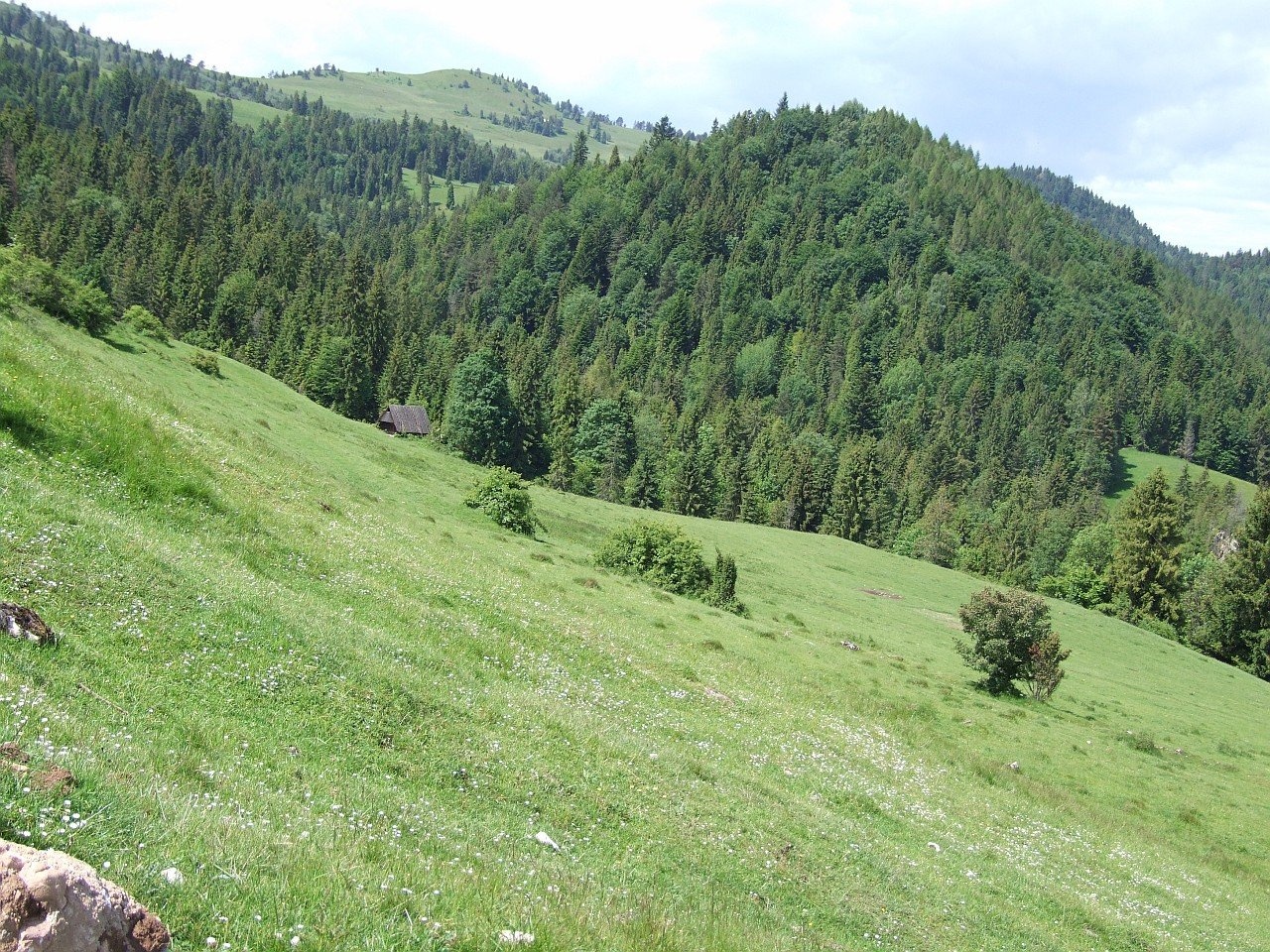
Wysoki Wierch (Slovak Šľachovky or Šlachtovský vrch) is an 898 m dome-shaped summit in the Small Pieniny, right on the Polish–Slovak border. It lies on the main ridge of the Small Pieniny, south of Jarmuta, above the Leśnicki stream valley. It is a junction summit: a ridge runs south from it linking the Small Pieniny with the Golica group in Slovakia. Below lie two Slovak villages, Lesnica and Veľký Lipník, and Polish Szlachtowa; Veľký Lipník and Szlachtowa are about 2.5 km away, Jaworki about 3.2 km.
The Polish slopes belong to Szlachtowa (Szczawnica municipality, Nowy Targ County, Lesser Poland), the Slovak ones to Stará Ľubovňa District in the Prešov Region.
How to get there / routes
- Blue trail along the Small Pieniny ridge – from the Pieniny Road via Szafranówka, Łaźne Skały, Cyrhle, Wysoki Wierch, Durbaszka, Wysoka and Wierchliczka to the Rozdziele pass and Przełęcz Gromadzka in the Sądecki Beskid. It does not reach the summit itself but traverses the northern, Polish slopes.
- Szlachtowa – Wysoki Wierch – Przełęcz pod Tokarnią – Veľký Lipník (yellow): about 2 h, 2 h 5 min in the opposite direction. On the Slovak side the path from Lesnické sedlo runs along the western flank of the summit.
A short path across the meadows leads onto the dome; Slovak sources mention no marked trail to the highest point.
What you can see from the summit
The dome is almost treeless and surrounded on all sides by large meadows, so it offers some of the finest views in the Pieniny: the Trzy Korony massif, the Tatras, the Gorce, the Beskid Wyspowy, the Sądecki Beskid and the nearby Golica group. Slovak sources add the Spišská Magura and the Levoča Mountains. Below you see Lesnica, Veľký Lipník and Szlachtowa.
Nature and history
The meadows on the slopes were once fields of the Lemkos of Szlachtowa, who were deported in Operation Vistula. Traditional sheep grazing has been revived here. Because farming and mowing stopped, the slopes – especially the steep Slovak ones – are being overgrown by forest; unless something is done the summit will lose its views. The open dome is popular with paragliders and model-aircraft flyers, and in winter the slopes are good skiing terrain.
The Krupianka (Sztolnia) stream, a tributary of the Grajcarek, flows from the northern slopes. West of the summit, at 865 m on the ridge towards Rabsztyn, there used to be a seasonal border crossing between Szlachtowa and Veľký Lipník.
Early 19th-century documents record the mountain as Rabsztyński Groń; the name Koguci Wierch was wrongly attributed to it by Kazimierz Sosnowski, and the Lemkos of Szlachtowa simply called it Groń. Rare plants for Poland found here include the burnt orchid and Achillea setacea.
Safety, season and rules
Wysoki Wierch is an easy grassy summit but exposed to every wind: in bad weather and thunderstorms it is an uncomfortable place, and in fog the path across the meadows is easily lost. In summer sheep graze on the slopes – go around the flocks and do not provoke the sheepdogs. There is no spring on the summit itself, so bring water from the valley. Poland and Slovakia are both in the Schengen area, so you may cross the border on marked trails, but carry your passport.
The Polish side is covered by the Podhale group of the mountain rescue service GOPR (station in Szczawnica): call 985 or +48 601 100 300, or 112. On the Slovak side call the Mountain Rescue Service HZS: 18 300 (+421 18 300) or 112.
Interesting facts
- The Lemkos of Szlachtowa simply called the mountain Groń.
- Model-aircraft shows are held on the meadows of Wysoki Wierch.
Photos: Jerzy Opioła, CC BY-SA 4.0; Jerzy Opioła, CC BY-SA 3.0; Jerzy Opioła, CC BY-SA 3.0; Jerzy Opioła, CC BY-SA 4.0 — Wikimedia Commons.
Getting there from Ukraine
Border crossings
- Krakovets – Korczowa — road, 24/7
- Shehyni – Medyka — road, 24/7 Pedestrian crossing is not confirmed by the Ukrainian border service — check dpsu.gov.ua before the trip.
- Smilnytsia – Krościenko — road, 24/7
- Hrushiv – Budomierz — road, 24/7
- Mostyska – Przemyśl (rail) — rail, 24/7
By car
Lviv – Szczawnica ≈384 km, ≈5 h 25 min without queues: M-10 → Krakovets – Korczowa → A4 to Brzesko (≈198 km) → DK75 to Nowy Sącz → DW969 via Stary Sącz and Łącko to Krościenko nad Dunajcem → Szczawnica. ≈306 km, ≈4 h from the border.
Checked 23.10.2026; border crossing hours and timetables change — check before you travel.
Location on the map
Water and shelter nearby
- Spring below Wysoki Wierch (north-east slope)170 m · Not verified · 830 m
- Bacówka Shelter, 821 m190 m · Not verified · 821 m
- Spring below Wysoki Wierch (north slope)230 m · Not verified · 821 m
- Hut below Cyrhle1.6 km · Not verified · 734 m
- Schronisko pod Durbaszką1.6 km · Standing · 834 m
- Žliabky Pass2.3 km · Not verified · 580 m
- Spring below Homole2.9 km · Not verified · 701 m
Comments
Trails nearby
All trails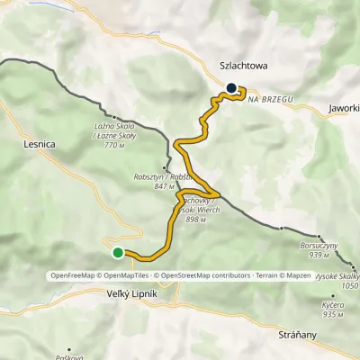 EasyOne-dayMarkedLesnické Saddle SzlachtowaElevation profile519–898 m6.8 kmascent 224 m≈ 2 h walkingunder 1 km from Wysoki Wierch
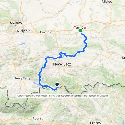 HardMulti-dayMarkedTarnów Wielki RogaczElevation profile206–1 211 m191.5 kmascent 6 941 munder 1 km from Wysoki Wierch
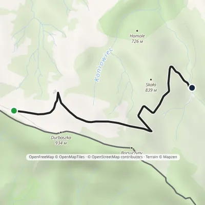 EasyOne-dayMarkedJunction Hut under DurbaszkaElevation profile707–900 m3 kmascent 30 m≈ 45 min walking1.3 km from Wysoki Wierch
Nearby attractions
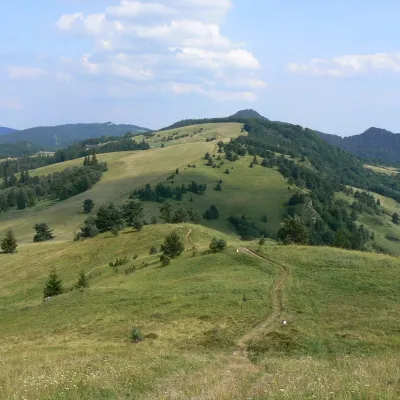 PeakDurbaszkaaltitude 934 m1.8 km from Wysoki WierchDurbaszka is an inconspicuous 934 m summit on the main ridge of the Small Pieniny (Małe Pieniny), in the eastern part of the Pieniny.
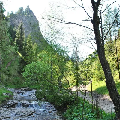 NatureHomole Gorge2.7 km from Wysoki WierchThe Homole Gorge (Wąwóz Homole) is one of the most beautiful rocky gorges in Poland. It lies in the Little Pieniny, in the Lemko village of Jaworki near Szczawnica.
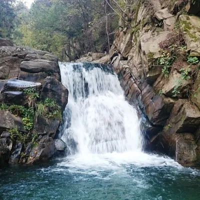 WaterfallZaskalnik Falls4.9 km from Wysoki WierchZaskalnik is a small but very picturesque waterfall on the Sopotnicki stream (Sopotnicki Potok) near the spa town of Szczawnica.
Craft nearby
All craft places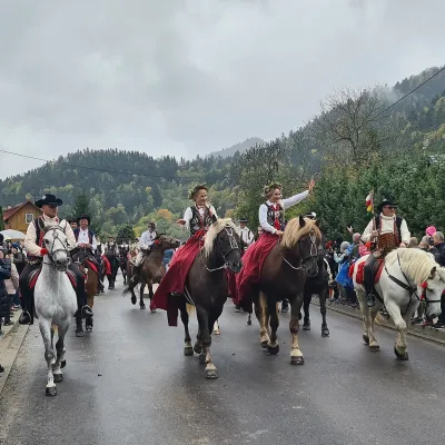 Markets & fairsAutumn Redyk in Szczawnica: sheep drive, oscypek and shepherds5.1 km from Wysoki WierchRedyk is an old Carpathian shepherding custom: in spring the flocks are driven up to the mountain pastures (hale), and in autumn, after the cheese-making season, they...
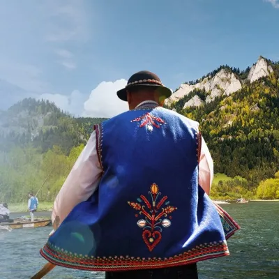 Ethno tours & guidesGoral raftsmen of Červený Kláštor: wooden-raft trip on the Dunajec7.2 km from Wysoki WierchBetween Červený Kláštor and Lesnica the Dunajec cuts a deep, winding gorge through the limestone Pieniny, and here the river becomes the border between Slovakia and...
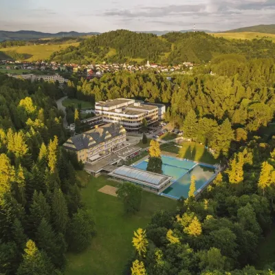 Water parks & thermal poolsVyšné Ružbachy Spa: Izabela Mountain Pools and Indoor Thermal Pool10 km from Wysoki WierchVyšné Ružbachy is one of Slovakia’s oldest spas. It lies on the south-eastern slope of the Spišská Magura at about 617 m, surrounded by coniferous forest that merges...
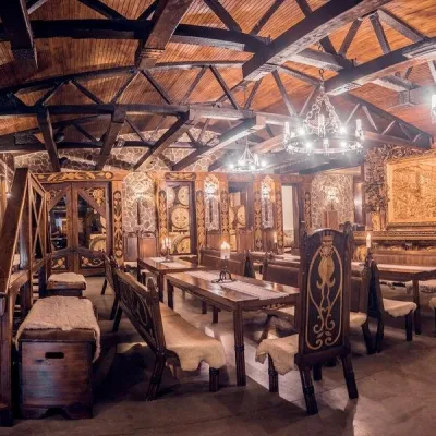 Craft producersNestville Distillery, Hniezdne — Home of the First Slovak Whisky14 km from Wysoki WierchThis tradition is the basis for BGV, a company founded in 2001, which built the Nestville Distillery here.
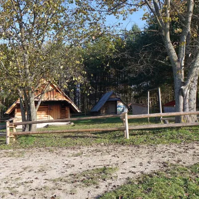 Cheese dairies & pasturesMajerz Meadow Shepherd's Hut, Pieniny National Park: oscypek and żętyca14 km from Wysoki WierchMajerz meadow (hala) sits on a 689 m hill between Czorsztyn-Nadzamcze and the village of Hałuszowa, above Lake Czorsztyn.
 Craft producersCastle Distillery below Ľubovňa Castle: fruit spirits and tastings16 km from Wysoki WierchStará Ľubovňa is a town in northern Spiš, overlooked by Ľubovňa Castle. For more than three and a half centuries Ľubovňa was one of the Spiš towns pledged to the...
