Condition
StandingLatest report: standing, usable as a shelter.
- 1 286 m
- Has a stove
- Sleeps up to 7
- Water nearby
About
Gorgany range, about 1 290 m above sea level. Mount Kin Grofetsky (1 552 m) is about 930 m away. The nearest settlement is Osmoloda, about 8.8 km in a straight line. 8 of the site’s trails pass nearby, including “Myslivka village, via Mount Moloda, Mount Popadia, Svoboda village, Lake Synevyr and Mount Ozerna to Mizhhiria”.
Inside: a stove, bunks or plank beds. Sleeps up to about 7 people. There is water nearby.
On the map
Coordinates: 48.62754, 23.94316
How to get there
Trails nearby
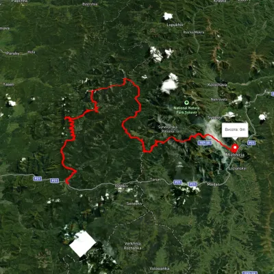 HardMulti-dayUnmarkedMyslivka village to Mizhhiriavia Mount Moloda, Mount Popadia +3Elevation profile444–1 717 m117 kmascent 6 438 m
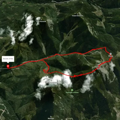 ModerateOne-dayUnmarkedOsmoloda village loopvia Mount GrofaElevation profile823–1 721 m13.4 kmascent 989 m≈ 5.5 h walking
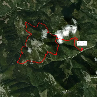 HardOne-dayMarkedEco-trail around Mount GrofaElevation profile944–1 488 m13.6 kmascent 1 768 m≈ 7 h walking
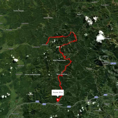 HardMulti-dayUnmarkedOsmoloda village to Myslivka villagevia Mount Popadia, Mount Koretvyna +3Elevation profile660–1 731 m74.8 kmascent 3 739 m
 HardMulti-dayUnmarkedOsmoloda village loopvia Mount Grofa, Mount Koretvyna +1Elevation profile713–1 723 m40.6 kmascent 2 038 m
 HardMulti-dayMarkedEast Carpathian Tourist TrailElevation profile635–1 819 m278.1 kmascent 14 105 m
Nearest settlement: Osmoloda, about 8.8 km in a straight line.
Report the condition
Been here recently? Tell us what you saw and add photos — your report appears on the page right away with today’s date.
No photos yet — send yours together with a condition report.
