Condition
Poor conditionReported in poor condition: gaps, leaking roof or no door. Bring a tent.
Last edited on the OSM map 28.12.2020
- 1 245 m
- Open fire inside (smoke hut)
- Sleeps up to 4
About
Chornohora range, about 1 250 m above sea level. The nearest settlement is Bystrets, about 2.1 km in a straight line. 4 of the site’s trails pass nearby, including “Iltsi village – Vesnarka polonyna”.
According to the latest reports, it is in poor condition. Inside: an open fire, bunks or plank beds. Sleeps up to about 4 people. The nearest known spring is 300 m away.
In an emergency in the mountains call the rescuers: 101 or 112.
Comments
Travellers’ experience: reports, tips, questions.
No one has written here yet. Be the first — your experience helps others.
On the map
Coordinates: 48.14136, 24.70217
How to get there
Trails nearby
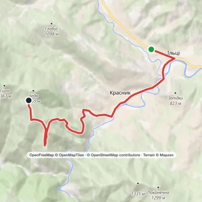 ModerateOne-dayIltsi village Vesnarka polonynaElevation profile636–1 262 m9.8 kmascent 656 m≈ 3.5 h walking
 HardTwo-dayIltsi village to Voronenko villagevia Mount KukulElevation profile637–1 586 m45.8 kmascent 1 957 m
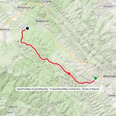 Hard1–2 daysKrasnyk village to Voronenko villagevia Kostrych ridge, Mount KukulElevation profile637–1 586 m39.2 kmascent 1 893 m≈ 13 h walking
 HardTwo-dayKrasnyk village to Kozmeshchykvia Mount Shpytsi, Mount HoverlaElevation profile658–2 061 m39.5 kmascent 2 521 m
Nearest settlement: Bystrets, about 2.1 km in a straight line.
Report the condition
Been here recently? Tell us what you saw and add photos — your report appears on the page right away with today’s date.
No photos yet — send yours together with a condition report.
