Condition
Weak flowWeak flow — slow to fill, may disappear in hot weather.
- 886 m
- Dries out in summer or drought
About
Gorgany range, about 890 m above sea level. The nearest settlement is Osmoloda, about 3.9 km in a straight line. 7 of the site’s trails pass nearby, including “Osmoloda village, via Mount Popadia, Mount Koretvyna, Mount Grofa, Mount Moloda and Mount Yayko-Ilemske to Myslivka village”.
This spring dries out in summer or in dry years, so do not rely on it as your only water. The flow is weak: filling a bottle takes time.
On the map
Coordinates: 48.59372, 23.98560
How to get there
Trails nearby
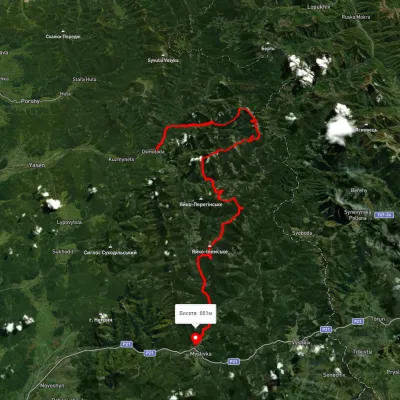 HardMulti-dayUnmarkedOsmoloda village to Myslivka villagevia Mount Popadia, Mount Koretvyna +3Elevation profile660–1 731 m74.8 kmascent 3 739 m
 HardMulti-dayMarkedEast Carpathian Tourist TrailElevation profile635–1 819 m278.1 kmascent 14 105 m
 HardMulti-dayUnmarkedOsmoloda village loopvia Mount Grofa, Mount Koretvyna +1Elevation profile713–1 723 m40.6 kmascent 2 038 m
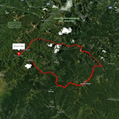 HardMulti-dayUnmarkedLopukhiv village to Ust-Chorna villagevia Legioniv Pass, Peklo tract +3Elevation profile522–1 809 m94.1 kmascent 3 095 m
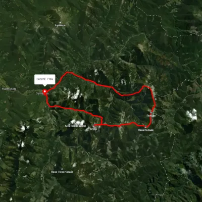 HardMulti-dayUnmarkedOsmoloda village loopvia Mount Grofa, Mount Parenky +2Elevation profile722–1 744 m42.5 kmascent 1 982 m
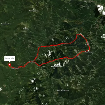 HardMulti-dayUnmarkedOsmoloda village loopvia Plistse polonyna, Mount Koretvyna +2Elevation profile649–1 731 m42.6 kmascent 1 933 m
Nearest settlement: Osmoloda, about 3.9 km in a straight line.
Report the condition
Been here recently? Tell us what you saw and add photos — your report appears on the page right away with today’s date.
No photos yet — send yours together with a condition report.
